La Comunidad Valenciana (Comunitat Valenciana) es una de las 17 Comunidades Autónomas que componen España y está compuesta por tres provincias. Estas son: Alicante, Castellón y Valencia. Con algo más de 5 millones de habitantes, fue creada en el año 1982 al aprobarse su Estatuto de Autonomía. Su capital es la ciudad de Valencia.
Como siempre, recomendamos viajar con un buen seguro de viajes. IATI es especialista en seguros de viaje y, por ser nuestro lector, tienes un 5% de descuento.
Valencia (València) es la capital de la Comunidad Valenciana y de la provincia homónima en España. Está situada a orillas del Turia, en la costa oriental de la península ibérica, a orillas del mar Mediterráneo.
Con 860.000 habitantes, Valencia es la tercera ciudad más poblada de España, llegando a casi 2,5 millones en su área metropolitana.
Como siempre, recomendamos viajar con un buen seguro de viajes. IATI es especialista en seguros de viaje y, por ser nuestro lector, tienes un 5% de descuento.
Valencia fue fundada como colonia romana en el año 138 a. C. con el nombre de «Valentia Edetanorum». Su militarización surgió a raíz de la amenaza que suponía la presencia bizantina al sur, junto con su efectiva integración al Reino visigodo de Toledo a finales del siglo VI.
El dominio islámico y la aculturación se produjeron en el siglo VIII, junto con la introducción de nuevos sistemas de irrigación y cultivos. Con la conquista cristiana aragonesa en 1238, la ciudad se convirtió en la capital del Reino de Valencia.
Gracias al comercio con el resto de la Península Ibérica, los puertos italianos y otros lugares del Mediterráneo, la ciudad prosperó en el siglo XV. Esto covirtió a Valencia en una de las ciudades europeas más grandes a finales de siglo.
La actividad económica de la ciudad sufrió una crisis tras la expulsión de los moriscos en 1609. Valencia se convirtió en un importante centro de fabricación de seda en el siglo XVIII.
Encuentra tu hotel ideal al mejor precio en Valencia con Agoda:
*Nos ayuda a mantener el blog
Qué ver y hacer
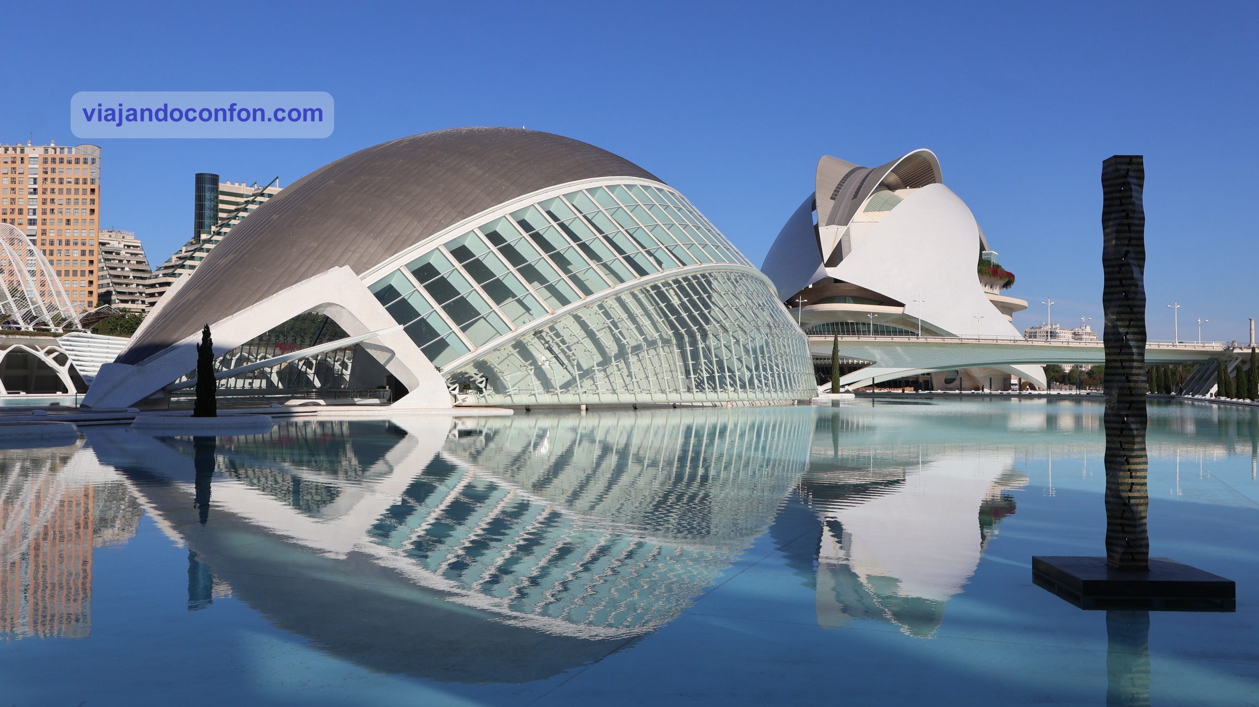
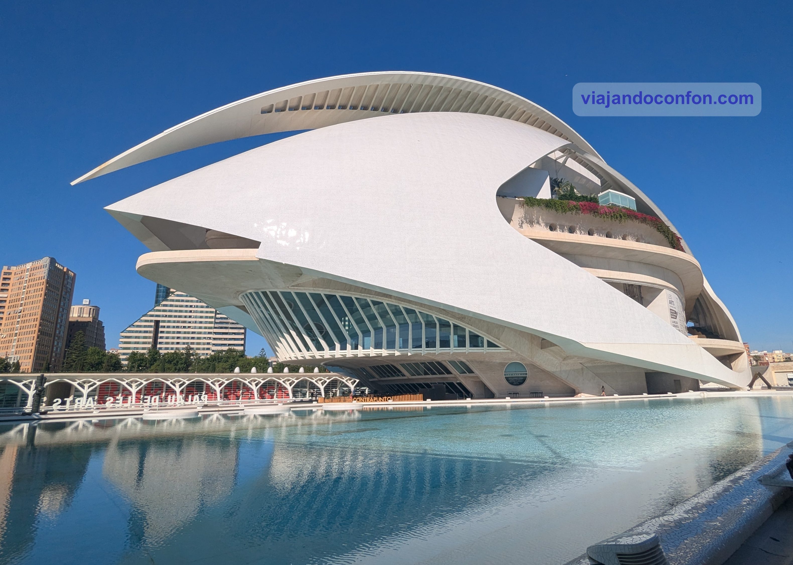
01. Ciudad de las Artes y las Ciencias (Ciutat de les Arts i les Ciències)
Se trata de un complejo cultural y arquitectónico, situado en el extremo sureste del antiguo cauce del río Turia. Este cauce fue drenado y desviado tras una inundación catastrófica en 1957.
Diseñado por Santiago Calatrava y Félix Candela, el proyecto inició sus primeras fases de construcción en julio de 1996 y se inauguró el 16 de abril de 1998 con la apertura de L’Hemisfèric.
El último componente principal de la Ciudad de las Artes y las Ciencias, el Palau de les Arts Reina Sofía, se inauguró el 9 de octubre de 2005, Día de la Comunidad Valenciana. El edificio más reciente del complejo, L’Àgora, se inauguró en 2009.
Originalmente presupuestado en 300 millones de euros en 1991 para tres estructuras, se añadieron otras, lo que triplicó el coste inicial previsto.
Edificios y estructuras
El complejo está formado por los siguientes edificios y estructuras, presentados en orden de su inauguración:
L’Hemisfèric (1998): en el encontramos un cine IMAX, planetario y laserium. El edificio está diseñado para asemejarse a un ojo gigante y tiene una superficie aproximada de 13 000 m². Conocido como el planetario o el “ojo del conocimiento”, es la pieza central de la Ciudad de las Artes y las Ciencias.
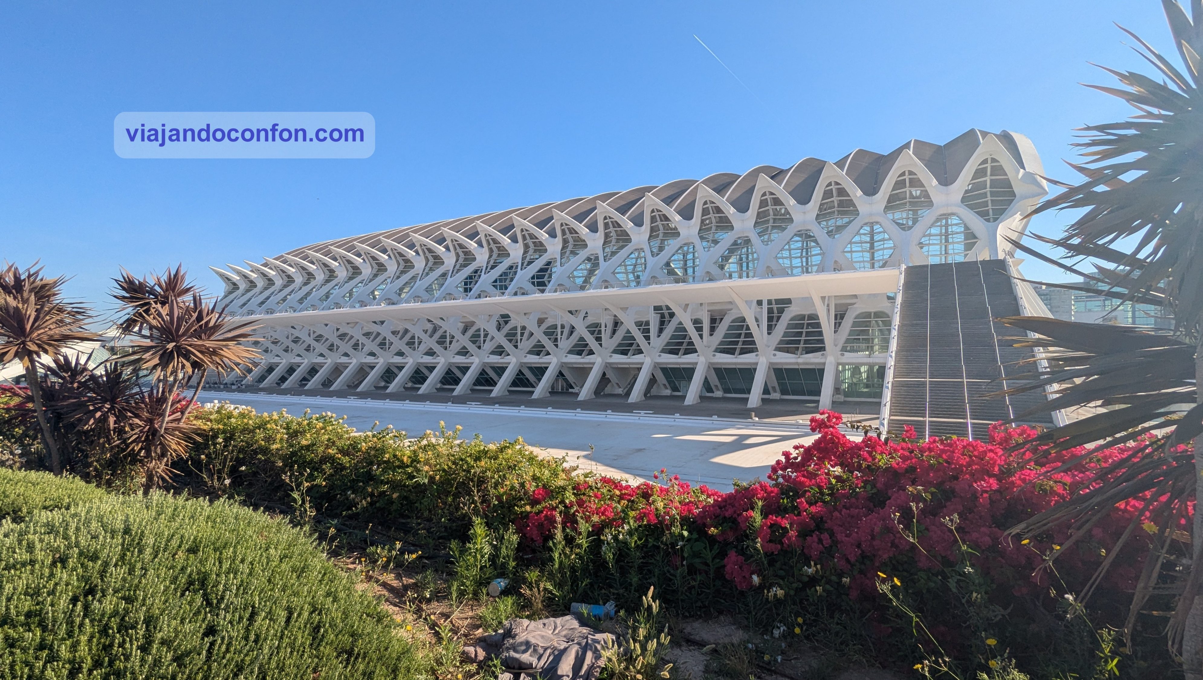
Museu de les Ciències Príncipe Felipe: un museo interactivo de ciencia que se asemeja al esqueleto de una ballena. Ocupa alrededor de 40.000 m² en tres plantas.
Gran parte de la planta baja está ocupada por una cancha de baloncesto patrocinada por un equipo local y varias empresas.
La primera planta tiene vistas al Jardín del Turia que lo rodea, que abarca más de 13.500 m² de agua.
En la segunda planta encontramos la exposición “El Legado de la Ciencia” de los investigadores Santiago Ramón y Cajal y Severo Ochoa y Jean Dausset.
La tercera planta se conoce como el “Bosque de los Cromosomas” y muestra la secuenciación del ADN humano. También en esta planta se encuentran las exposiciones “Gravedad Cero”, “Academia Espacial” y “Superhéroes de Marvel”.
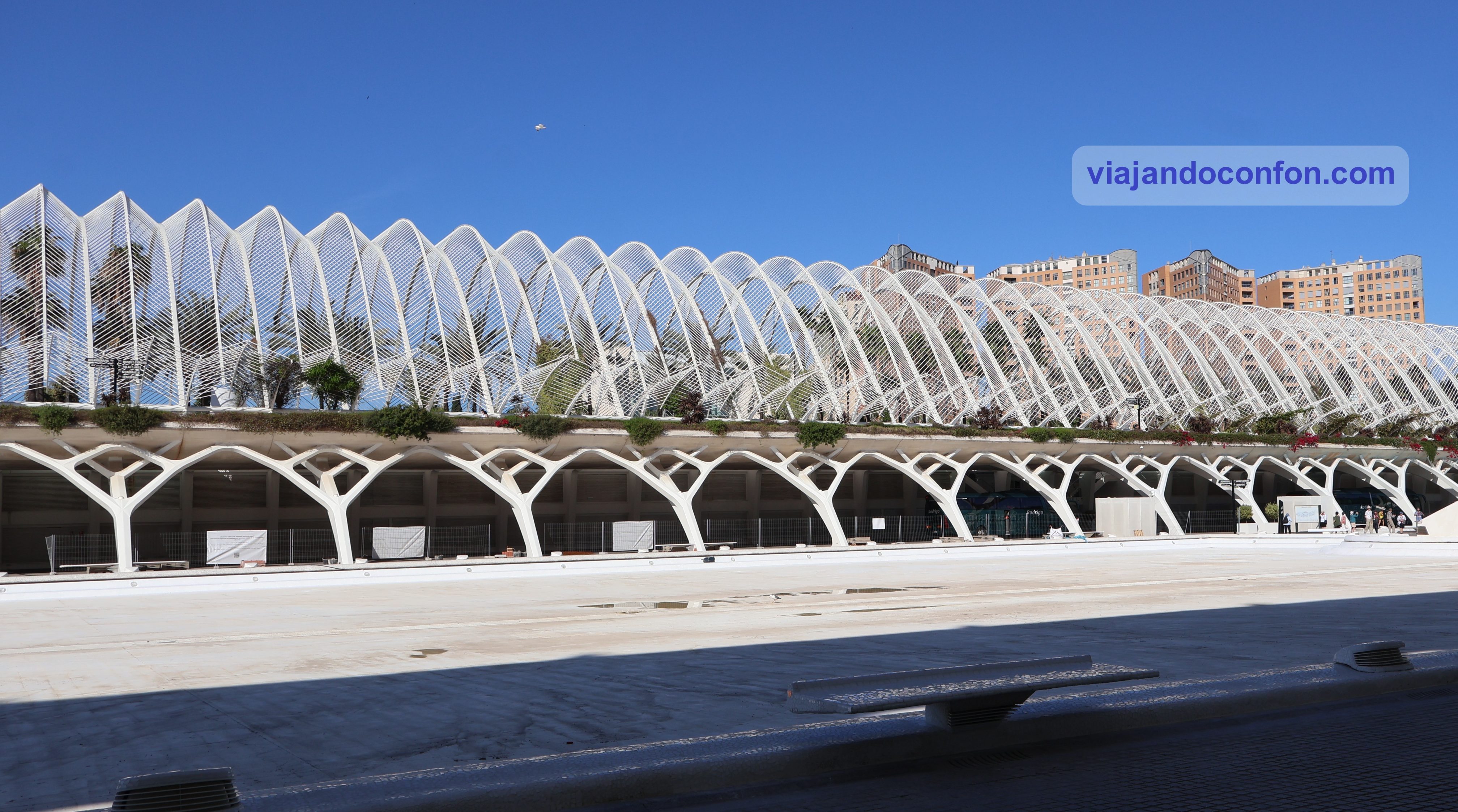
L’Umbracle: se trata de una estructura abierta que envuelve un paseo ajardinado con especies vegetales autóctonas de Valencia. Las plantas expuestas fueron cuidadosamente seleccionadas para cambiar de color con cada estación.
En su interior alberga el Paseo de las Esculturas, una galería de arte al aire libre con esculturas de artistas contemporáneos como Miquel de Navarra o Yoko Ono.
Fue diseñado como entrada a la Ciudad de las Artes y las Ciencias. Tiene 320 metros de largo y 60 metros de ancho, y se ubica en el lado sur del complejo.
L’Oceanogràfic: es el acuario oceanográfico más grande de Europa con 110.000 m². Fue construido con la forma de un nenúfar y es obra del arquitecto Félix Candela.
Cada edificio representa diferentes entornos acuáticos, incluyendo el Mediterráneo, humedales, mares templados y tropicales, la Antártida, el Ártico, islas y el Mar Rojo. Llega a albergar más de 500 especies diferentes.
Puedes adquirir tus entradas para L’Oceanogràfic cómodamente en Civitatis:
*Nos ayuda a mantener el blog
Palau de les Arts Reina Sofía: se trata de un teatro de ópera y centro de artes escénicas dedicado a la música y las artes escénicas. El Palau de Les Arts tiene cuatro secciones: la sala principal, la sala maestra, el auditorio y el teatro Martin y Soler.
Puente Montolivet: es un puente que cruza el lecho seco del río Turia. Consta de un segmento norte de calzada recta más antiguo con pilares de columna diseñado por Fernández Ordóñez. Este lo conecta con un segmento al sur de calzada curva más nuevo con soportes de punta de arco blanco diseñado por Santiago Calatrava.
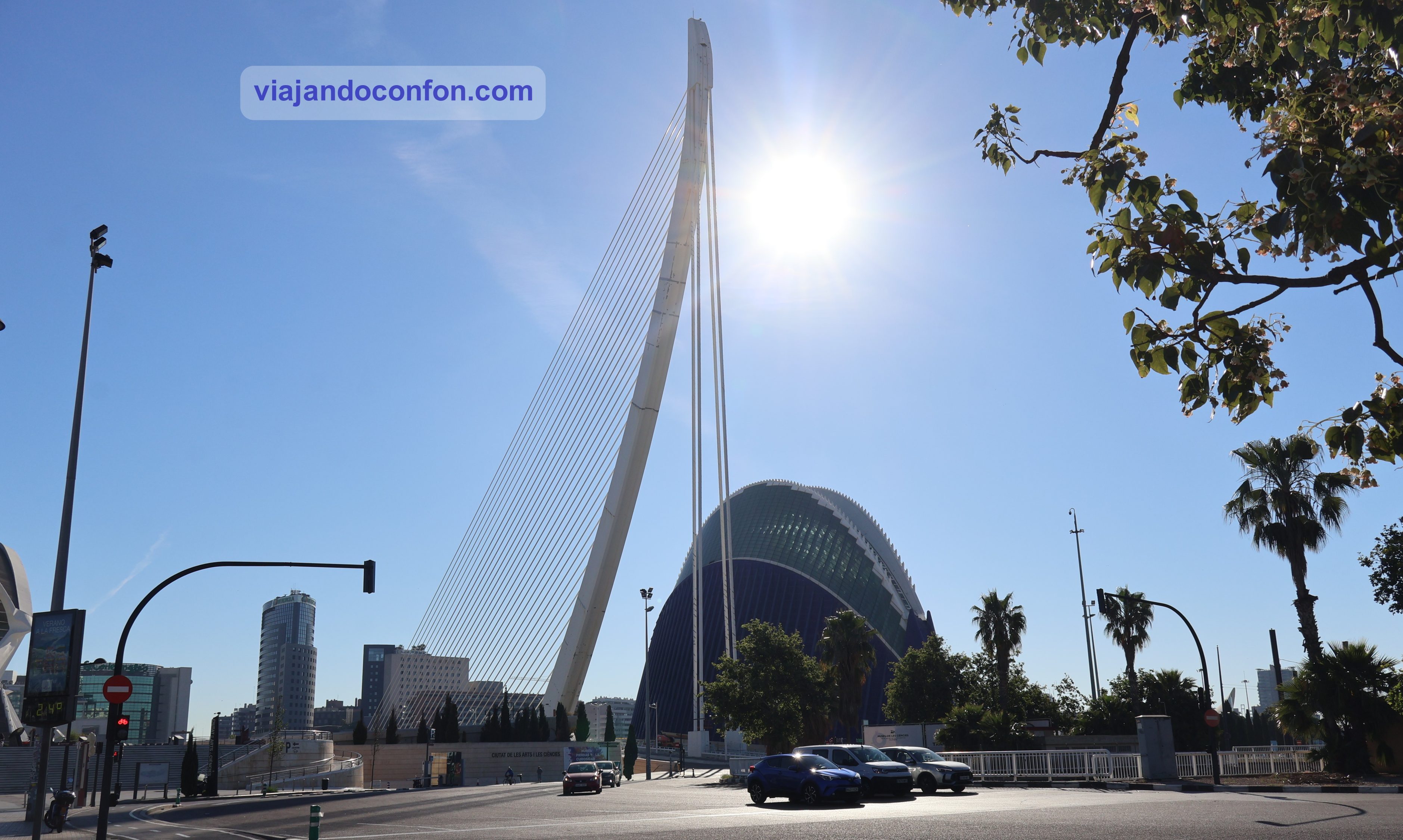
Puente Assut de l’Or: se trata de un puente atirantado blanco, sostenido por un pilón curvo con contrapesos. Cruza el cauce seco del río Turia y conecta la orilla sur con la calle Menorca, entre el Museo de las Ciencias y el Ágora. El pilón del puente, de 125 metros de altura, es el punto más alto de la ciudad.
L’Àgora: el Ágora es un espacio diseñado para albergar diversos eventos, como conciertos, espectáculos, exposiciones, convenciones, congresos y encuentros deportivos internacionales.
Puente Assut de l’Or y Ágora
Compra cómodamente tus entradas desde casa en Civitatis:
*Nos ayuda a mantener el blog
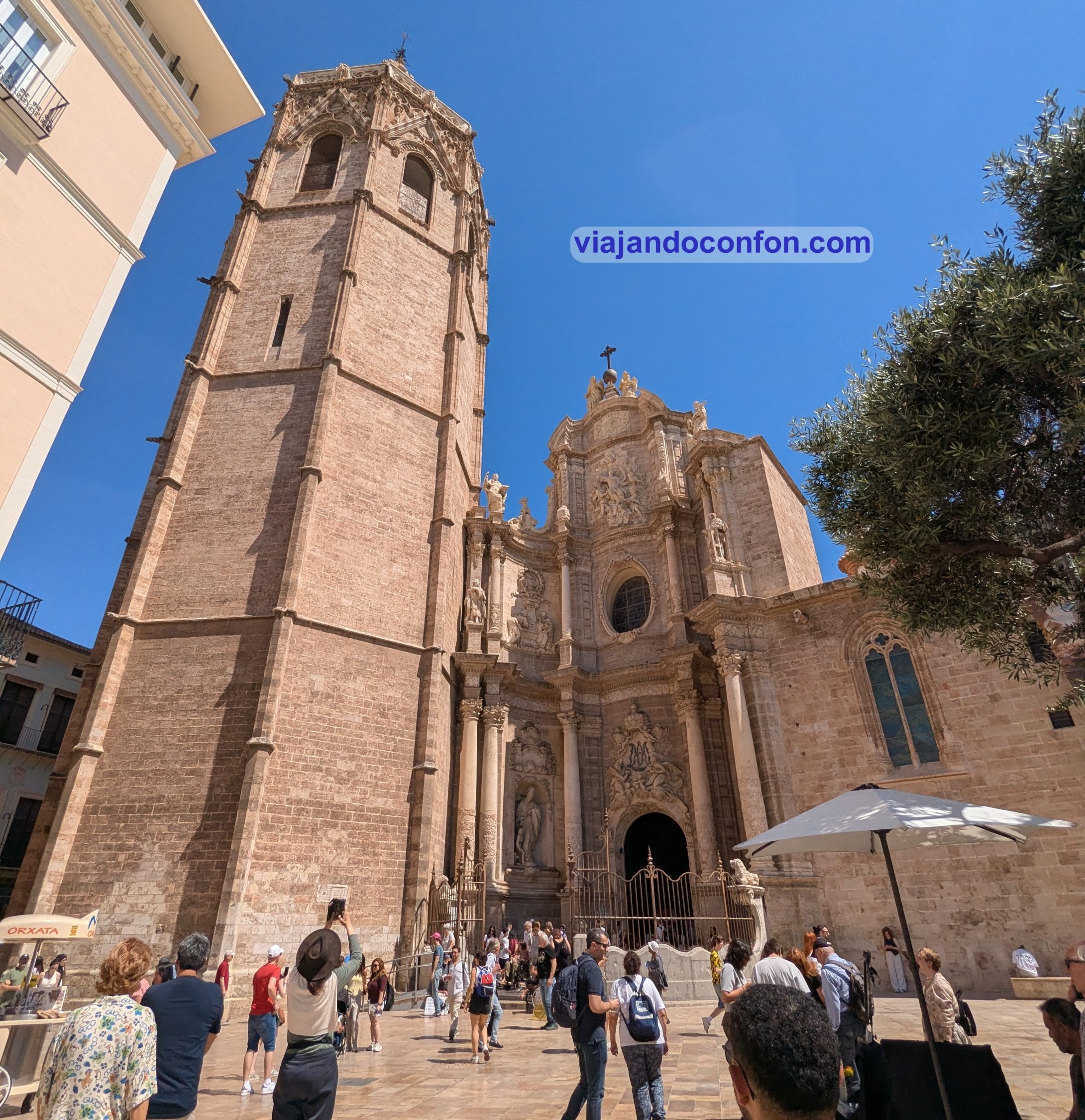
02. Catedral de Santa María
Oficialmente Catedral Metropolitana-Basílica de la Asunción de Nuestra Señora de Valencia. Fue consagrada en 1238 por el primer obispo de Valencia tras la Reconquista, Pere d’Albalat, arzobispo de Tarragona, Está dedicada a a Santa María por orden de Jaime I el Conquistador.
Está edificada en el emplazamiento de la antigua catedral visigoda, que bajo el dominio musulmán había sido convertida en mezquita. El gótico valenciano es el estilo arquitectónico predominante de la catedral, aunque también incorpora elementos románicos, góticos franceses, renacentistas, barrocos y neoclásicos.
La catedral alberga numerosas pinturas del siglo XV. Algunas son de artistas locales, como Jacomart, y otras de los artistas renacentistas italianos Francesco Pagano y Paolo da San Leocadio. Ambas fueron encargadas por el papa valenciano Alejandro VI, quien, siendo aún cardenal, solicitó la elevación de la Sede Valencia a la categoría de sede metropolitana, otorgada por el papa Inocencio VIII en 1492.
Curiosidad: Un supuesto Santo Cáliz, considerado por muchos como el verdadero Santo Grial, se conserva en una de las capillas de la catedral.
A parte de la catedral, también podemos visitar el museo. En el podemos encontrar multitud de obras de artereligioso dedicado al culto cristiano.
El campanario, empezado a construir en 1381 es conocido como “El Miguelete”. Esto se debe a su gran campana de la hora, que le dio el nombre de “Torre del Micalet”. Originalmente era una torre exenta que se unió a la Catedral a finales del XV al prolongarse la nave central.
Podemos subir al Miguelete para admirar las preciosas vistas, pagando una tarifa, claro.
Horario del Miguelete: todos los días de 10.00 a 18.45. Precio: 3€ / Reducida 2€*. *Pensionistas, personas con movilidad reducida, desempleados, niños (8 a 17 años) y estudiantes / Usuarios de Renfe Cercanías con tarjeta +RENFE&TÚ.
Horario de la catedral y museo del 1 de julio al 30 de septiembre: lunes a sábado de 10.30 a 18.30 / Domingos de 14.00 a 18.30. Horario de la catedral y museo del 1 de enero al 30 de junio y del 1 de octubre al 31 de diciembre: lunes a viernes de 10.30 a 18.30 / Sábados de 10.30 a 17.30 / Domingos de 14.00 a 17.30. Precio: 12€ / Reducida 6€* (Se incluye audioguía en 10 idiomas.) *Pensionistas, personas con movilidad reducida, desempleados, niños (8 a 17 años) y estudiantes / Usuarios de Renfe Cercanías con tarjeta +RENFE&TÚ.
Descubre la Catedral y el Santo Grial en profundidad con esta maravillosa VISITA GUIADA
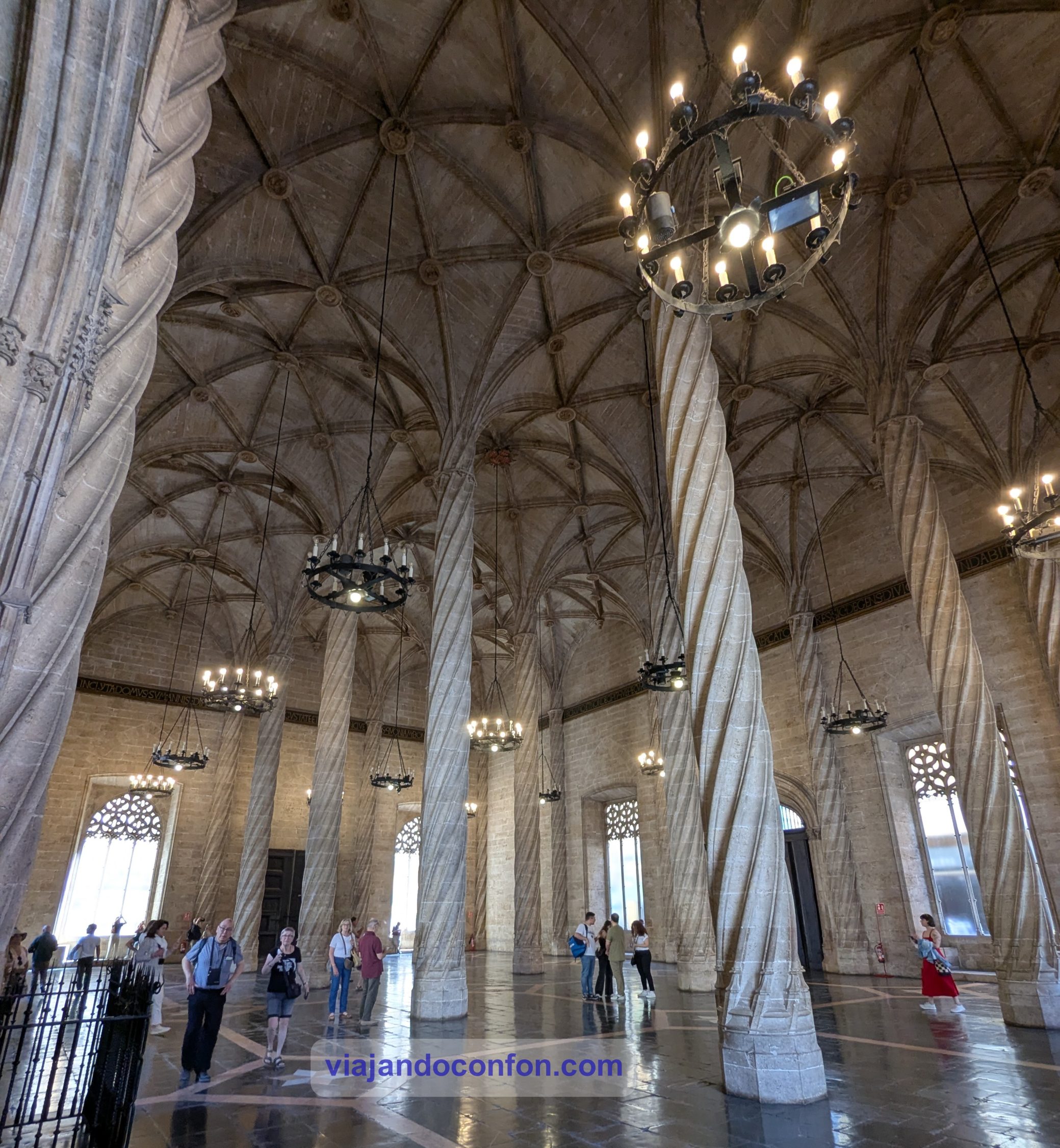
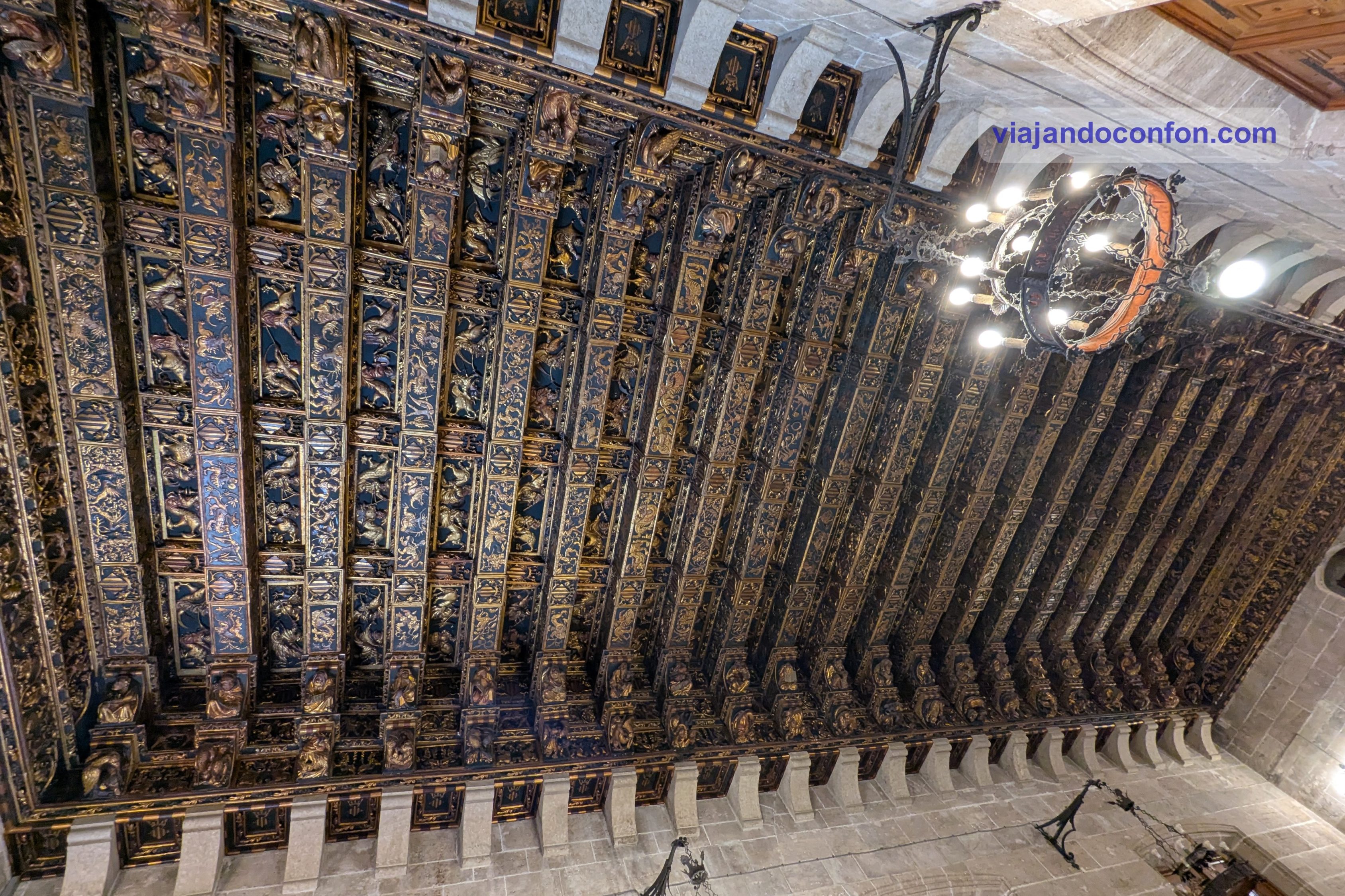
03. Lonja de la Seda (Llotja de la Seda)
Se trata de un edificio civil de estilo gótico valenciano tardío. Construida entre 1482 y 1533, la Llotja se compone de tres partes, más el Jardín de los Naranjos, un patio amurallado.
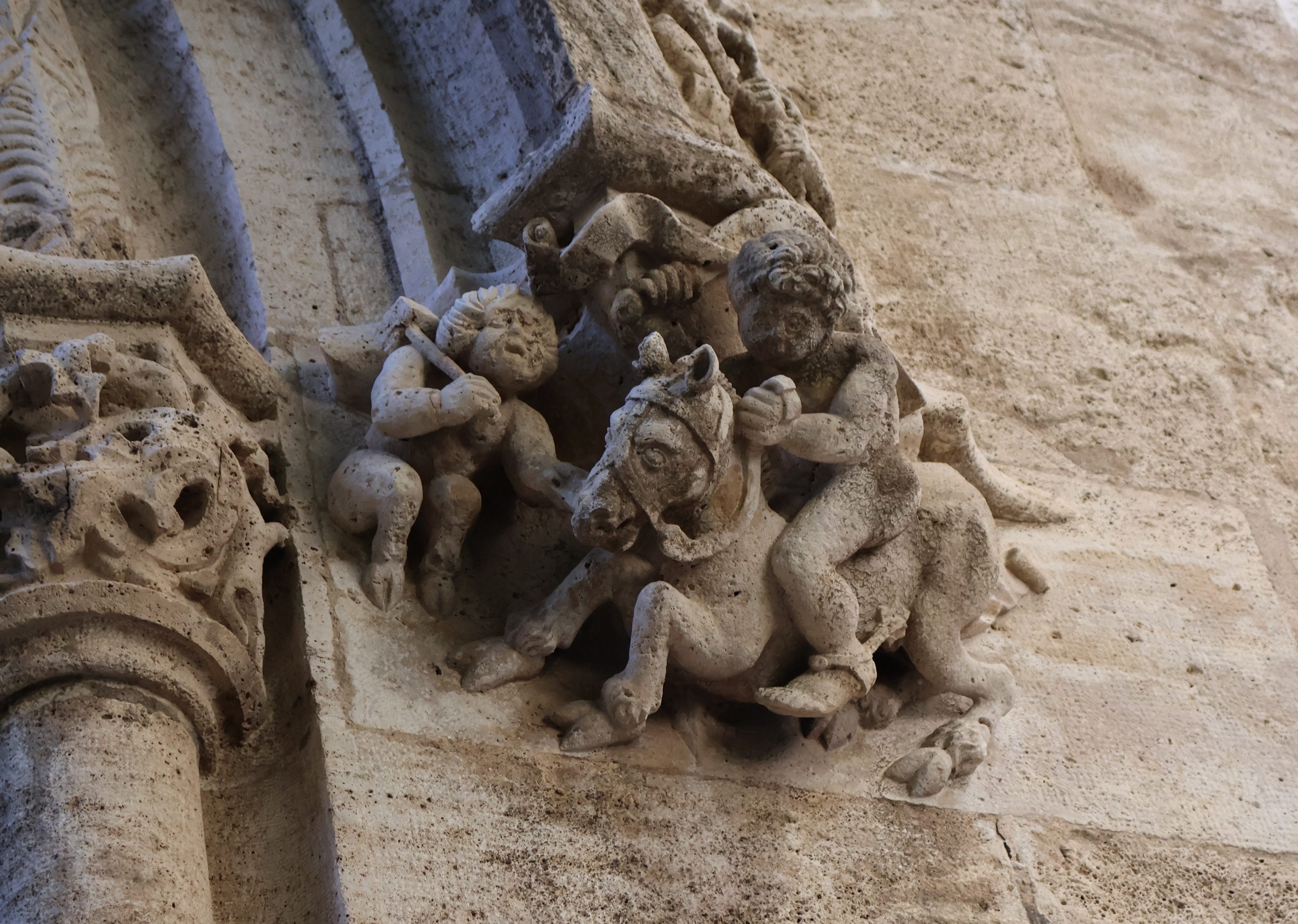
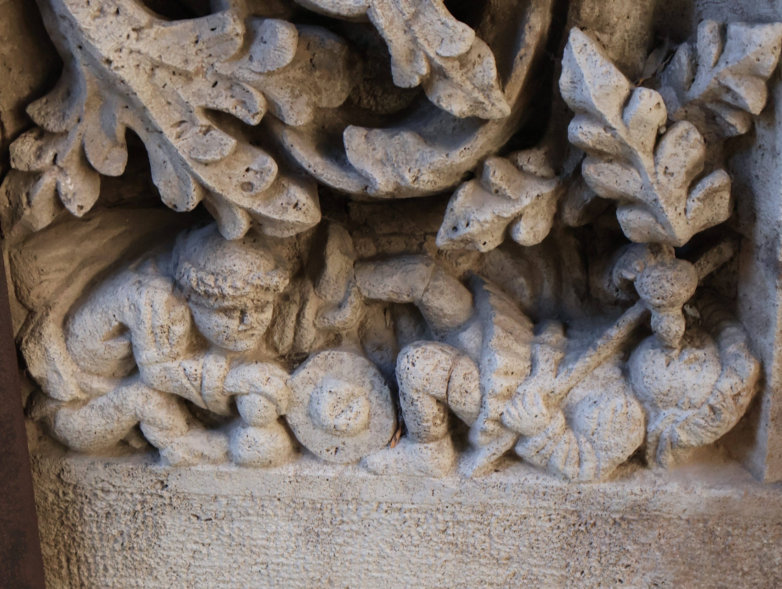
La sala principal, la Sala de Contractació (Sala de Comercio), es un amplio espacio ricamente decorado, sostenido por magníficas columnas retorcidas. Este era el centro financiero de La Lonja, donde los mercaderes negociaban contratos.
El ala lateral se llama Pabellón del Consulado y fue la sede del Consolat del Mar, el primer tribunal mercantil marítimo que se formó en España.
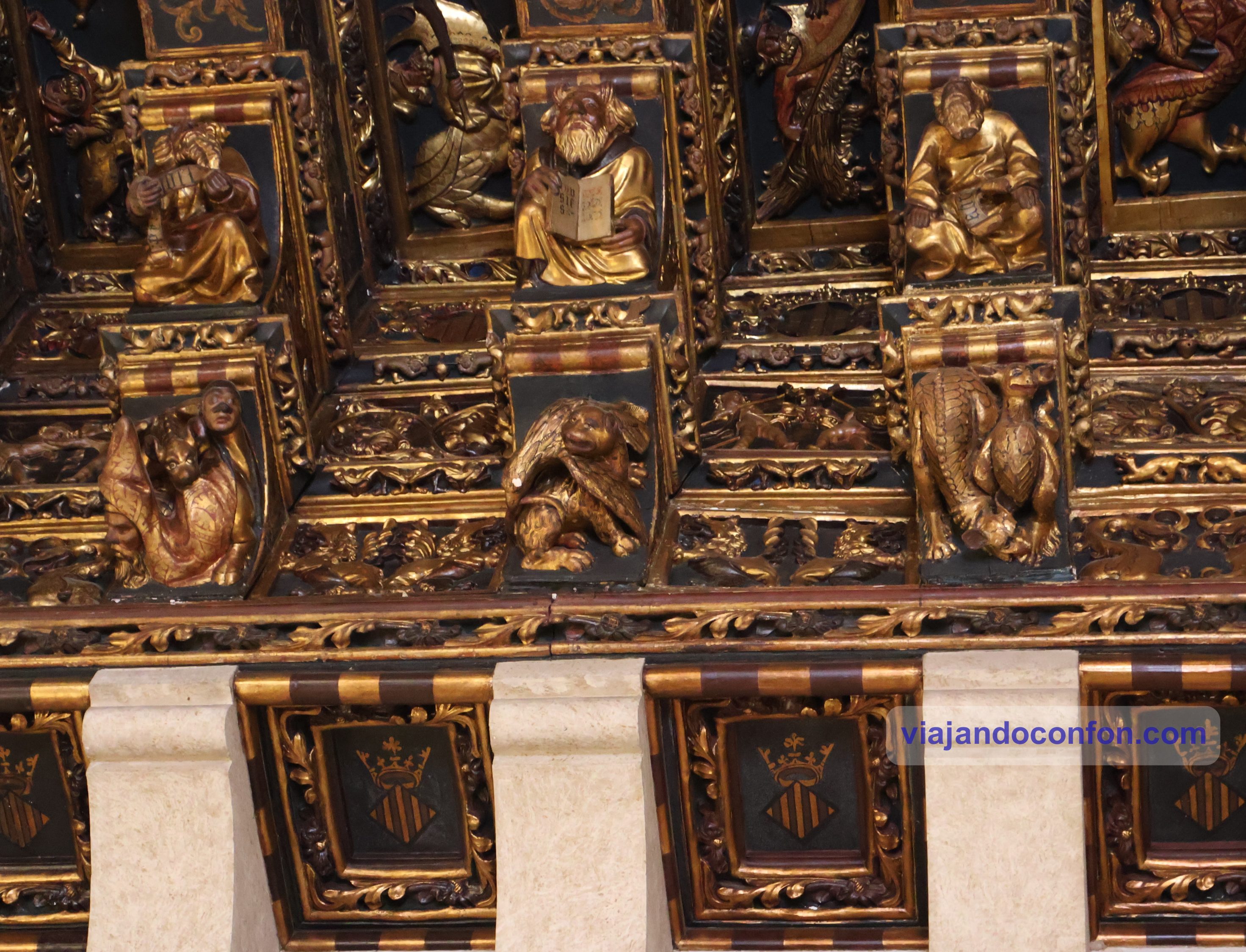
La segunda planta tiene un techo ricamente ornamentado. La verdad es que es realmente espectaular y puedes contemplarlo durante un largo rato. Estas salas aún conservan el mobiliario original. Ocasionalmente, el Tribunal encarcelaba a mercaderes por deudas en la torre central de La Lonja, la tercera parte del edificio.
Algo que también llamó mi atención, y que me gustaron mucho, son las figuras que adornan el arco de entrada a la Sala de Contractació.
Horario: lunes a sábado de 10.00 a 19.00 / Domingo de 10.00 a 14.00. Precio: 2€ / Reducida 1€.
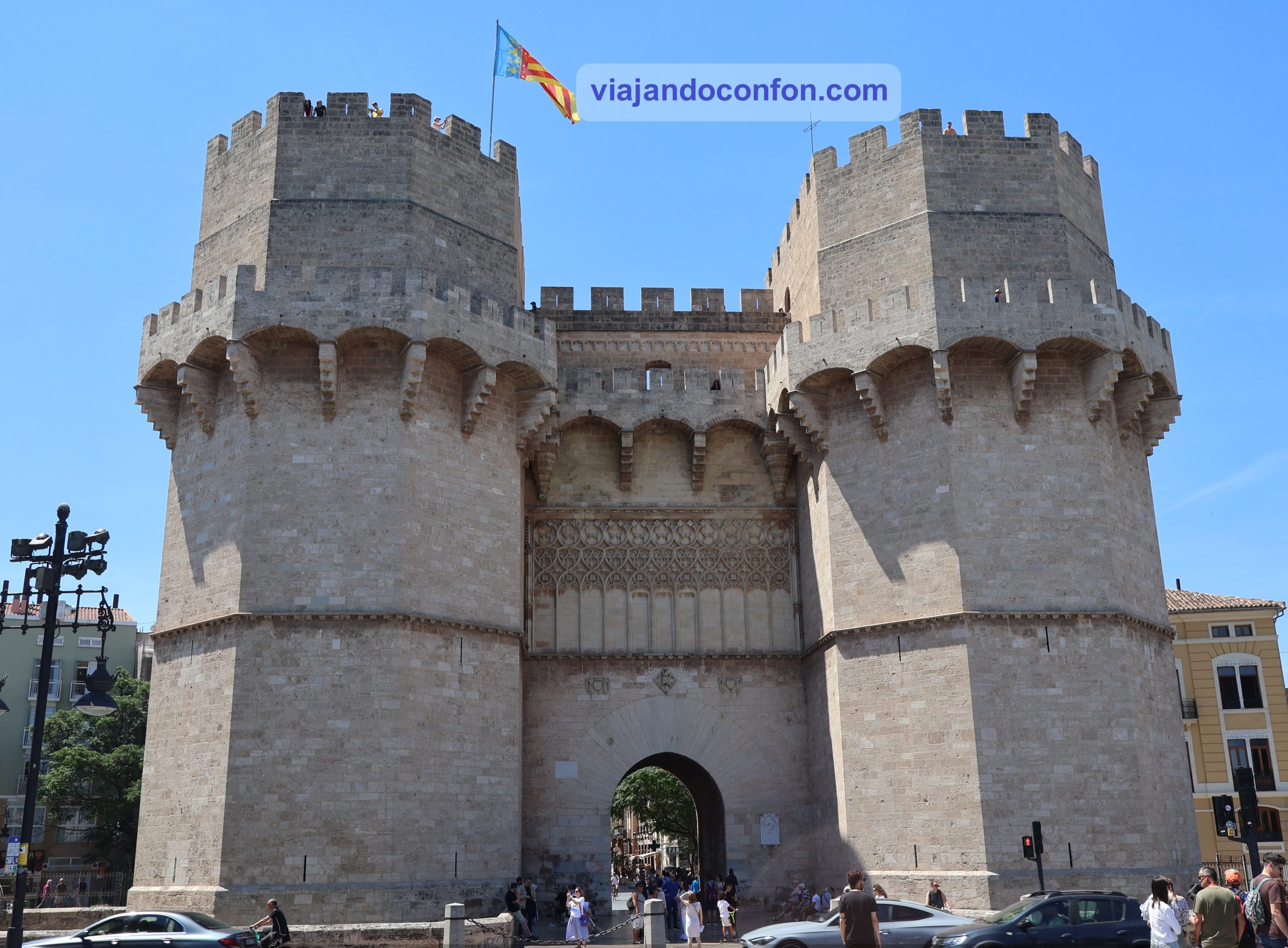
04. Torres de Serranos
La Puerta de Serranos es una de las doce puertas que formaban parte de la antigua muralla de la ciudad, la muralla medieval cristiana de la ciudad de Valencia. Fue construida en estilo gótico valenciano entre 1392 y 1398.
De la antigua muralla, que fue derribada en 1865 por orden del gobernador provincial Cirilio Amorós, solo han sobrevivido las Torres Serrans, las Torres Quart del siglo XV y algunos otros restos arqueológicos y ruinas, como las de la Puerta de los Judíos.
La principal función de la puerta fue defender la ciudad en caso de asedio o ataque. Pero también se utilizaba con frecuencia para ceremonias, como las de bienvenida a embajadores y reyes, ya que se consideraba la entrada principal a la ciudad.
Tras el incendio de una de las principales prisiones de Valencia en 1586, las torres se convirtieron en prisión para caballeros y nobles. Fue hasta que los presos fueron trasladados al monasterio de San Agustín en 1887.
Actualmente se utilizan para diferentes ceremonias oficiales de la Ciudad de Valencia, la más famosa de las cuales es la crida, la ceremonia de apertura de las Fallas.
El último domingo de febrero, la Fallera Mayor declara inauguradas las Fallas desde una plataforma erigida frente al edificio. Tras ello se canta el himno de la Comunidad Valenciana y la Marcha Real.
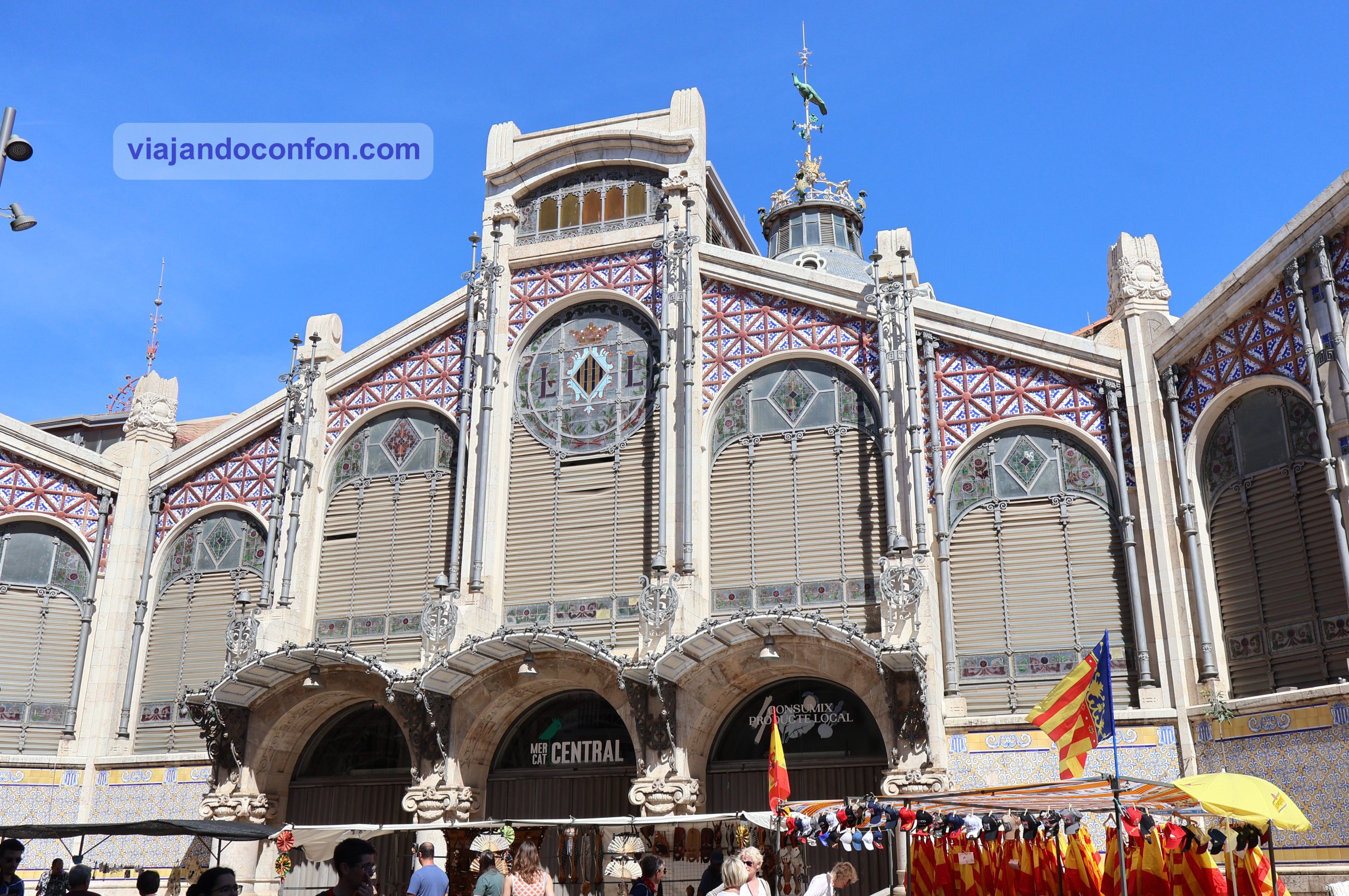
05. Mercado Central de Valencia
El Mercado Central (Mercat Central) es un mercado público situado frente a la Llotja de la Seda y la Iglesia de Santos Juanes, en el centro de la ciudad. Es una de las principales obras del modernismo valenciano.
En 1839, el lugar se utilizó para inaugurar un mercado al aire libre llamado Mercat Nou. En 1910, un concurso seleccionó el diseño actual de Alexandre Soler March y Francesc Guàrdia Vidal. La construcción comenzó en 1914 y no se completó del todo hasta 1928 bajo la dirección del arquitecto valenciano Enrique Viedma Vidal.
Curiosidad: El Mercado Central de Valencia es uno de los más grandes de Europa. Este abarca más de 8.000 m².
Horario: de lunes a sábado de 7.30 a 15.00.
06. Palau de la Generalitat
El Palacio de la Generalitat Valenciana es un palacio histórico que data del siglo XV. Se construyó inicialmente en estilo gótico valenciano con posteriores añadidos y cambios renacentistas. Actualmente alberga las oficinas de la ejecutiva de la Generalitat Valenciana.
El Palacio de la Generalitat de Valencia es uno de los pocos edificios de origen medieval en Europa que aún conserva la sede del gobierno y de la institución que lo construyó: la Generalitat del Reino de Valencia.
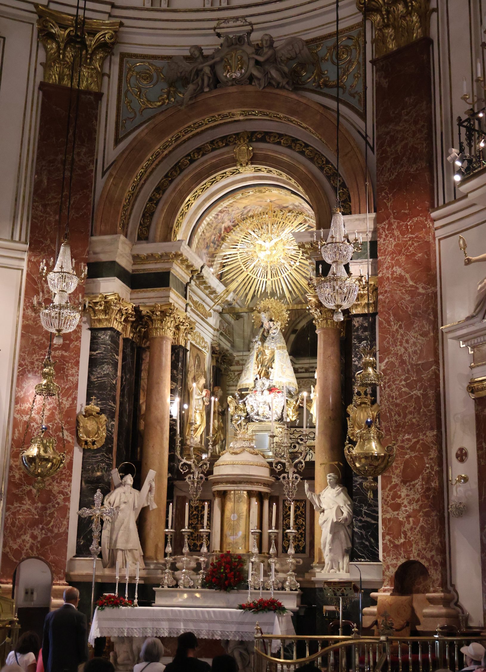
07. Real Basílica de Nuestra Señora de los Desamparados
La Basílica de la Virgen de los Desamparados alberga la imagen de la Virgen del mismo nombre, la más venerada por los valencianos. Se alza en el centro histórico, a pocos metros al norte de la Catedral de Valencia. Está conectada a esta por un pequeño puente.
En este lugar se encontraba originalmente la iglesia de una cofradía que cuidaba de niños expósitos y enfermos mentales.
El edificio fue construido entre 1642 y 1667 por Diego Martínez Ponce de Urrana. El santuario para la imagen de la Virgen María se creó entre 1683 y 1694. La figura de madera de la Virgen María en el altar mayor data de 1460.
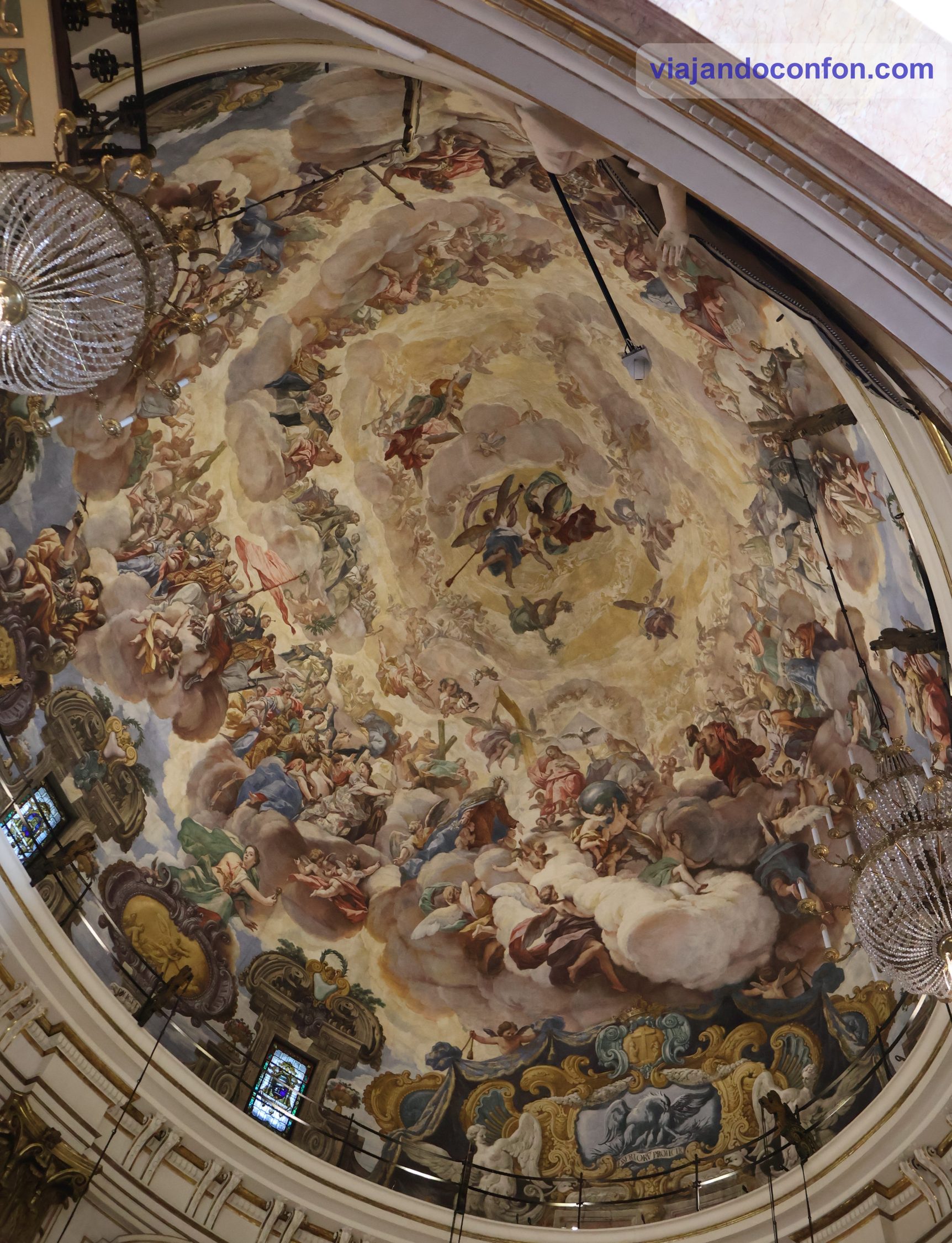
La impresionante pintura del techo de la cúpula interior fue pintada por Antonio Palomino en 1701. Posteriores modificaciones neoclásicas, románticas e historicistas fueron cambiando gradualmente el estilo renacentista original hasta el siglo XX.
Horario: de 7.30 a 14.00 y de 16.30 a 21.00.
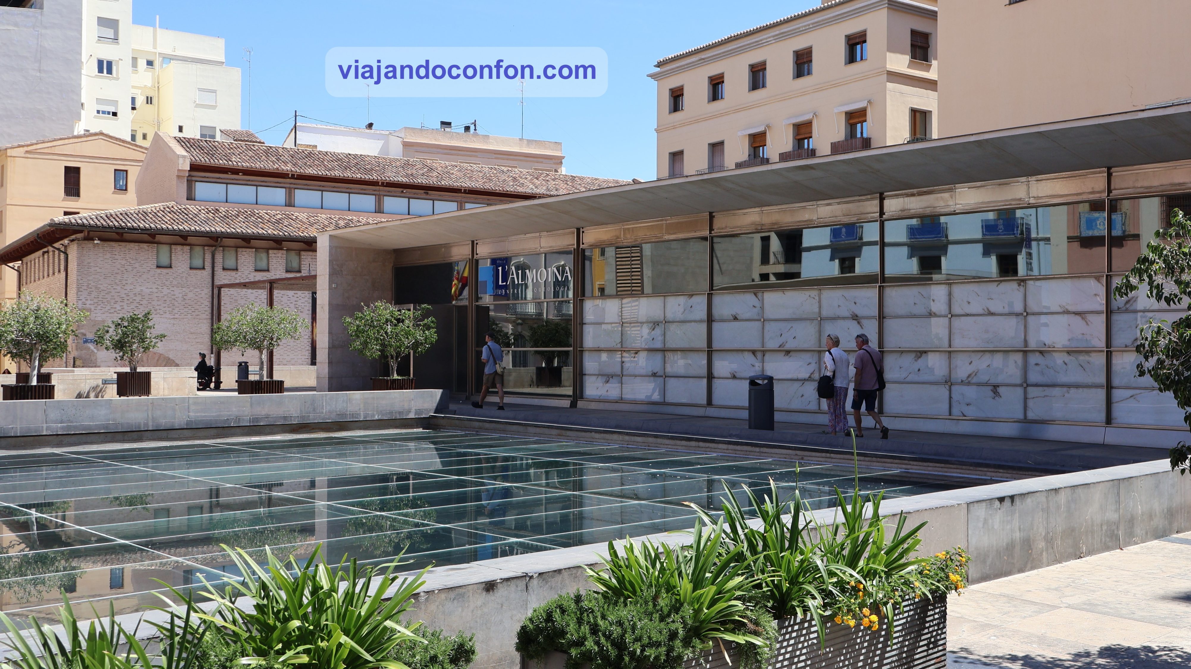
08. Centro Arqueológico de l’Almoina
El Museo de l’Almoinaa en la ciudad de Valencia ofrece la posibilidad de recorrer más de 2000 años de historia de la ciudad, desde la fundación de la Valencia romana en el 138 a. C. hasta la Edad Media.
El edificio se construyó sobre los restos arqueológicos desenterrados durante las excavaciones realizadas entre 1985 y 2005. Su diseño fue obra del arquitecto José María Herrera García.
Es posible reconstruir parte del cardo y el decumanus maximus originales y observar los restos de las columnas del Foro Romano que aún se conservan en su lugar. Los restos son parcialmente visibles desde el exterior a través de un suelo de cristal y una ventana.
Horario: lunes a sábado de 10.00 a 19.00 / Domingos y festivos de 10.00 a 14.00. Precio: 2€ / Reducida 1€ / Domingos y festivos gratis.
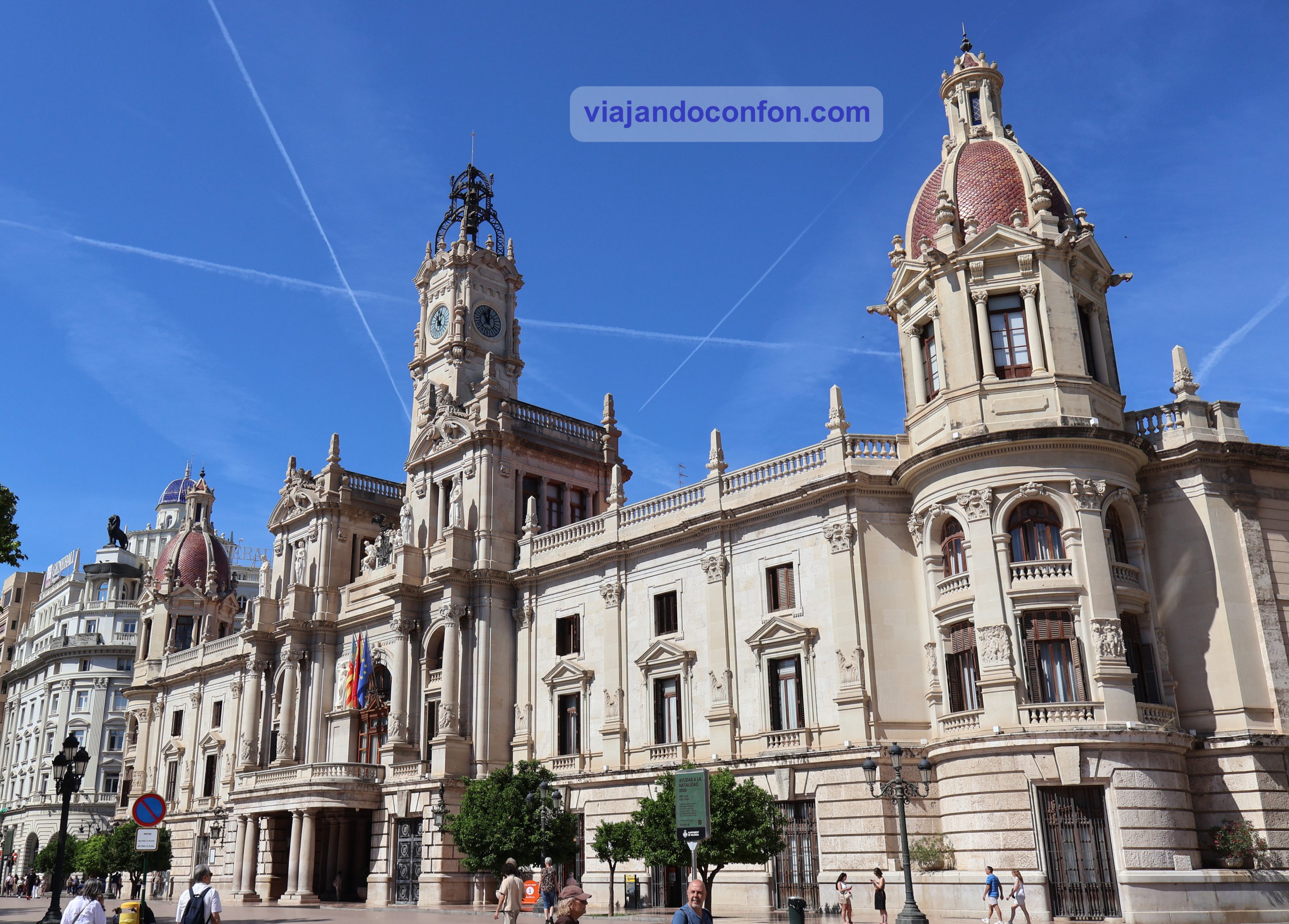
09. Ayuntamiento de Valencia (Ajuntament de València)
Situado en la Plaça de l’Ajuntament, se compone de dos edificios construidos en diferentes épocas. La Casa de Enseñanza, construida por iniciativa del arzobispo Andrés Mayoral entre 1758 y 1763, y el edificio que constituye la fachada principal, construido entre 1920 y 1930.
Desde noviembre de 1936 hasta octubre de 1937, cuando Valencia se convirtió en capital de la Segunda República en las primeras etapas de la Guerra Civil, el edificio sirvió como sede oficial de los Tribunales Republicanos.
Esto propició que fuera bombardeado el 28 de mayo de 1937 por la Fuerza Aérea Italiana, que apoyaba al bando nacional.
El edificio también alberga el Museo Histórico Municipal y fue declarado Bien de Interés Cultural en 1962.
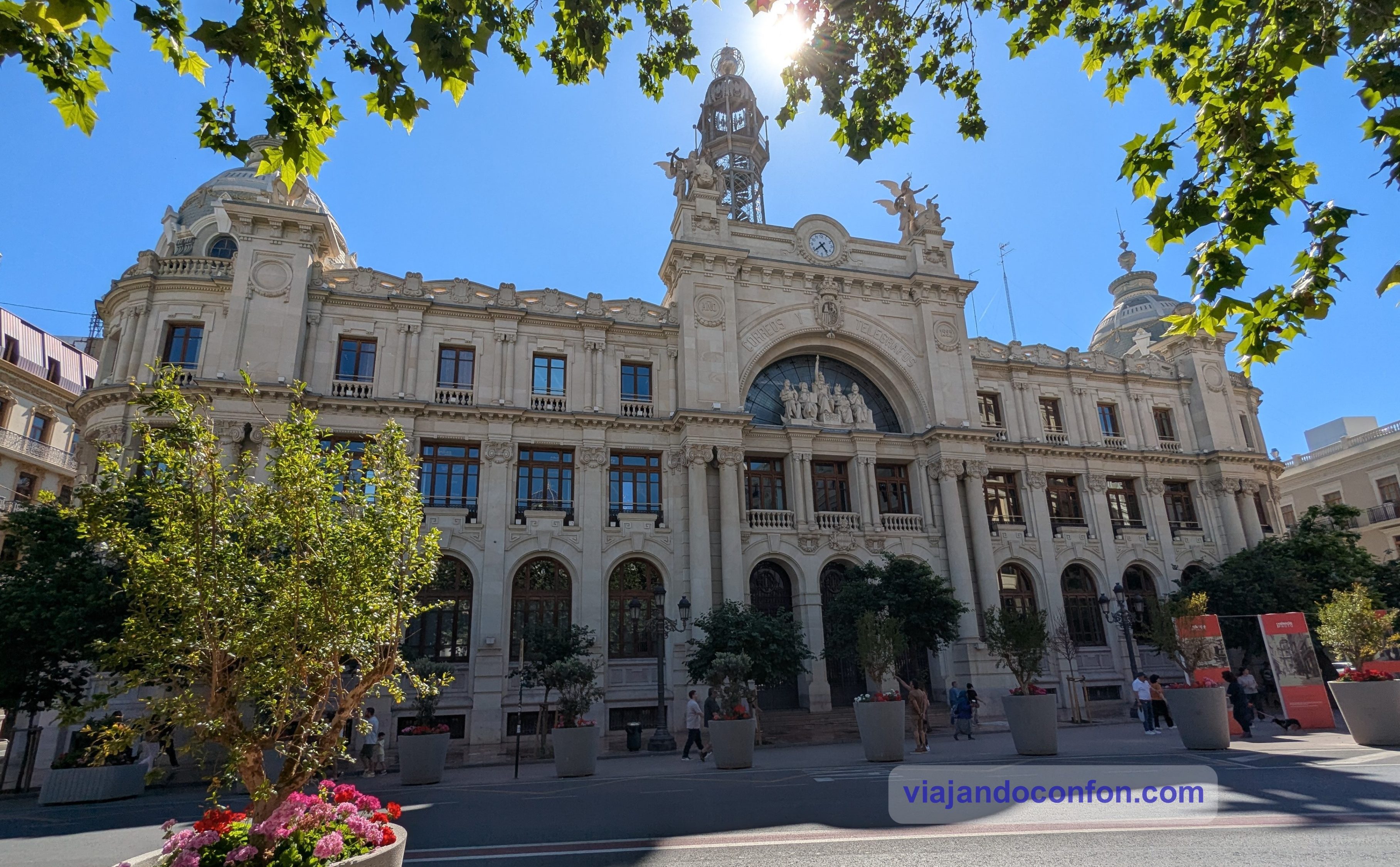
10. Palacio de las Comunicaciones de Valencia (Edificio de Correos)
También situado en Plaça de l’Ajuntament, fue construido entre 1915 y 1922 por el arquitecto zaragozano Miguel Ángel Navarro en estilo ecléctico. Aunque también cuenta con algunos elementos de modernismo valenciano.
Se construyó en un antiguo barrio de pescadores y fue inaugurado en 1923.
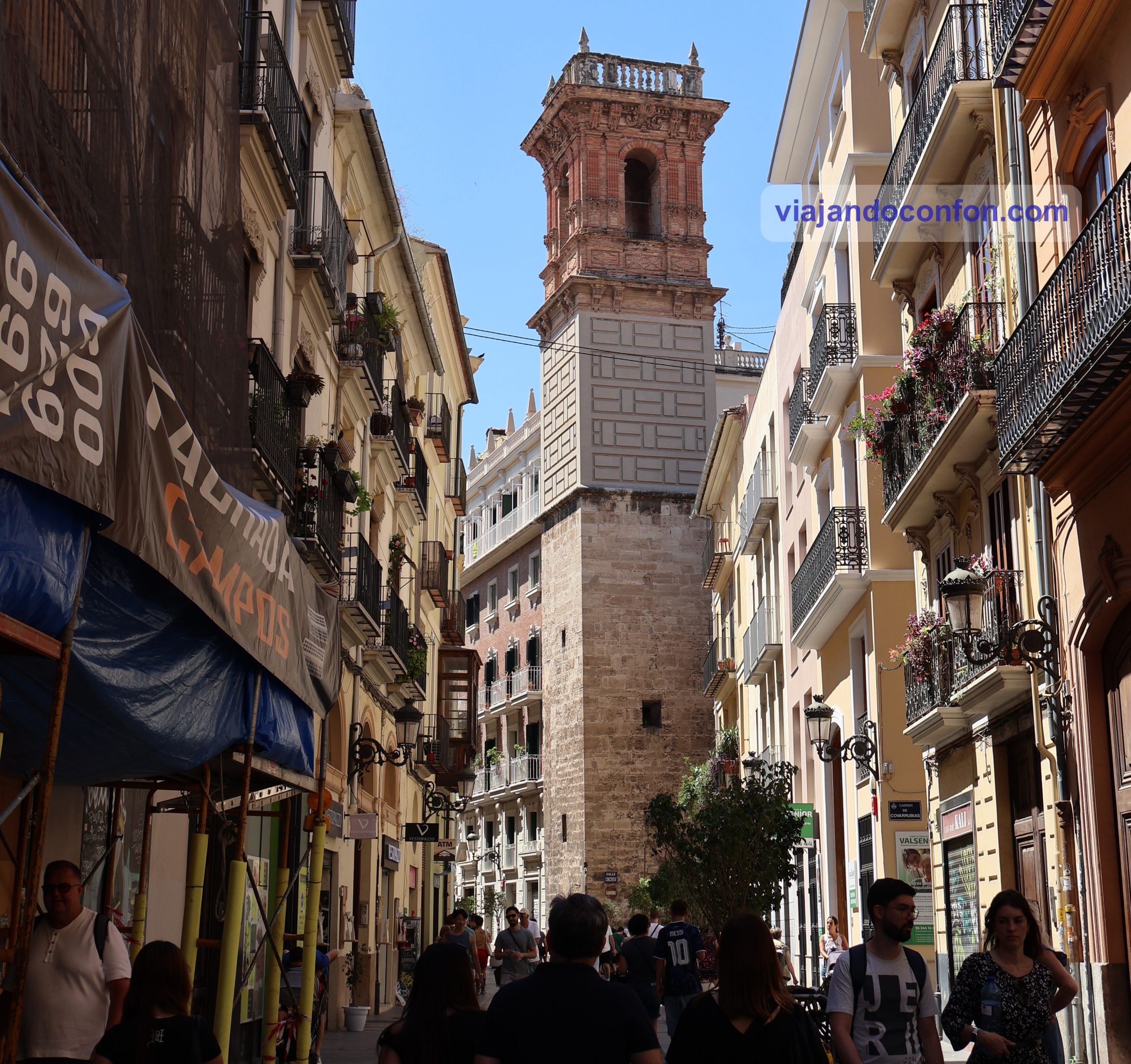
11. Torre de San Bartolomé Apóstol (Torre de Sant Bartomeu)
La torre es el único vestigio que queda de la iglesia de Sant Bartomeu, construida en 1239. Esta era una de las diez iglesias iniciales que se edificaron en la ciudad de Valencia terminada la conquista. La torre se encuentra al final de la calle de Serranos, cerca de la plaza de Manises.
La iglesia gótica de Sant Bartomeu fue reconstruida entre los años 1666 y 1683, aprovechando los muros del templo anterior. Esto motivó la desviación campanario que cargaba el peso por un lado sobre la pared antigua de la iglesia. Fue arreglado por el prestigioso arquitecto Juan Pérez Castiel
.La iglesia de San Bartolomé fue incendiada en 1936, al inicio de la Guerra Civil, y se demolió en 1944. La torre quedó dañada pero, por suerte, se pudo restaurar.
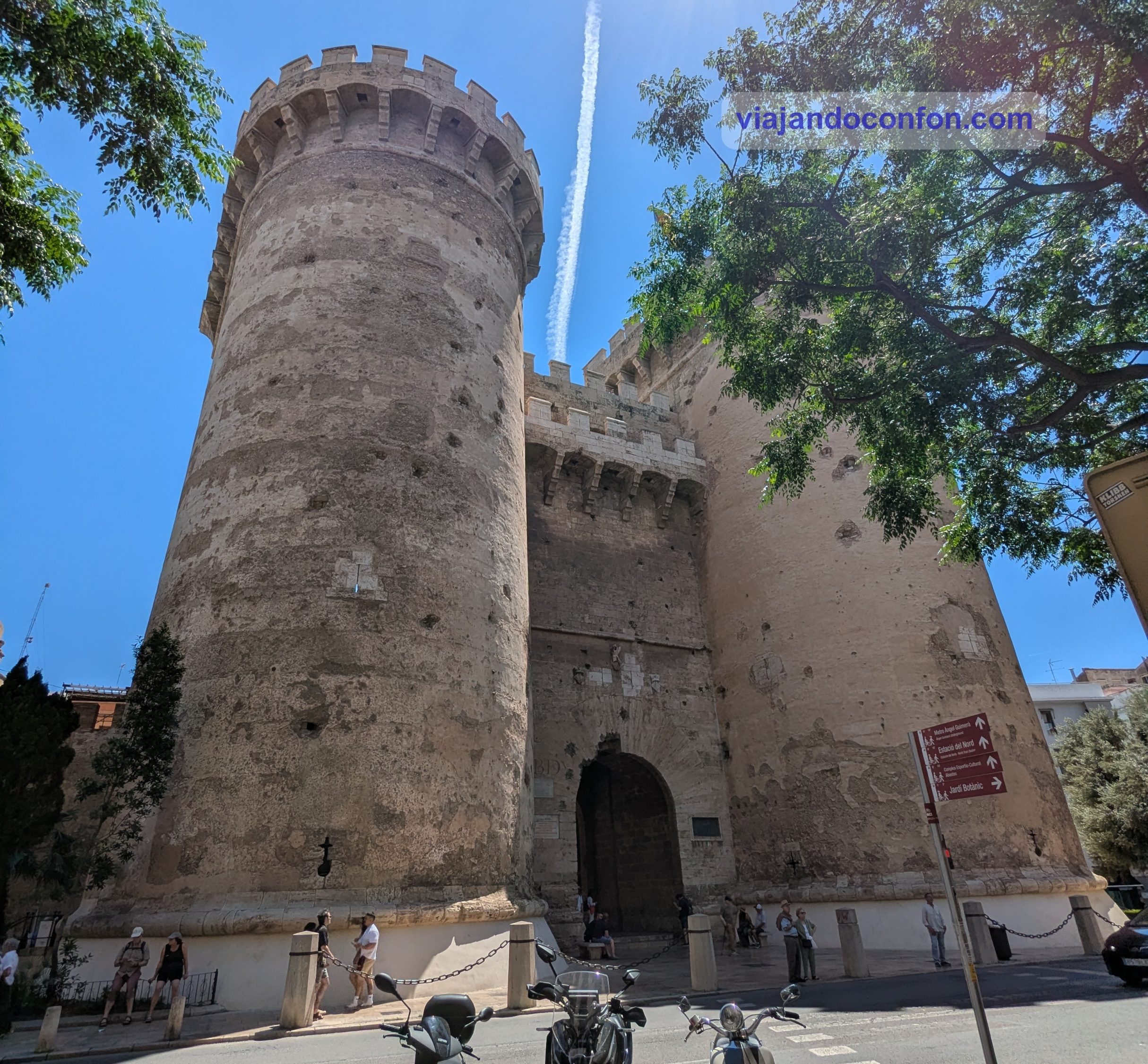
12. Torres de Quart
La Torre de Quart o Puerta de Quart es una de las dos puertas que se conservan de la antigua muralla medieval de Valencia. Se construyó entre 1441 y 1493, y recibe ese nombre porque el camino a Quart de Poblet partía de ella.
Estuvo en uso durante la Guerra de la Independencia, cuando quedó marcada por cañonazos y disparos de mosquete.
Originalmente aquí se encontraba una de las puertas de la muralla ordenada construir por Abd al-Aziz ibn Abi Amir (1021-1061) y llamada Alcántara.
Durante el siglo XIV, durante el reinado de Pedro I de Castilla y León (el Cruel), la población había aumentado fuera de las murallas islámicas originales y las inundaciones del río Turia eran una preocupación creciente. Esto dio lugar a proyectos para reemplazar las murallas islámicas y reconstruir las puertas.
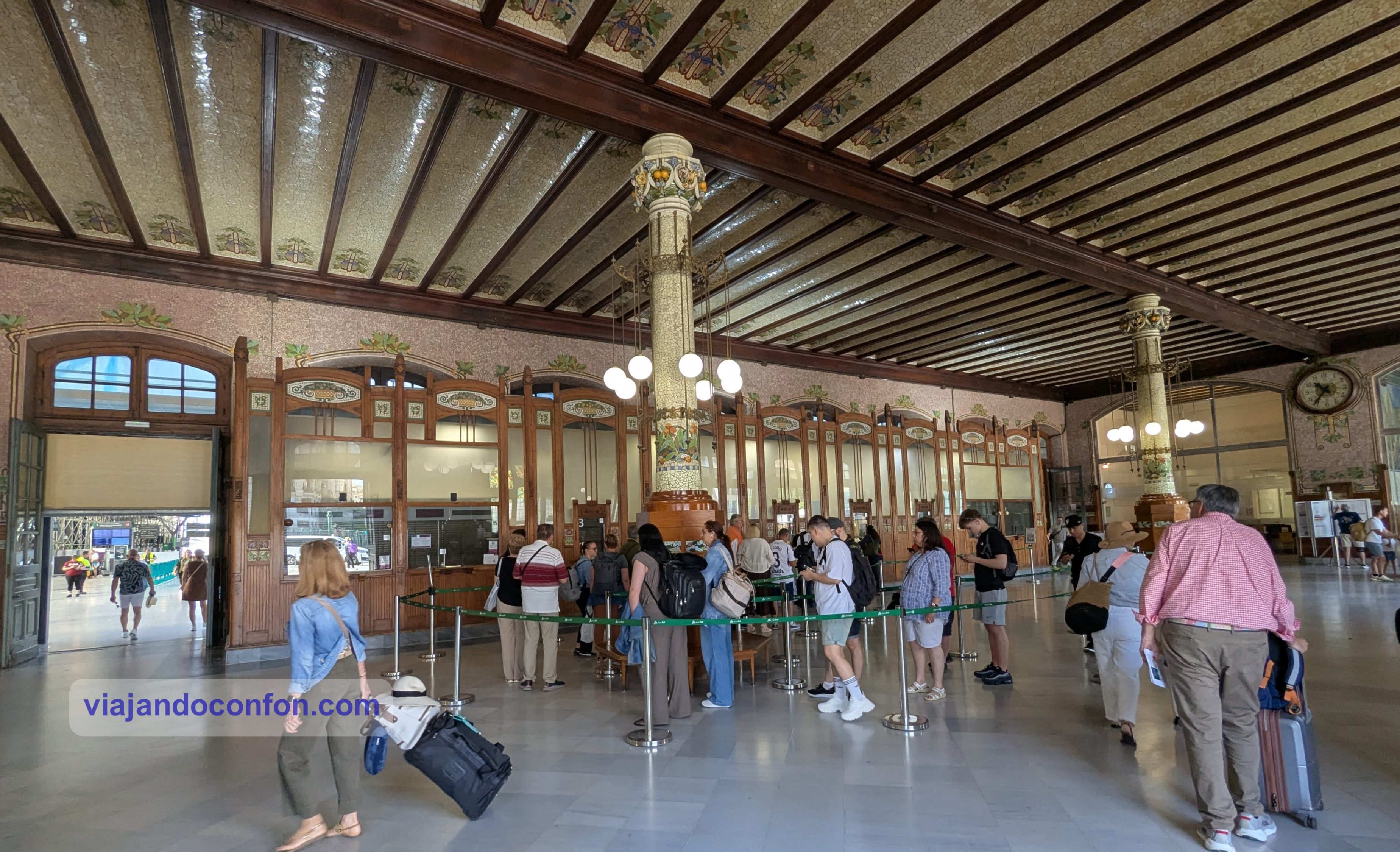
13. València Estació del Nord
La Estación del Norte es la principal estación de tren de Valencia y se encuentra en el centro de la ciudad, junto a la plaza de toros. El edificio es una de las principales obras del modernismo valenciano y fue declarado Bien de Interés Cultural en 1987.
El nombre de esta estación hace referencia a Caminos de Hierro del Norte de España, la compañía ferroviaria que la construyó e inauguró en 1917. Posteriormente fue nacionalizada e incorporada a Renfe y, actualmente, está gestionada por Adif.
Su fachada, con motivos vegetales, naranjas y flores de azahar, se inspira en la agricultura valenciana. También incluye otros elementos referenciando a la ciudad, como las cuatro barras rojas sobre fondo oro del escudo heráldico valenciano. En su interior destaca su vestíbulo, con una combinación de maderas, cristal y mármol.
14. Playa de la Malvarrosa (Platja de la Malva-rosa)
La playa de la Malvarrosa es la playa urbana más conocida de Valencia. Su nombre, así como el del barrio situado a su lado, data de 1848. Es gracias a un jardinero, Félix Robillard, que por aquel entonces ejercía el cargo de jardinero mayor del Jardín Botánico de Valencia.
Antiguamente era utilizada para desembarcar la pesca y para el intercambio de comercio entre los diferentes poblados cercanos a la capital. Poco a poco se fue convirtiendo en lugar de descanso de la burguesía valenciana.
Curiosidad: Ésta es la playa que pintó Sorolla en el verano de 1903 en el cuadro “Las tres velas”.
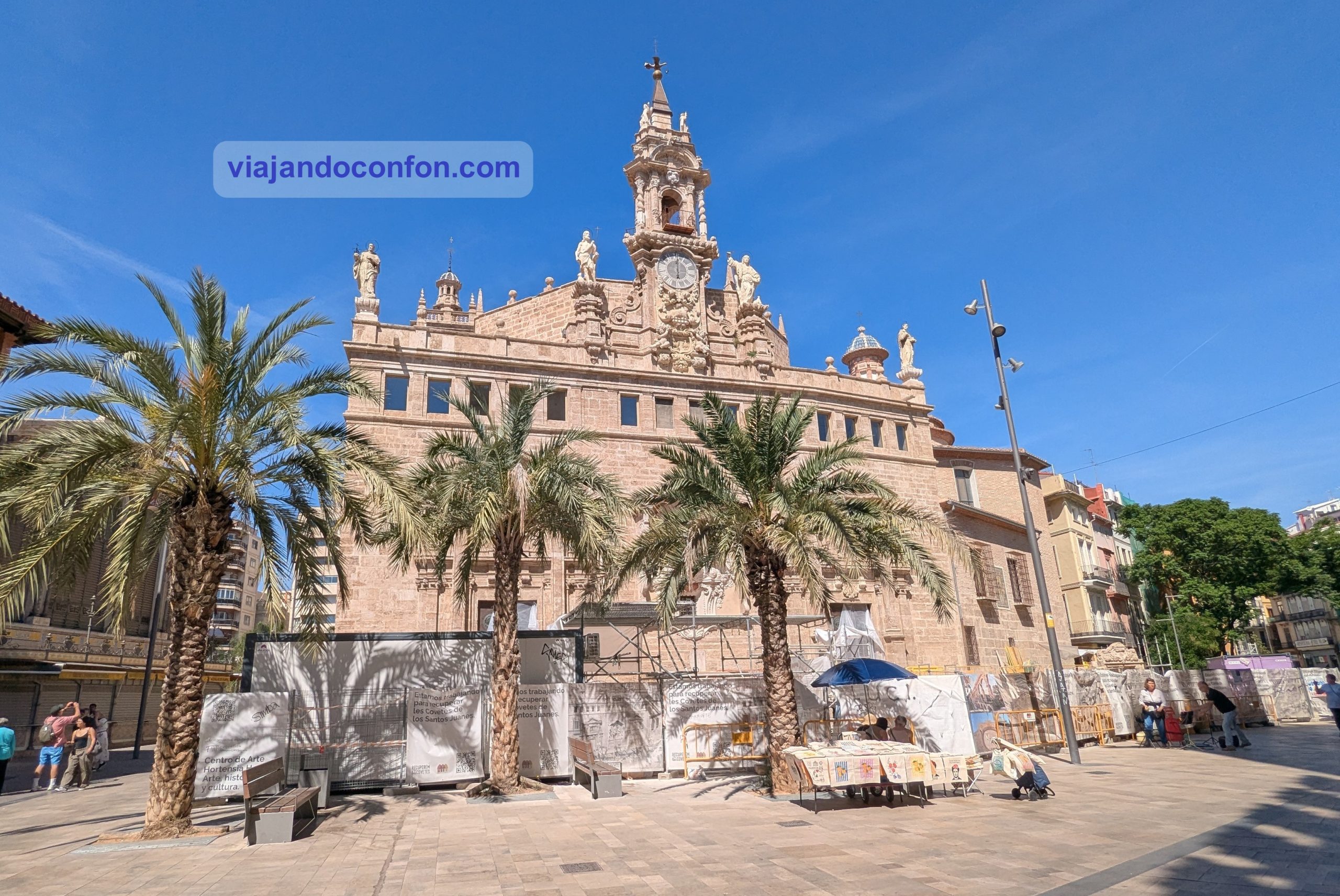
15. Parròquia de Sant Joan del Mercat
La Real Parroquia de los Santos Juanes o Parròquia de Sant Joan del Mercat es una iglesia católica ubicada en el barrio de Mercat, frente a la Lonja de la seda.
A mediados del siglo XIII, se construyó una iglesia gótica sobre el emplazamiento de una antigua mezquita. Tras varios incendios y reconstrucciones, la última en 1592, propició la reconstrucción del templo actual. Se inauguró en 1700 y se construyó en estilo barroco, por orden de el arzobispo y virrey Juan de Ribera.
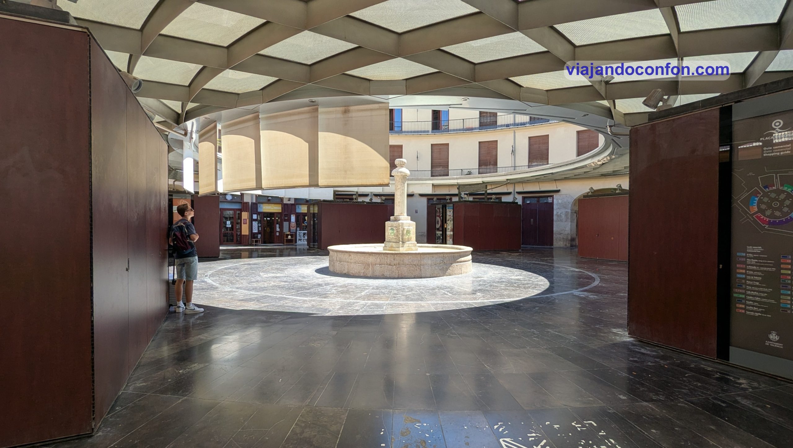
16. Plaça Redonda
La Plaça Redona, también llamada Plaça del Clot es una plaza ubicada en el tramo El Mercat(ca) del distrito de Ciutat Vella.
La plaza está rodeada de casas y edificios comerciales, por lo que resulta invisible desde el exterior. consta de una alta fuente en el centro, iluminada por una farola que prácticamente constituye la única iluminación. Alrededor de la fuente hay un espacio abierto y, a continuación, un anillo de puestos de venta.
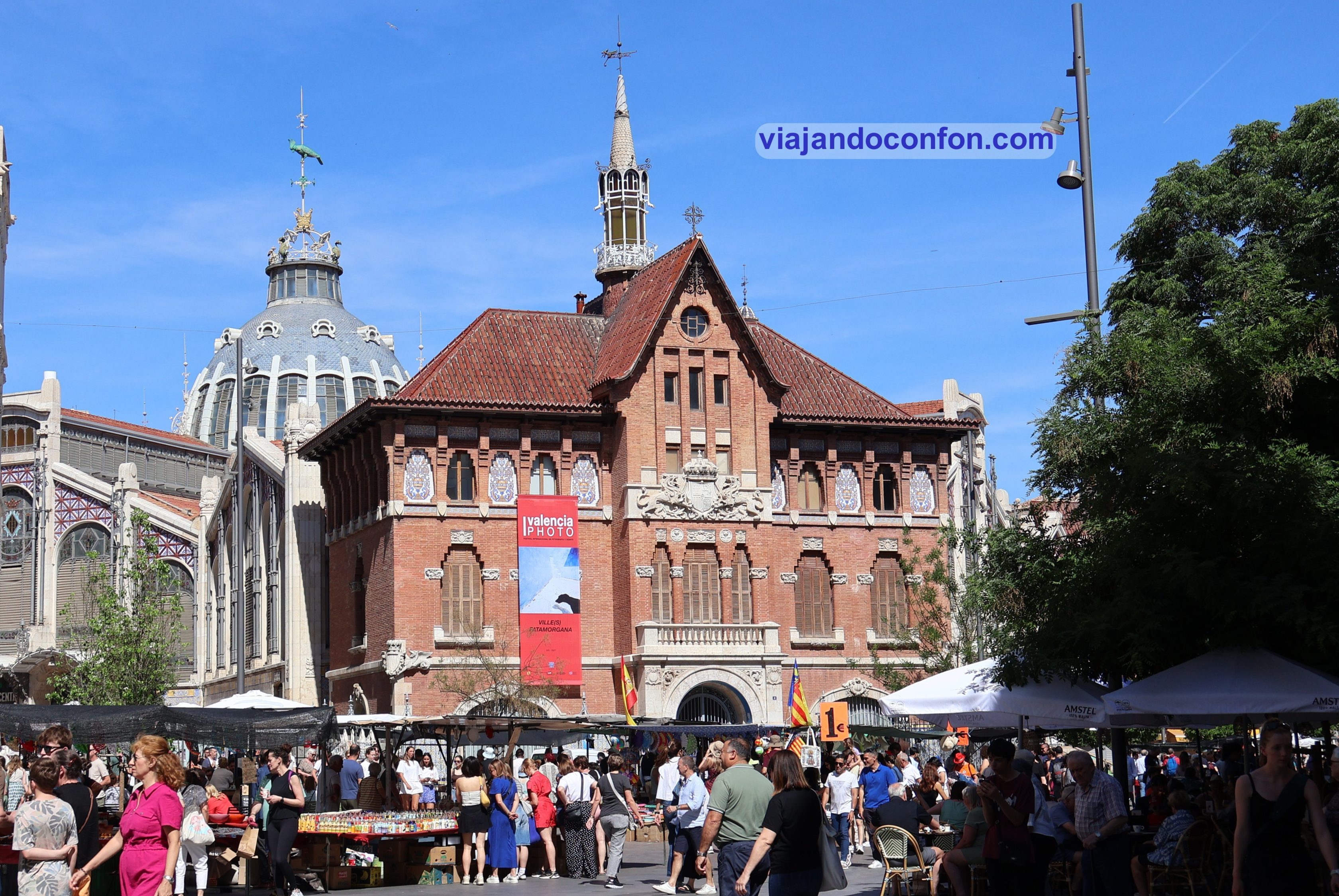
17. Fundación Mediterráneo – La Llotgeta Centro Fotográfico
Construido en la primera década del siglo XX, es un edificio que llama la atención, siendo una auténtica joya del Modernismo Valenciano. Inaugurado en 1928, forma parte del conjunto arquitectónico del Mercado Central.
Actualmente un centro que mantiene una programación de exposiciones fotográficas, conferencias, acciones formativas y actividades diversas.
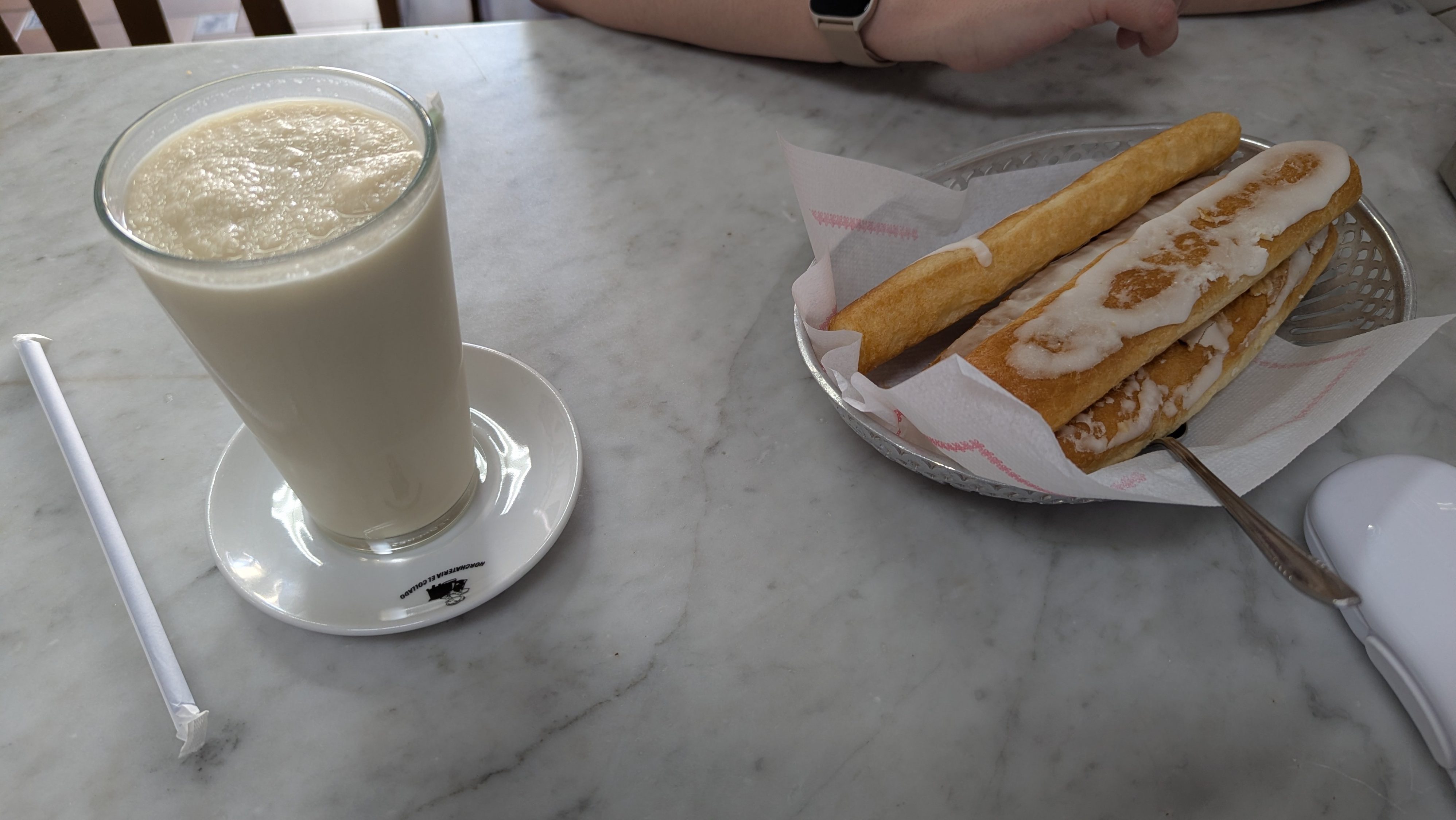
Bola Extra:
Híncate una horchata natural bien fresquita mientras empujas unos buenos y esponjosos fartons…
Encuentra las mejores actividades y tours en Valencia con Civitatis:
Como siempre, recomendamos viajar con un buen seguro de viajes. IATI es especialista en seguros de viaje y, por ser nuestro lector, tienes un 5% de descuento.
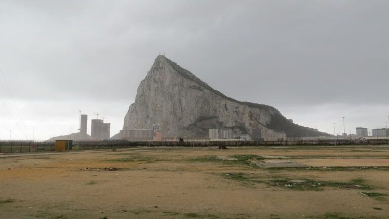
Se trata de un Territorio Británico de Ultramar ubicado en el extremo sur de la Península Ibérica. Hace frontera con España con La Línea de la Concepción, Provincia de Cádiz.
Tiene una superficie de tan sólo 6,7 km². Su paisaje destaca por el peñón. Es un macizo rocoso a cuyos pies se encuentra el área urbana, con unos 32.000 habitantes.
¡¡IMPORTANTE!!: A partir del 15 de julio de 2026 Gibraltar entra en Espacio Schengen. A partir de ese momento desaparece la frontera física y habrá libre circulación entre España y la colonia británica.
Información general
En 1704, las fuerzas anglo-holandesas capturaron Gibraltar de España durante la Guerra de Sucesión española. El territorio fue cedido a Gran Bretaña a perpetuidad bajo el Tratado de Utrecht en 1713. Entonces se convirtió en una base importante para la Royal Navy. Particularmente durante las Guerras Napoleónicas y la Segunda Guerra Mundial. Ya que controlaba la entrada y salida estrechas al mar Mediterráneo.
El Estrecho de Gibraltar, de solo 14,3 km de ancho, separa Europa de África. Este cuello de botella sigue siendo estratégicamente importante, ya que la mitad del comercio marítimo mundial pasa por él.
Su economía se basa en gran medida en el turismo, los juegos de azar en línea, los servicios financieros y el abastecimiento de combustible. Básicamente es un paraíso fiscal.
La soberanía de Gibraltar es un punto de discordia en las relaciones anglo-españolas, ya que España reclama el territorio. Los gibraltareños rechazaron abrumadoramente las propuestas de soberanía española en un referéndum de 1967. También la soberanía compartida en un referéndum de 2002. Sin embargo, la colonia mantiene estrechos vínculos económicos y culturales con España. Con muchos gibraltareños que hablan español, así como un dialecto local conocido como llanito.
Haciendo un apunte sobre el llanito… me parece harto gracioso. La manera que tienen de intercalar el inglés y el gaditano cerrado. Me encanta.
El 31 de enero de 2020, el Reino Unido y Gibraltar abandonaron la Unión Europea. En diciembre de 2020, el Reino Unido y España acordaron en principio una base sobre la cual el Reino Unido y la UE podrían negociar los términos para que la colonia participe en aspectos del Acuerdo de Schengen.
Encuentra tu hotel ideal al mejor precio en Gibraltar con Agoda:
Castilla-La Mancha es una de las 17 Comunidades Autónomas que componen España y está compuesta por cinco provincias. Estas son: Albacete, Ciudad Real, Cuenca, Guadalajara y Toledo. Con algo más de 2 millones de habitantes, fue creado en 1982. La sede del gobierno está en Toledo, que es la capital de facto.
Como siempre, recomendamos viajar con un buen seguro de viajes. IATI es especialista en seguros de viaje y, por ser nuestro lector, tienes un 5% de descuento.
Como siempre, recomendamos viajar con un buen seguro de viajes. IATI es especialista en seguros de viaje y, por ser nuestro lector, tienes un 5% de descuento.
La ciudad de Jaén es una gran desconocida turísticamente hablando. Una verdadera pena ya que es una ciudad preciosa con muchos atractivos y un sinfin de palacios de todas las épocas. Es una delicia pasear por su maravilloso centro histórico.
Encuentra tu hotel ideal al mejor precio en Jaén con Agoda:
*Nos ayuda a mantener el blog
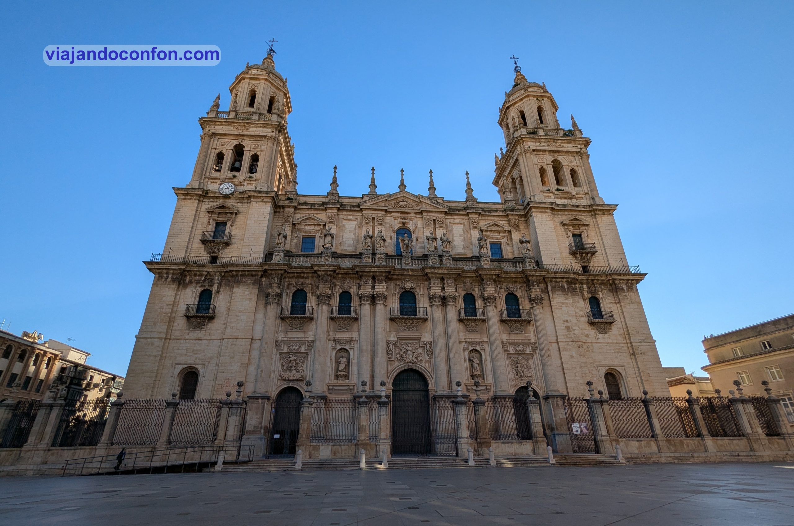
01. Catedral de Jaén
La Santa Iglesia Catedral de la Asunción de la Virgen es la catedral de Jaén, sede episcopal de la diócesis de Jaén. Se ubica en la plaza de Santa María, frente al Palacio Municipal y el Palacio Episcopal.
Tras la reconquista de Jaén por las tropas del rey Fernando III en 1246, la antigua mezquita de la ciudad sirvió como sede episcopal. La construcción de una catedral gótica comenzó en 1494, pero su cúpula del crucero se derrumbó en 1525.
En 1540 se inició la construcción de un nuevo edificio, de mayores dimensiones, que no se completó hasta 1725. El arquitecto principal responsable del diseño y de la primera fase de la construcción fue Andrés de Vandelvira, quien también falleció en Jaén (1575). Posteriormente, los arquitectos Alonso Barba (1594), Juan de Aranda Salazar (1654) y Eufrasio López de Rojas (1684) continuaron la obra.
Horario: de lunes a jueves de 10:00 a 13:30 y de 17:00 a 19:00 // Viernes y sábados de 10.00 a 17.00 // Domingos de 14.00 a 17.00. Precio: adultos: 8€ / Mayores de 65: 7€ / Jóvenes de 13 a 25: 6€ / Menores de 12: gratis.
Puedes conocer a fondo la Catedral con esta fabulosa VISITA GUIADA:
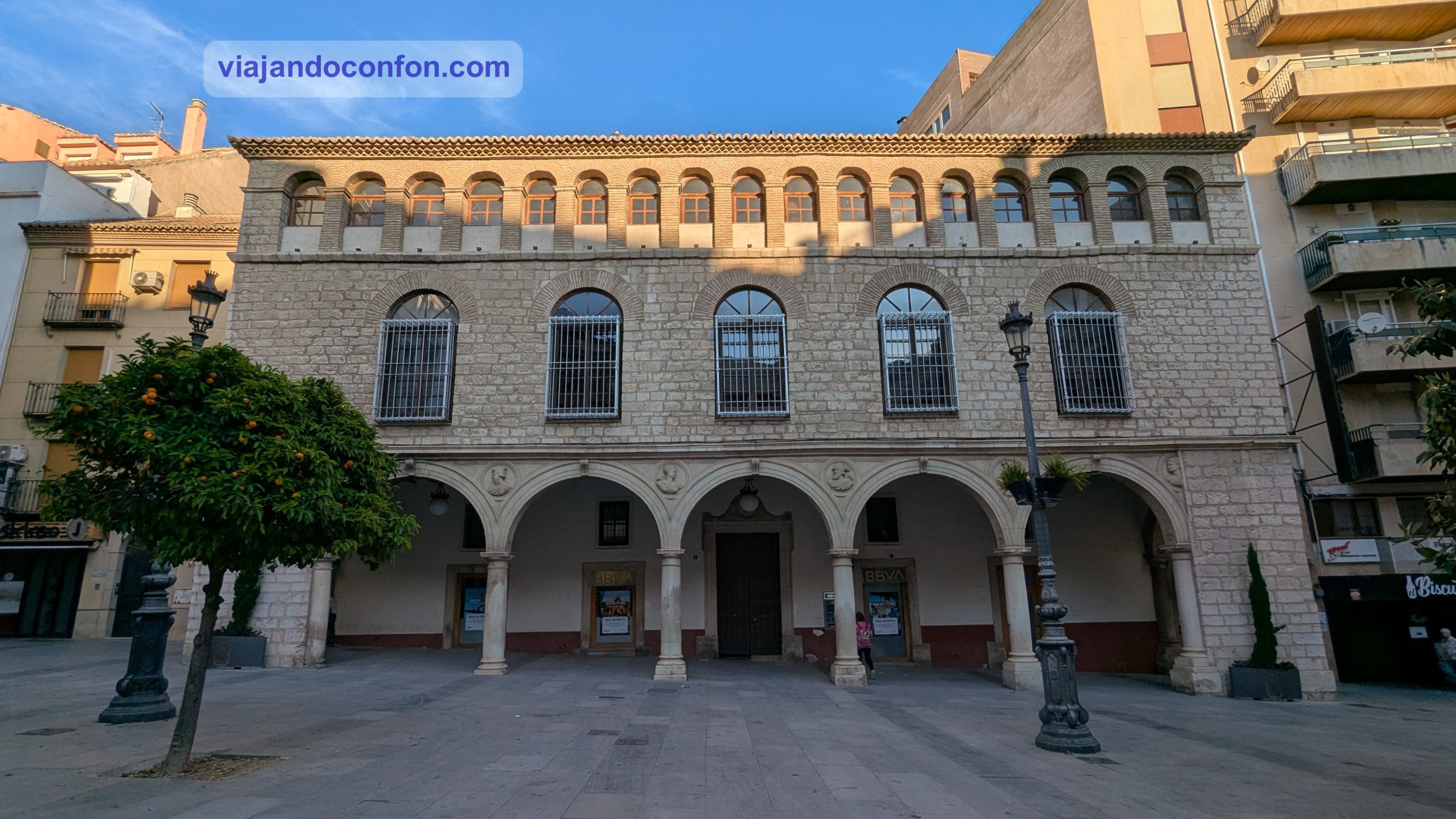
02. Palacio de Villardompardo
El Palacio de los Condes de Villadompardo se construyó en estilo renacentista en el siglo XVI. Fue por orden de Fernando Torres y Portugal, I Conde de Villardompardo y Virrey del Perú. Durante los siglos XVII y parte del XVIII se utilizó como banco.
A finales del siglo XVIII paso a ser el Hospicio de Mujeres, tras ser adiquirido por la Junta del Real Hospicio, pasando éste a la Beneficencia Provincial. A principios del XIX se hacen algunas restauraciones como la de la puerta de entrada del Palacio, colocándose sobre su dintel esta inscripción:
“Pascentur primoneniti Pauperum, et pauperes Fiducialiter requiescent“ (Los primogénitos de los pobres se alimentan, y los pobres descansan confiadamente).
Desde principios del siglo XX, el edificio forma parte del patrimonio inmobiliario de la Diputación Provincial de Jaén. En 1970, tras el traslado del Hospicio, comienzan las obras de restauración de los Baños Árabes situados en los sótanos del Palacio así como la rehabilitación de todo el edificio.
Actualmente el edificio es un centro cultural y es sede de:
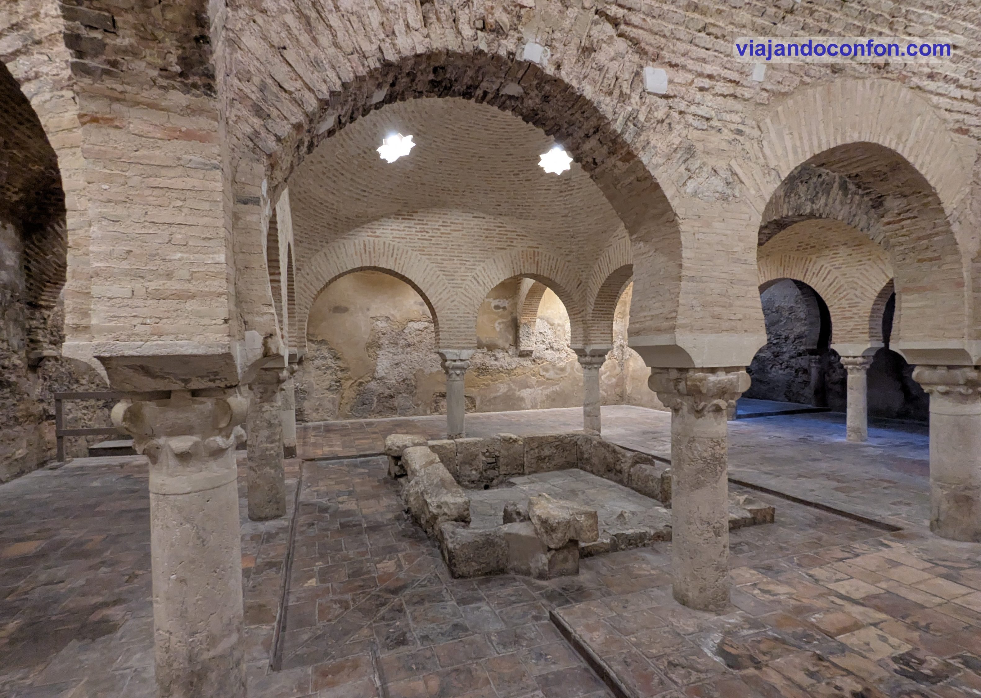
Baños Árabes de Jaén: Son también conocidos como Baño del Niño (Hamman al-Walad), son un hammam (casa de baños islámicos). Estos fueron uno de los cinco baños árabes conocidos en Jaén.
Se construyeron sobre un baño romano en 1002, cerca del final del Califato de Córdoba. Aunque seguramente hayan sufrido modificaciones posteriores, probablemente en el siglo XII. Estos baños se abastecían de agua del manantial de la Magdalena.
Tras la conquista cristiana de la ciudad por Fernando III en 1246, los baños siguieron utilizándose durante un tiempo hasta que fueron reconvertidos en curtidurías.
Fueron redescubiertas definitivamente por Enrique Romero de Torres en 1913 durante un estudio de los edificios históricos de la ciudad. El sitio fue declarado Bien de Interés Cultural de España en 1931.
Museo Internacional de Arte Naïf de Jaén «Manuel Moral»: Se trata de una galería de arte naïf situada en el ala izquierda del palacio. Fue inaugurado el 20 de diciembre de 1990 siendo el primer museo de España dedicado a este estilo.
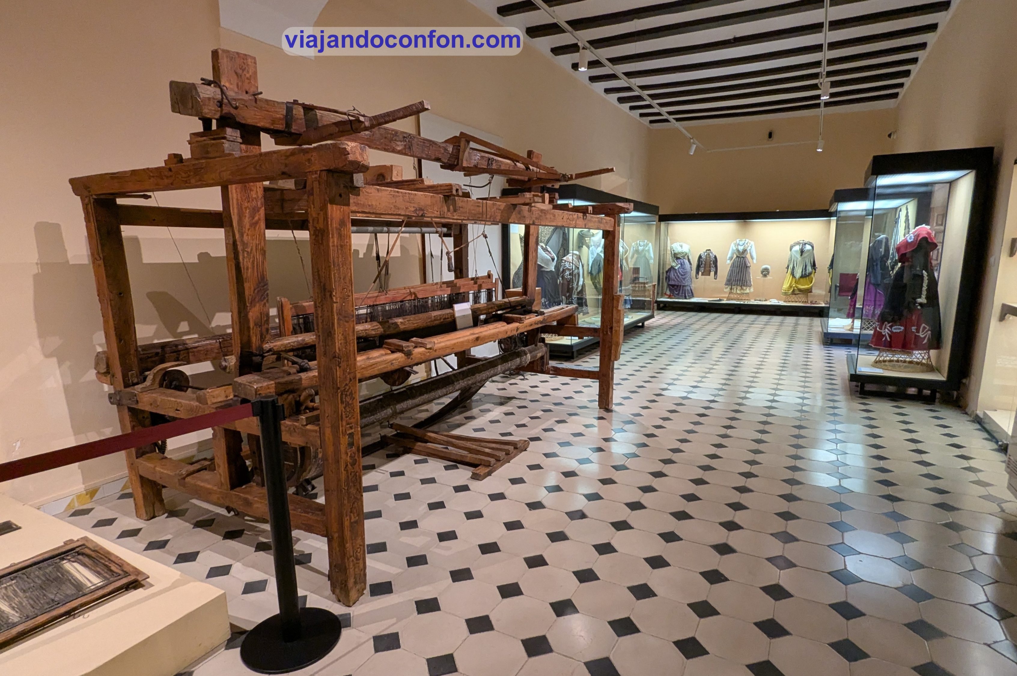
Museo de Artes y Costumbres Populares de Jaén: Es un museo dedicado a la cultura y costumbres de la provincia de Jaén. Inaugurado el 20 de diciembre de 1990 y aquí se muestran los modos de vida populares anteriores a la industrialización de Jaén.
Por cierto, en la parte alta del palacio tenemos una gran terraza desde la que podemos disfrutar de unas bonitas vistas de la ciudad y sus alrededores.
Horario: De martes a sábado y festivos de 9:00 a 21:00 // Domingos de 9:00 a 15:00. // Lunes cerrado. Precio: gratis.
Entérate de todos los entresijos del palacio con esta fantástica visita guiada:
*Nos ayuda a mantener el blog
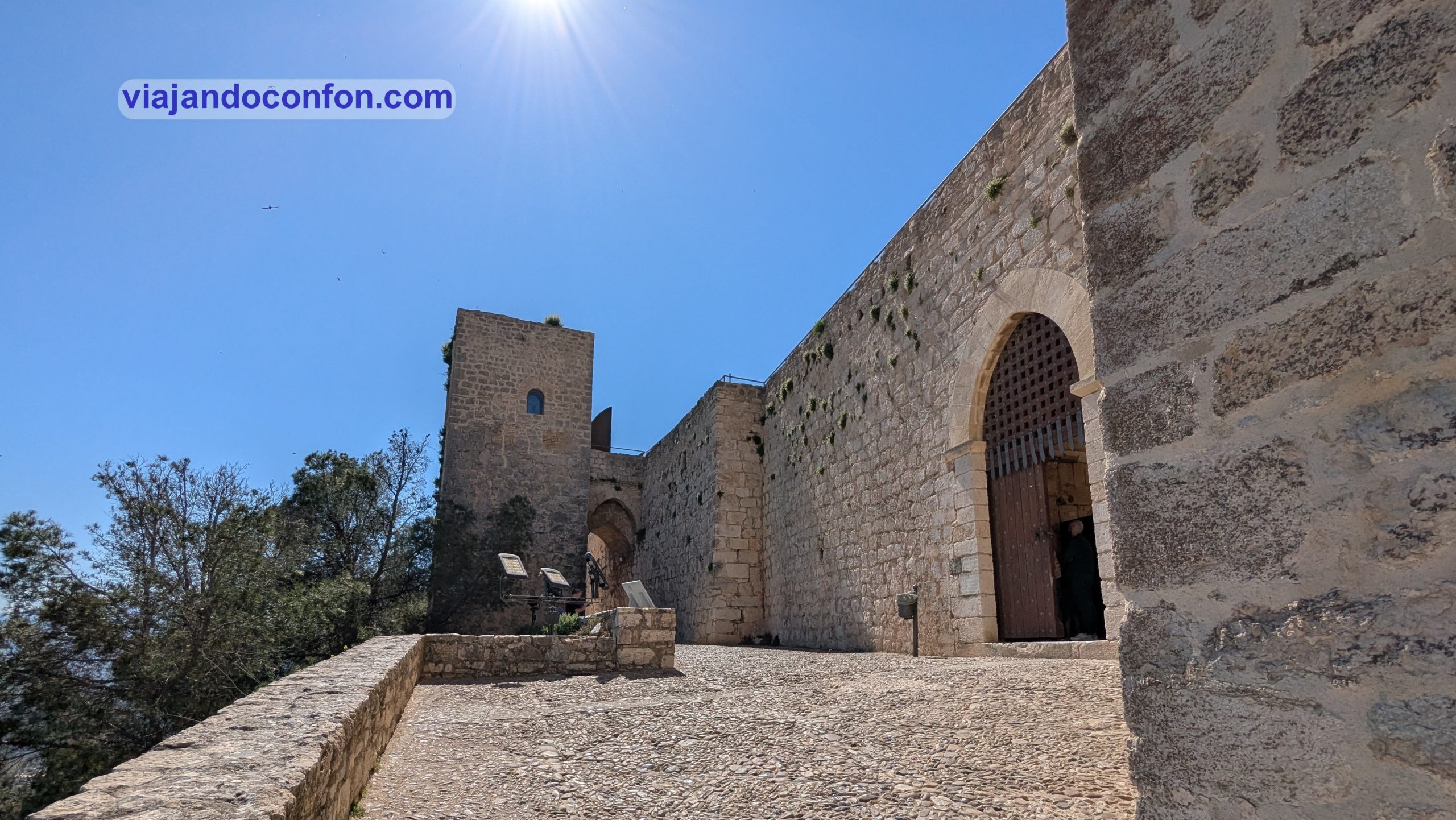
03. Castillo de Santa Catalina
El castillo de Santa Catalina, o Alcázar Nuevo es una construcción defensiva de acabado cristiano-medieval, que corona el cerro homónimo. Su nombre proviene de la capilla gótica de Santa Catalina de Alejandría, construida aquí tras la conquista de la ciudad por los cristianos.
El castillo comenzó como una fortaleza morisca construida por los omeyas en el siglo VIII. Posteriormente fue mejorada por el gobernante nazarí del Emirato de Granada, Abdallah ibn al-Ahmar (quien también construyó la Alhambra).
Después de que el rey Fernando III de Castilla capturara la ciudad en 1246, inició una transformación del castillo. Esto incluyó la construcción de lo que se conoció como el Castillo Nuevo en el extremo oriental de la colina. Sin embargo, la mayor parte de la obra se llevó a cabo durante los reinados de Alfonso X y Fernando IV.
A principios del siglo XIX, las fuerzas napoleónicas construyeron un almacén de pólvora, establos, un hospital, oficinas, una cocina y una plataforma de artillería. De la mayoría de estas construcciones, solo quedan los cimientos.
La construcción del parador en 1965 provocó la destrucción de muchos elementos del antiguo castillo. Los pocos vestigios de la fortaleza original se encuentran en el extremo occidental de la colina.
En la cima de la colina se alza una cruz monumental que recuerda la que Fernando III mandó erigir allí. Al pie de la cruz, grabado en la roca, se encuentra el “Soneto a la Cruz” del poeta Almendros Aguilar.
Horario invierno (16 sep – 15 jun): lunes a sábados de 10.00 a 18.00 // Domingos de 10.00 a 15.00. Horario verano (16 jun – 15 sep): lunes a sábados de 10.00 a 14.00 y 17.00 a 21.00 // Domingos de 10.00 a 15.00. Precio: 3.50€ // Reducida: 1.50€.
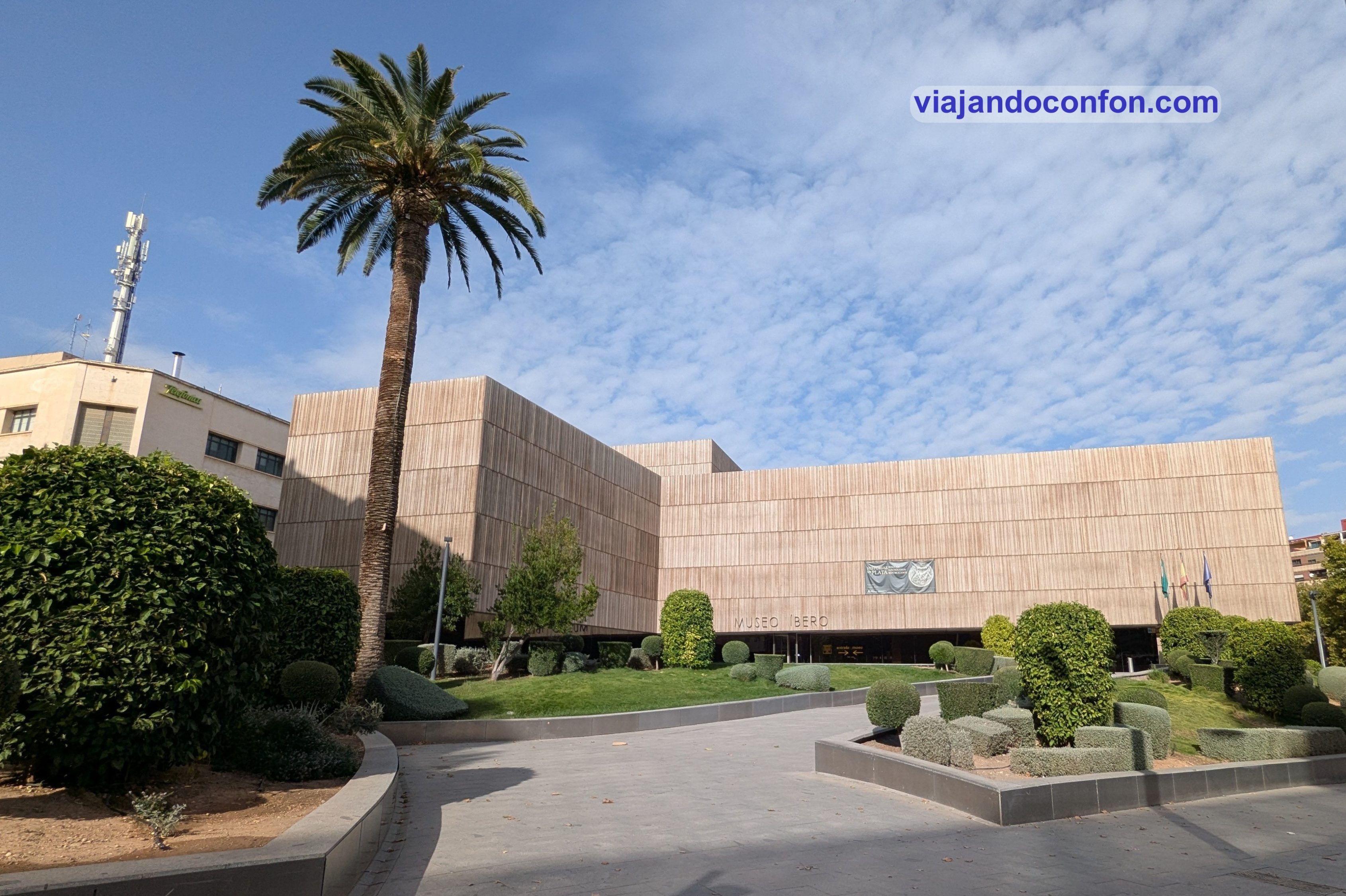
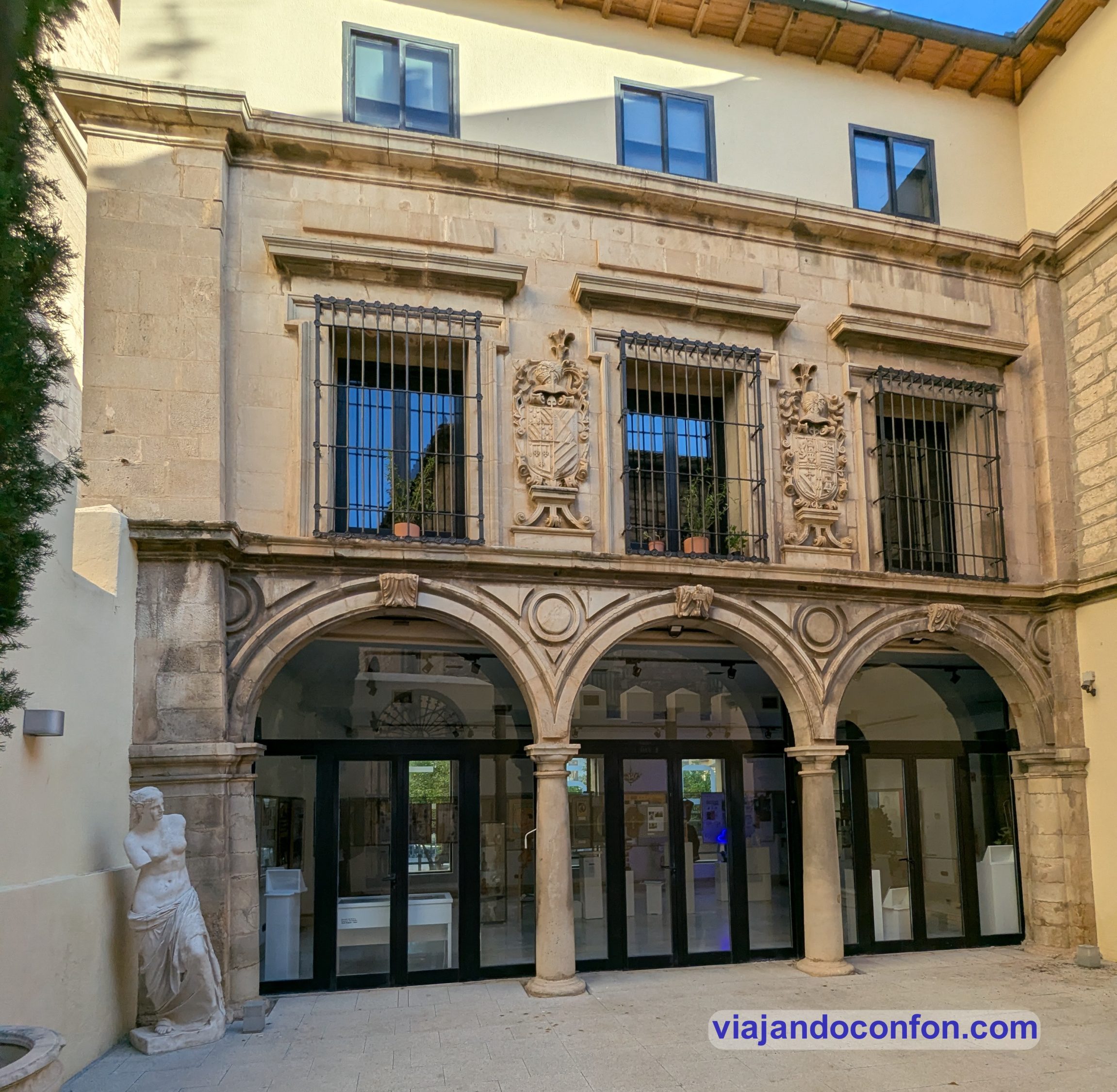
04. Museo Íbero
Inaugurado el 11 de diciembre de 2017, alberga una destacada colección de arte íbero. Se encuentra situado en el lugar en el que se encontraba la antigua prisión provincial, en el Paseo de la Estación.
La mayoría de sus colecciones provienen del Museo de Jaén, así como de los yacimientos íberos de Jaén. Como, por ejemplo, Cástulo en Linares o Cerrillo Blanco en Porcuna. También objetos íberos de los museos arqueológicos de Almería, Sevilla, Córdoba, Granada y Linares.
Asimismo encontraremos tres exvotos del yacimiento de Torreparedones en Baena, Córdoba.
Horario de verano (16 junio a 15 de septiembre): martes a domingo y festivos de 9:00 a 15:00. Lunes cerrado excepto víspera de festivo. Horario de invierno (16 de septiembre a 15 de junio): martes a sábado de 9:00 a 21:00 // Domingos y festivos de 09:00 a 15:00. Lunes cerrado excepto víspera de festivo. Precio: 1.50€ // Gratis para los ciudadanos de la UE.
05. Fuente del Lagarto
En la plaza de la Magdalena encontramos una curiosa fuente. Se trata de la Fuente del Lagarto o Fuente de la Magdalena. Está enclavada en el lugar en el que nació la leyenda del lagarto de Jaén, de origen medieval.
Dicha leyenda cuenta que aquí dormía un monstruoso lagarto que tenía asustada a la población. A un joven pastor se le ocurrió un plan para acabar con el. Le ofreció un cordero con las tripas llenas de pólvora. El lagarto, al comerse el cordero, explotó dando fin a la amenaza.
Desde entonces, este reptil es el animal que simboliza a la capital.
06. Iglesia de la Magdalena
La Iglesia de Santa María Magdalena es una iglesia gótica construida sobre los cimientos de una mezquita erigida en 825 por Abd al-Rahman II. Es una de las más antiguas de la ciudad, datando del siglo XVI.
De esta mezquita aún se conservan las cuatro naves y el patio. También unos arcos de herradura y otros de medio punto. El campanario actual era el antiguo minarete, aunque supuestamente fue rediseñado por Andrés de Vandelvira.
07. Raudal de la Magdalena
Hasta el siglo XIX fue la principal fuente de agua potable de la ciudad. Desde la construcción del ninfeo romano, el raudal principal fue ampliándose al mismo tiempo que se producia el crecimiento de la ciudad.
Este abastecía termas, mezquitas, baños públicos, aljbes y fuentes en época islámica. Asi como fuentes omamentales y palacios de las principales familias de la ciudad medieval y moderna, hasta llegar al punto de unión con el Rautal de Santa Maria en el actual palacio de cultura, antiguo palacio del Condestable D. Miguel Lucas de Iranzo.
Este manantial de agua es el protagonista de la legendaria y mas famosa leyenda de la ciudad de Jaén “El lagarto de la Magdalena” al ser identificada como su guarida.
Puedes encontrar un sinfin de actividades en Jaén con Get Your Guide
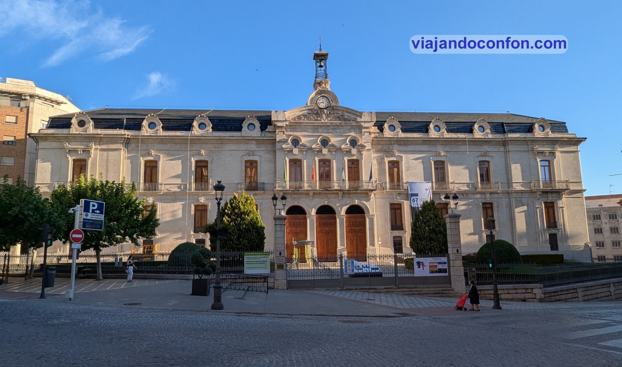
08. Palacio de la Diputación Provincial
Construido a finales del siglo XIX, es un edificio ecléctico diseñado por Jorge Porrúa y Moreno. En su patio interior destaca una monumental fuente procedente del antiguo Convento de Santo Domingo de La Guardia de Jaén. El palacio también alberga una interesante colección de pinturas distribuidas en sus dependencias anexas.
Se edificó sobre el solar del Real Convento de Nuestro Seráfico Padre San Francisco de Asís. Este fue residencia de Fernando III de Castilla tras la conquista de la ciudad y fue destruido en 1867.
Horario: de lunes a viernes de 9.00 a 14.00 // Sábados, domingos y festivos de 10.00 a 14.00. Precio: gratis.
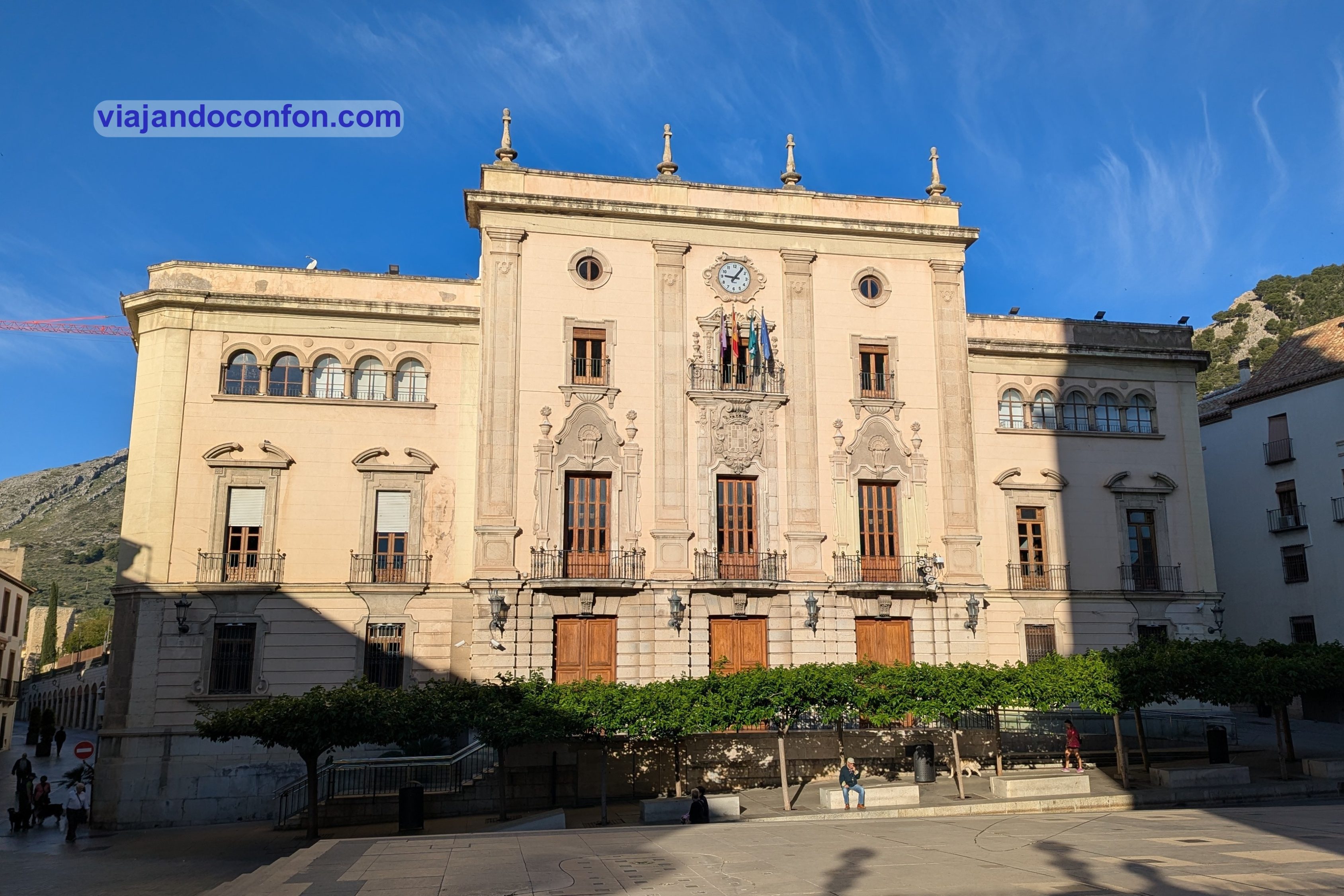
09. Ayuntamiento de Jaén
Se encuentra enclavado en un palacio construido en estilos neoclásico y neobarroco construido en 1901. En principio, el edficio no fue del agrado de la ciudadanía. Esto hizo que la fachada sufriera una profunda reforma entre 1918 y 1922 arquitecto municipal Agustín Eyres.
Como resultado de esta reforma, el edificio adquirió cierto aire modernista afrancesado con algunos toques de trazas regionalistas. Reforma que tampoco gustó. Se llegó a calificar popularmente al edificio como «Estación de ferrocarril francés».
En 1949 se le dotaría de su aspecto actual, suprimiendo ese aire de «estación de tren». Esta reforma fue obra del arquitecto Antonio María Sánchez.
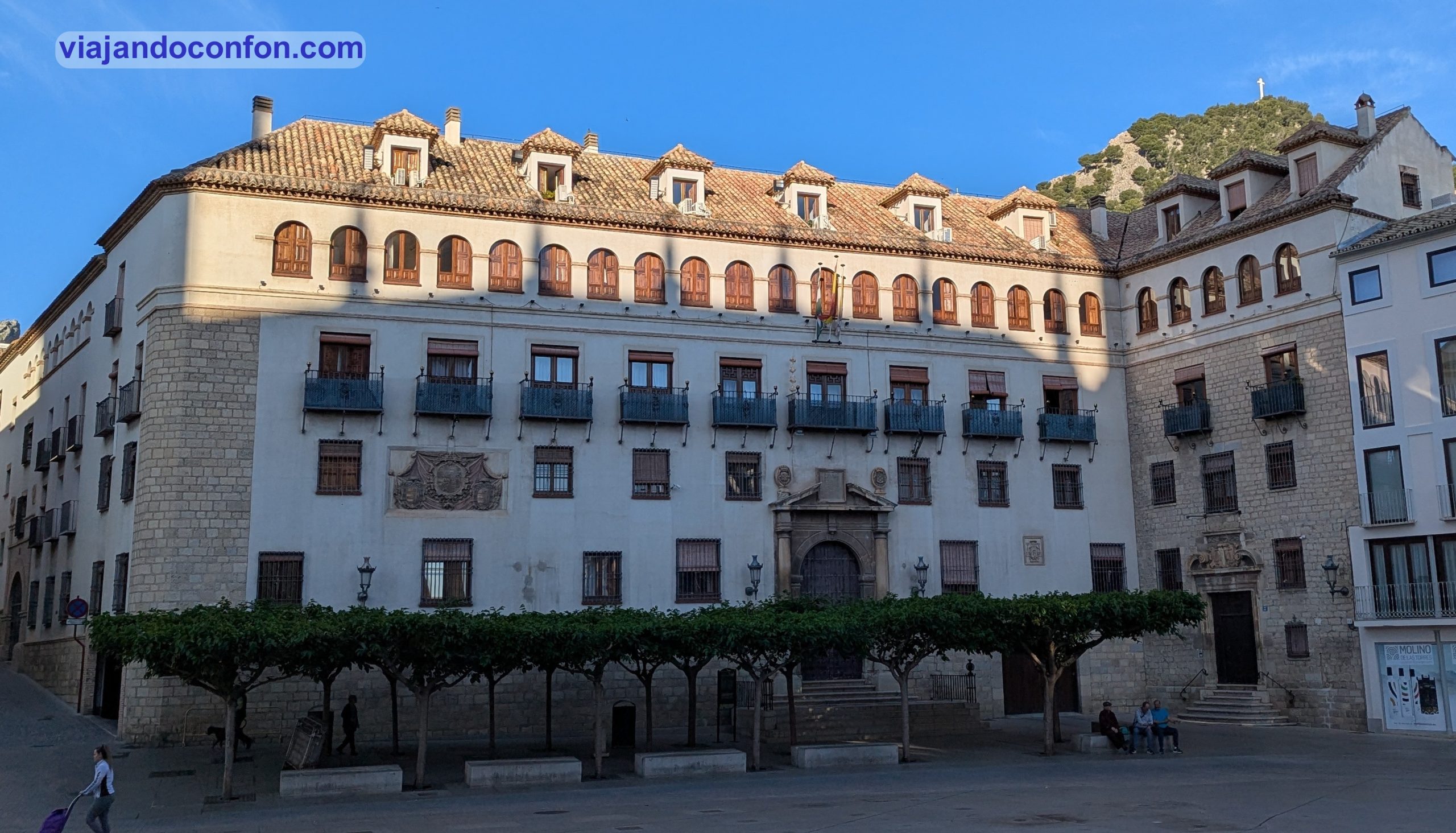
10. Palacio Episcopal de Jaén
Originalmente era un palacio del siglo XV, construido con numerosas ampliaciones y añadidos. En 1980 se demolieron todas las edificaciones. Se respetaron sólo sus fachadas y zonas nobles y se transformó en Casa de la Iglesia y viviendas con arreglo a un proyecto del arquitecto don Luís Berges Roldán.
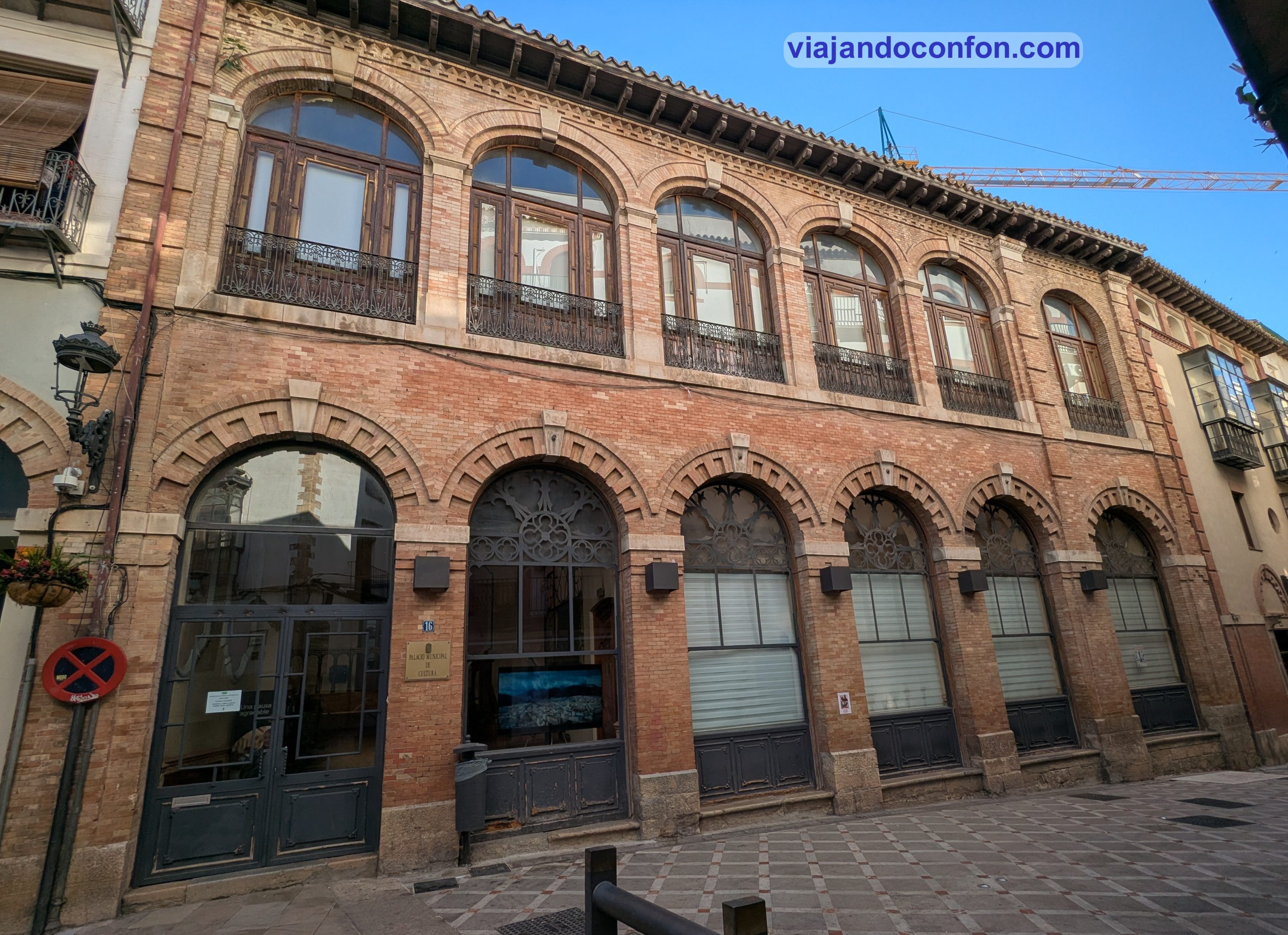
11. Palacio del Condestable Miguel Lucas de Iranzo
Se trata de un edificio de estilo mudéjar del siglo XV. Se encuentra situado en la zona en la que se asentaron las familias nobles de la ciudad.
La casa fue adquirida por Miguel Lucas de Iranzo convirtiéndose en su lugar de residencia desde 1462. Este realizó grandes obras que la transformaron por completo, convirtiéndolo en un suntuoso palacio mudéjar.
Tras la muerte de Miguel, en 1473, el edificio pasa por diferentes manos hasta llegar a la posesión de los Marqueses de Bélgida. Estos lo modificaron y vendieron una parte Fernando de Aranda en 1805.
En la segunda mitad del siglo XIX sufre una gran transformación. Se levanta sobre algunas zonas del edificio un teatro, varias viviendas y el popular Casino Primitivo. En 1892 fue adquirido por el arquitecto Justino Flórez Llamas. Este vende en 1919 al Casino Primitivo la parte principal del palacio, volviendo a sufrir nuevas obras en 1928.
En la actualidad, este palacio es propiedad Ayuntamiento de Jaén, que ha instalado allí el Patronato Municipal de Cultura y Turismo.
Horario: de lunes a viernes de 9.00 a 14.00 y de 16.00 a 19.00 // Sábados y domingos cerrado. Precio: gratis.
12. Arco de San Lorenzo
El Arco de San Lorenzo se encuentra en la intersección de las calles Almendros Aguilar y Madre de Dios. Forma parte de la antigua iglesia de San Lorenzo, construida entre los siglos XIII y XIV.
Su interior alberga azulejos y paneles de estilo mudéjar, así como una pequeña capilla. También es sede de la asociación Amigos de San Antonio. Fue declarado Bien de Interés Cultural en 1877.
13. Torreón del Conde de Torralba
Es el resto más visible de la muralla árabe de Jaén. Esta iba desde el castillo de Santa Catalina y bajaba por el monte rodeando la ciudad. Fue reforzado y ampliado por los cristianos.
Tras su utilización meramente defensiva, mantuvo una función fiscal, ya que en ella se cobraban los impuestos sobre las mercancías que entraban y salían de la ciudad.
El Torreón Conde de Torralba está realizado en sillería y cuenta con una sala amplia que recoge la luz por tres saeteras. Se accede desde el adarve cubierto por dos arcos de ladrillo. Fue restaurado en 1972.
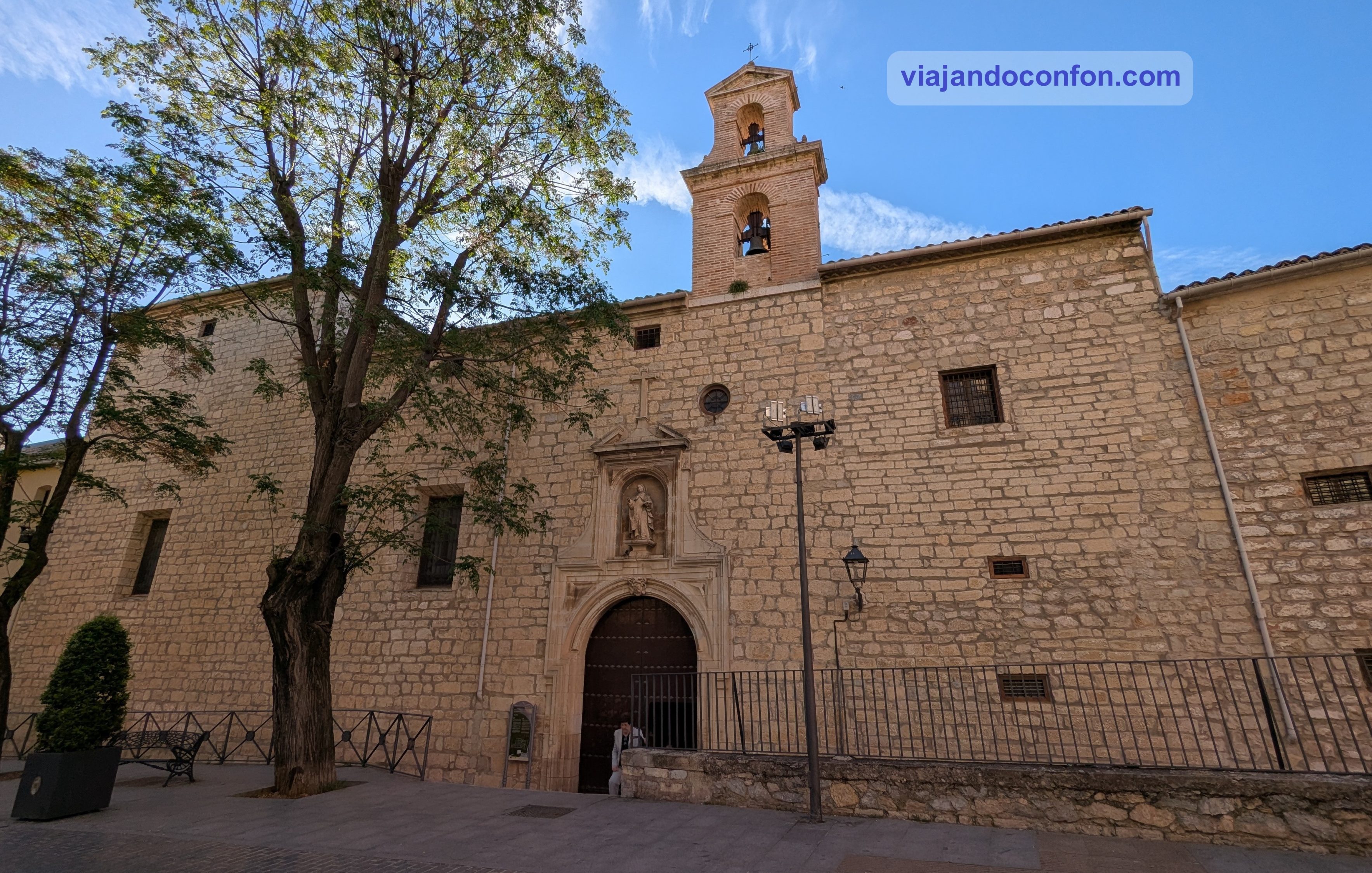
14. Convento de Santa Teresa de Jesús
Se trata de un edificio barroco de las Carmelitas Descalzas de clausura. Fue fundado por el matrimonio Francisco Palomino Ulloa y Juana de Quesada, en 1615. Estos donaron sus propiedades para poder sufragarlo.
En este monasterio se conservan muchas obras del convento de las carmelitas de Beas de Segura, que al desaparecer se llevaron a Jaén.
15. Palacio de los Vilches
El palacio de los Vilches es un edificio construido a principios del siglo XVII en estilo renacentista situado en la Plaza del Deán Mazas.
Destaca por su preciosa fachada con seis arcos de medio punto apoyados sobre ocho columnas dóricas. Entre ellas encontramos bustos de héroes de la antigüedad.
16. Plaza de la Constitución o de las Palmeras
Se trata de una plaza situada en el centro de Jaén, urbanizada por primera vez en el siglo XV. Entonces era el mercado del Arrabal y lugar para organizar eventos festivos. Se consolidó como Plaza Mayor durante los siglos XVI y XVII.
Para entonces aquí se encontraba la Casa de Comedias y el Cuartel de San Rafael. También el Palacio de los Vilches, que aún se conserva en el mismo lugar, aunque ya fuera de la plaza.
En el siglo XIX se le empieza a conocer como Plaza de las Palmeras. Fue por la reforma que hizo el alcalde José del Prado Palacio de los jardines de una glorieta con palmeras.
Después de la segunda República, en 1932, se construyó en el centro de la plaza el edificio de la Delegación de Hacienda. Esto supuso la división de la plaza, dando como resultado el espacio actual y el de la plaza del Deán Mazas.
También conocido como Casa del Deán o Casa de los Minallones, es un edificio de estilo renacentista de principios del siglo XVII.
Destaca por su portada principal, consistente en un arco de medio punto reforzado mediante sillares sostiene el balcón del primer piso. Este se encuentra rematado por el blasón de la familia esculpido en medio de un frontón.
En la actualidad alberga el Colegio de Arquitectura de la ciudad.
18. Palacio de los Vélez
Fue originalmente construido en 1506 por orden de Don Alfonso Vélez de Mendoza, caballero de Jaén y su procurador en Cortes. Aunque el aspecto actual de su fachada es una reconstrucción de 1630.
Destaca por su preciosa fachada de galería porticada en el que se pueden observar algunos escudos nobiliarios.
Actualmente el palacio es la la sede del Colegio Oficial de Arquitectos.
19. Basílica de San Ildefonso
La Basílica de San Ildefonso es una iglesia católica romana situada en el barrio de San Ildefonso. Se construyó en el siglo XVI en estilo gótico. La parroquia está dedicada a Ildefonso de Toledo y ostenta el título de basílica menor.
Este templo sustituye a otro del año 1248 erigido tras la ampliación de las murallas de la ciudad. En esta iglesia reposan los restos mortales del arquitecto y cantero Andrés de Vandelvira, fallecido en 1575 y constructor de las catedrales de Jaén y Baeza.
Tras la aparición mariana en la ciudad en 1430, la pequeña capilla adquirió gran importancia y se convirtió en santuario donde se veneraba a la Virgen María. A partir de entonces, la capilla fue ampliada,
Estas dieron fruto a una iglesia con una mezcla de estilos, transformándola en una gran iglesia con apariencia de catedral.
20. Museo Provincial
Inaugurado en 1920, el Museo de Jaén es uno de los museos arqueológicos e histórico-artísticos más importantes de Andalucía y de toda España. Recibe alrededor de 50.000 visitantes al año.
Entre las piezas más importantes del departamento de arqueología se encuentran un guerrero ibérico de Porcuna. También varios fragmentos de mosaicos romanos, numerosas urnas funerarias, un sarcófago de la Antigüedad tardía procedente de Martos y varios vasos de cerámica del periodo islámico.
El departamento de historia del arte presenta numerosas pinturas de los siglos XVII al XIX. Principalmente centradas en temas religiosos, para luego abordar temas clásicos o literarios.
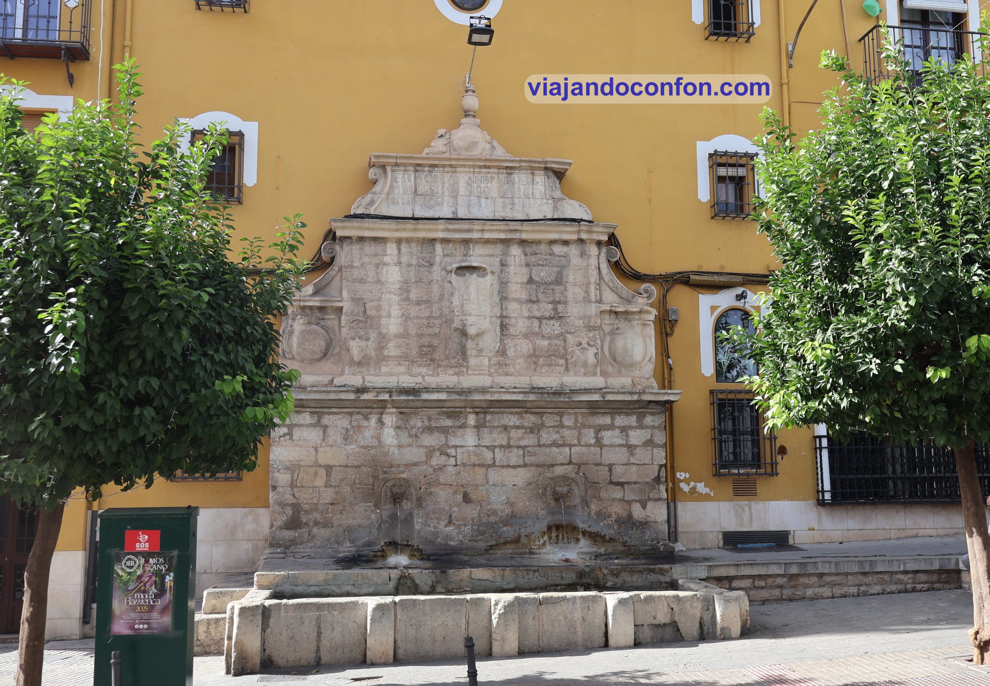
21. Pilar del Arrabalejo
Se construyó en estilo renacentista en 1574 por petición de los vecinos del Arrabal de la Puerta de Baeza. Este recibía las aguas del generoso raudal de la Magdalena.
Tiene una estructura de tres cuerpos horizontales. El primero con dos caños de agua saliendo de sus respectivas hornacinas. El segundo y el tercero está adornado con escudos y cartelas. El conjunto está coronado con un jarrón de piedra y una inscripción solemne que recuerda a los «muy ilustres señores» que mandaron levantarla.
La leyenda popular vincula este pilar con el famoso Lagarto de la Magdalena. Este está alimentado por el mismo caudal que pasa por la morada de esta bestia. Así, los vecinos creían que sus aguas traían la esencia de este.
Descubre las mejores actividades y tours en Jaén con Civitatis:
Como siempre, recomendamos viajar con un buen seguro de viajes. IATI es especialista en seguros de viaje y, por ser nuestro lector, tienes un 5% de descuento.
Navarra (Nafarroa en euskera) es una comunidad autónoma foral sin litoral y provincia del norte de España, que limita con el País Vasco, La Rioja y Aragón en España y Nueva Aquitania en Francia. Su capital es Pamplona (Iruña en euskera) y ciudad más grande de Navarra con unos 210.000 habitantes.
La provincia actual constituye la mayor parte del territorio del reino medieval de Navarra. Este era un antiguo reino pirenaico que ocupaba tierras a ambos lados de los Pirineos occidentales, con su parte más septentrional, la Baja Navarra, ubicada en el extremo suroeste de Francia.
Navarra se sitúa en la zona de transición entre la verde costa cantábrica y las zonas semiáridas del interior, por lo que sus paisajes varían considerablemente en toda la región.
Es considerada por los nacionalistas vascos como una de las provincias vascas históricas: sus rasgos vascos son notables en el norte, pero prácticamente inexistentes en el sur.
Pero, sin duda, el evento más conocido de Navarra es la fiesta anual de San Fermín, que se celebra en Pamplona en julio.
Encuentra tu hotel ideal al mejor precio en Navarra con Agoda:
Como siempre, recomendamos viajar con un buen seguro de viajes. IATI es especialista en seguros de viaje y, por ser nuestro lector, tienes un 5% de descuento.
*Nos ayuda a mantener el blog
Irlanda (Éire en Irlandés) o República de Irlanda, con una población de algo más de 5 millones de habitantes, consta de 26 de los 32 condados de la isla de Irlanda.
Es uno de los veintisiete Estados miembros de la Unión Europea y comparte su única frontera terrestre con Irlanda del Norte, que forma parte del Reino Unido.
El Estado Libre Irlandés se creó con estatus de Dominio en 1922, tras el Tratado Anglo-Irlandés. En 1937, se adoptó una nueva constitución, en la que el estado pasó a llamarse Irlanda y se convirtió de facto en una república, con un presidente electo no ejecutivo. Fue declarada oficialmente república en 1949, tras la Ley de la República de Irlanda de 1948.
Irlanda se convirtió en miembro de las Naciones Unidas en 1955. Se unió a las Comunidades Europeas (CE), predecesora de la Unión Europea (UE), en 1973.
El estado no mantuvo relaciones formales con Irlanda del Norte durante la mayor parte del siglo XX, pero en las décadas de 1980 y 1990 los gobiernos británico e irlandés colaboraron con los partidos norirlandeses para resolver el conflicto conocido como Troubles (Problemas).
Desde la firma del Acuerdo de Viernes Santo en 1998, los gobiernos de Irlanda e Irlanda del Norte han cooperado en diversas áreas políticas en el marco del Consejo Ministerial Norte/Sur creado por dicho Acuerdo.
Encuentra tu hotel ideal al mejor precio en Irlanda con Agoda:
Nuestro viaje a Irlanda se empieza a acabar. Pero aún quedan espectaculares paisajes por visitar.
Como siempre, recomendamos viajar con un buen seguro de viajes. IATI es especialista en seguros de viaje y, por ser nuestro lector, tienes un 5% de descuento.
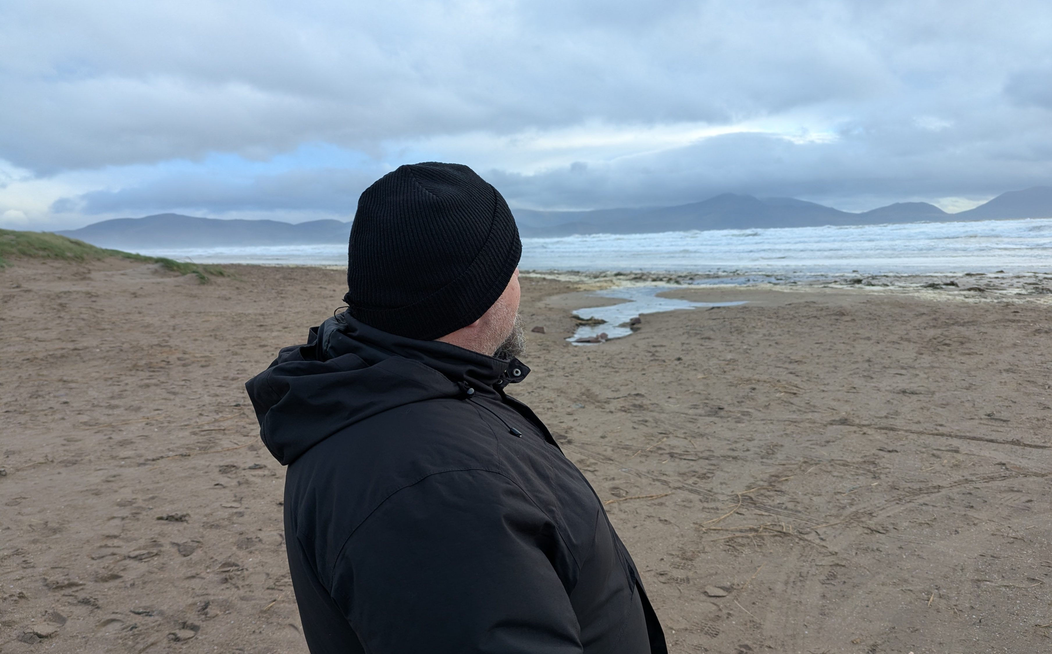
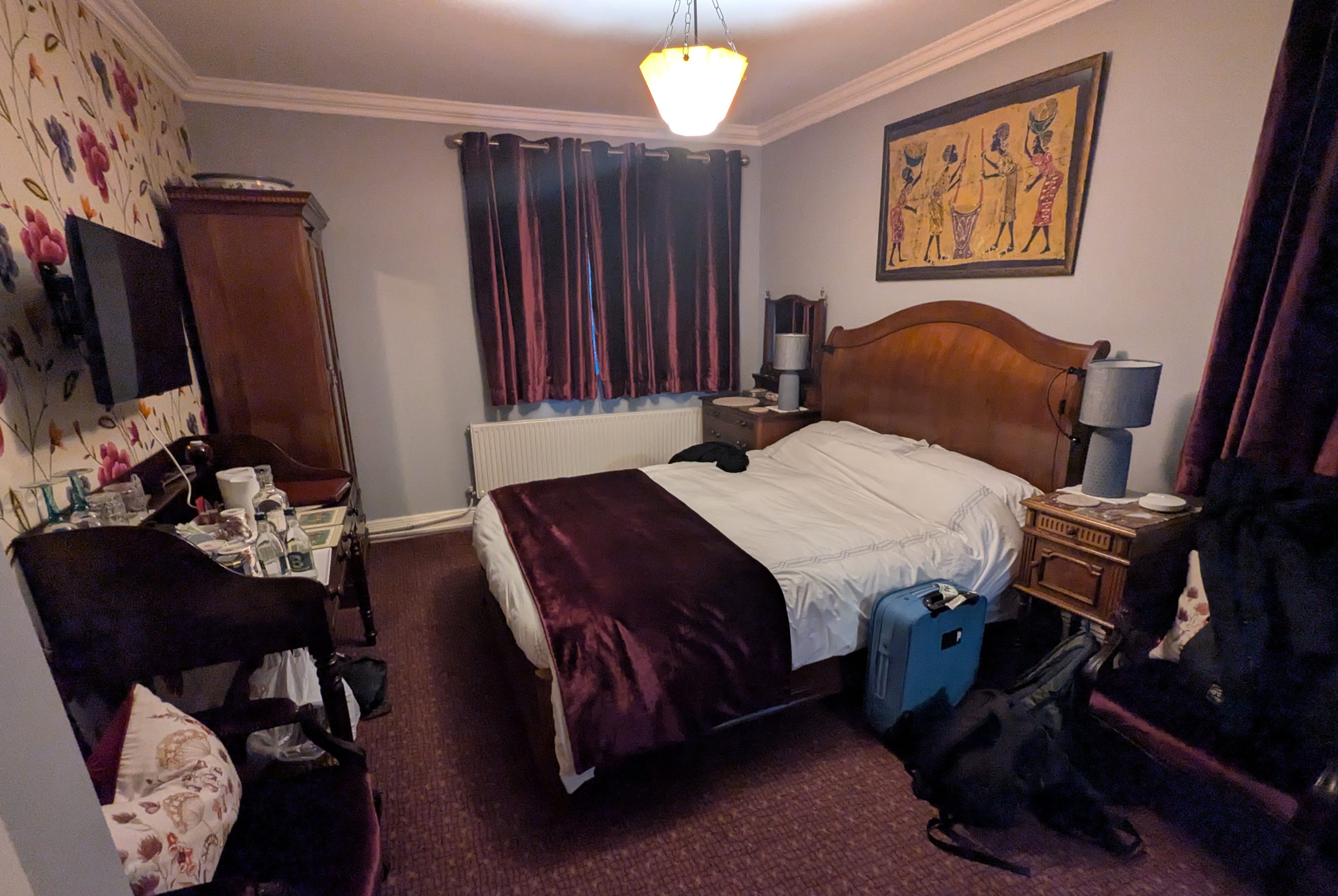
Nos levantamos temprano y salgo a contemplar un poco el paisaje a la luz del día. Espectacular, aunque algo asustado por la pequeña nevada que había caído en la cima de las pequeñas montañas cercanas. Al menos de momento no llueve.
Vistas desde nuestro alojamiento
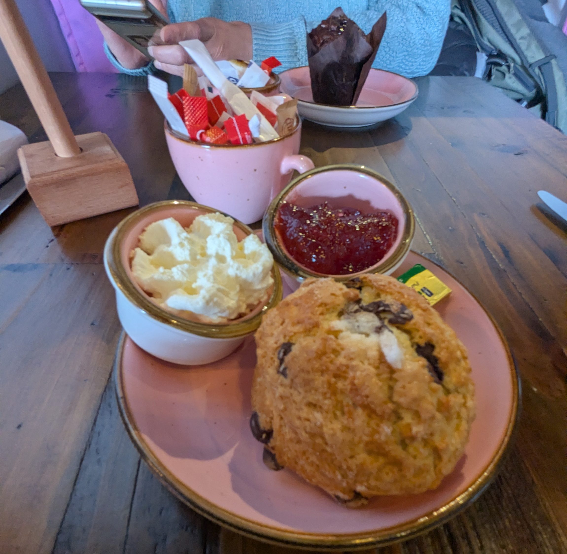
Desayunamos tranquilos unos bollos típicos irlandeses llamados scone que nos había dejado nuestra anfitriona. No los había probado nunca y la verdad es que estaban deliciosos.
Tras el desayuno nos volvemos a poner en camino. Nos vamos hasta An Chonair o Conor Pass, del que nos separaban 16 km.
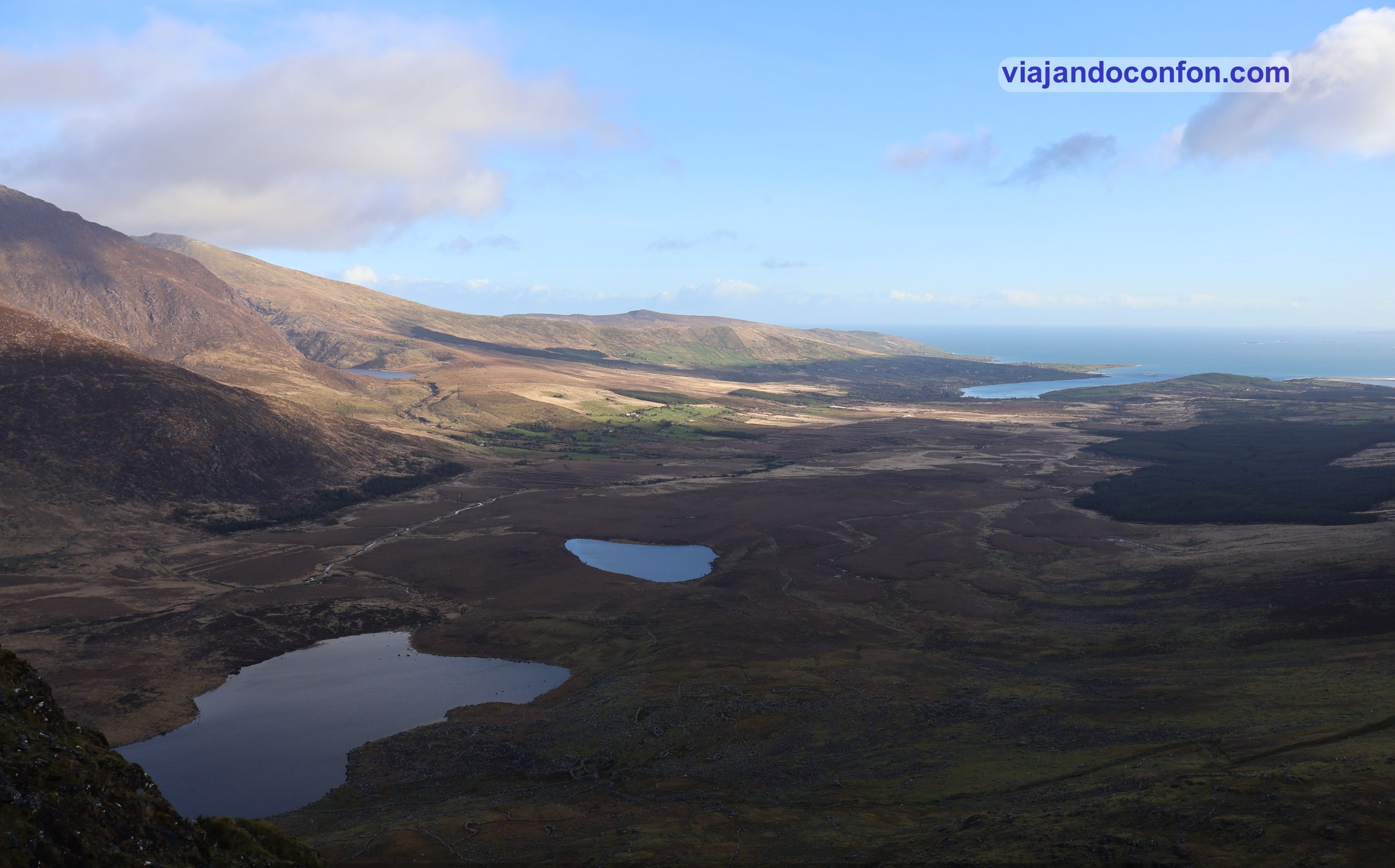
An Chonair, (el camino o sendero’) es uno de los pasos de montaña más altos de Irlanda con una carretera asfaltada, con 456 metros. Une Dingle, en el suroeste, con Brandon Bay y Castlegregory en el noreste.
La pintoresca carretera que conduce al paso serpentea entre los afilados acantilados y pasa junto a lagos de circo glaciar. En su punto más alto, pasa entre los picos de las montañas Binn Dubh (‘Beenduff’) y Sliabh Mhacha Ré (‘Slievanea’).
El paisaje desde aquí es realmente espectacular. Puede que sea el más bonito que hemos visto en toda Irlanda. Además todo era más encantador mientras caía una ligera nevada. Y eso que el cielo estaba despejado…
An Chonair / Conor Pass
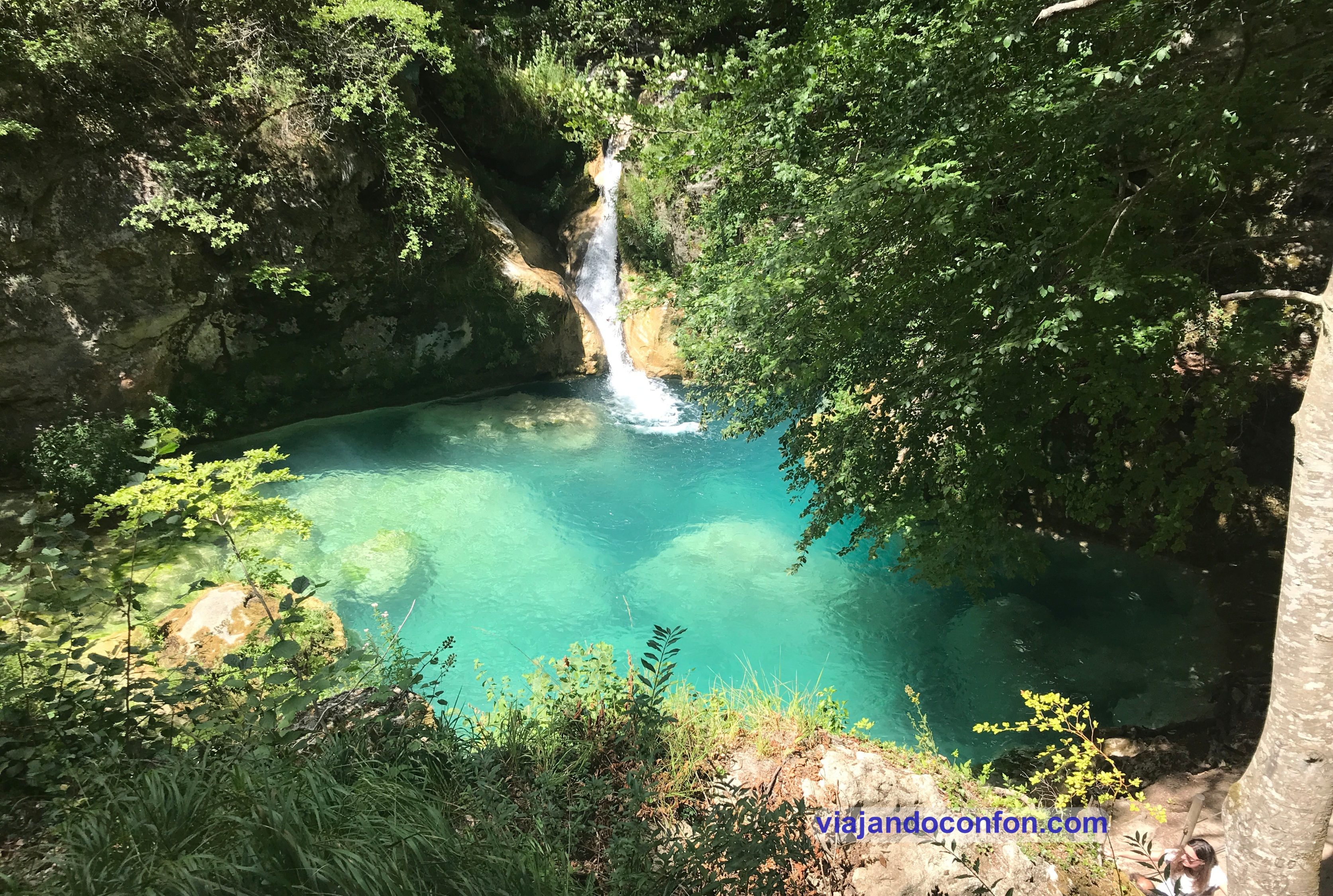
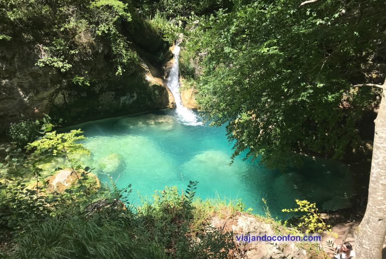
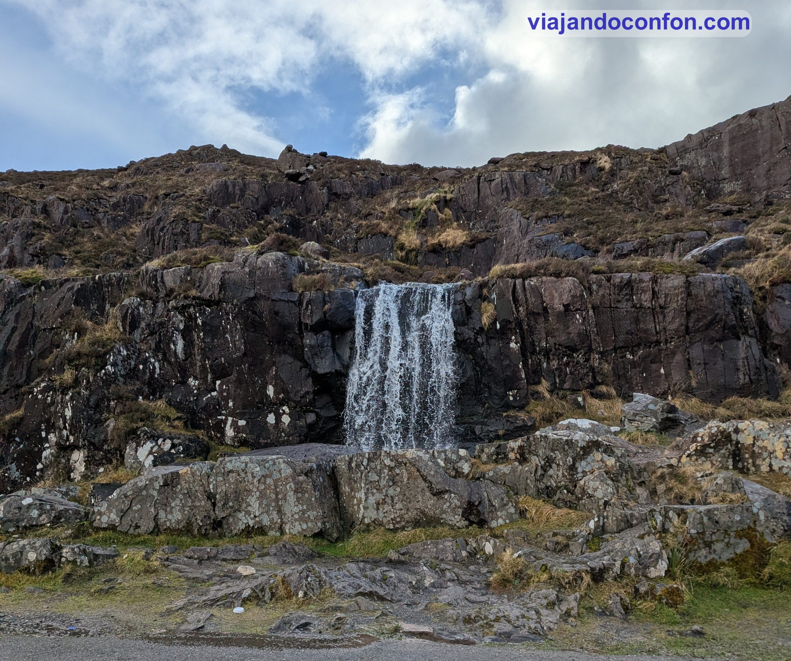
Despues de contmplar durante un largo rato el paisaje, volvemos a ponernos en camino. Recorremos parte del sinuoso y estrechísimo camino hasta An Chonair Waterfall. Aunque no nos paramos mucho para que no se nos echara el tiempo encima.
Puedes encontrar algunas bonitas excursiones por Dingle e Irlanda en Get Your Guide
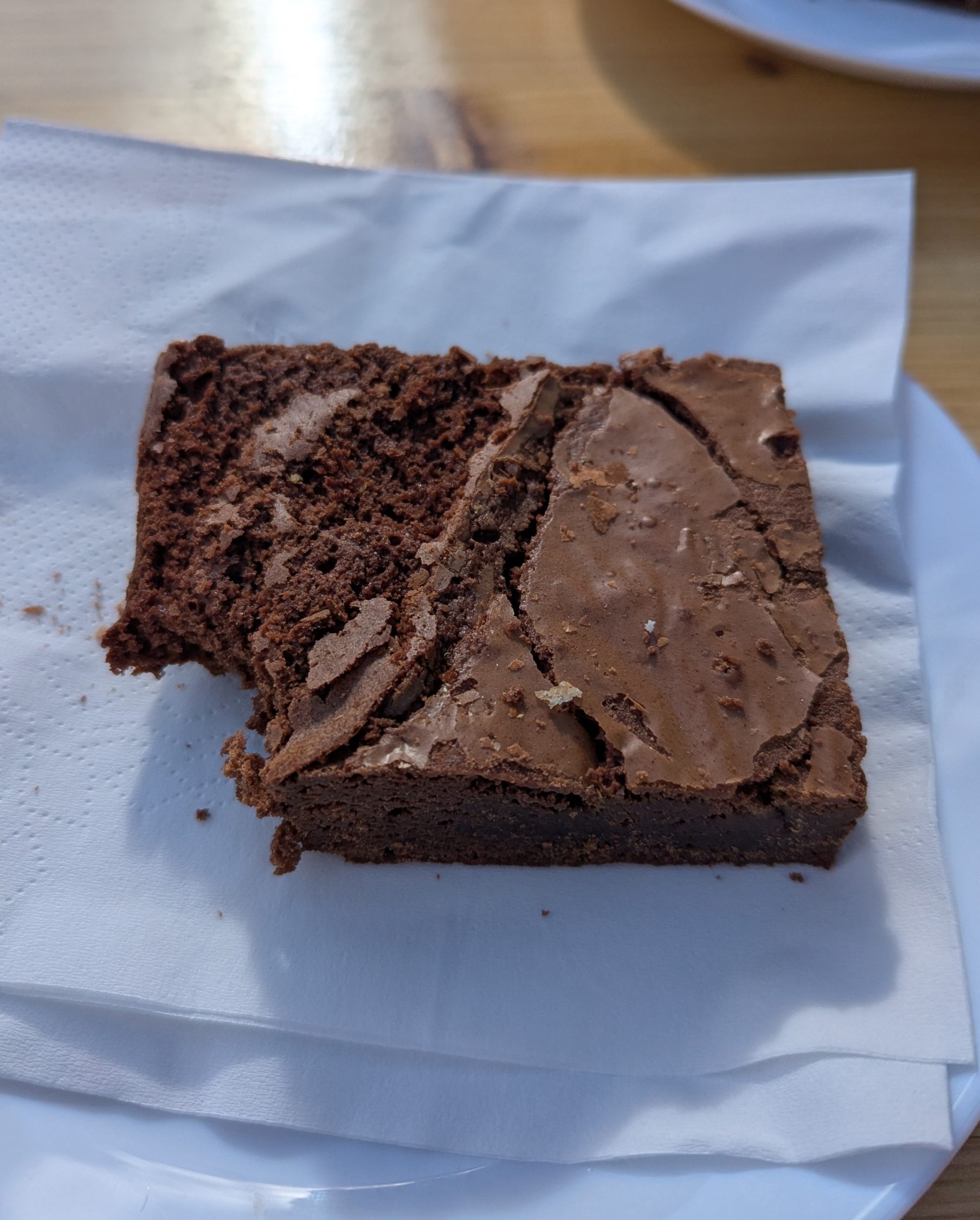
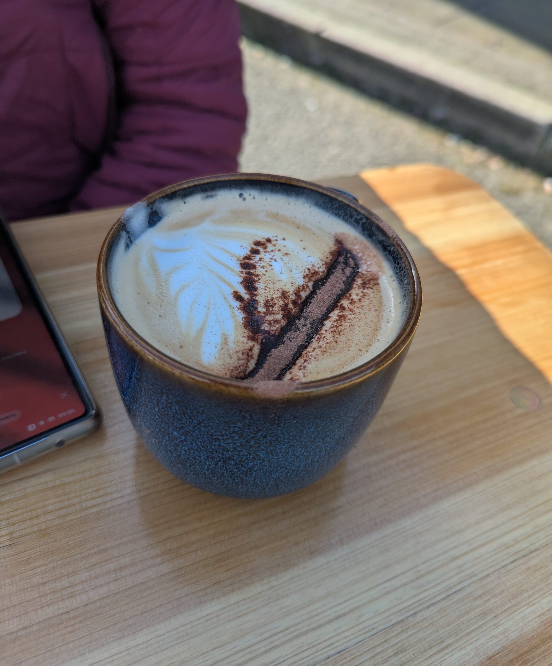
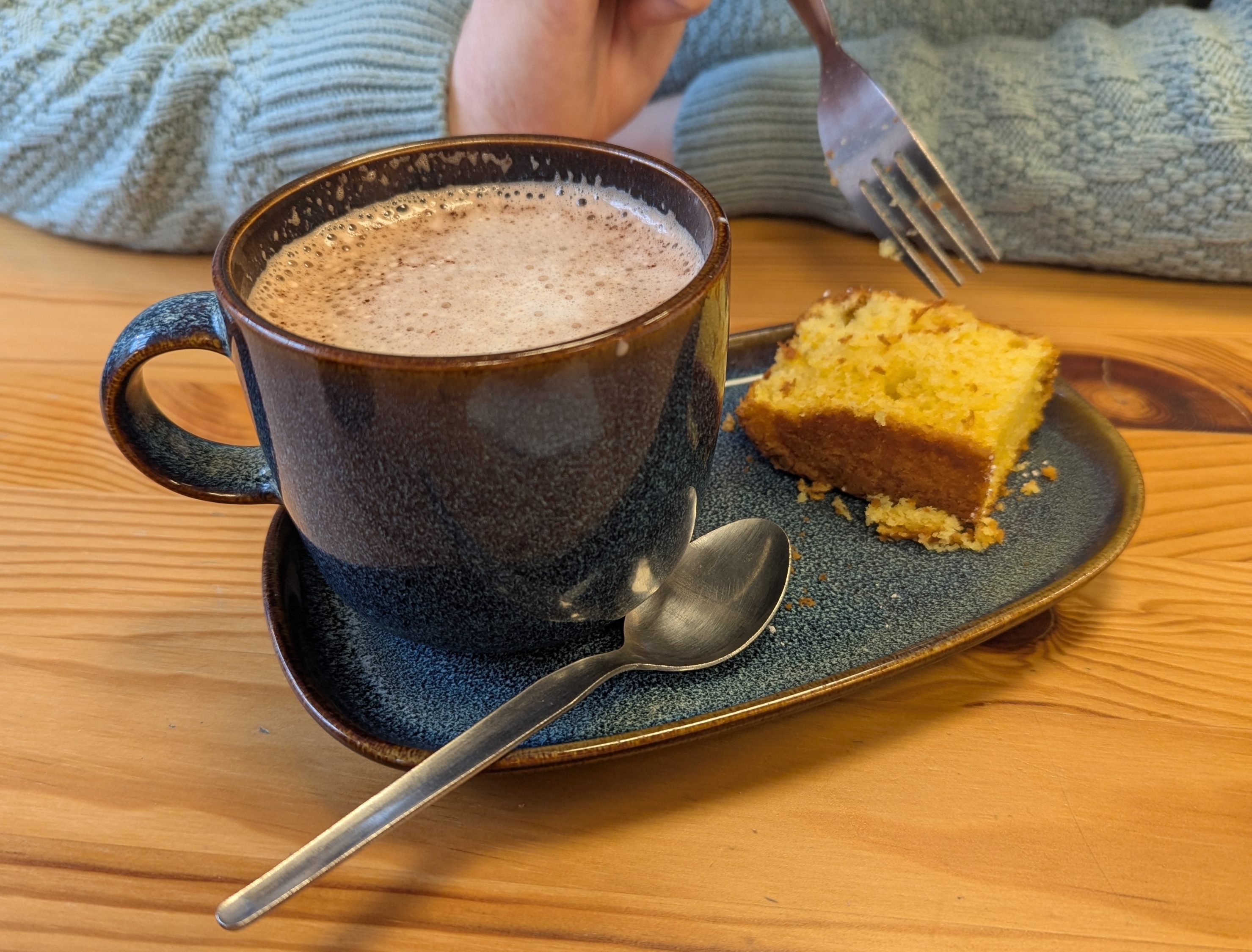
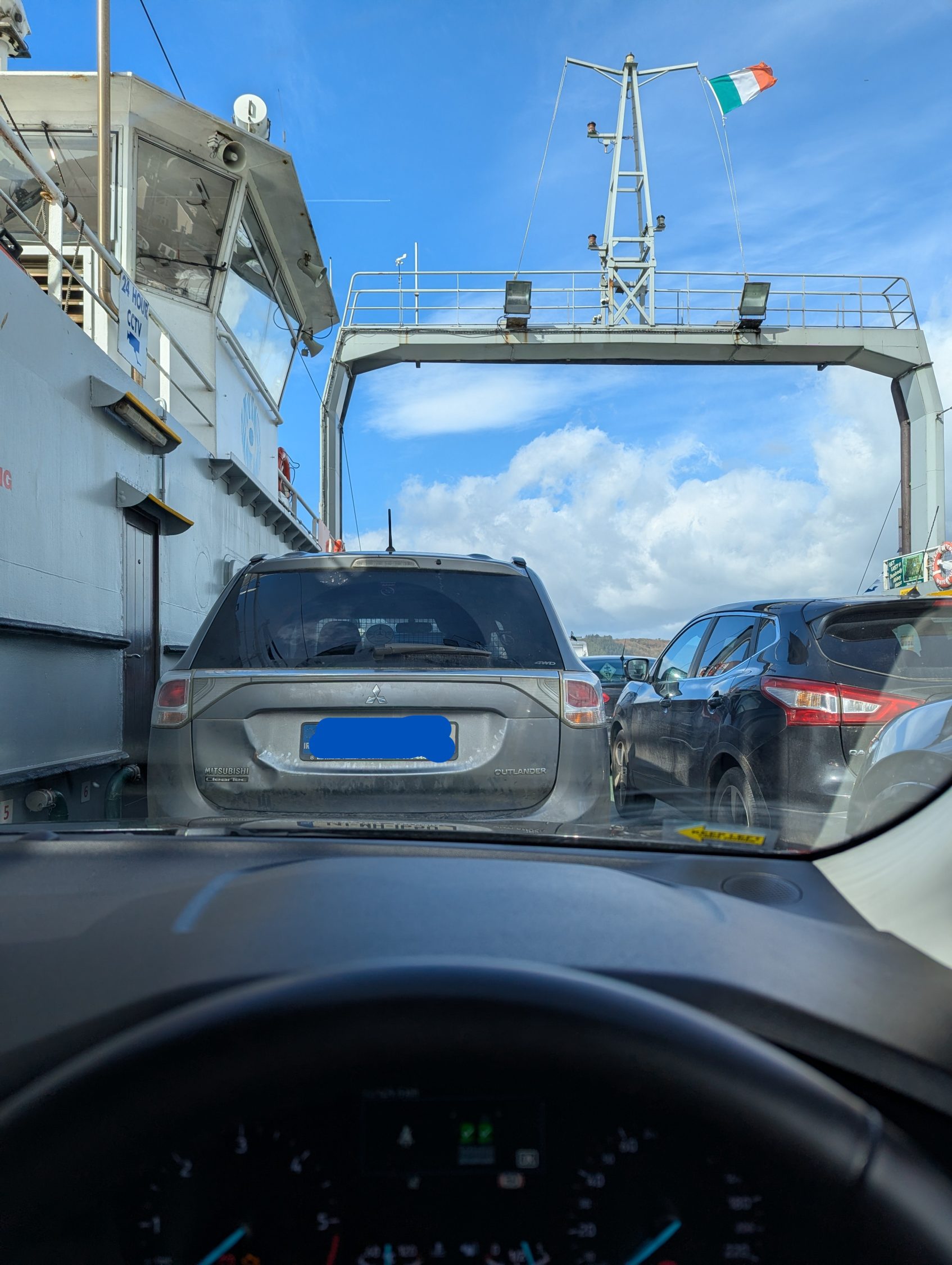
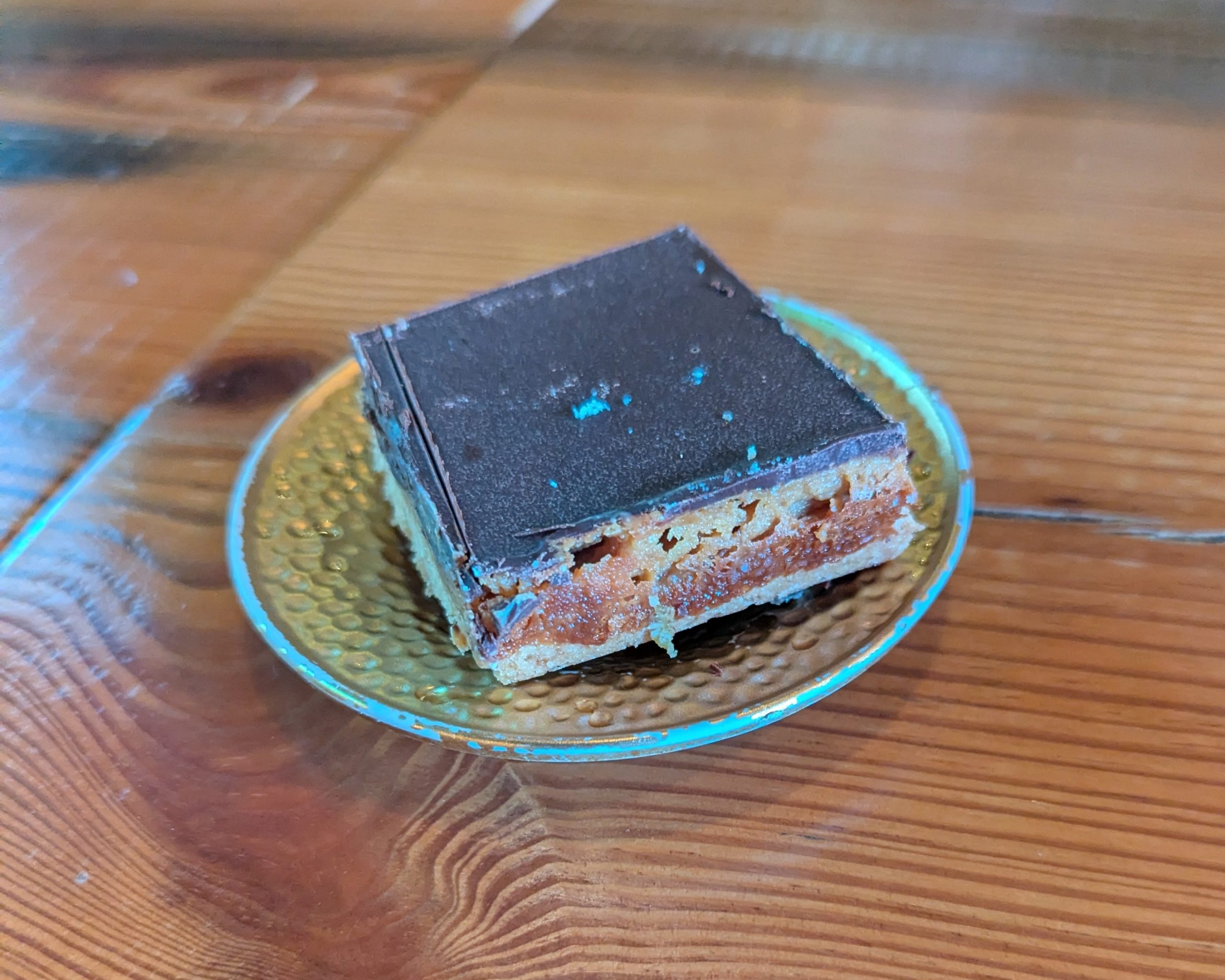
Así que continuamos nuestro camino hacia Old Glin Castle, a 95km. Al llegar a la ciudad de Glin, nos apetecía un café. Así que aparcamos y nos fuimos directamente a Rachel’s Cafe. Una colorida cafetería restaurante. Los cafes estaban buenos pero los dulces… brutales.
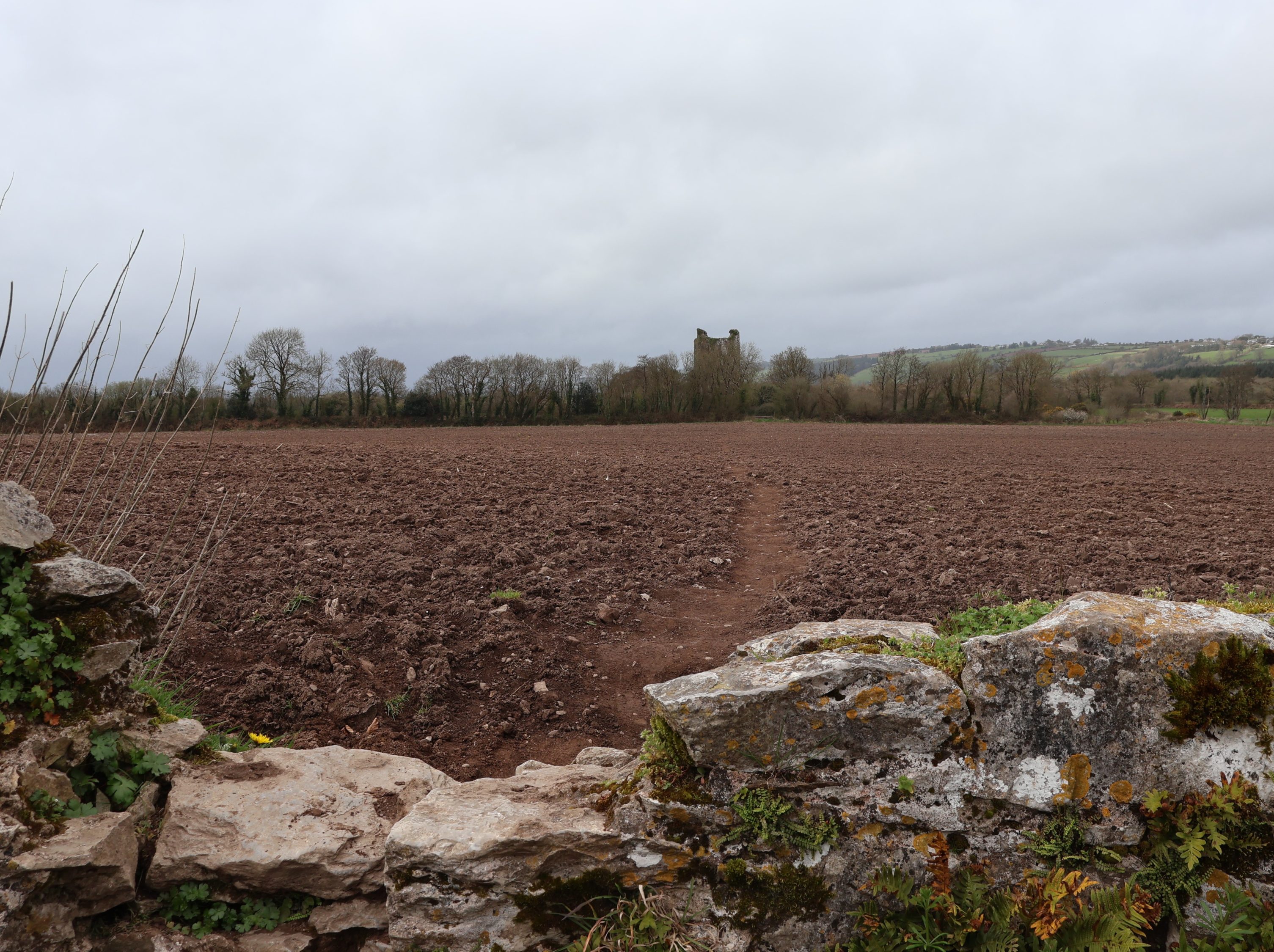
Tras llenar la barriga aunque con ganas de probar más pasteles, nos vamos a Old Glin Castle.
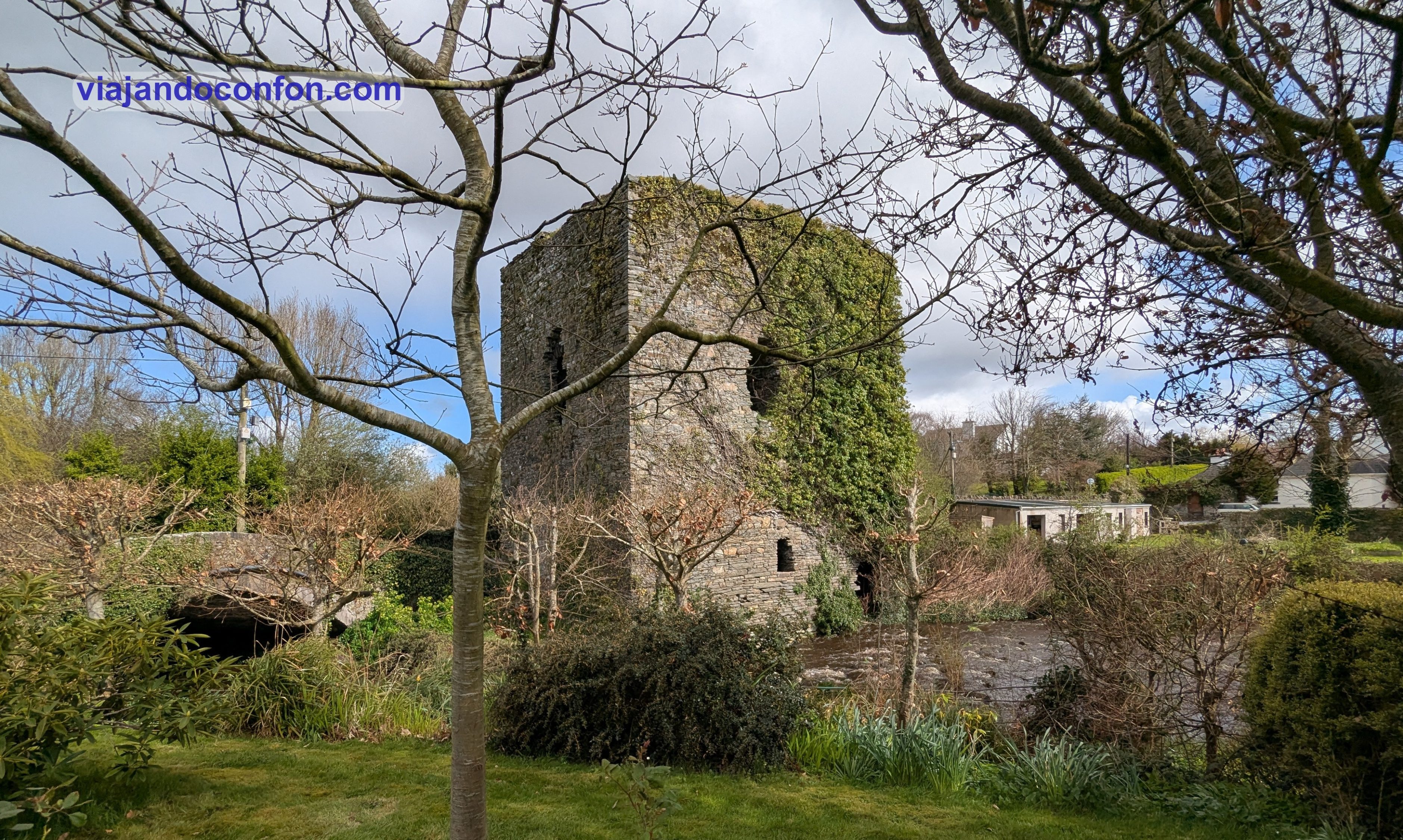
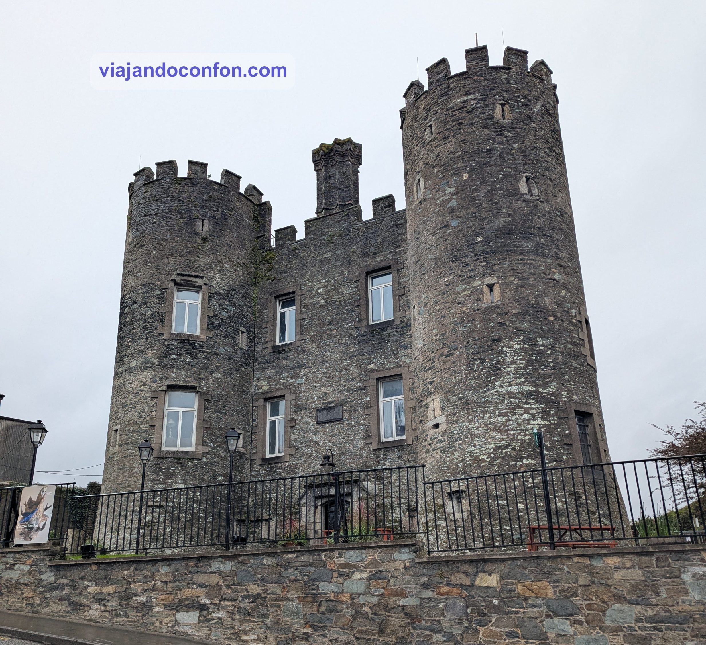
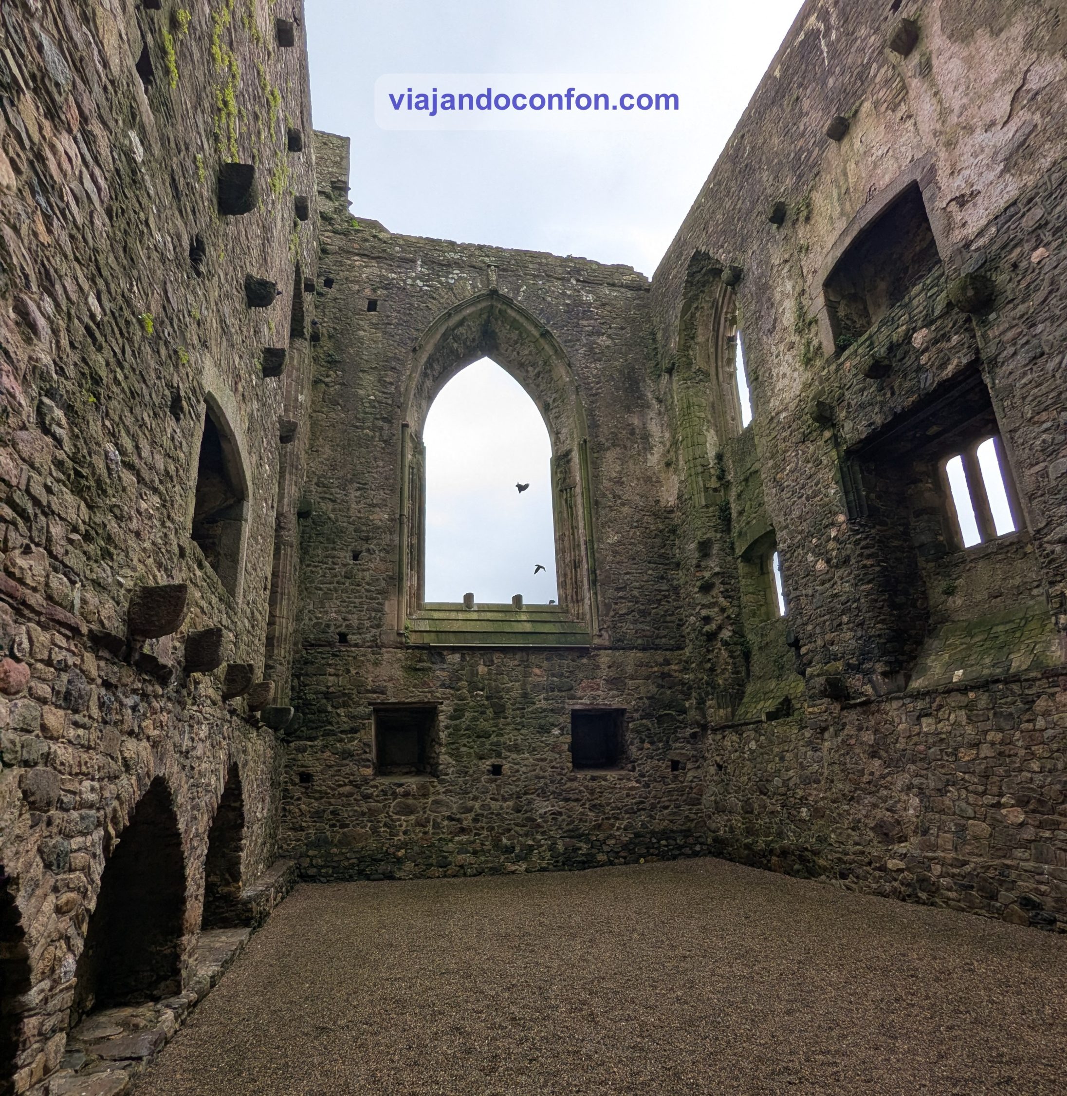
El Castillo de Glin se construyó alrededor de 1260 por John Fitzlohn FitzGerald, el primer Caballero de Glin. Hogar de los Caballeros de Glin durante 400 años, el Castillo de Glin fue uno de los muchos castillos construidos por los FitzGerald para defender sus vastos territorios a lo largo del estuario del Shannon. Su castillo aquí en Gleann Corbraighe (Glencorbry) era considerado uno de los bastiones más estratégicos y fortificados de Limerick.
Durante la Guerra de los Nueve Años de 1594-1603, después de capturar los castillos de Bruff, Croom y Askeaton, una fuerza inglesa de 800 infantes y 80 jinetes bajo el mando de Sir George Carew, presidente de Munster, sitió el castillo de Glin.
La guarnición luchó valientemente y los que no murieron en las murallas se arrojaron al río Glencorbry. Se cree que solo tres hombres, Mahon Dillane, Lewy O’Connor y Donal Beag Culhane, sobrevivieron al asedio.
En 1642, el Castillo de Glin fue atacado de nuevo por los ingleses, quienes capturaron y lo devastaron. Entonces el castillo quedó abandonado. A finales del siglo XVIII, John Bateman FitzGerald, el 23.º caballero de Glin, construyó un “nuevo” castillo al oeste del pueblo.
Old Glin Castle
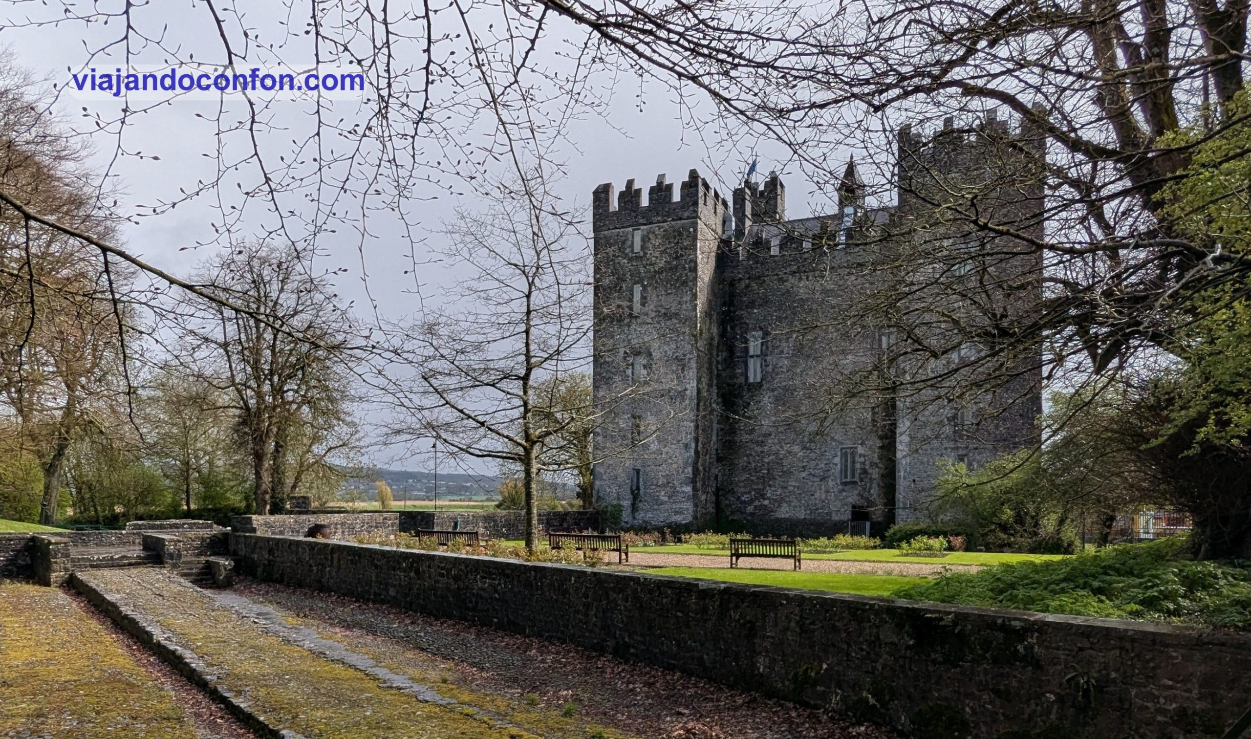
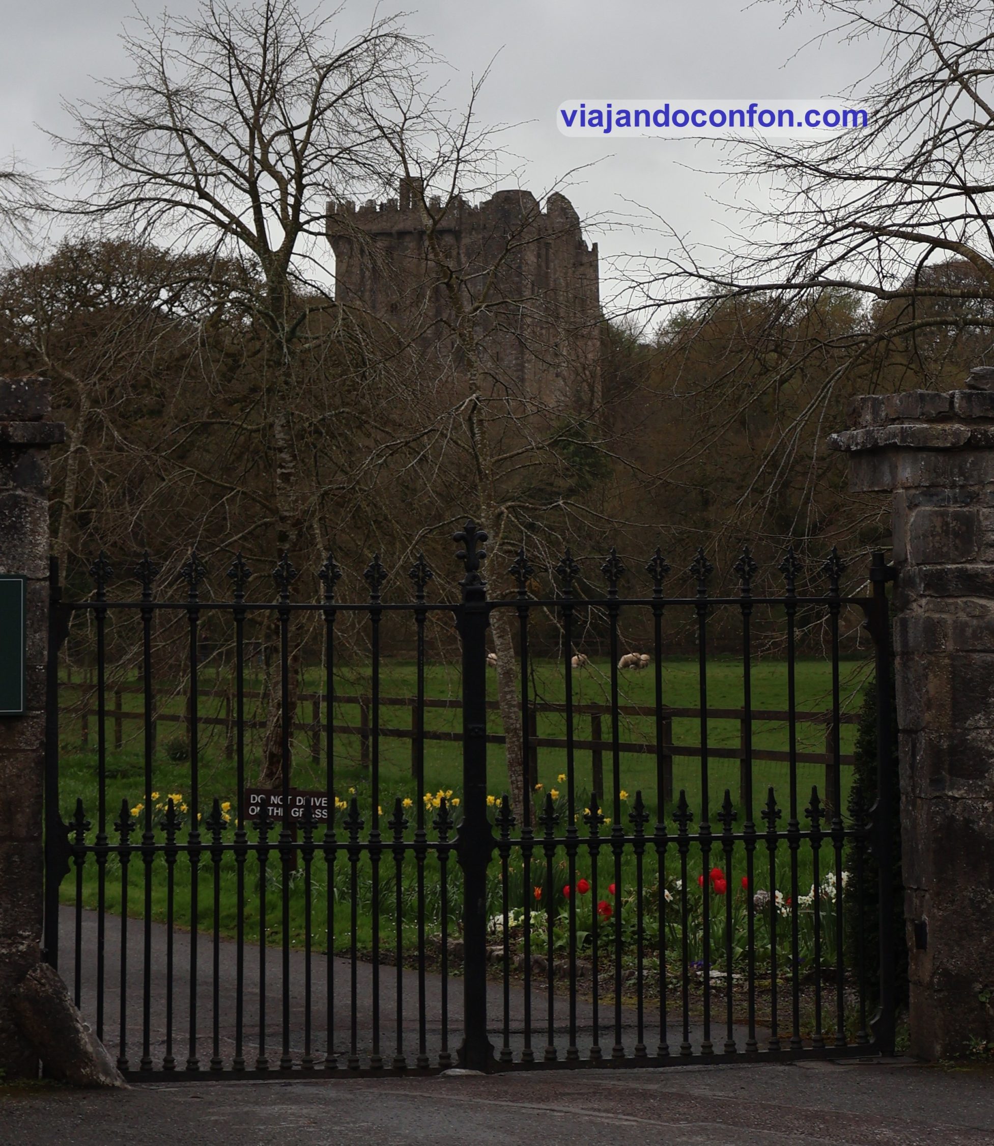
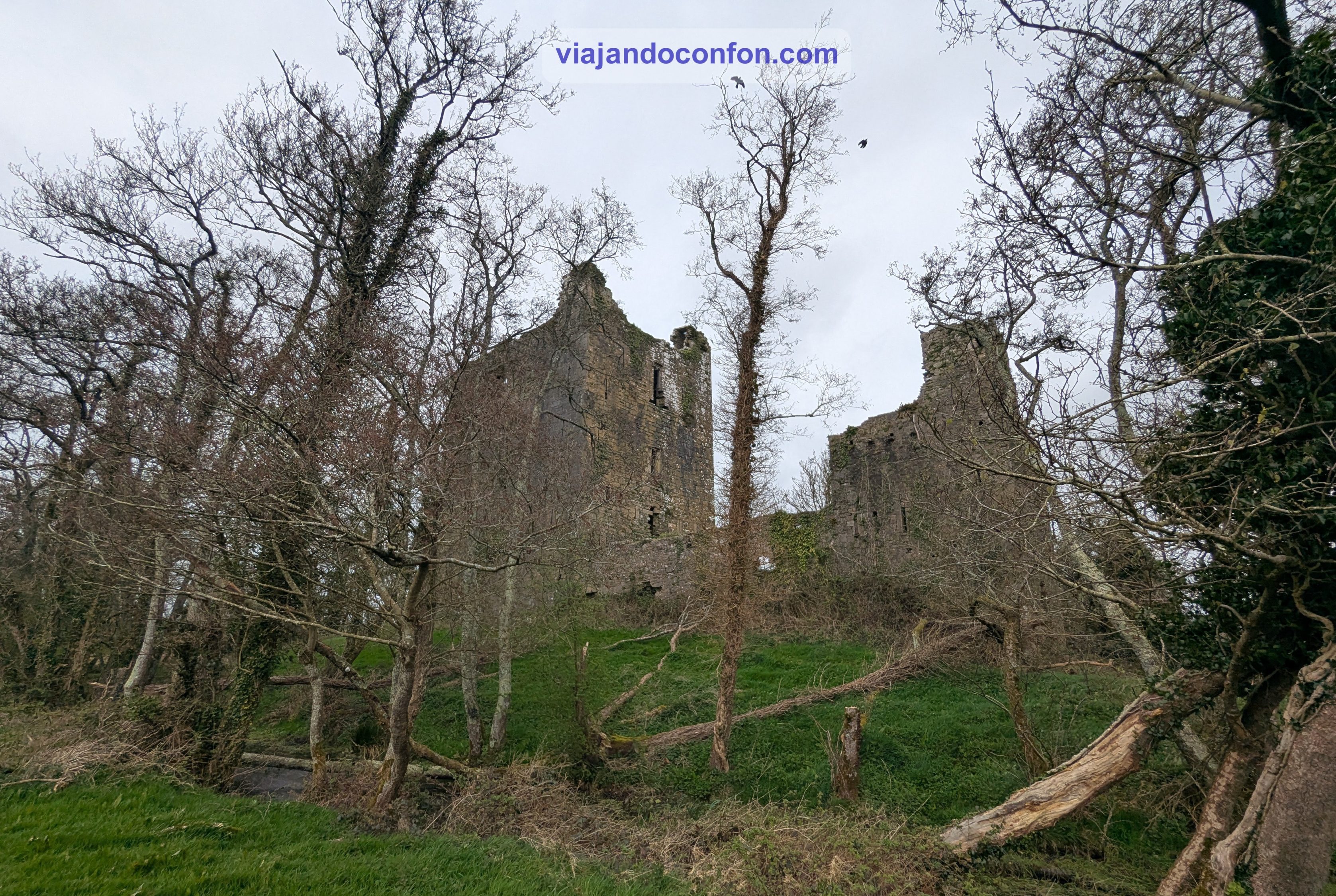
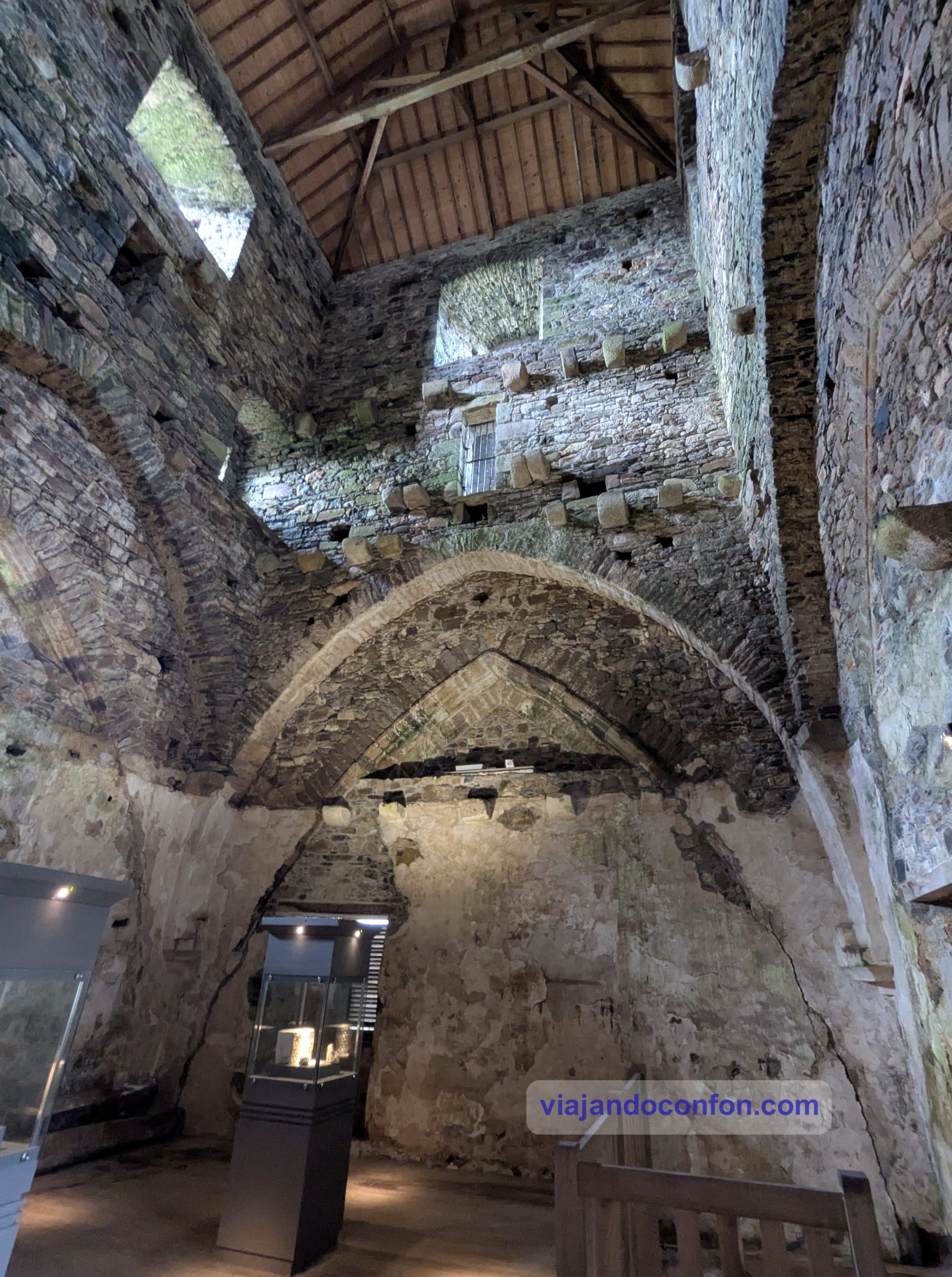
Después de una corta visita y estirar un poco las piernas, volvemos otra vez al coche. Nos ponemos camino del Castillo de Bunratty, a 62 km. Se trata de una gran casa torre del siglo XV situada en el condado de Clare.
El primer asentamiento registrado en el lugar pudo haber sido un campamento comercial vikingo. Según los Anales de los Cuatro Maestros fue destruido por Brian Boru en 977. Aunque no se han encontrado restos de este asenatmiento.
En el siglo XIV, Limerick era un puerto importante para la Corona inglesa. Tras varias estructuras construidas (y destruidas) en la zona, el acrual empieza a confeccionarse en 1450. Su constructor pudo haber sido Maccon Sioda MacNamara, jefe del clan Cuilein.
Hacia 1500, el castillo de Bunratty pasó a manos de los O’Brien, el clan más poderoso de Munster y posteriormente condes de Thomond. Lo ampliaron y convirtieron en su sede principal, trasladándola allí desde Ennis.
Tras pasar por varias familias a lo largo de los siglos, la familia Studdert abandonó el castillo dejándolo en ruinas a principios del siglo XIX. Durante un tiempo el castillo se utilizó como cuartel por la Real Policía Irlandesa. A finales del siglo XIX, el techo del Gran Salón se derrumbó.
En 1956, el castillo fue adquirido y restaurado por el séptimo vizconde Gort, con la ayuda de la Oficina de Obras Públicas.Reparó el tejado y lo salvó de la ruina. El castillo abrió sus puertas al público en 1960, con mobiliario deportivo, tapices y obras de arte que datan de alrededor del siglo XVII.
Castillo de Bunratty
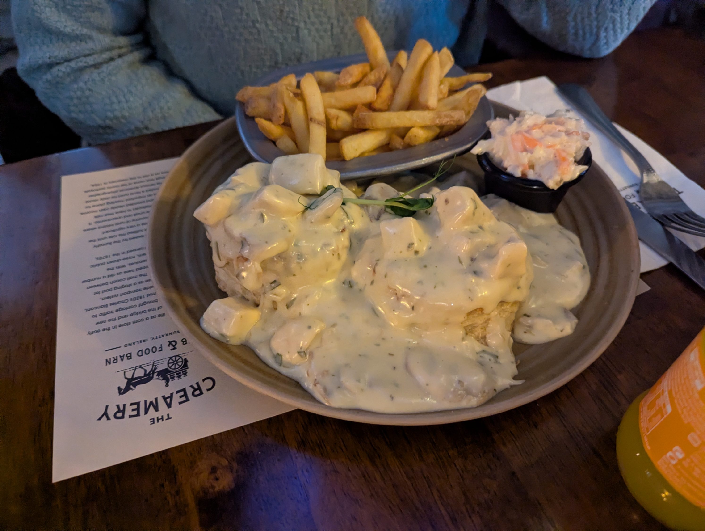
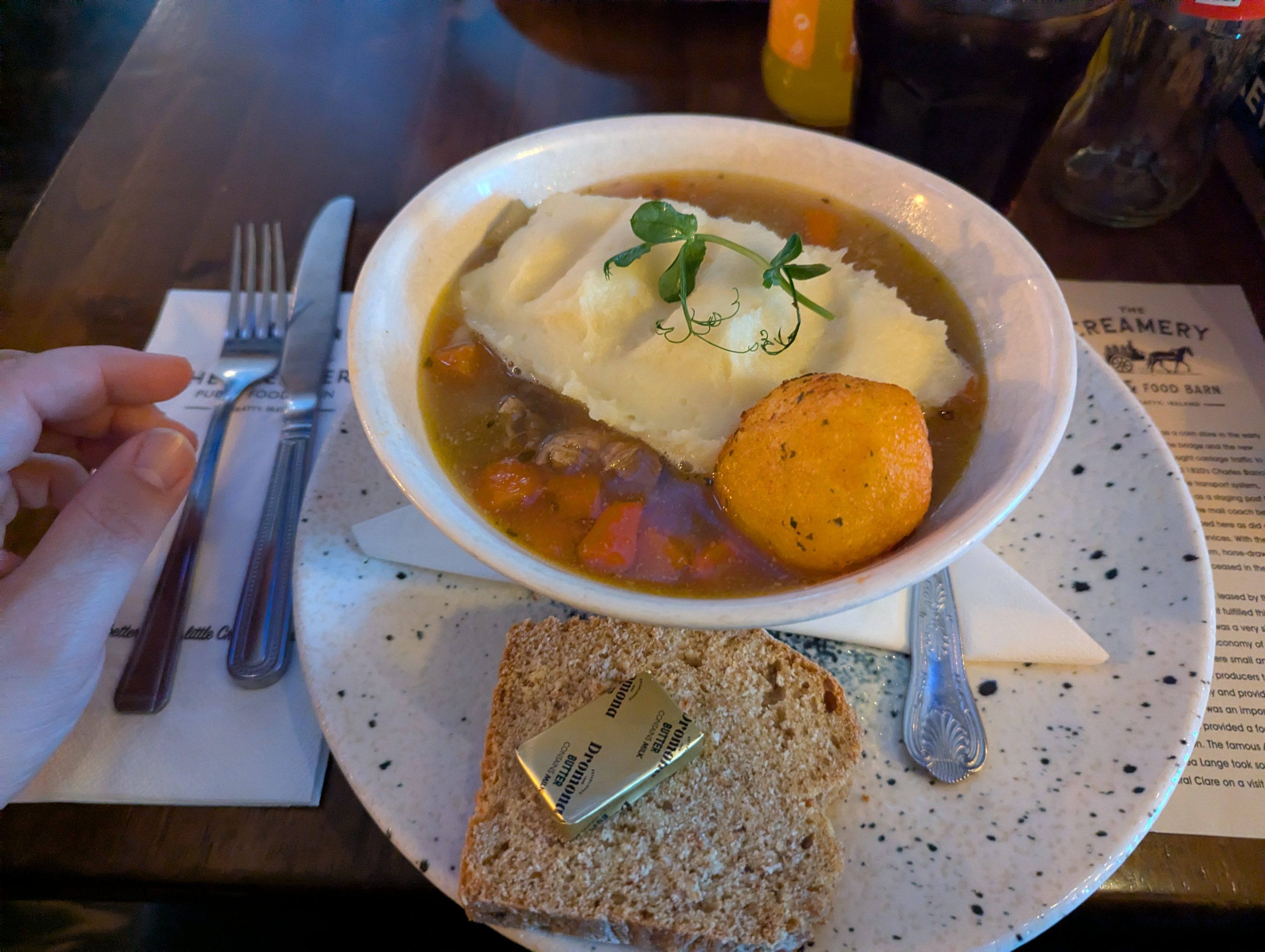
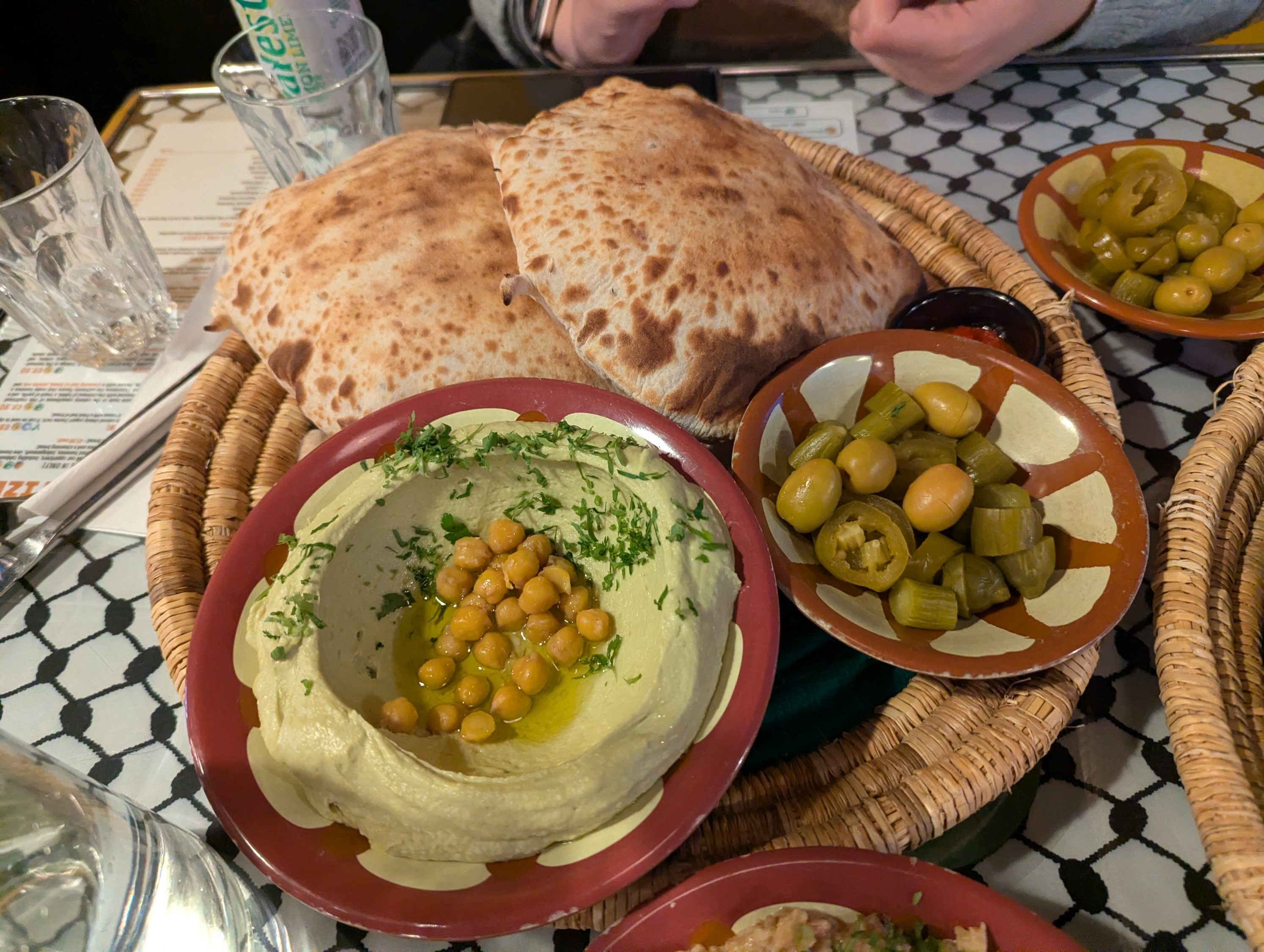
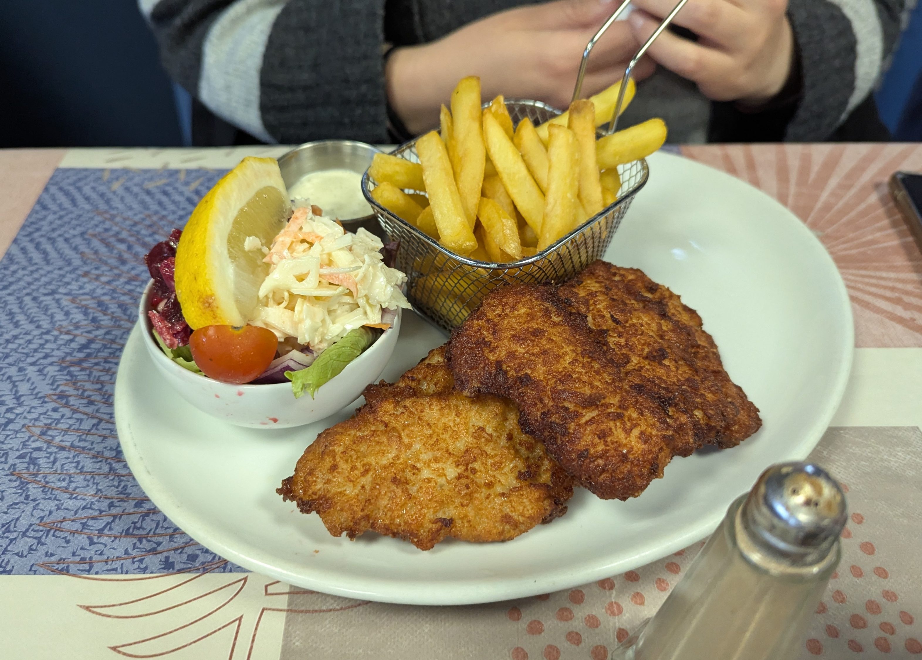
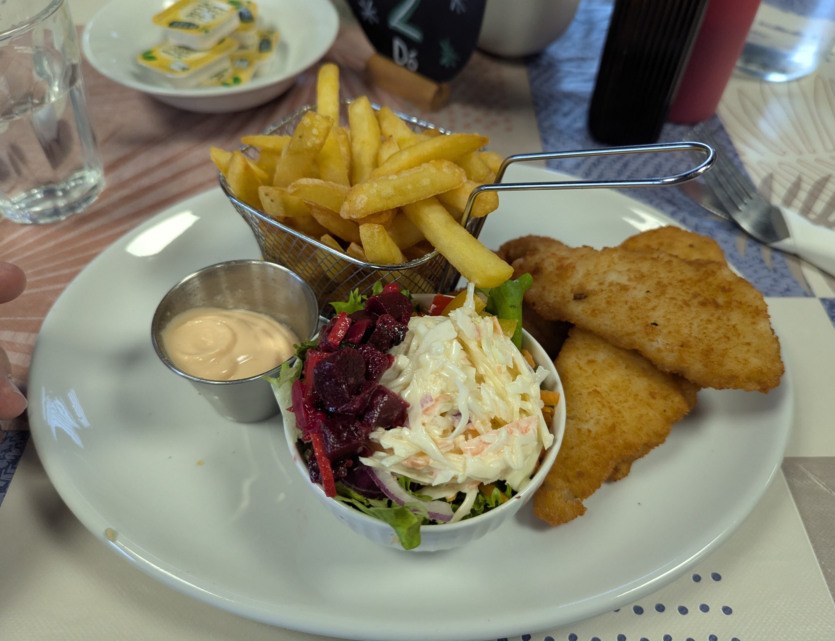
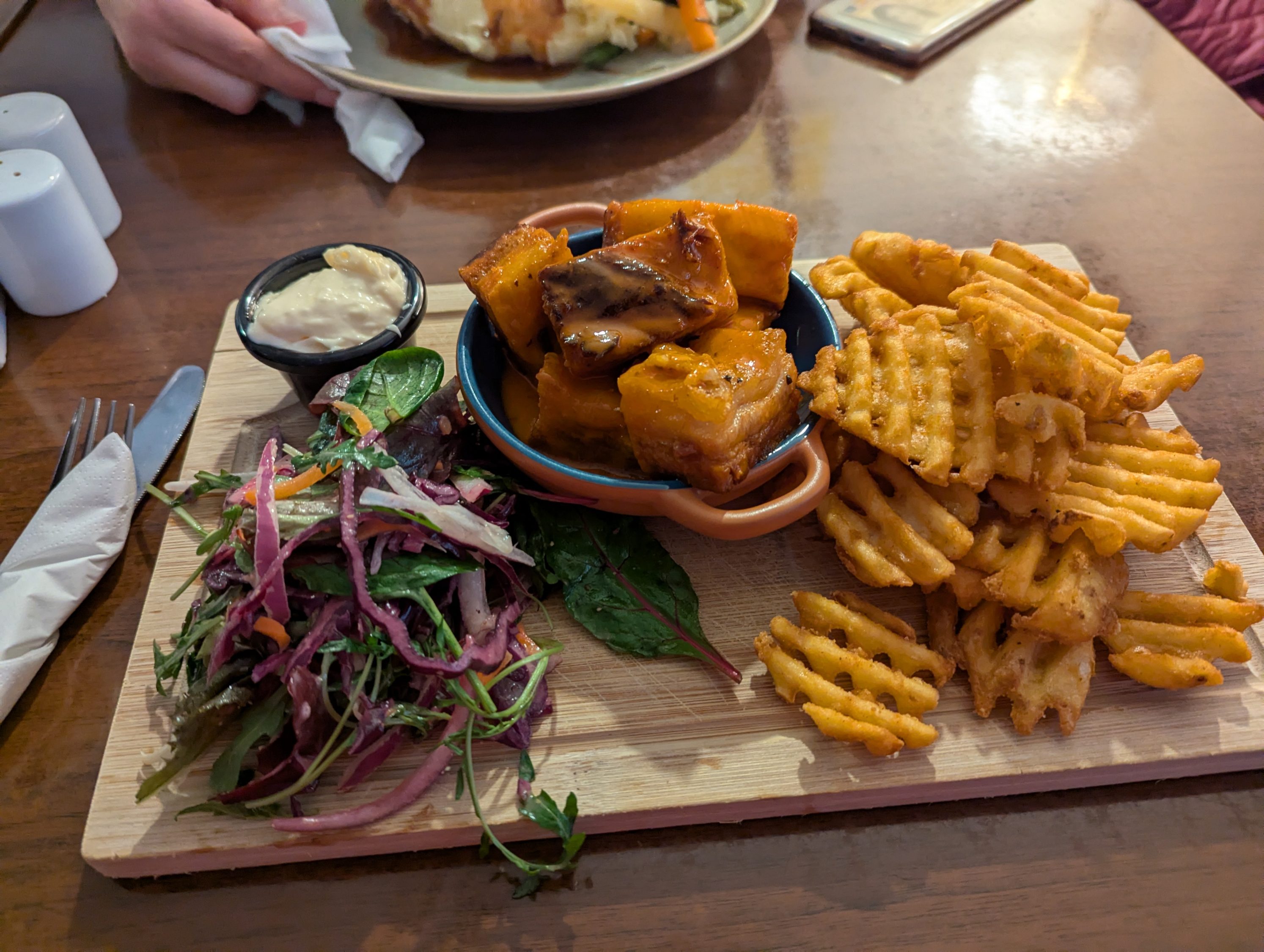
Como ya se hacía la hora de comer, decidimos buscar algo alrededor del castillo. Lo hicimos en un sitio llamado The Creamery Bar & Restaurant. A pesar de estar en todo el meollo turístico, la comida estaba muy buena y el servicio fue rápido y agradable. El precio en la línea de lo que nos encontramos. Todo nos costó 44,30€.
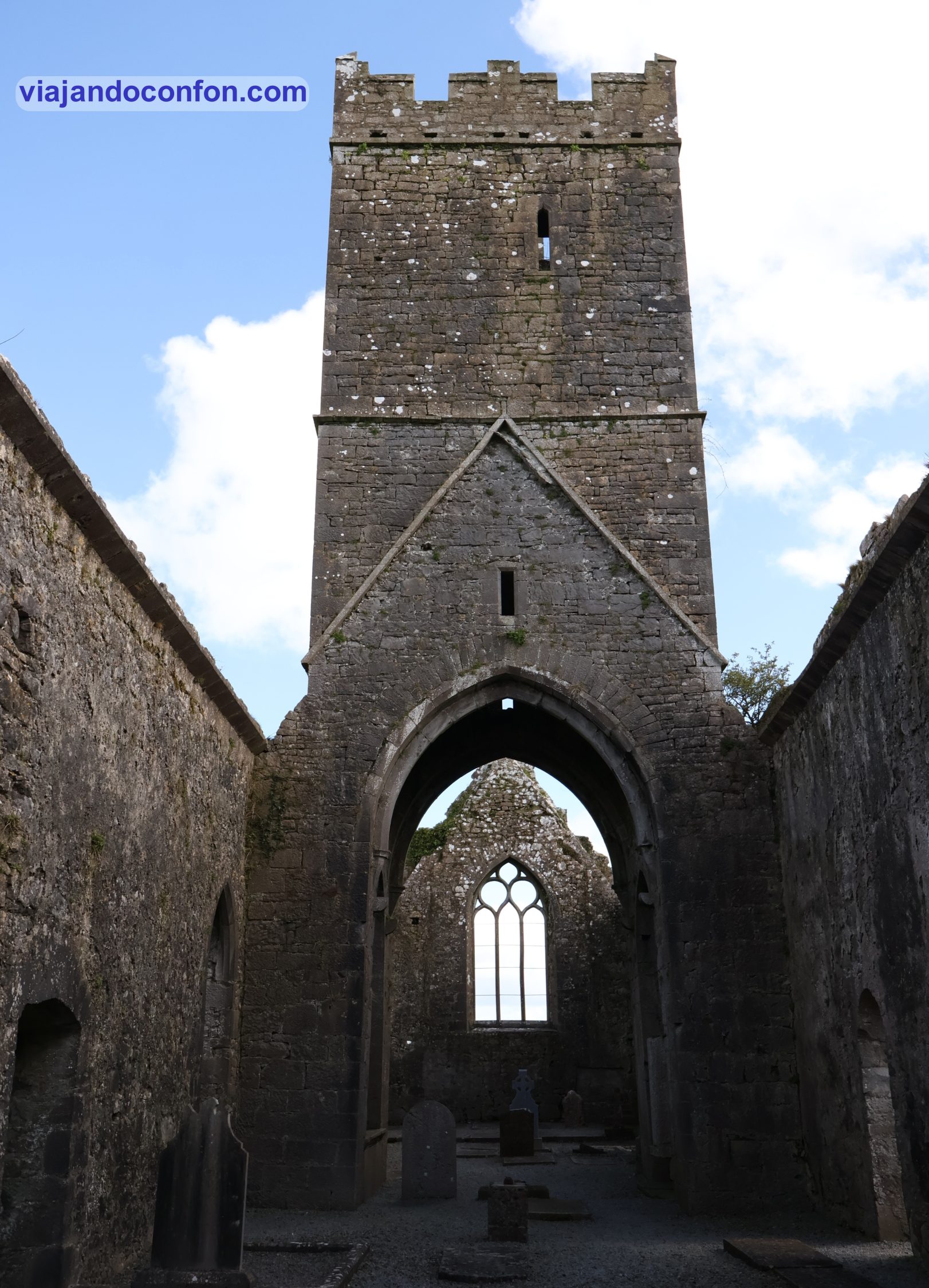
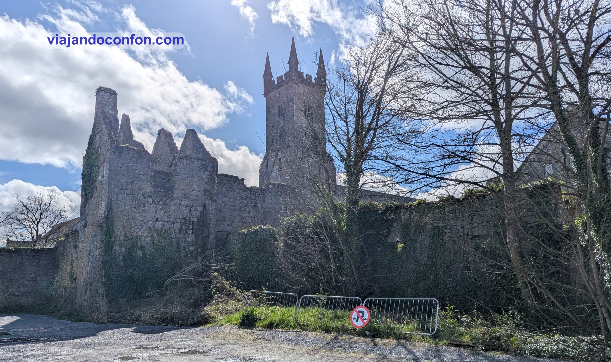
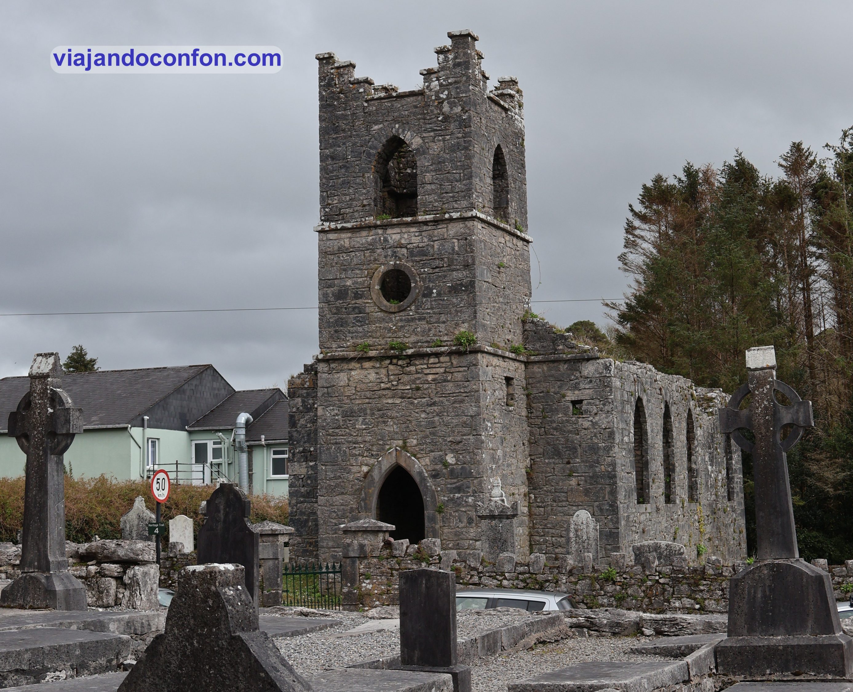
Después de comer nos volvemos a poner en camino. Esta vez recorreríamos 23km hasta Clare Abbey. Tienes un pequeño aparcamiento junto a la entrada. Nosotros no lo sabíamos así que aparcamos a 10 minutos andando.
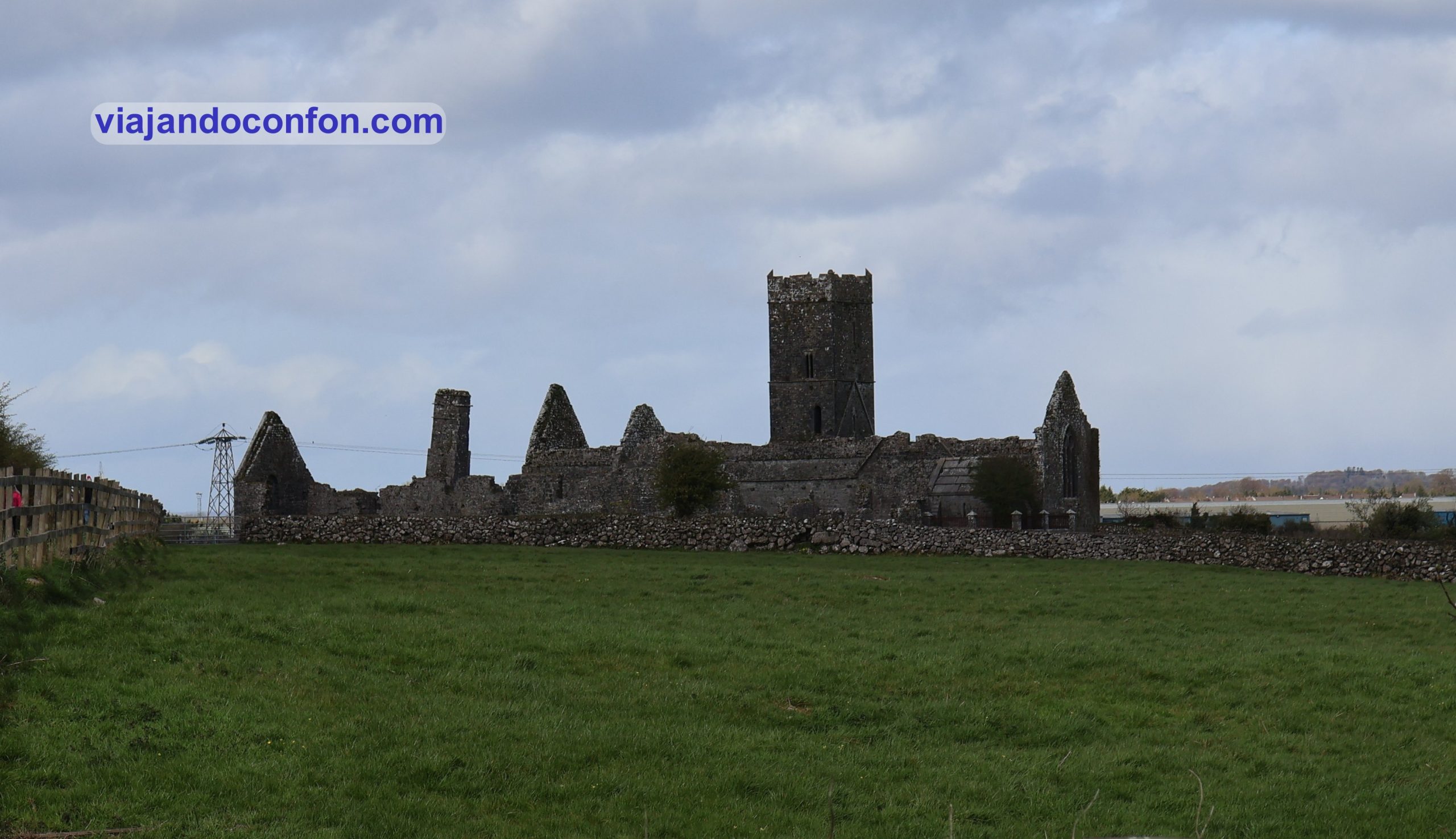
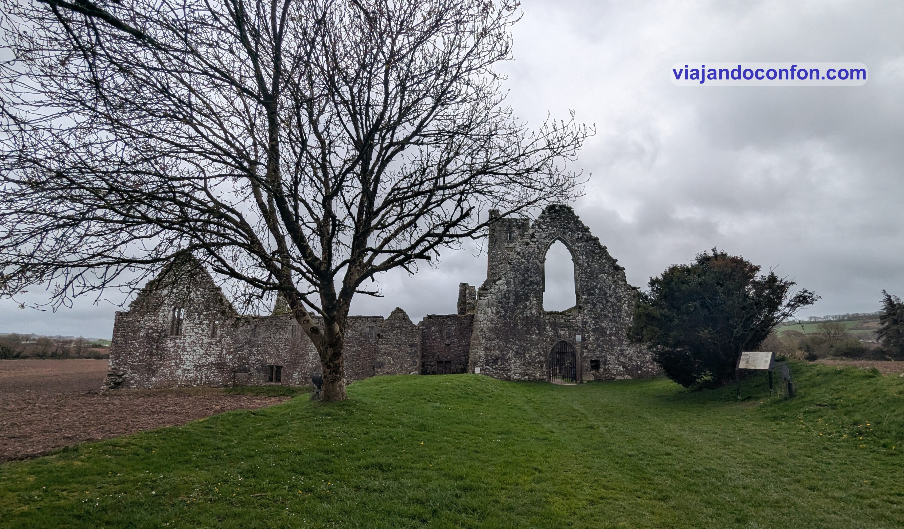
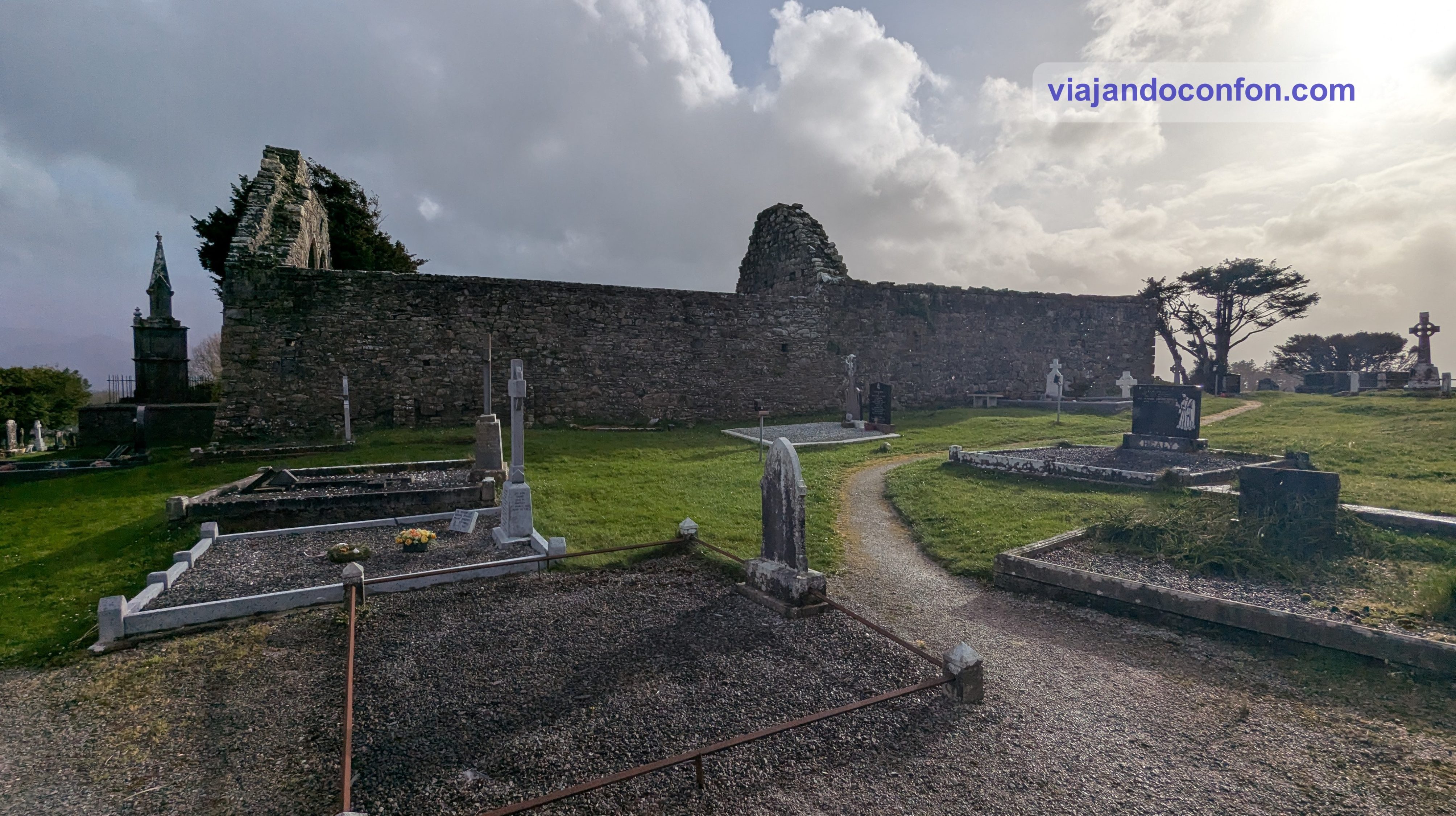
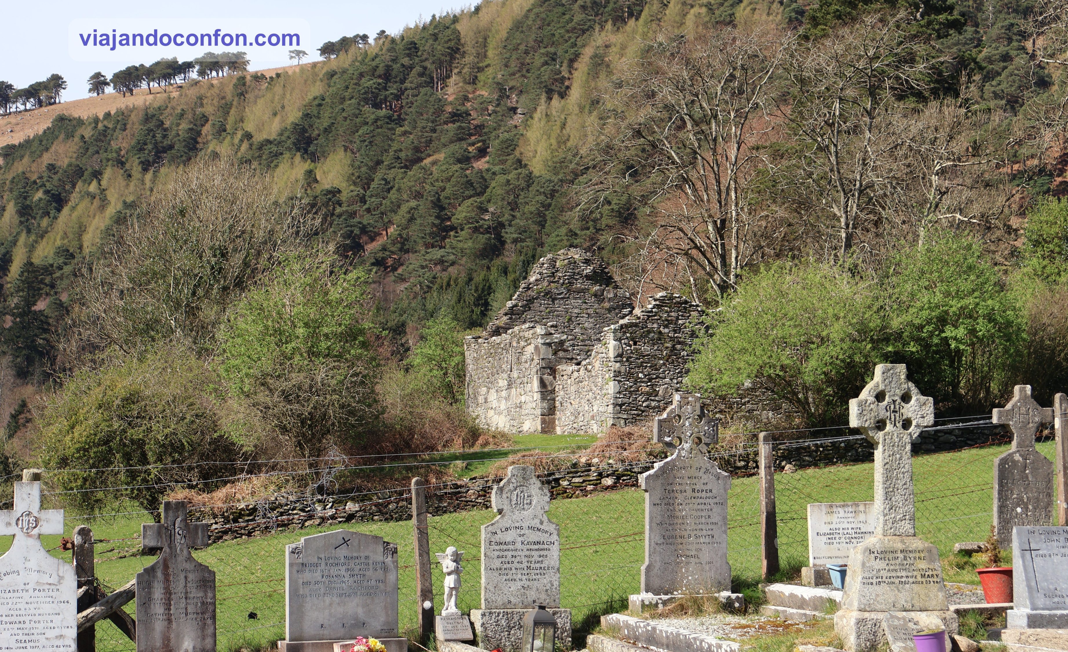
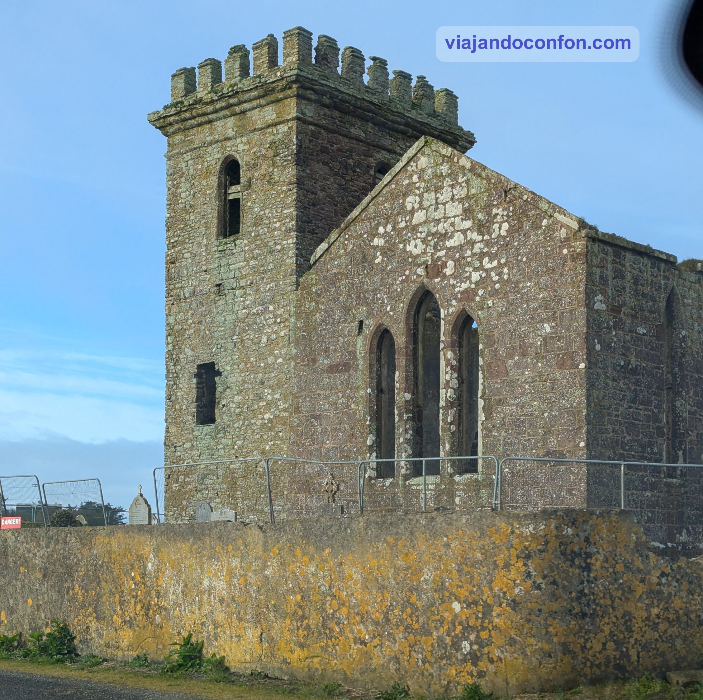
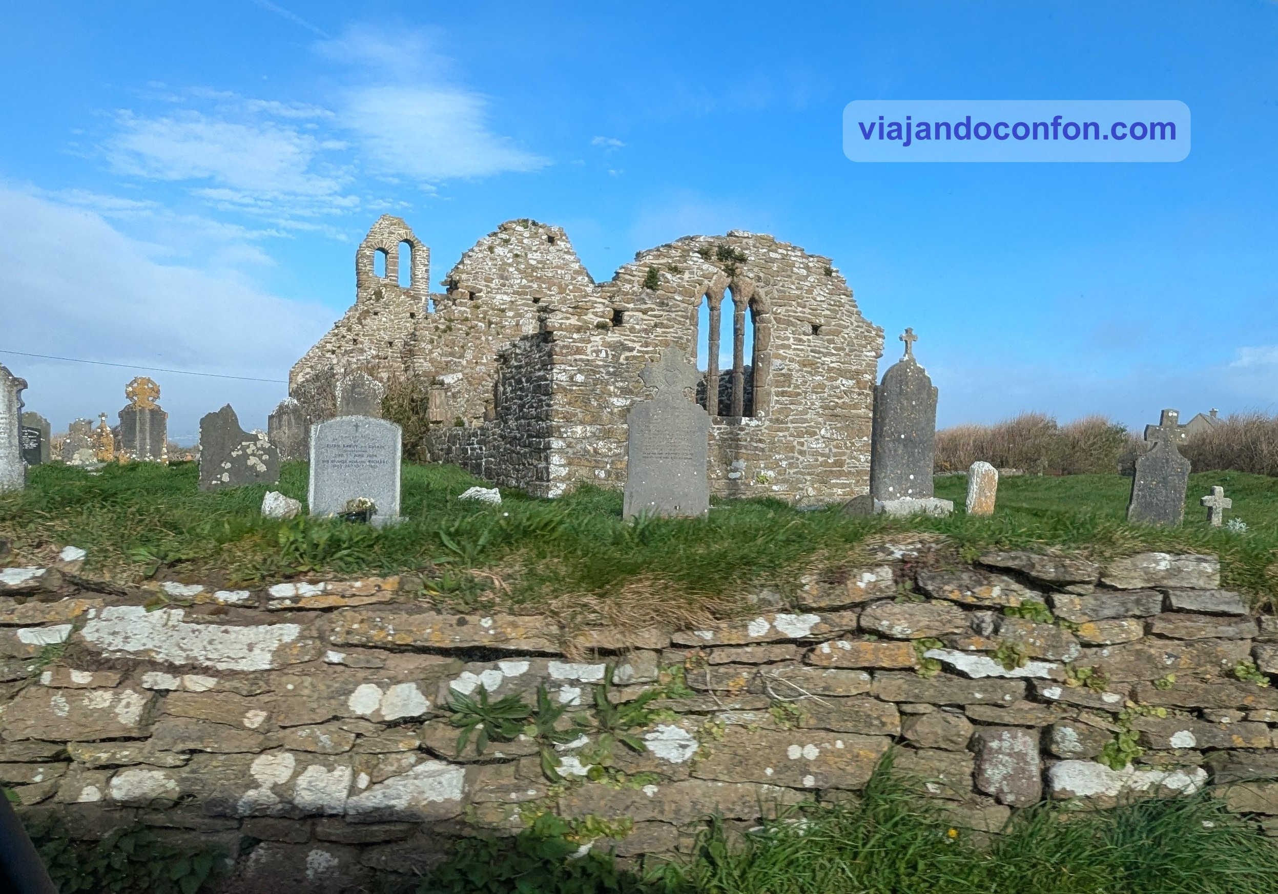
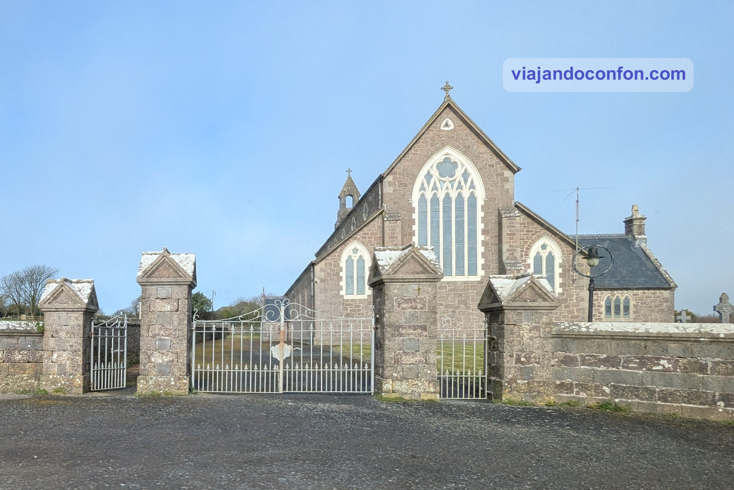
La Abadía de Clare es un monasterio agustino en ruinas situado cerca de la ciudad de Ennis, a orillas del río Fergus, en el condado de Clare.
Originalmente llamada la “Abadía de San Pedro y San Pablo en Kilmony”, se fundó alrededor de 1189. Se cree que por Domnall Mór Ua Briain (Donald O’Brien), rey de Thomond, quien murió en 1194.
El monasterio fue disuelto por el rey Enrique VIII de Inglaterra en 1541, aunque parece que siguió estando ocupado por los canónigos de la orden al menos hasta 1650.
Los restos de la abadía consisten en una iglesia con un campanario cuadrado y varios edificios residenciales. Estos al sur y al este de la iglesia, todos rodeando un claustro ajardinado. Como ocurre con tantas ruinas eclesiásticas medievales, parte del terreno interior actual se ha utilizado posteriormente para enterramientos por familias locales.
Curiosidad: En 1871, Thomas Crowe, D. L., de Dromore House, Ruan, Condado de Clare, erigió una gran tumba victoriana en el ala este, junto al coro de la iglesia, para él y su familia.
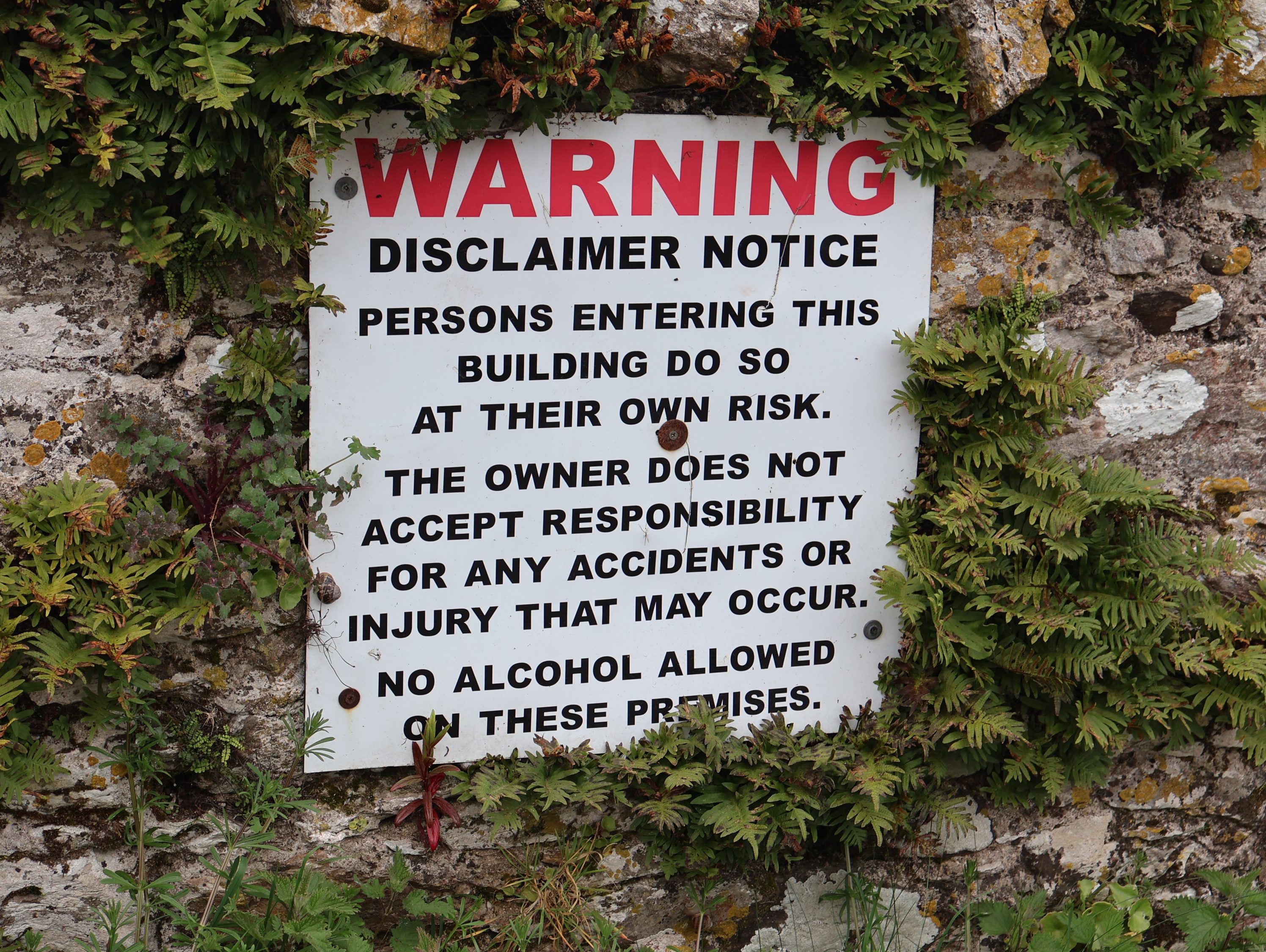
Por cierto, se recomienda tener cuidado ya que, al estar en ruinas, puede ser peligroso circular por su interior.
Abadía de Clare
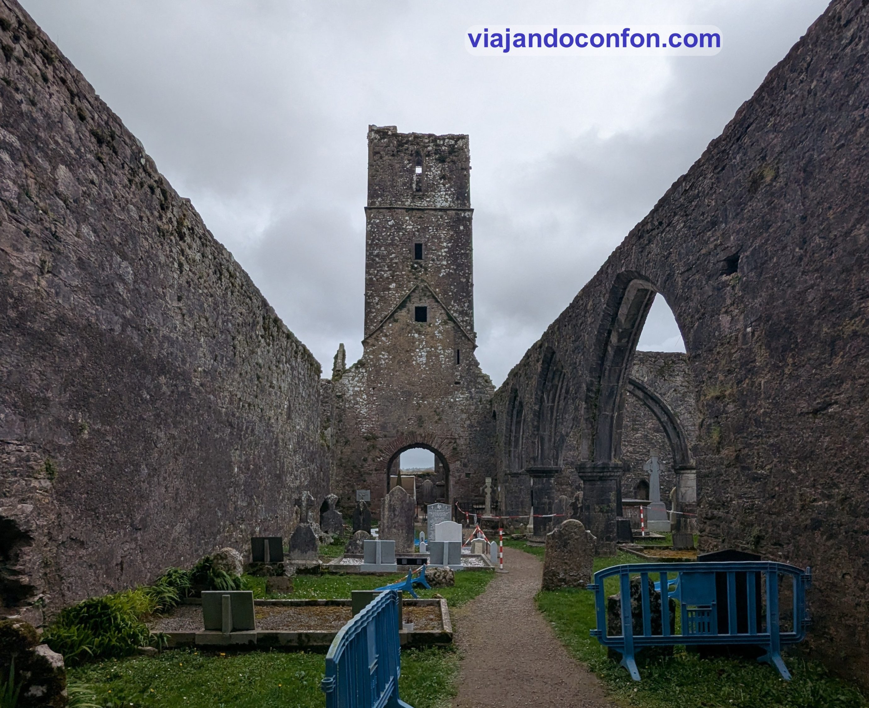
Ya que estábamos cerca de la ciudad de Ennis, decidimos adentrarnos en ella para visitar Ennis Friary, el convento de Ennis.
Fue fundado por los O’Brien de Thomond a mediados del siglo XIII. Para 1375 ya contaba con 350 frailes y una renombrada escuela de 600 alumnos. Fue la última escuela de teología católica que sobrevivió a la Reforma.
El edificio alberga una excepcional colección de esculturas de los siglos XV y XVI talladas en la dura piedra caliza local, incluyendo una de San Francisco mostrando los estigmas. Cuenta con un gran aparcamiento.
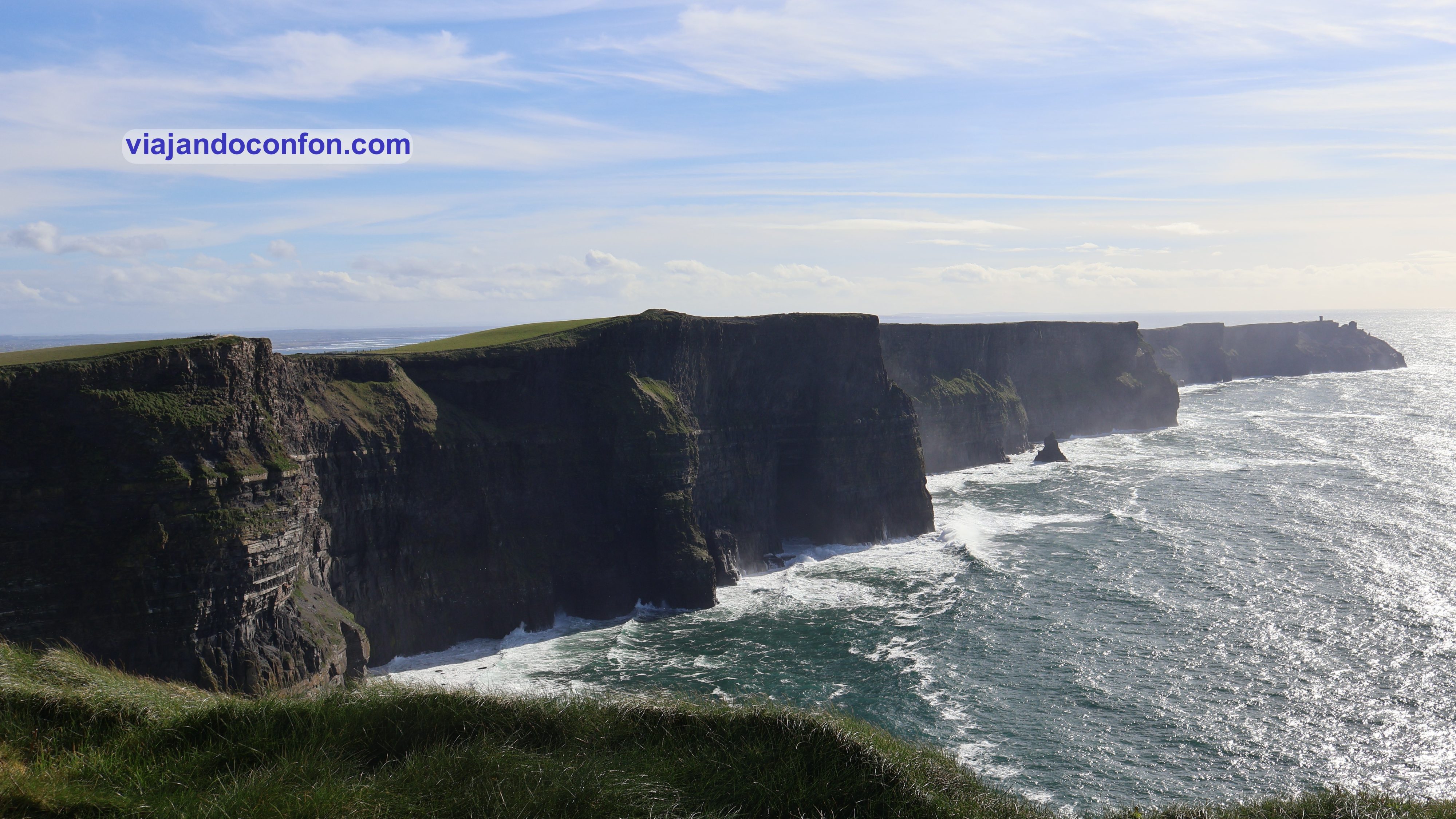
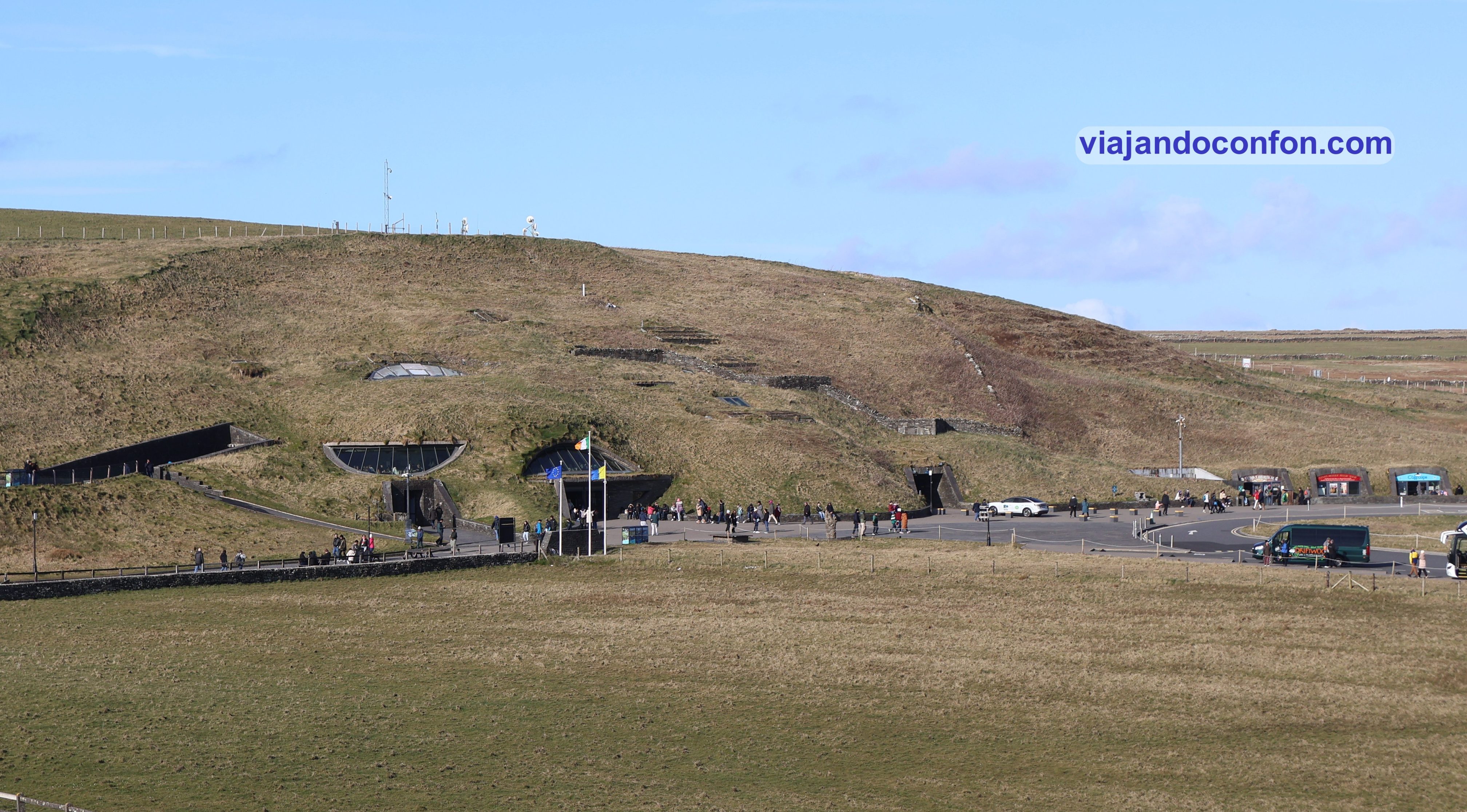
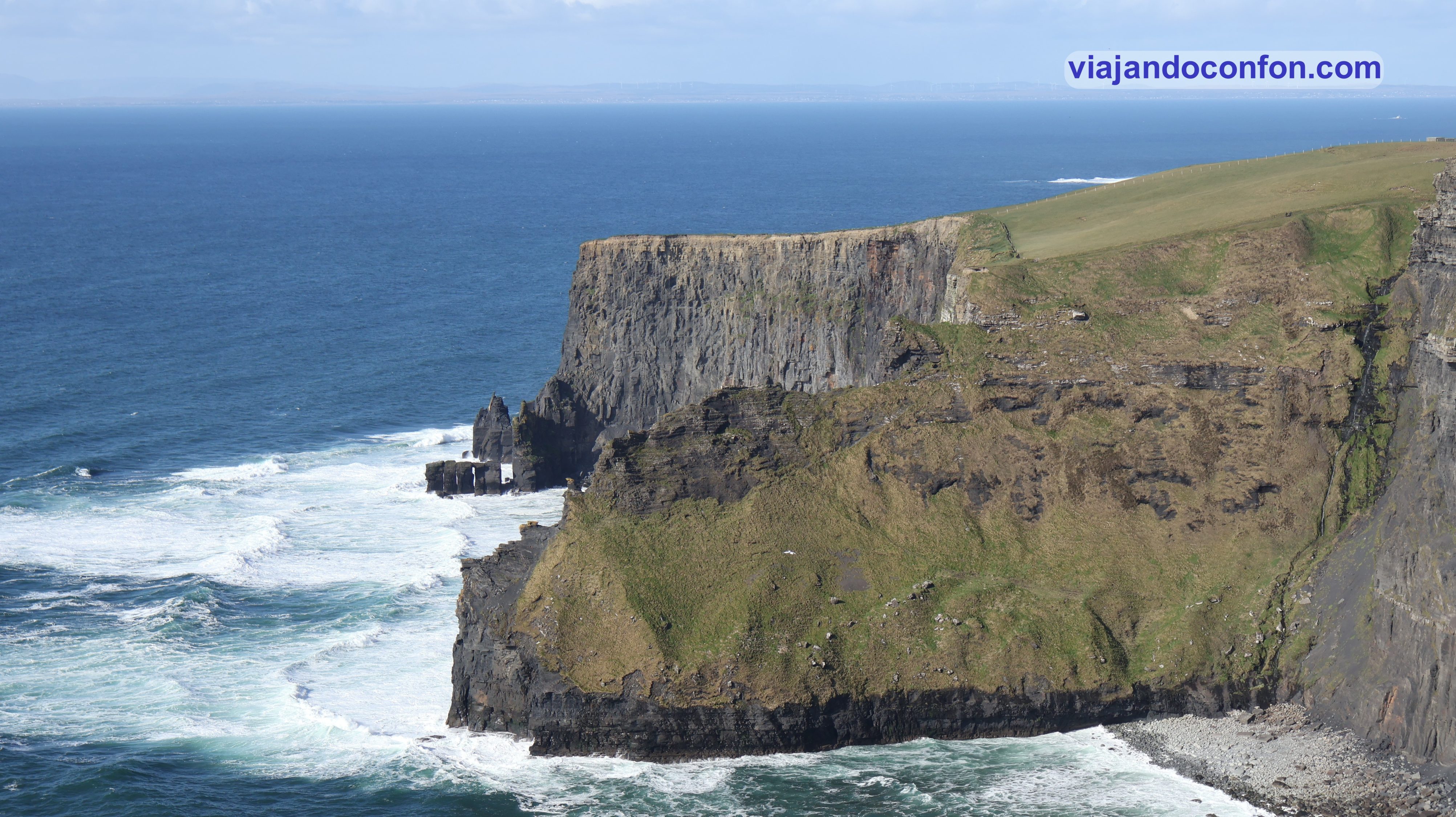
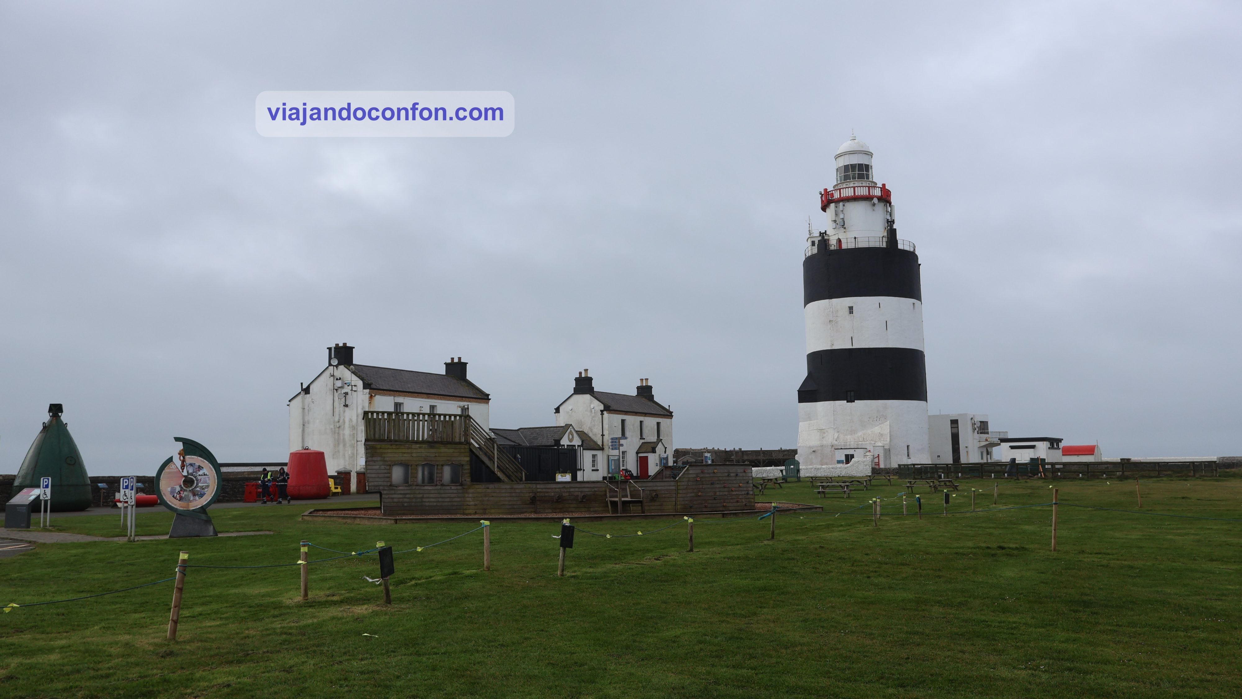
Tras esta visita salimos corriendo a los famosos Acantilados de Moher (Aillte an Mhothair), a unos 40 km. son acantilados costeros situados en el extremo suroeste de la región de Burren, en el condado de Clare.
Se extienden a lo largo de unos 14 km. En su extremo sur, se elevan 120 metros sobre el océano Atlántico en Hag’s Head. 8 kilómetros al norte, alcanzan su altura máxima de 214 metros.
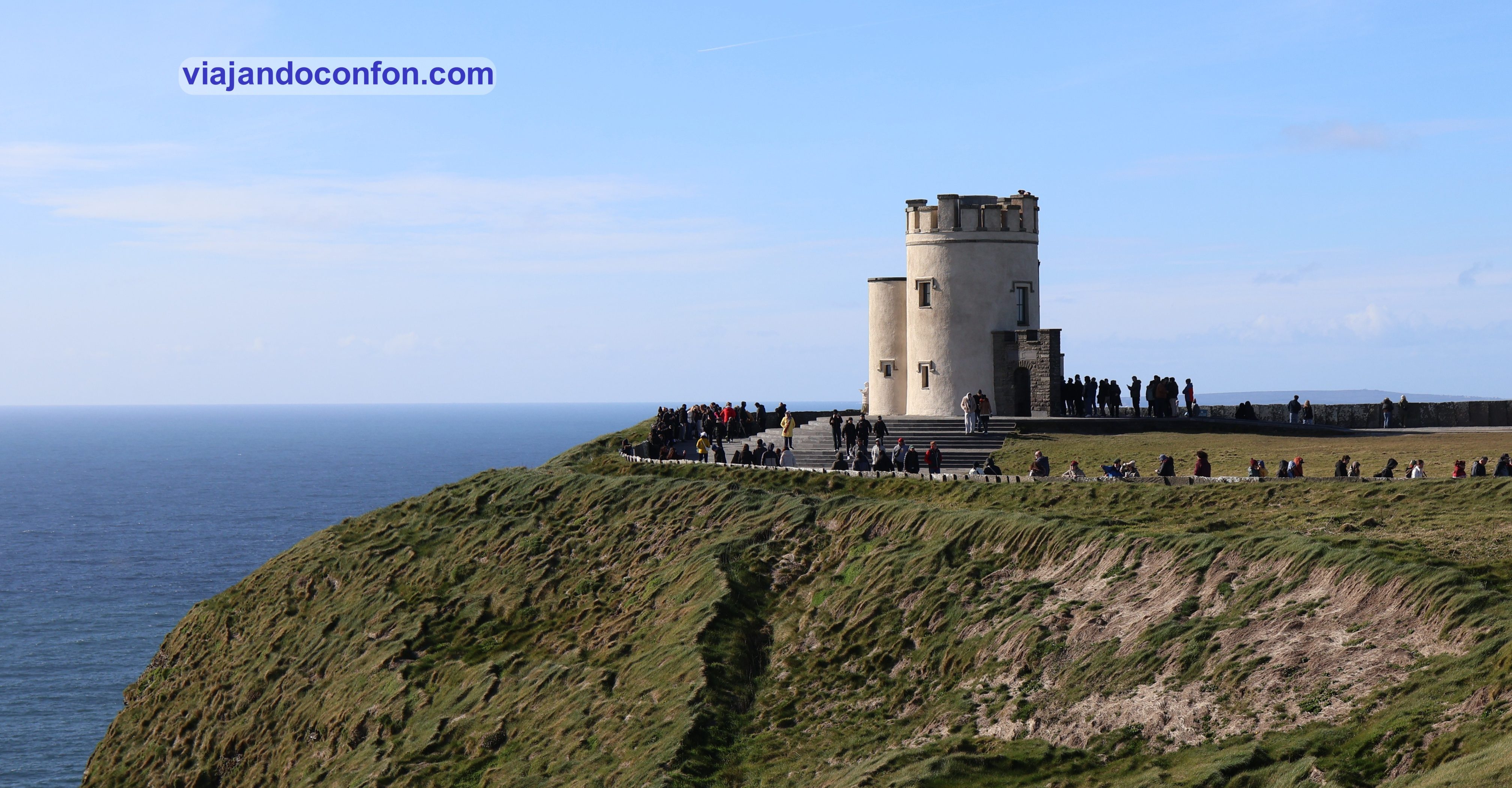
Es justo al norte de la Torre de O’Brien. Esta es una torre redonda de piedra cerca del punto medio de los acantilados, construida en 1835 por Sir Cornelius O’Brien. A ella podemos subir para contemplar el paisaje en 360º.
Aquí encontrarás diferentes excursiones y actividades en los Acantilados de Moher ¡No te arrepentirás!
Nada más llegar al parking, antes de entrar compramos las entradas. Nos crujen nada más y nada menos que 15€ por persona. Para darnos cuenta de que la puerta al recinto permanece abierta, sin tornos ni vigilancia. A mi me parece realmente excesivo el precio.
Al entrar nos encontramos unas tiendas de recuerdos y el centro de visitantes, con otra tienda más grande, baños y una exposición sobre los acantilados.
A parte de los acantilados, también podemos contemplar a lo lejos las Islas Arán (Oileáin Árann). Se trata un archipiélago de tres islas situadas en la desembocadura de la bahía de Galway.
Los acantilados se encuentran entre los lugares turísticos más visitados de Irlanda, con alrededor de 1,5 millones de visitas al año. No se como será entemporada alta pero ese día había más gente que en la guerra.
Acantilados de Moher
Si no dispones de mucho tiempo en Irlanda, te recomendamos esta excursión desde Dublín
*Nos ayuda a mantener el blog
Después de pasar largo rato disfrutando de los espectaculares paisajes de los acantilados, nos volvemos al coche. Siguiente destino (y último del día): Doonagore Castle, a unos 5 km.
El castillo de Doonagore es una casa-torre redonda del siglo XVI con un pequeño recinto amurallado. Está situada a aproximadamente 1 km al sur del pueblo costero de Doolin, en el condado de Clare. Su nombre podría derivar de Dún na Gabhair, que significa «el fuerte de las colinas redondeadas» o «el fuerte de las cabras».
Actualmente, el castillo de Doonagore es una casa de vacaciones privada, inaccesible al público. Además, se encuentra en una carretera muy complicada en la que no se puede ni parar. Así que pasamos por su lado pero no pudimos ni pararnos.
Así pues, seguimos con nuestro itinerario, rumbo al Castillo de Dunguaire, a 45km. La carretera por momentos era complicada, estrechísima, llena de curvas y con límite de velocidad a 80km/h, aunque íbamos entre 30 y 40.
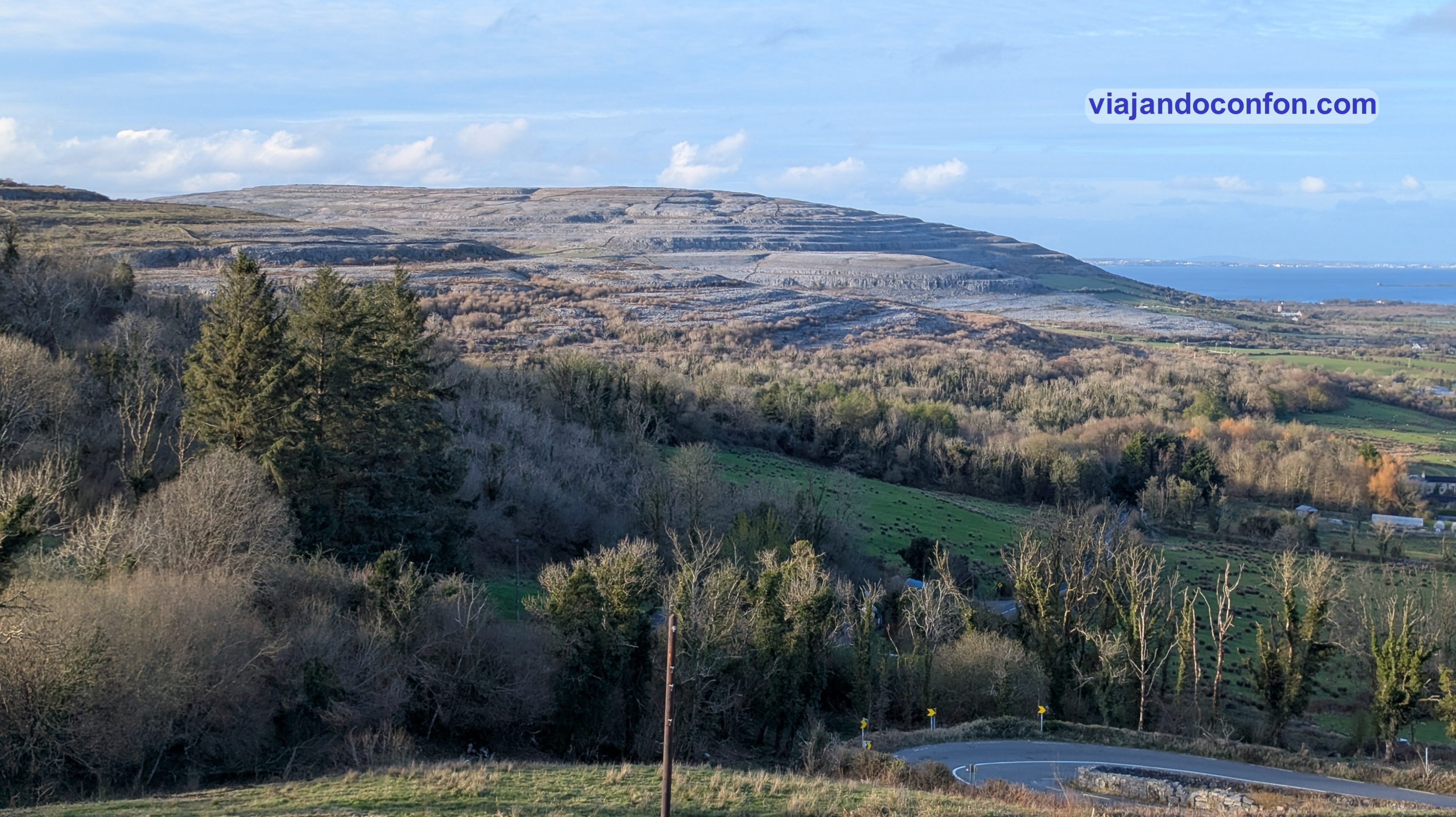
Mira tú por dónde, tras una curva nos encontramos con lago que no contábamos. El incomparable paisaje del Gregans Geopark, con una vista increible desde Corkscrew Hill.
El Geoparque de Gregans se encuentra en la ladera de un valle formado por el movimiento de las capas de hielo hace 20.000 años. Las capas de hielo habrían viajado desde Galway hasta aquí, transportando rocas y modelando los valles. Se encuentra enclavado en el Burren and Cliff of Moher Geopark, incluido en el Patrimonio de la UNESCO.
https://youtube.com/shorts/ej2ZPWm4HKQ
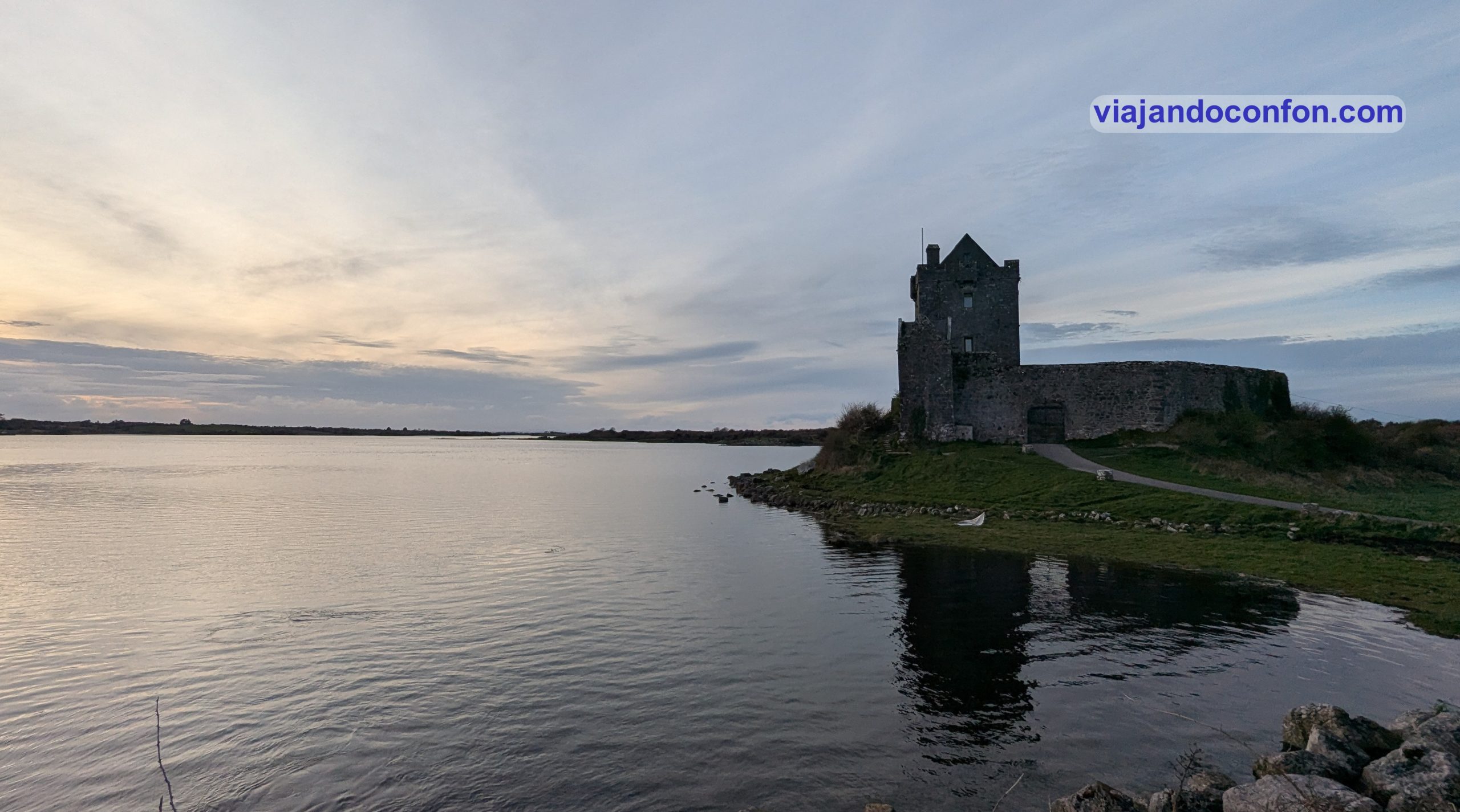
Seguimos nuestro camino y por fin llegamos al Castillo de Dunguaire al atardecer. Es una casa-torre del siglo XVI situada en la costa sureste de la bahía de Galway. Su nombre deriva del fuerte del rey Guaire, el legendario rey de Connacht.
Curiosidad: El Castillo de Dunguaire se utilizó en la película de Walt Disney de 1969, «El secreto del castillo», donde se representó como el Castillo de Boyne.
La estampa del castillo junto al lago al atardecer era realmente mágica. También, a los frikis puede llegar a recordarnos la peli de “Los Inmortales”.
Como ya era bastante tarde, decidimos buscar algo para comer en el pueblo. Lo hicimos en la pizzería The Rustic Oven. Barato y las pizzas muy ricas. Las dos nos costaron 28€. Además, la bebida debías comprarla en el pub de al lado con el que se encuentra conectado por dentro.
Tras la cena nos pusimos en camino del alojamiento. Un pequeño apartamento turístico cerca de la localidad de Galway. Sencillo pero nada caro. No tenía cocina pero si utensilios para el desayuno, que teníamos incluido. Nos dejaron mermeladas caseras y una mantequilla, también casera, que era para comérsela a cucharadas.
Penúltimo día de nuestro viaje a Irlanda. Nos levantamos bien temprano con algo de lluvia (como no). Desayunamos y nos ponemos en camino a Galway.
Galway (Gaillimh) es la capital del condado homónimo. Se encuentra a orillas del río Corrib, entre el lago Corrib y la bahía de Galway. Es la cuarta ciudad más poblada la República de Irlanda, con una población de unos 86.000 habitantes.
Situada cerca de un asentamiento anterior, Galway creció alrededor de una fortificación construida por el rey de Connacht, Tairrdelbach Ua Conchobair, en 1124. Una carta municipal de 1484 permitió a los ciudadanos de la ciudad, ya amurallada, formar un consejo y una alcaldía.
Controlada en gran medida por un grupo de familias de comerciantes, las Tribus de Galway, la ciudad se convirtió en un puerto comercial.
Tras un período de declive, en el siglo XXI, Galway es un destino turístico conocido por sus festivales y eventos, incluido el Festival Internacional de las Artes de Galway.
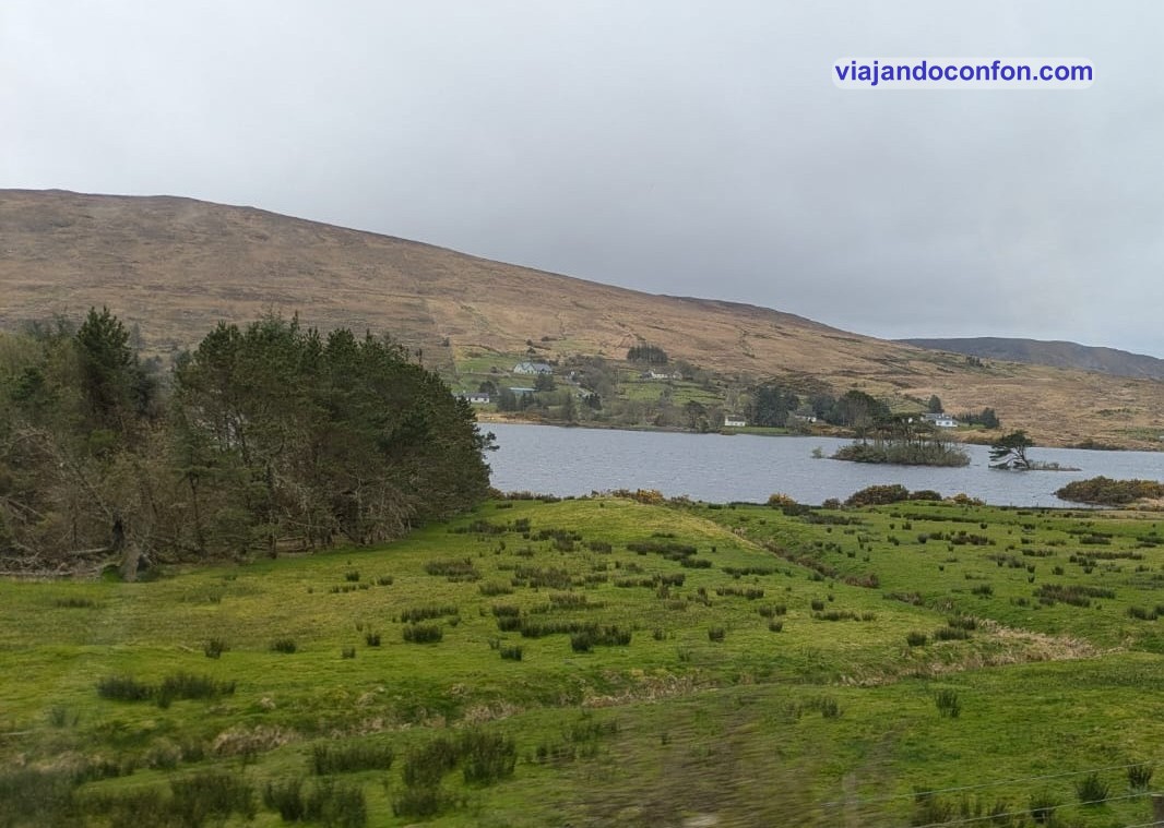
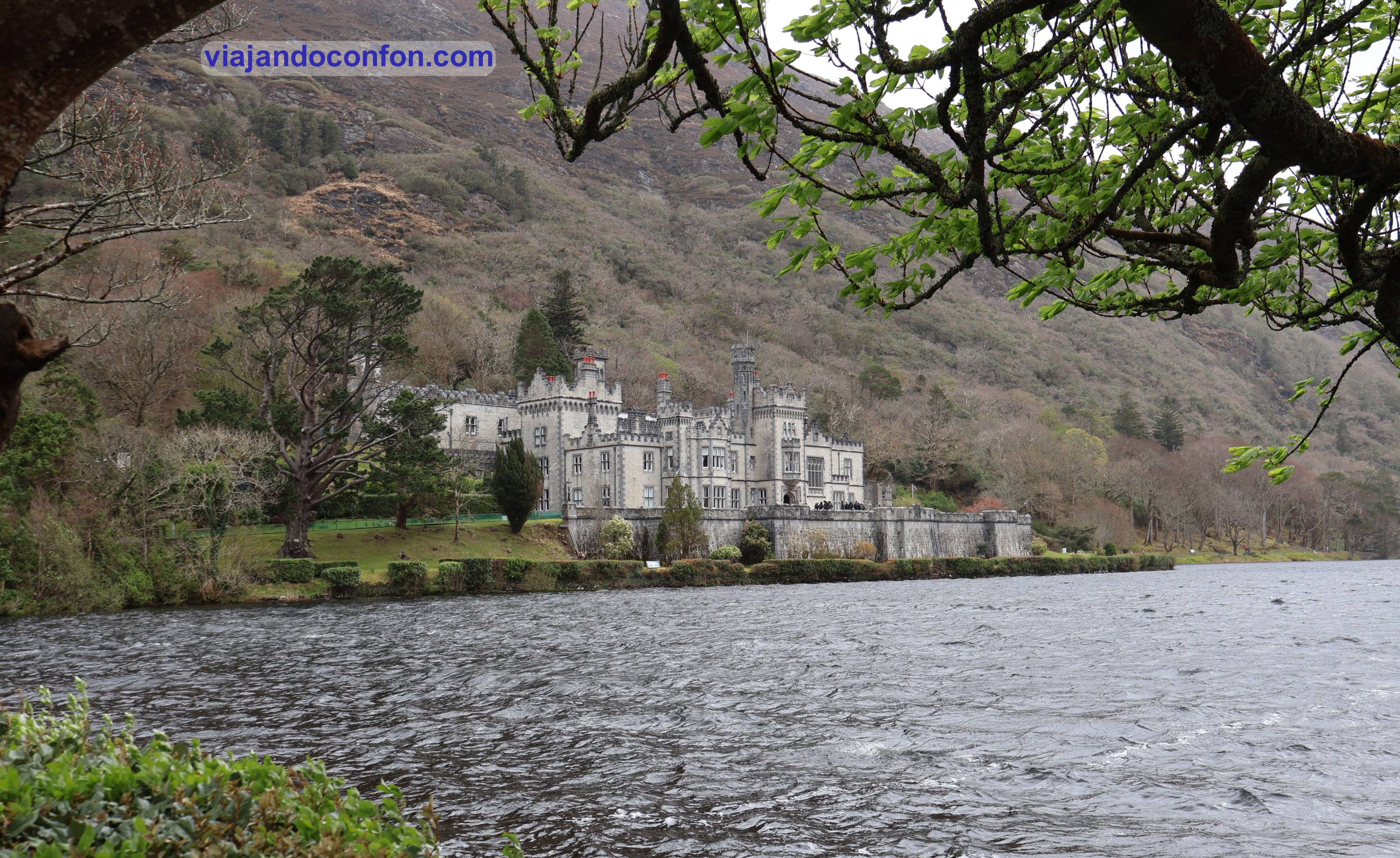
Por desgracia, después de dr como un millón de vueltas buscando aparcamiento, decidimos desecharla por falta de tiempo. Así que nos pusimos en camino del siguiente destino: la Abadía de Kylemore, a unos 80 km.
Kilómetros que se hicieron cortos gracias al espectacular paisaje que íbamos recorriendo.
La Abadía de Kylemore (Mainistir na Coille Móire) es un monasterio benedictino fundado en 1920 en los terrenos del Castillo de Kylemore, en Connemara, Condado de Galway. Fue fundada para monjas benedictinas que huyeron de Bélgica durante la Primera Guerra Mundial.
Desde 2022, pertenece a la Congregación Benedictina Inglesa. Bajo la administración de The Kylemore Trust, continúa su misión como monasterio benedictino, custodiando Kylemore y su misión espiritual, así como su patrimonio natural y arquitectónico.
Encuentra diferentes excursiones a la Abadía de Kylemore con Get Your Guide
El castillo de Kylemore fue construido en 1868 como residencia privada para la familia de Mitchell Henry. Este era un médico adinerado de Londres cuya familia se dedicaba a la fabricación textil en Manchester. Se mudó a Irlanda cuando él y su esposa Margaret compraron los terrenos alrededor de la abadía, tras haber viajado allí de luna de miel a mediados de la década de 1840. Se dedicó a la política, siendo diputado por el condado de Galway desde 1871 hasta 1885.
Margaret falleció en 1874, tras contraer fiebre durante un viaje a Egipto. Tras su muerte, Henry construyó una capilla gótica y un mausoleo familiar en su memoria.Este alberga los cuerpos de Margaret Henry, Mitchell Henry y un sobrino nieto.
Aprovechamos la visita para tomar un café calentico y volver a ponernos en camino.
Si quieres disfrutar de los espectaculares paisajes y visitar la Abadía de Kylemore, en Civitatis tienes la excursión perfecta:
*Nos ayuda a mantener el blog
La siguiente parada estaba muy cerquita, Kilary Harbour, el único fiordo natural de Irlanda. Su nombre en gaélico es An Caoláire Rua, que significa ‘el fiordo rojo’. Tiene una longitud de 16 km y una profundidad máxima de entre 42 y 45 metros.
Seguimos con los espectaculares paisajes de Irlanda, parándonos en algún momento para sacar algunas fotos.
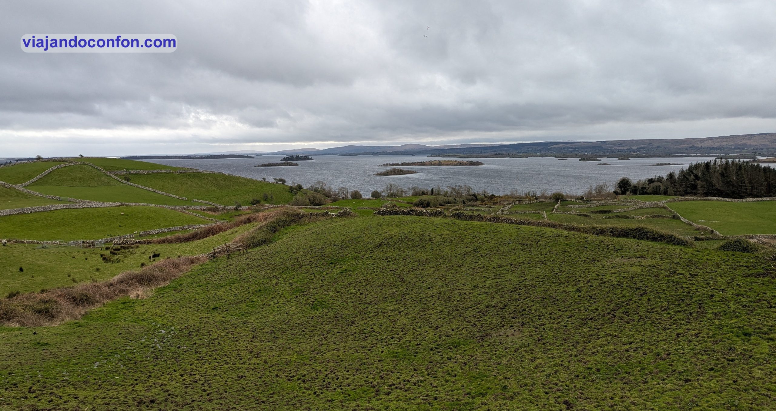
Tras recorrer 50 km, llegamos a la ciudad de Cong, en el Condado de Mayo, para visitar su abadía. Cong se encuentra en una isla formada por varios arroyos que la rodean por todos lados. Está situada en el istmo que conecta los lagos Corrib y Mask.
Cong fue el lugar de rodaje de la película de John Ford ganadora del Óscar en 1952, El hombre tranquilo, protagonizada por John Wayne, Maureen O’Hara y Barry Fitzgerald.
El pueblo y la zona del castillo permanecen prácticamente inalterados desde 1952, y la conexión de Cong con la película la convierte en una atracción turística.
Curiosidad: La película aún se celebra en el “Club de Fans de El hombre tranquilo”.
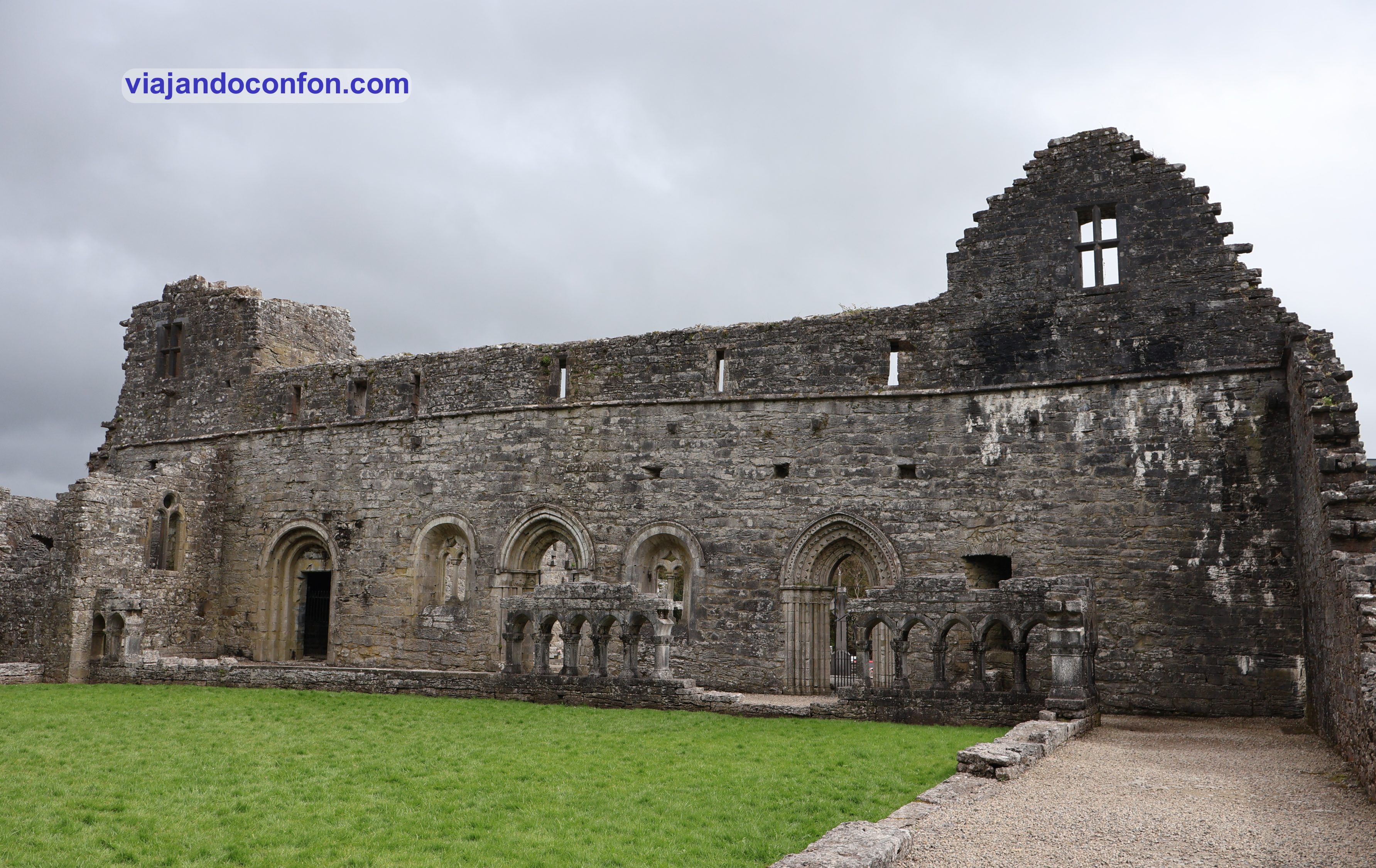
Dejamos el coche en un aparcamiento público (y gratuito) y nos ponemos camino de las ruinas de la Abadía de Cong.
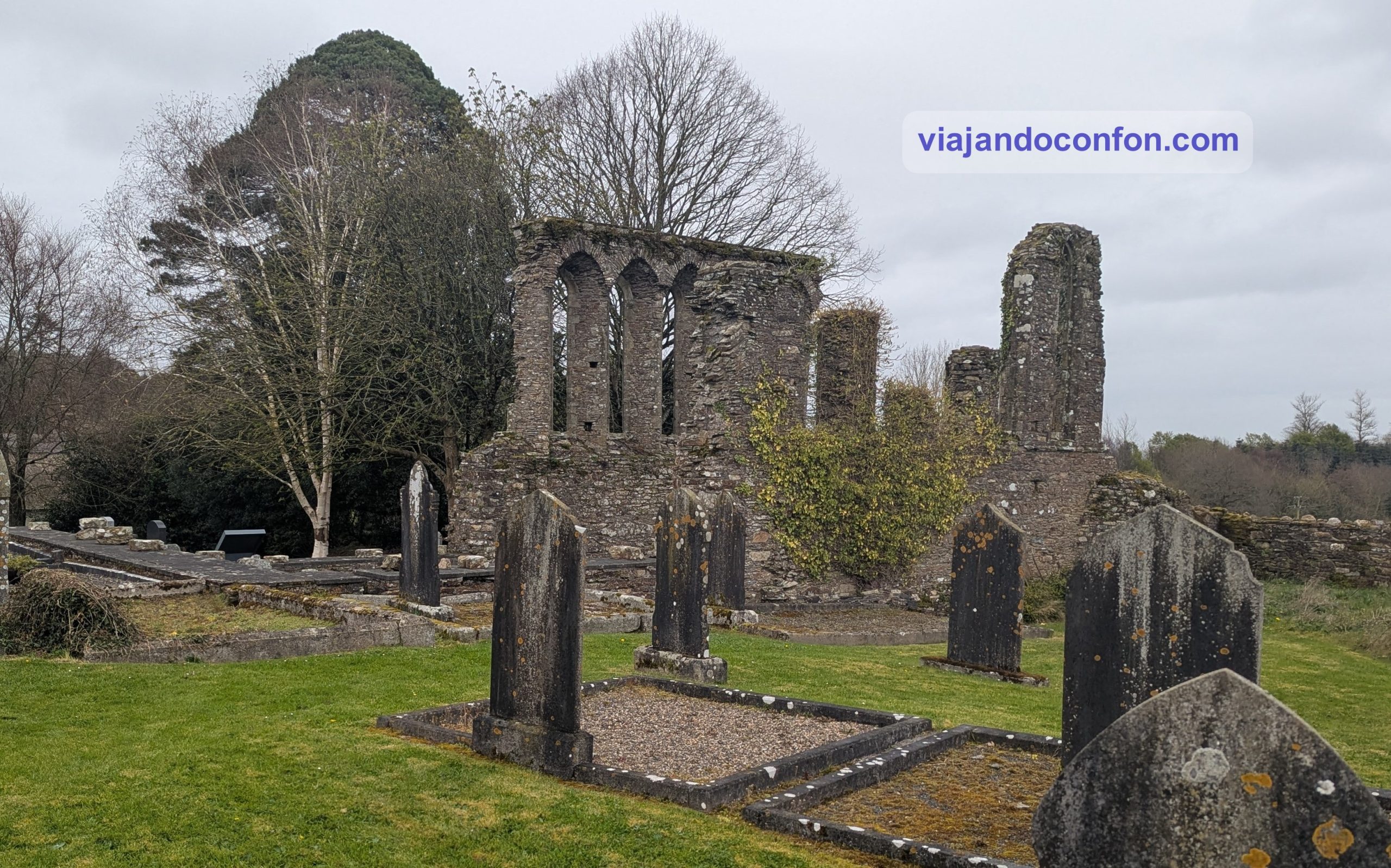
Las ruinas de la antigua abadía agustina datan principalmente del siglo XIII y se consideran algunos de los mejores ejemplos de arquitectura eclesiástica medieval en Irlanda.
Se fundó en el siglo XII por Turlough O’Connor, rey de Connaught. Se asienta sobre el emplazamiento de un monasterio anterior fundado en el siglo VII por San Feichin.
La iglesia se incendió en 1114 y 1137. Tras la Disolución de los Monasterios en la década de 1530, la abadía cambió de manos tres veces. Primero pasó a los Bingham, luego a los O’Donnell y finalmente a los Browne.
En lo que queda hoy se aprecian diferentes épocas de construcción; los muros norte y sur, el hastial este de la iglesia y la parte noreste del claustro son originales, mientras que el resto es principalmente una reconstrucción moderna.
La primera restauración de la abadía fue iniciada por Benjamin Guinness en 1855, poco después de haber comprado el cercano Castillo de Ashford en 1852.
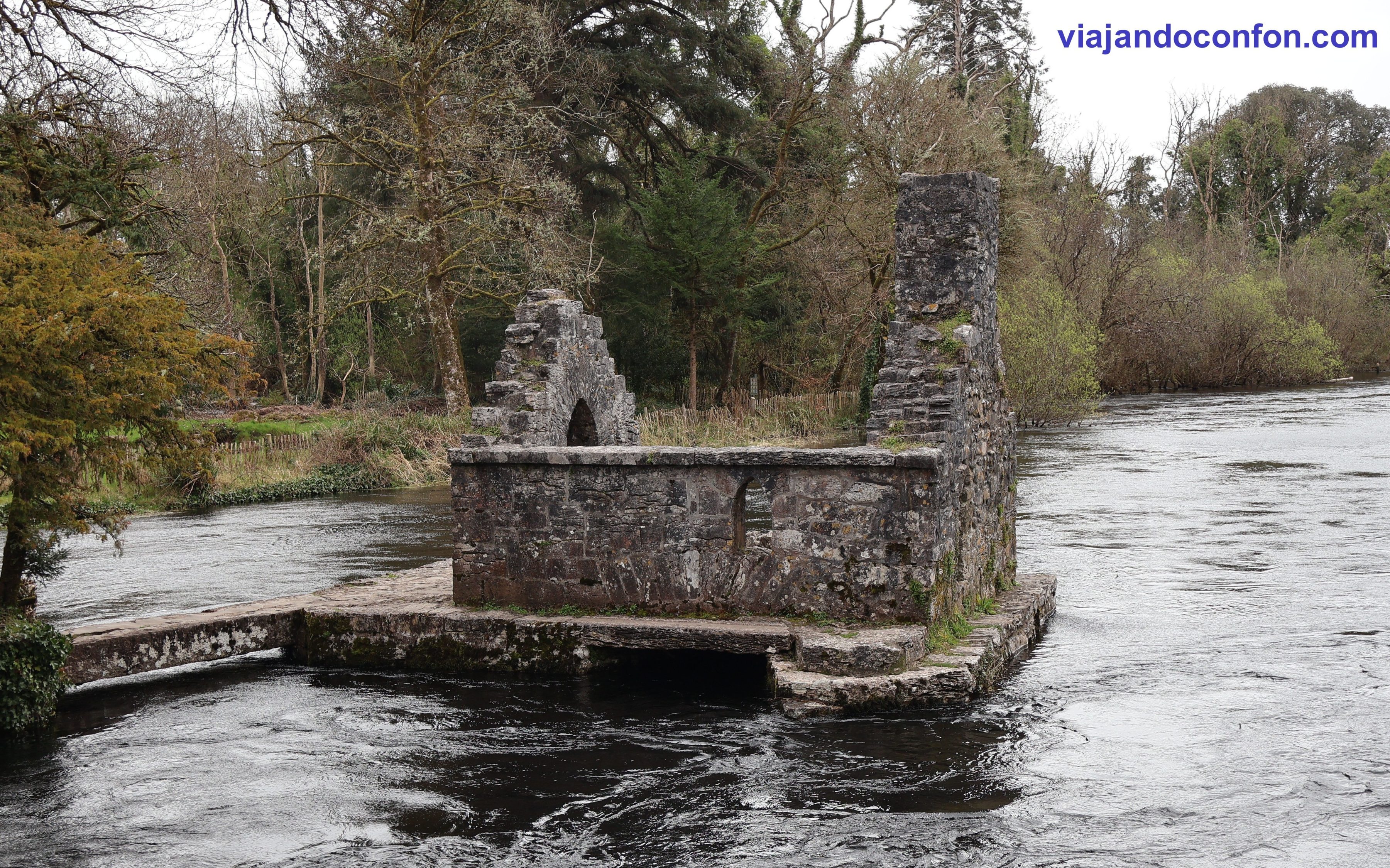
Muy cerquita se encuentra un pequeño edificio en el río que nos llamó la atención. Se trata de Monk’s Fishing House, la casa de pesca del monje. Se construyó entre los siglos XV y XVI y, como su nombre indica, eran utilizadas por los monjes de la Abadía de Cong para pescar.
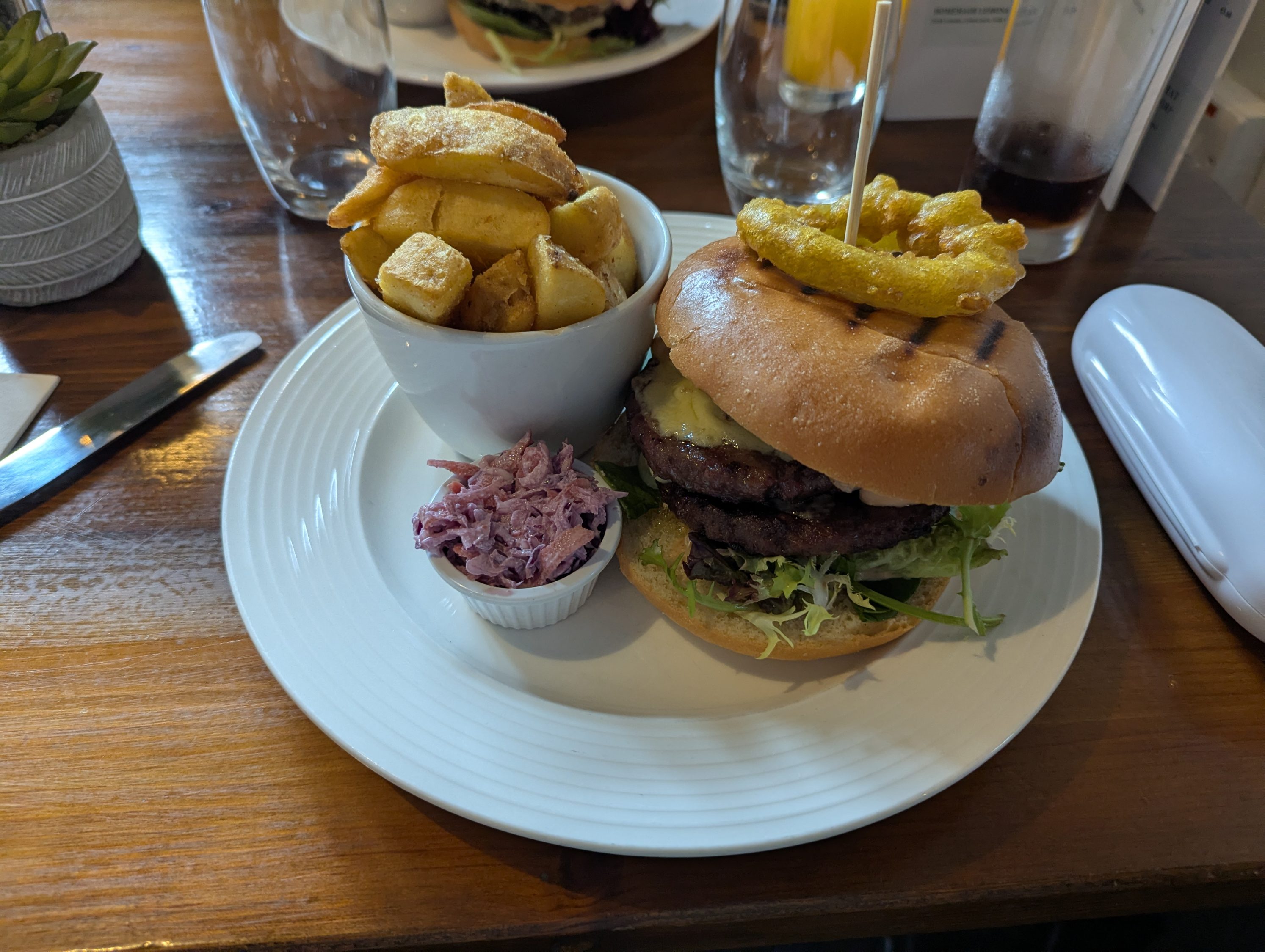
Como ya era buena hora para comer, nos dispusimos a buscar algún sitio donde hacerlo. La verdad es que no habían muchas opciones así que lo hicimos en Pat Cohan’s Gastro Pub (The Quiet Man Bar). Un sitio bastante caro aunque la hamburguesas que nos comimos eran algo más “económicas”. Hay que decir que estaban buenísimas. Nos costó 50,20€… casi ná.
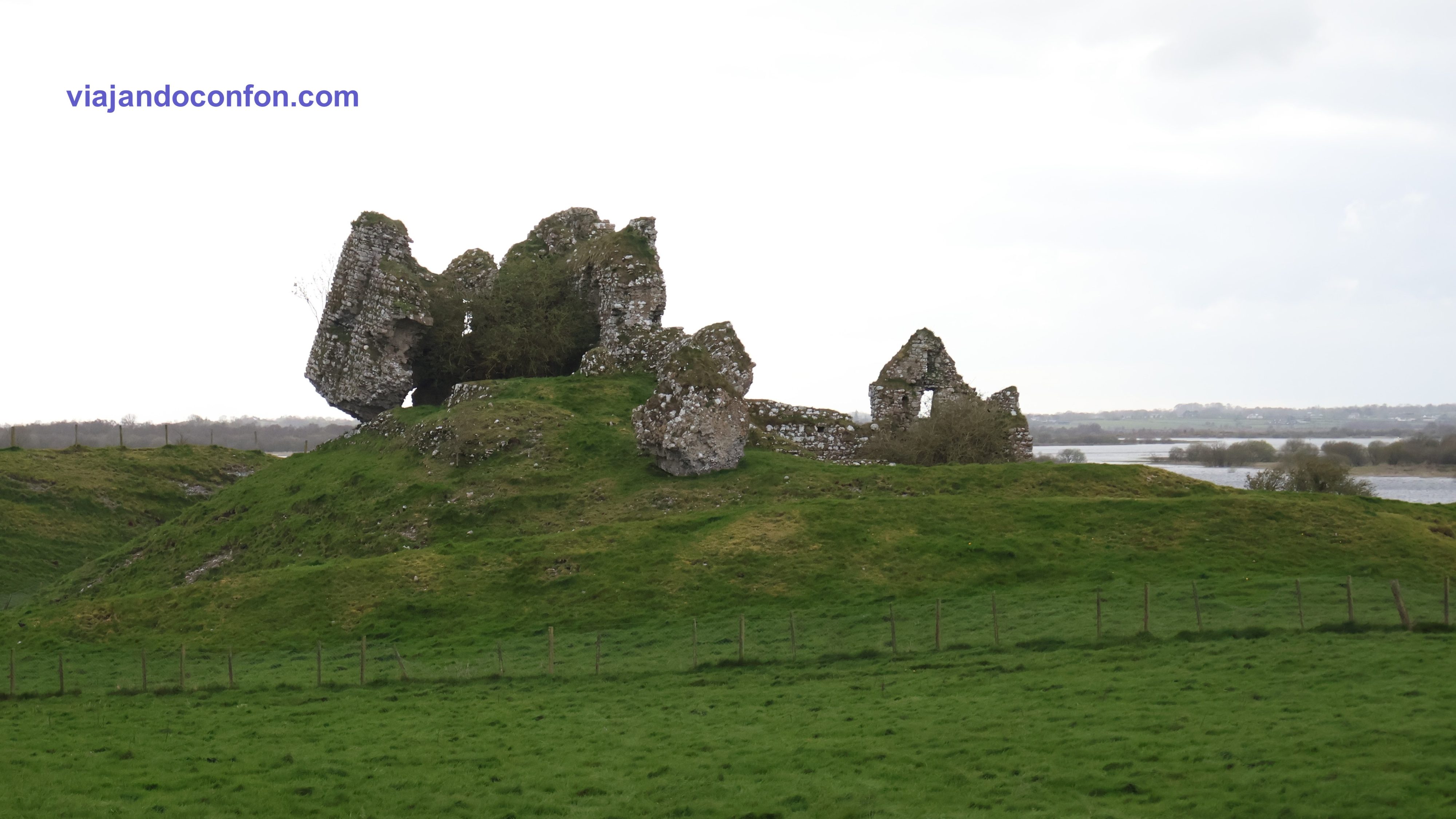
Después de comer tocaba ponerse en camino, acercándonos a Dublín. Tocaba pararse en Clonmacnoise, a 120 km.
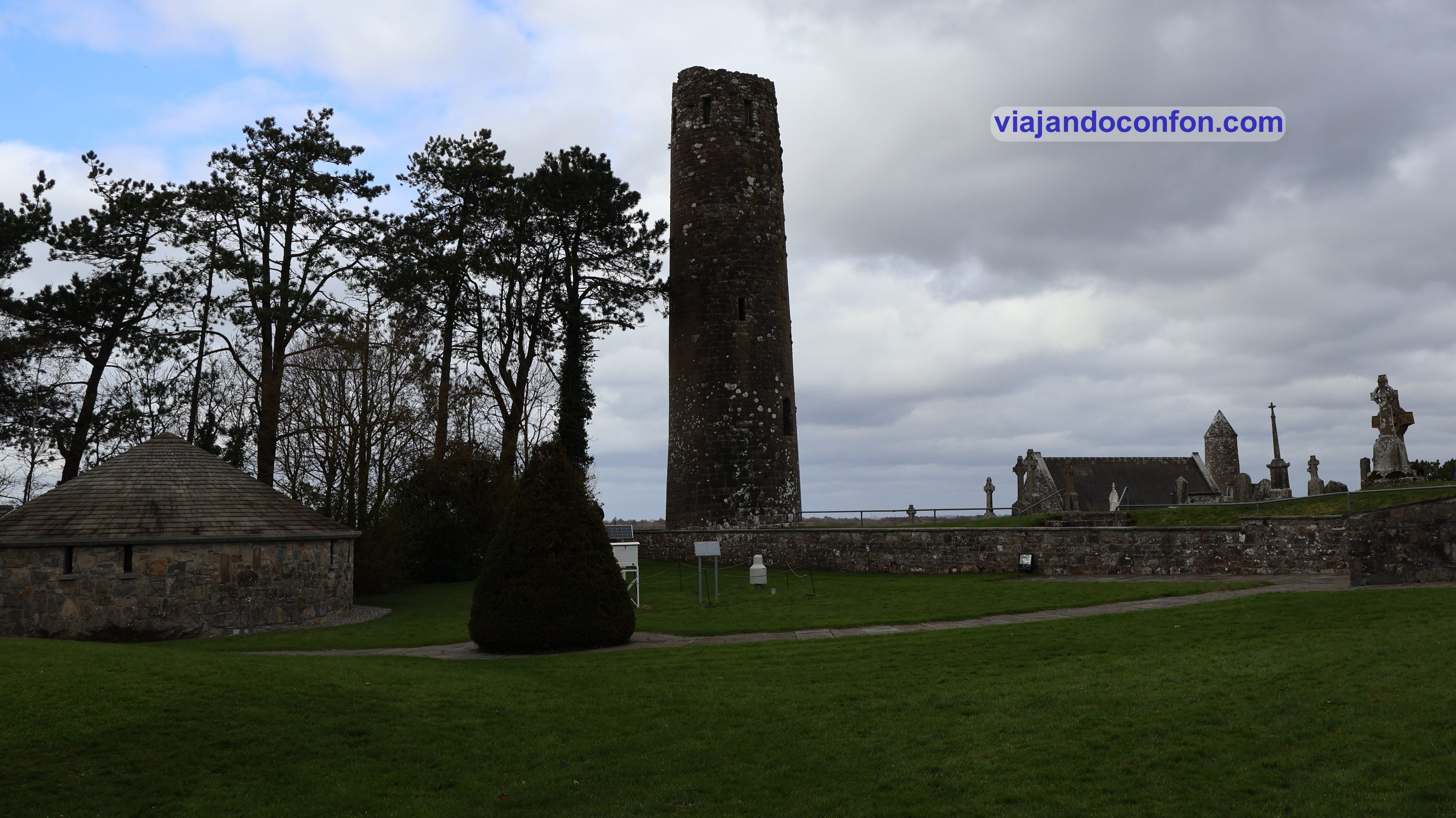
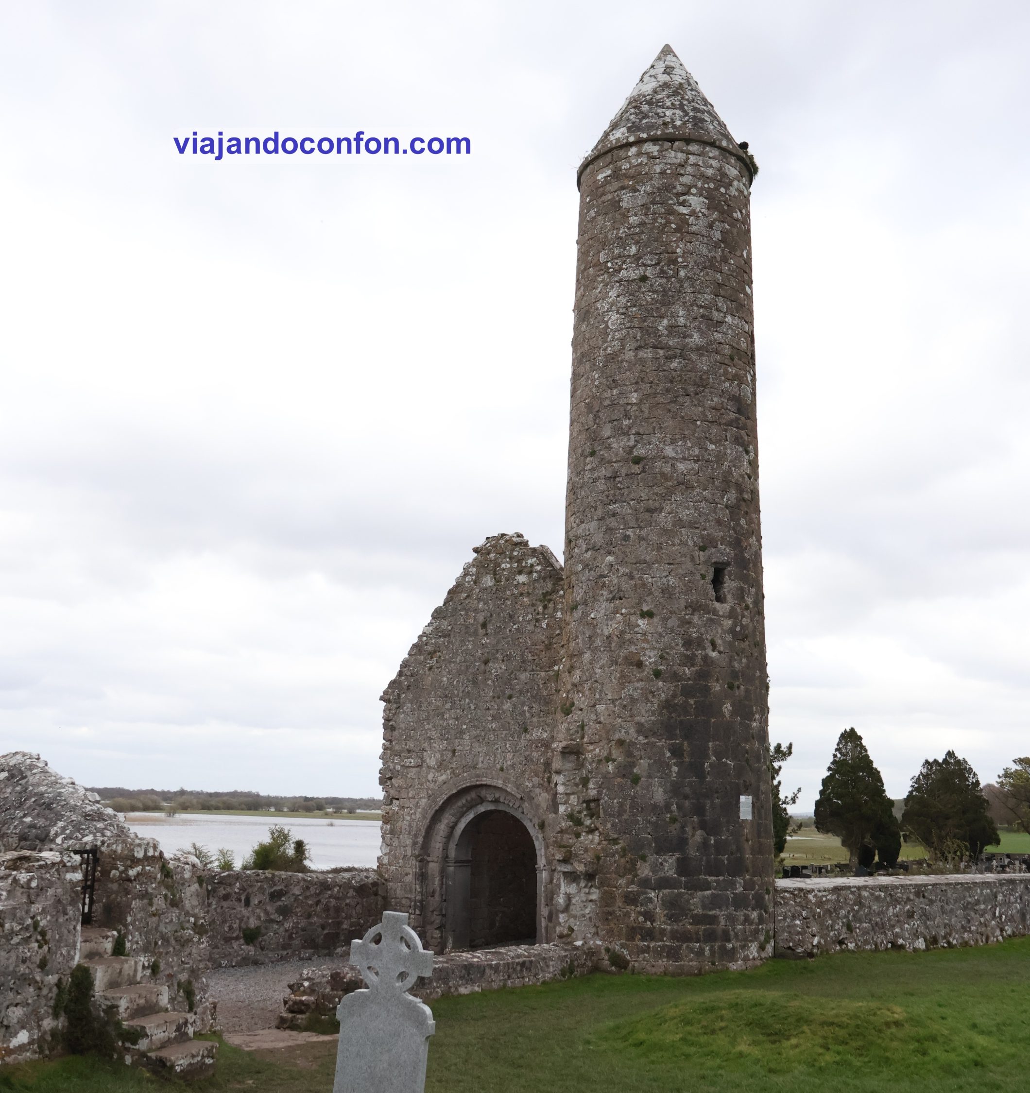
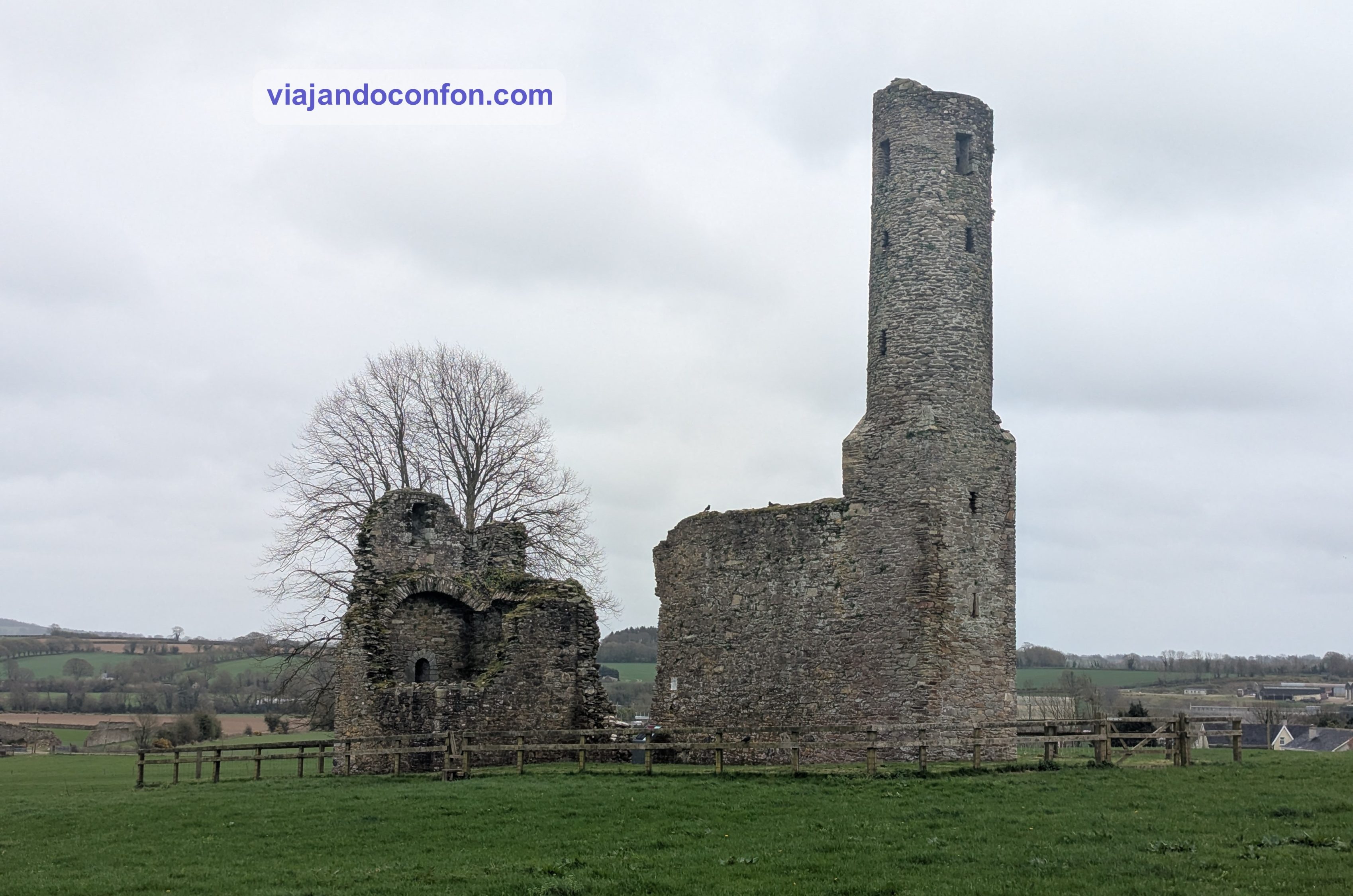
Clonmacnoise (Cluain Mhic Nóis) es un monasterio en ruinas en el condado de Offaly, a orillas del río Shannon. Se fundó en 544 por San Ciarán y hasta el siglo IX tuvo estrechas relaciones con los reyes de Connacht.
La ubicación estratégica del monasterio contribuyó a que se convirtiera en un importante centro de religión, aprendizaje, artesanía y comercio en el siglo IX. Junto con Clonard fue uno de los lugares más famosos de Irlanda, visitado por eruditos de toda Europa.
Clonmacnoise quedó prácticamente abandonada a finales del siglo XIII. Hoy en día, el yacimiento incluye nueve iglesias en ruinas, un castillo, dos torres redondas y un gran número de cruces y losas de piedra tallada. El cementerio está en uso y se celebran servicios religiosos en una capilla moderna.
Estos son algunos de los elementos que podemos ver:
O’Rourke’s Tower: Aunque se llama Torre de O’Rourke, en honor al rey de Connacht del siglo X, Fergal O’Rourke, el Chronicum Scotorum registra que fue terminada en 1124 por Turlough O’Connor, rey de Connacht, y Gilla Christ Ua Maoileoin, abad de Clonmacnoise.
Once años después, un rayo la alcanzó, derribando la parte superior de la torre. Se cree que la mampostería que se derrumbó durante la tormenta de 1135 pudo haber sido reutilizada en la construcción de la Torre de McCarthy.
Temple Finghín y la Torre de McCarthy: Iglesia románica con torre redonda del siglo XII. En 1864 sufrió un acto de vandalismo por una persona de Birr que se encontraba de excursión en Clonmacnoise. Esto dio lugar a un caso histórico cuando la Corona presentó una acusación contra el vándalo, gracias a los esfuerzos de la Real Sociedad de Anticuarios de Irlanda.
Parte de los fondos recaudados para la acusación fueron utilizados posteriormente por la Sociedad para reparar la cúpula de la torre. Esta estructura es posiblemente el ejemplo más antiguo de una iglesia con torre redonda integrada en un mismo edificio en Irlanda.
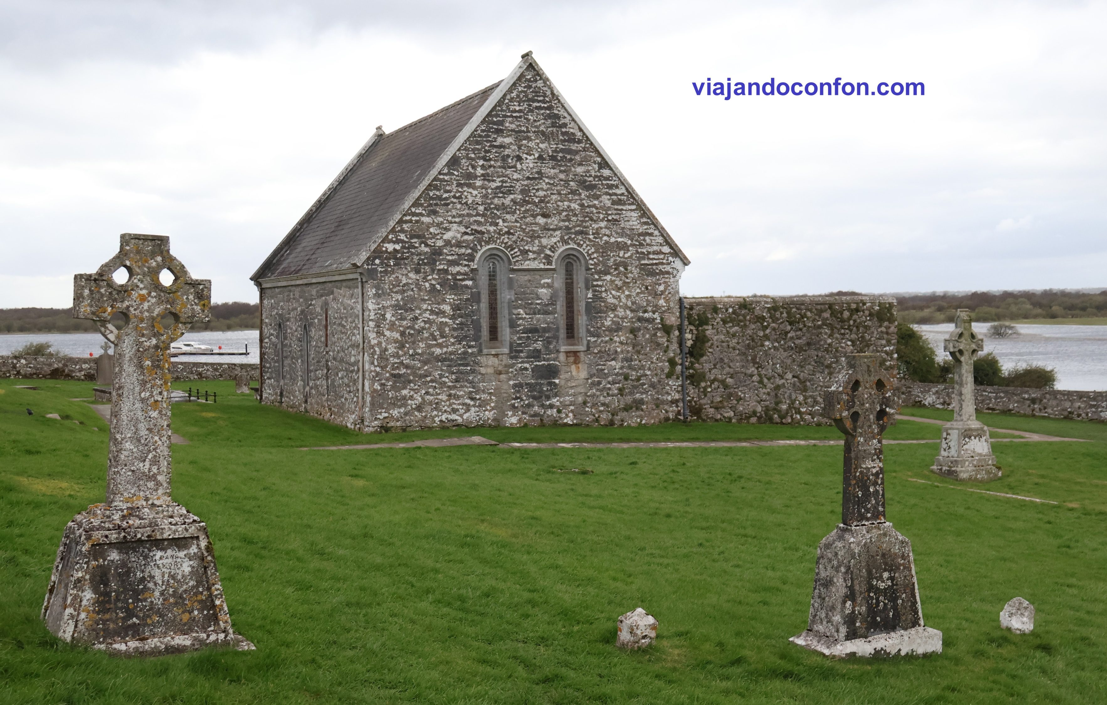
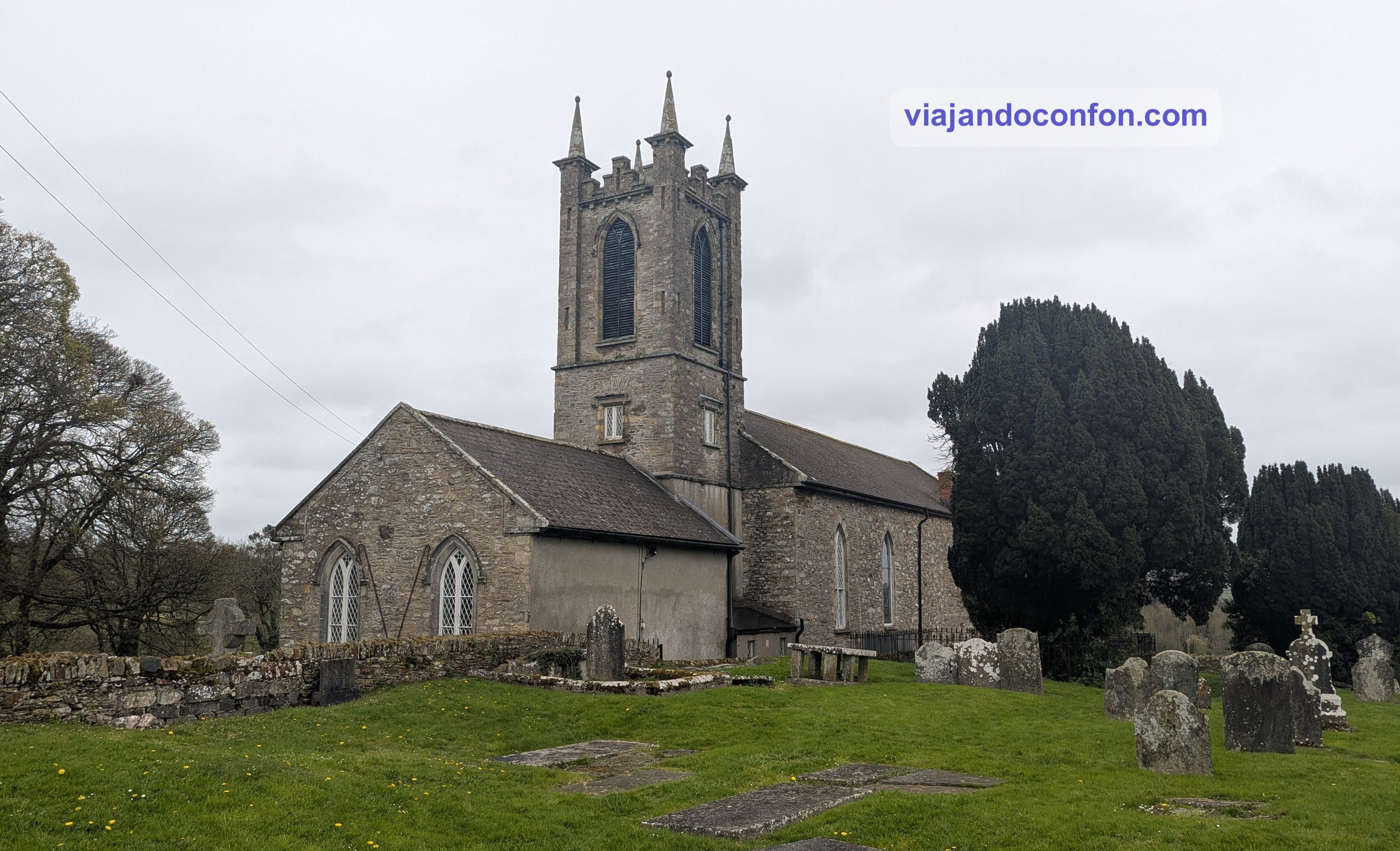
Temple Connor: Templo utilizado por la Iglesia de Irlanda desde el siglo XVIII. Fue objeto de importantes obras de restauración en la segunda década del siglo XX, cuando se elevó la pendiente del tejado y se remodeló el espacio interior.
La iglesia se mantiene bajo los auspicios de la Unión de Parroquias de Athlone, y cada domingo durante el verano se celebra un servicio a las cuatro de la tarde.
Temple Ciarán: Es la iglesia más pequeña de Clonmacnoise. Construida en 909, gran parte de sus muros son originales y se considera la iglesia de piedra datada más antigua que se conserva en Irlanda. Tradicionalmente presentada como la tumba de San Ciarán, las excavaciones de la iglesia desenterraron el báculo de Clonmacnoise, pero no se encontraron restos del santo.
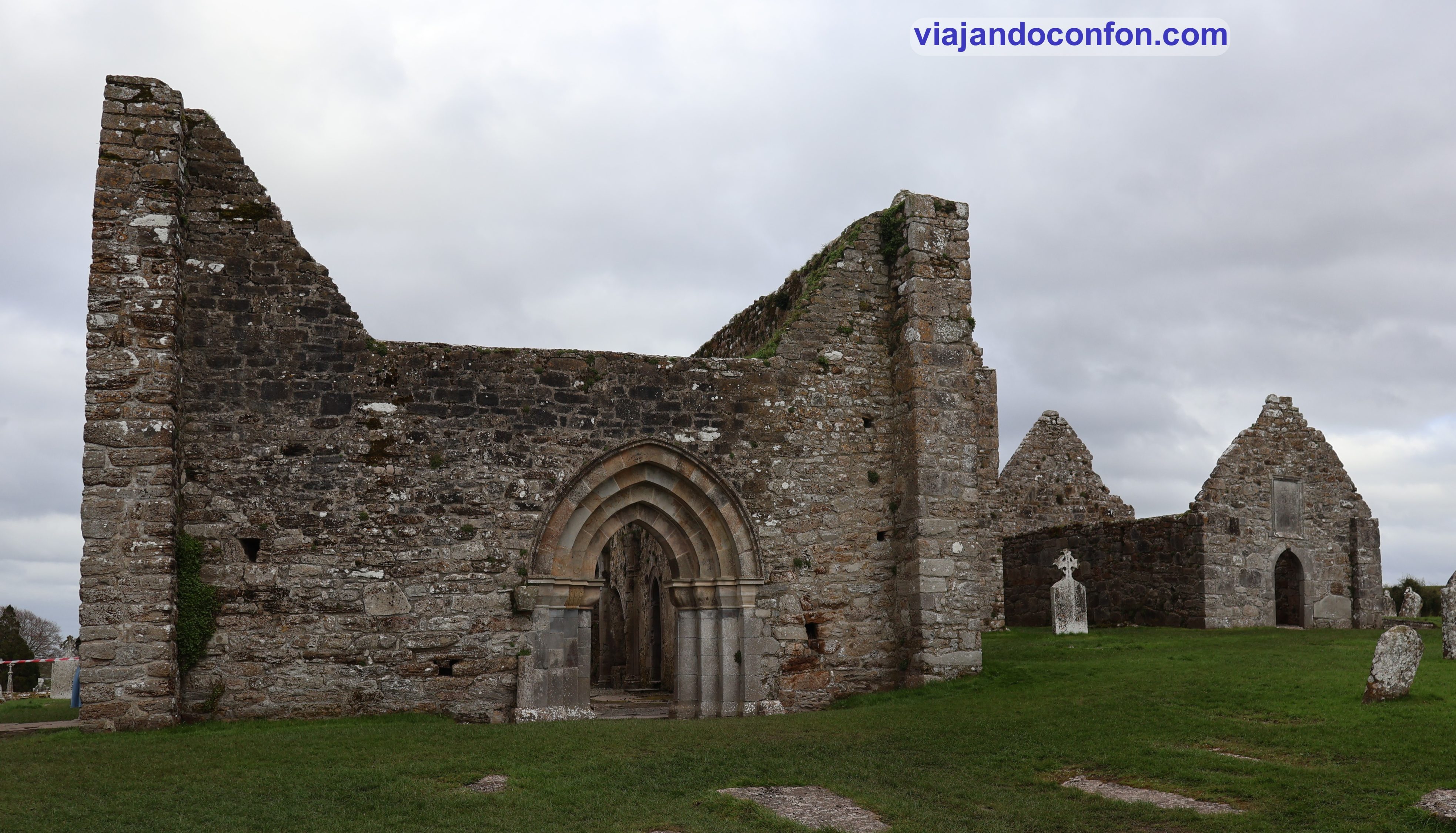
Catedral (Temple McDermot): La construcción comenzó alrededor del año 909 por el rey Flann Sinna y el abad Colmán mac Ailella. La catedral es la más grande de las iglesias de Clonmacnoise.
Rory O’Connor, el último Gran Rey de Irlanda, fue enterrado cerca del altar en 1198, junto a su padre Turlough. La mayoría de las tumbas que se ven actualmente en la iglesia pertenecen a la familia Coghlan, cuyo patriarca reconstruyó gran parte de la catedral a mediados del siglo XVII.
Catedral y, al fondo, Temple Ciarán
Temple Melaghlin: Construida en el siglo XIII, es también llamada la Iglesia del Rey. Es debido a que se dice que al menos siete generaciones de reyes Melaghlin están enterradas bajo la estructura. También se cree que la iglesia albergaba el scriptorium, la sala donde se diseñaban y decoraban los manuscritos.
Temple Dowling: Construida originalmente en el siglo X, esta pequeña iglesia lleva el nombre de Edmund Dowling, quien la renovó en 1689, colocando una talla de piedra con el escudo de su familia sobre la puerta.
Temple Hurpan: Construido en el siglo XVII en el extremo este de Temple Dowling, este anexo no tenía ninguna función religiosa más allá de servir como cementerio para algunos feligreses locales. A veces se le conoce como la iglesia de MacClaffey.
North Cross: La más antigua de las tres cruces que se conservan. Fue creada alrededor del año 800. Solo sobreviven el fuste de piedra caliza y la base de arenisca (una antigua piedra de molino). Una figura con las piernas cruzadas ha sido interpretada como el dios celta Cernunnos o una deidad similar, mientras que otros la han interpretado como el Diablo.
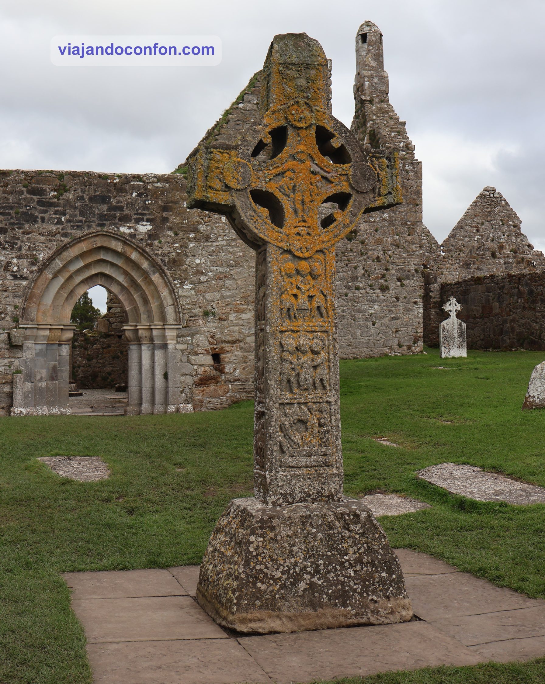
Cross of the Scriptures: Una cruz de arenisca de 4 metros de altura es una de las cruces altas irlandesas mejor ejecutadas que se conservan, de particular interés por su inscripción que pide una oración por Flann Sinna, rey de Irlanda, y el abad Colmán, quien encargó la cruz. Ambos hombres también fueron responsables de la construcción de la catedral.
La cruz fue tallada en arenisca de Clare alrededor del año 900. La superficie de la cruz está dividida en paneles que muestran escenas como la Crucifixión, el Juicio Final y Cristo en el Sepulcro. El original fue trasladado al centro de visitantes en 1991 para protegerlo de la intemperie; una réplica se encuentra en el sitio original.
South Cross: Una pieza del siglo IX, presenta una escena cristiana en su cara oeste: una tosca talla de la Crucifixión de Cristo. Muchos creen que esta cruz pudo haber servido de inspiración para la posterior Cruz de las Escrituras.
La pieza original se encuentra en el centro de interpretación, mientras que una réplica ocupa su emplazamiento original.
Enfrente del recinto monástico se encuentran las ruinas del castillo de Clonmacnoise. Entre los años 1170 y 1220, los anglonormandos iniciaron la colonización de Irlanda. Construyeron castillos de mota y patio por todo el país.
El castillo de madera que se alzaba sobre la mota de Clonmacnoise fue destruido por un incendio. Posteriormente, en 1214, el Justiciar de Irlanda, Enrique de Londres, construyó un castillo de piedra sobre la misma mota.
Tenía como objetivo controlar la región central del país y proteger el puente sobre el río Shannon. Este fue un periodo muy significativo en la historia, ya que marca el declive de Clonmacnoise como ciudad monástica. Los normandos estaban más familiarizados con la iglesia parroquial y apoyaban la iglesia diocesana.
El castillo fue destruido durante el resurgimiento gaélico a finales del siglo XIII y principios del XIV.
Nos entretuvimos tanto disfrutando de Clonmacnoise que llegó la hora del cierre. Así que nos ponemos en camino a Dublín. Ya muy cerca de la ciudad repostamos y nos fuimos a devolver el coche al aeropuerto.
Teníamos de nuevo el hotel que piilamos para las dos primeras noches, Beckett Locke, North Docks. En recepción nos dieron una alegría. Seguian con los problemas con el agua caliente y la iban a cortar a partir de las 8 de la mañana, sin hora de vuelta.
Encuentra tu hotel ideal al mejor precio en Irlanda con Agoda:
*Nos ayuda a mantener el blog
Era tal el cabreo, después de los problemas de la primera noche, que como compensación nos regalaron el desayuno por la mañana.
Como ya era bastante tarde y teníamos que madrugar, cenamos algo en la hamburguesería de la primera noche, y a dormir.
Me levanto tempranito y me encuentro un mensaje del hotel en el móvil. Resulta que iba a haber una protesta desde por la mañana de los agricultores por el precio del combusible e iban a paralizar la ciudad. Iba a afectar a todos los transportes que pasaran por el centro de la ciudad, incluyendo las líneas al aeropuerto.
Con el miedo en el cuerpo, decidimos cancelar nuestros planes e ir directamente al aeropuerto después de desayunar. Después de 6 horas de espera, alas 16.10 salía puntual nuestro vuelo a Málaga.
Aquí dejamos un mapa con todos los lugares visitados:
Descubre las mejores actividades y tours en Irlanda con Civitatis:
Continuamos nuestro recorrido por Irlanda. Seguimos viendo curiosas ruinas y paisajes espectaculares.
Como siempre, recomendamos viajar con un buen seguro de viajes. IATI es especialista en seguros de viaje y, por ser nuestro lector, tienes un 5% de descuento.
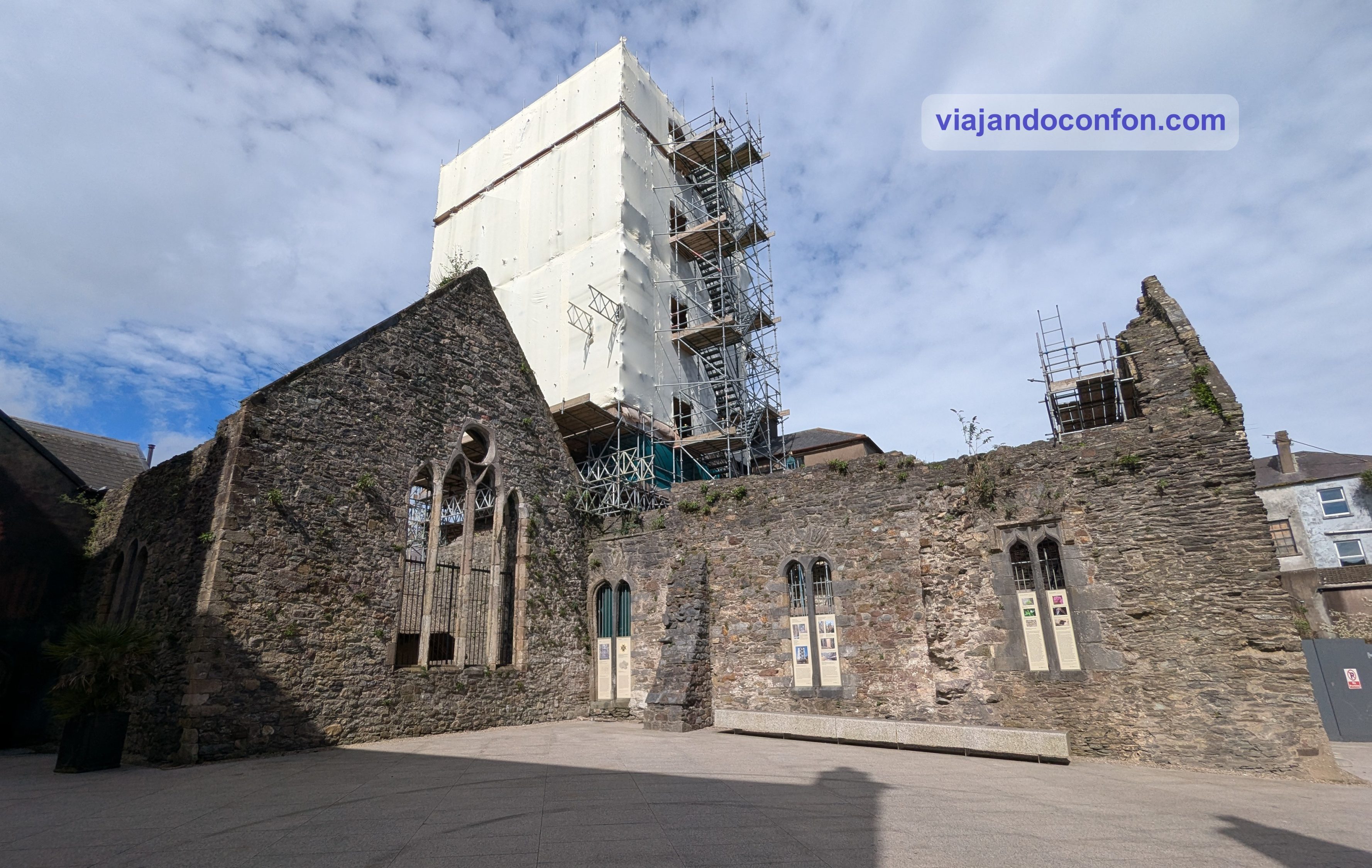
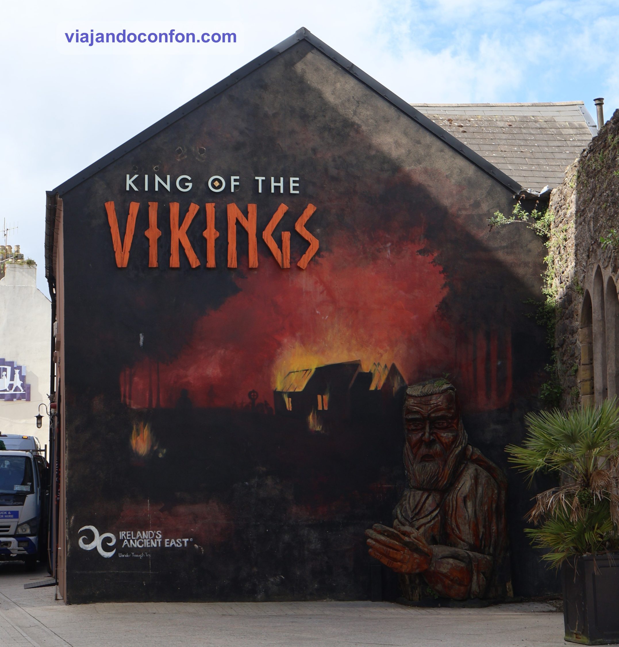
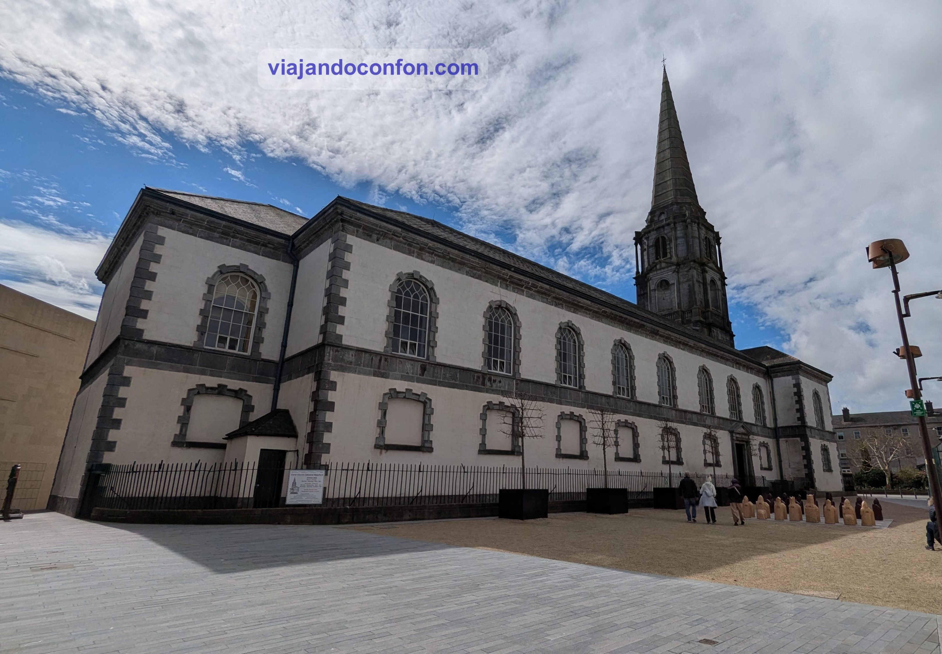
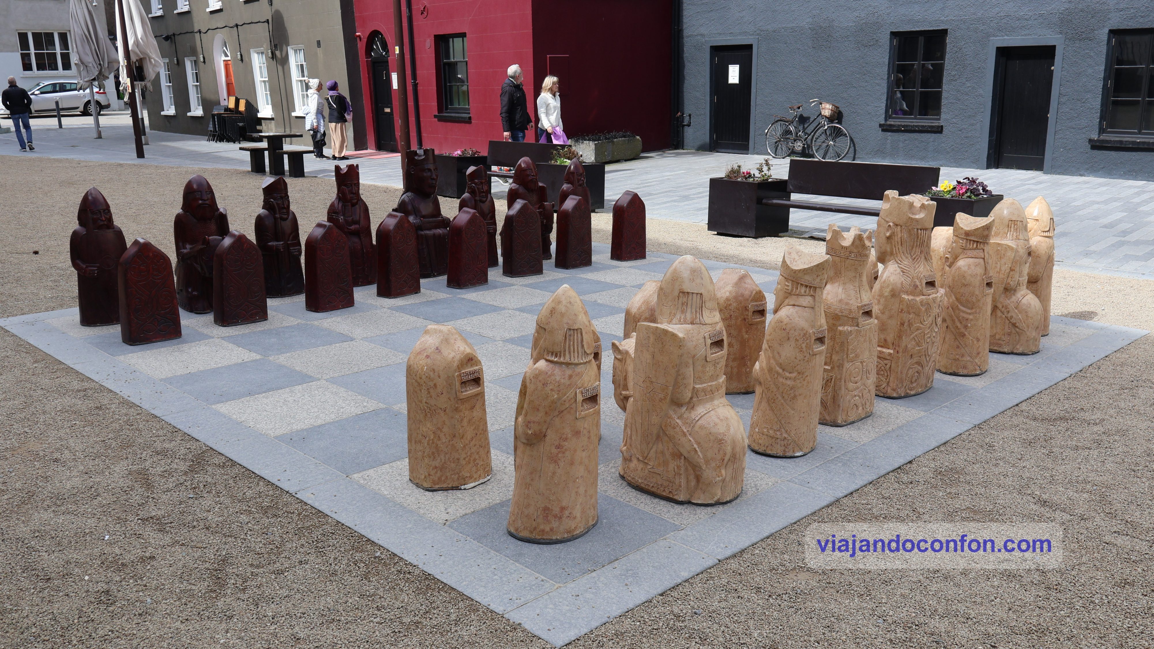
Dejamos atrás la ciudad de Waterford y su Triángulo Vikingo. Nos vamos camino de Rock of Cashel, que se encuentra en la ciudad de Cashel, a unos 72 km.
Aparcamos y vamos a pagar. Esta vez hemos tenido suerte. Es día festivo y hoy no se paga. Como se nos iba a hacer tarde para comer, en el mismo coche nos hicimos unos sandwiches de salami y al lío.
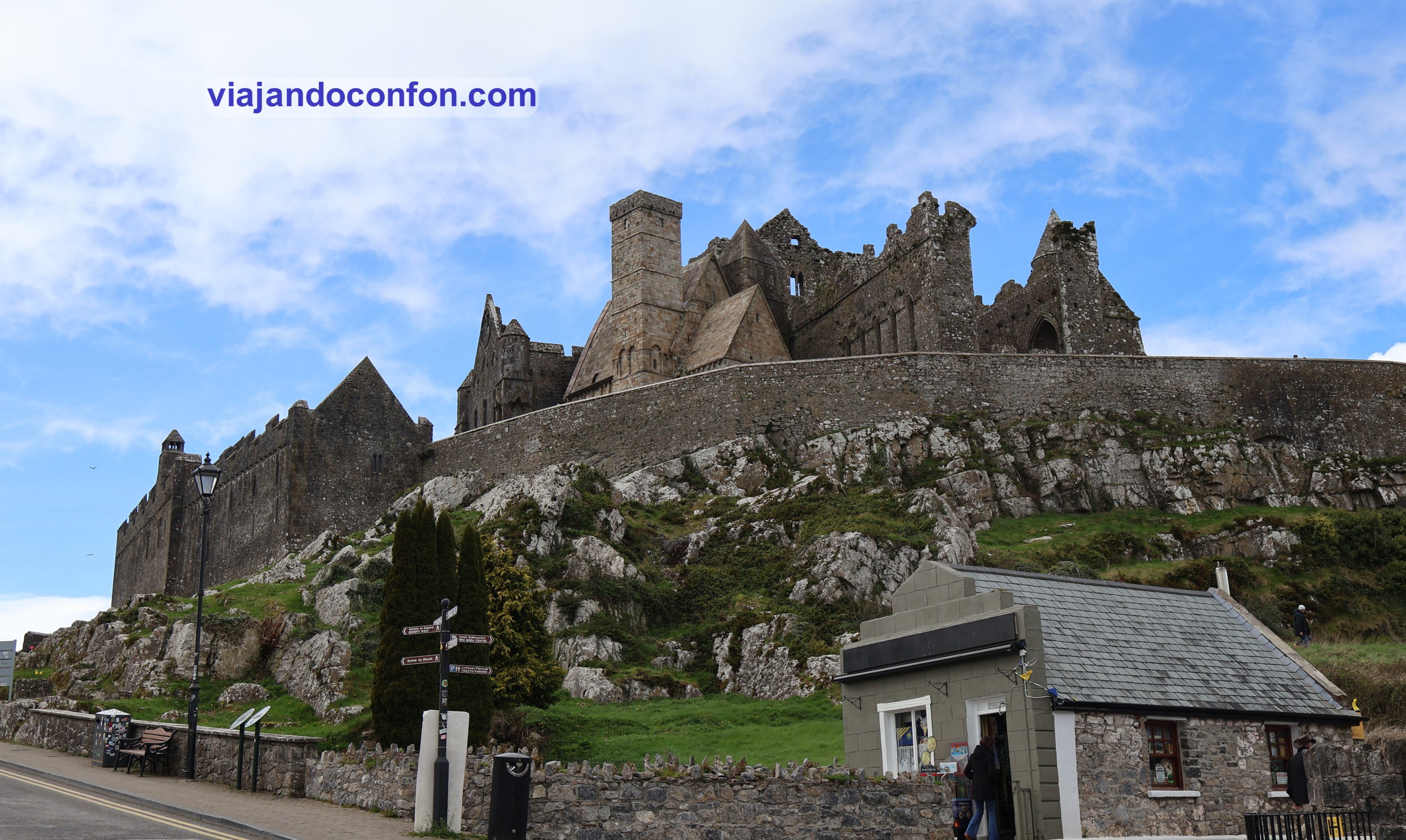
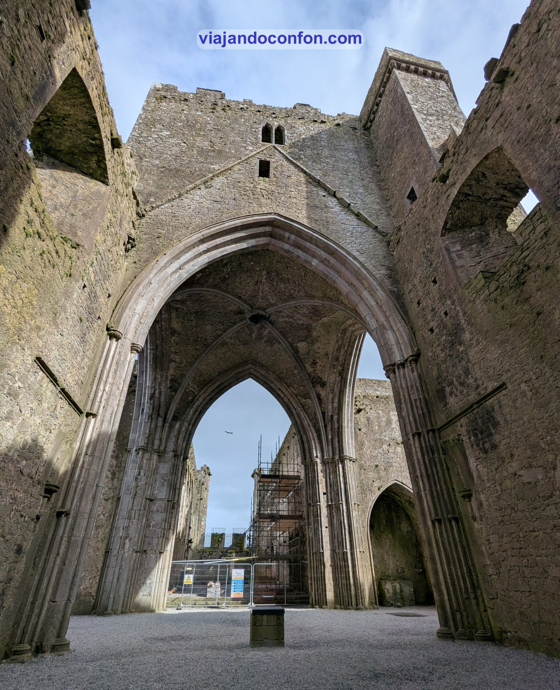
The Rock of Cashel (Carraig Phádraig), también conocida como Cashel of the Kings o Roca de San Patricio, es un sitio histórico situado de forma espectacular sobre una colina en Cashel, condado de Tipperary.
Según cuenta la leyenda, Rock of Cashel se originó en Devil’s Bit, una montaña a 30 km al norte de la ciudad. Fue cuando San Patricio desterró a Satanás de una cueva, lo que provocó que la Roca aterrizara en Cashel. Según la Vida Tripartita de San Patricio, se dice que Cashel es el lugar de la conversión del Rey de Munster por San Patricio en el siglo V.
Esta fue la sede de los reyes de Munster ya en el siglo IV y antes de la invasión normanda. Durante el siglo V, el clan Eóganachta construyó una fortaleza, manteniendo la supremacía allí durante siglos. En 1101, el rey de Munster, Muirchertach Ua Briain, donó su fortaleza a la Iglesia.
Actualmente sobreviven pocos restos de las estructuras antiguas. La mayoría de los edificios en el sitio actual datan de los siglos XII y XIII.
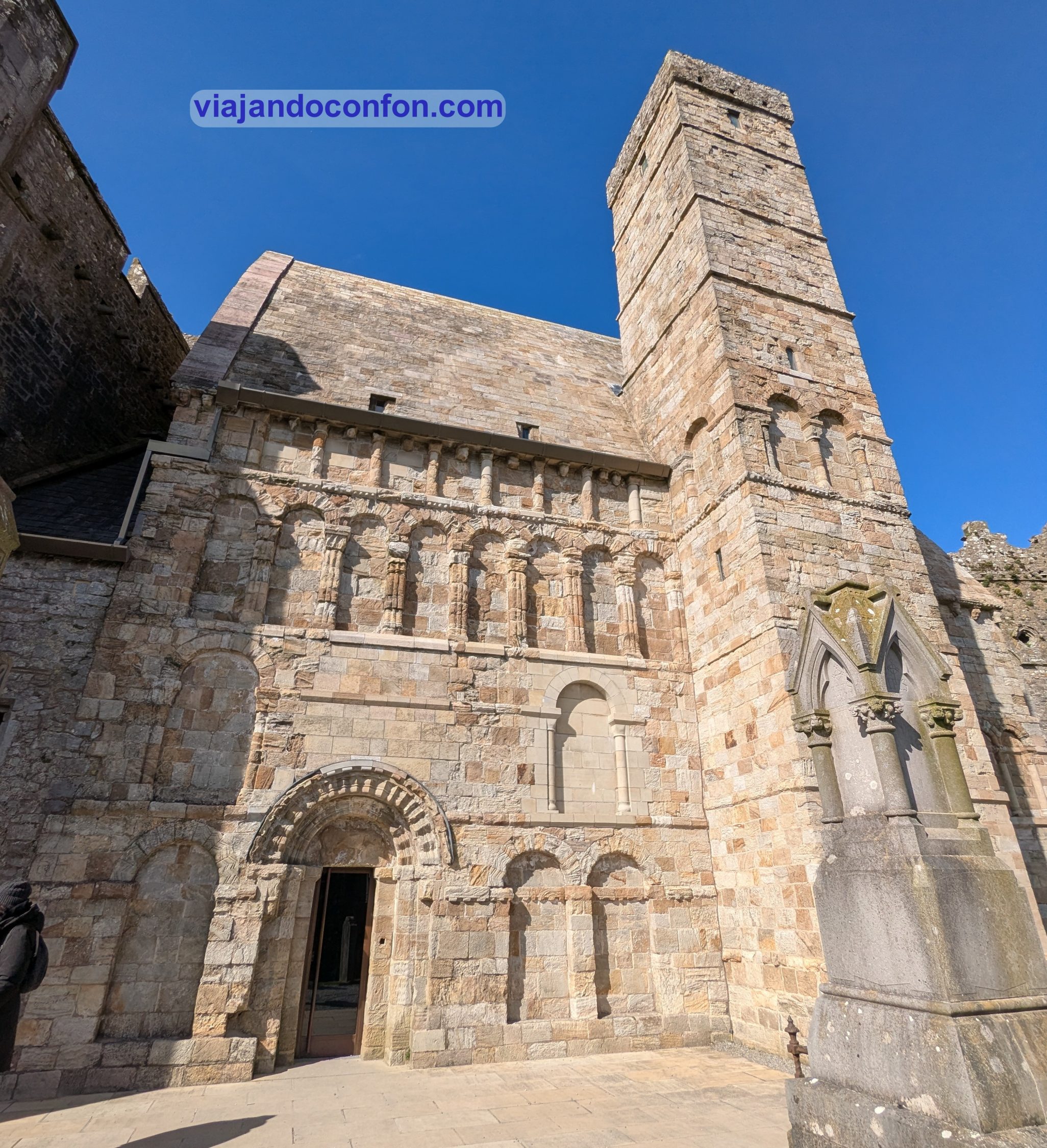
El recinto cuenta con varios edificios, como Cormac’s Chapel. La capilla del rey Cormac Mac Carthaigh, se comenzó a construir en 1127 y se consagró en 1134.
Su interior estaba cerrado al público durante nuestra visita.
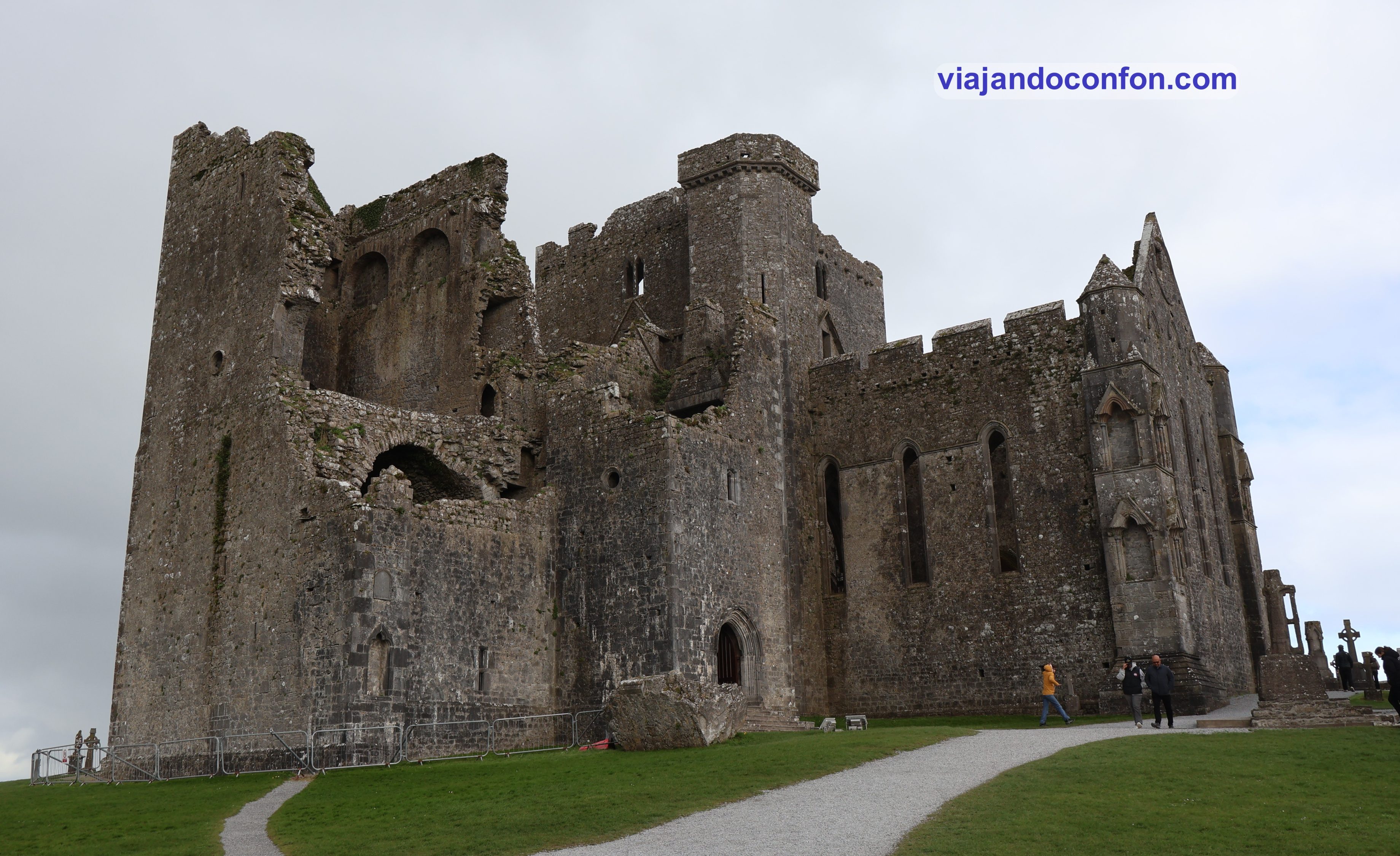
El edificio más grande es La Catedral, construida entre 1235 y 1270. Es un edificio sin naves laterales de planta cruciforme, con una torre central y que termina hacia el oeste en un enorme castillo residencial.
La torre central se añadió en el siglo XIV y se construyó un sólido castillo en el extremo occidental a principios del siglo XV.
El Salón de los Vicarios Corales fue construido en el siglo XV y alberga la Cruz de San Patricio, de más de 2 metros de altura.
En la catedral se conservan varias tumbas talladas del siglo XVI y el presbiterio alberga la efigie del pluralista Miler McGrath, arzobispo desde 1571 hasta 1621.
La verdad es que en su momento de mayor esplendor tuvo que ser un templo realmente impresionante.
Otro de los edificios reseñables es la Round Tower, que con sus 28 metros data del año 1100. Su entrada se encuentra a 3,7 metros del suelo), típica de las torres redondas.
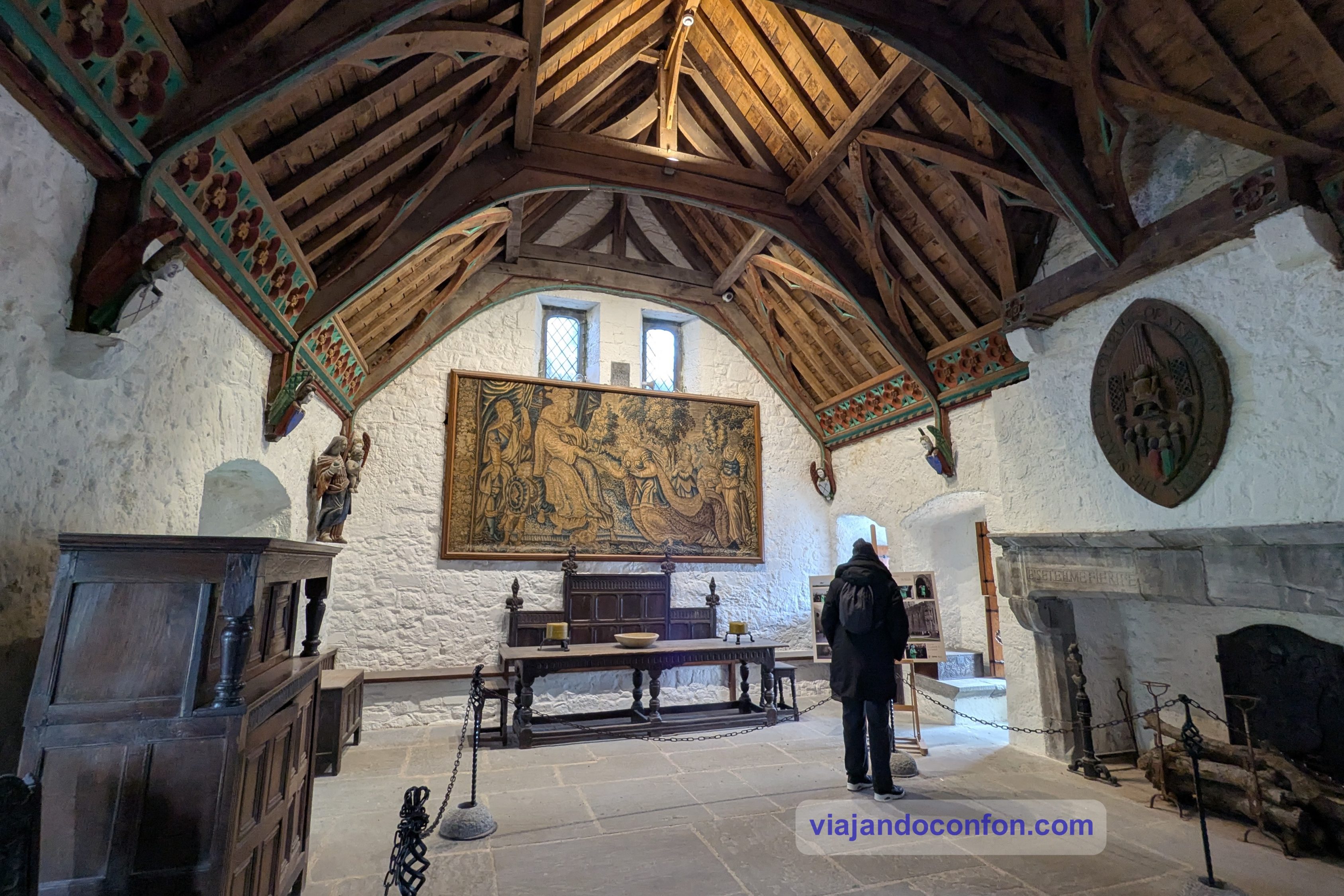
En el extremo sur del recinto se ubica The Hall of the Vicar’s Choral, el Salón del Coro del Vicario. Se construyó a principios del siglo XV por orden del arzobispo Richard O’Hedian.
Originalmente era la residencia para los ocho miembros del Coro del Vicario que cantaban la misa en la Catedral de San Patricio.
El nivel superior se utiliza ahora como teatro audiovisual. En ella se emite un pequeño documental sobre la historia de la Roca. Si lo solicitas con tiempo, lo pasan en el idioma que pidas.
Y ahí viene el problema. Tras esperar unos 15 minutos a que empezara, resulta que lo ponen en francés. Me parace muy bien pero ni tan siquiera estaba subtitulado en inglés. Me parece terrible después de esperar tanto rato, más otra media hora que debíamos de esperar al siguiente pase. Desde luego está muy mal organizado.
Ni que decir tiene que nos levantamos y nos fuimos, junto con casi toda la sala, excepto un muy pequeño grupo de viejos franceses.
La visita nos llevó alrededor de una hora, tiempo de sobra para contemplar con tranquilidad cada detalle del lugar.
Si tienes tiempo y quiers enterarte de todo, puedes hacer esta VISITA GUIADA con Get Your Guide
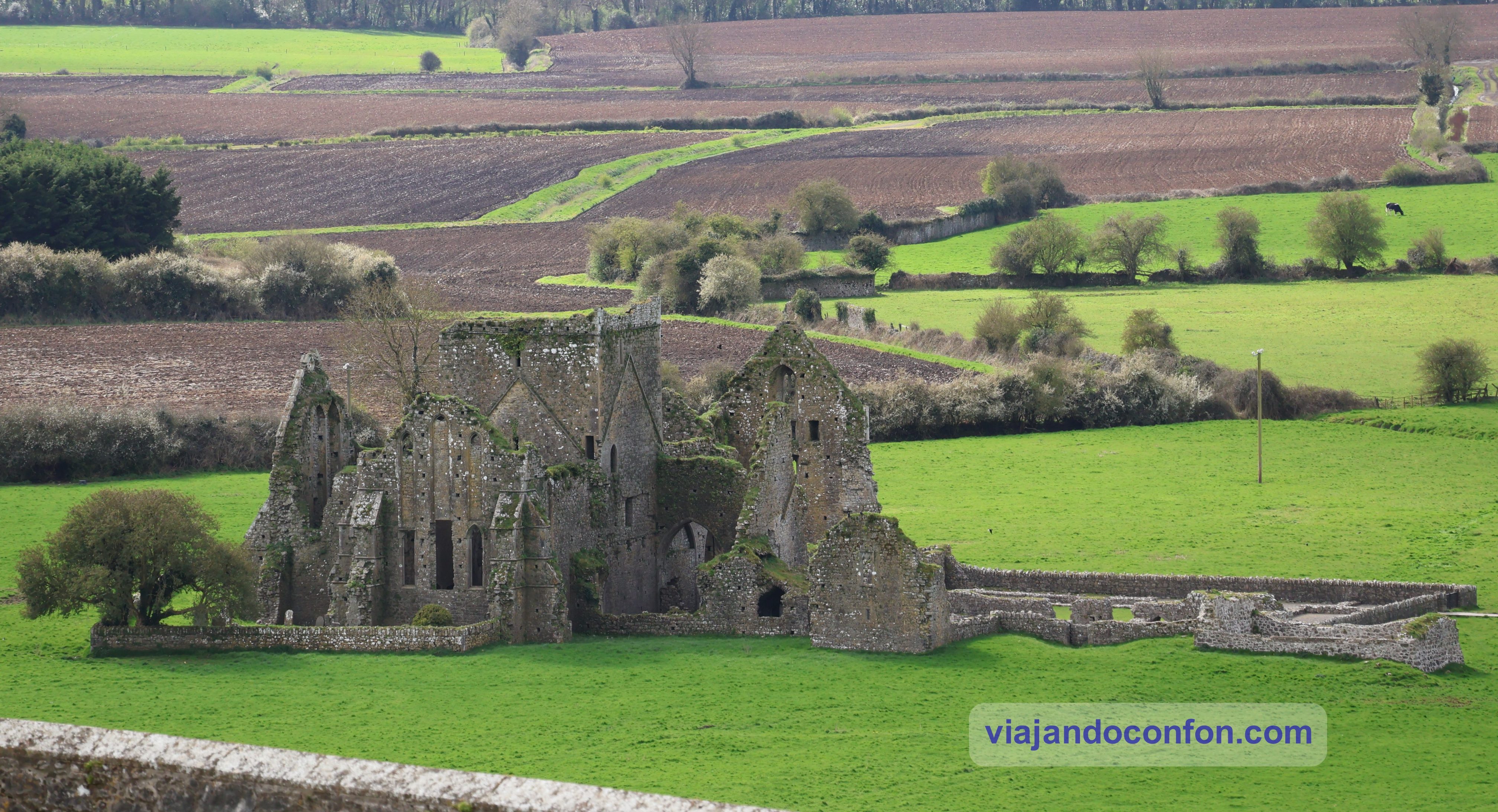
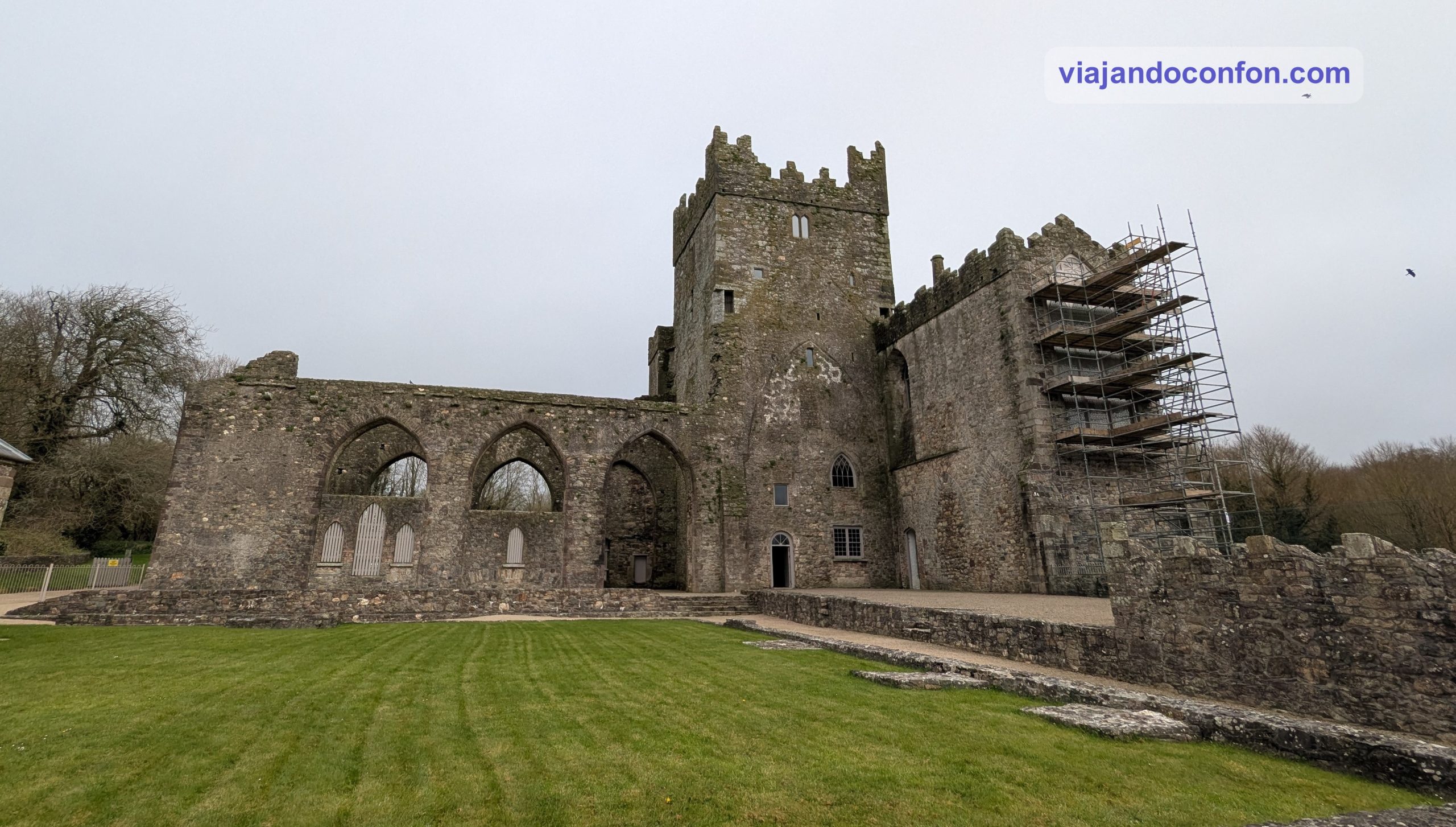
Muy cerquita se encuentran las ruinas de la Abadía Cistercense de Hore. Antes de ser una abadía cisterciense, fue un monasterio benedictino.
Este monasterio fue entregado a los cistercienses por el arzobispo David Mac Cerbaill en 1270. Quien posteriormente ingresó en el monasterio y fue enterrado allí en 1289. Mac Cerball Dotó generosamente a la abadía con tierras, molinos y otros beneficios eclesiásticos que antes pertenecían a la ciudad.
Esta abadía fue la última fundación irlandesa de esta orden antes de la Reforma de Enrique VIII. En 1540 la propiedad fue transferida a James Butler, noveno conde de Ormond. Los monjes continuaron sirviendo a la parroquia local. Posteriormente, se utilizaron como viviendas privadas.
En 1561 la reina Isabel I se lo concedió al cuarto conde de Sussex, Sir Henry Radcliffe. Este fue despojado de sus posesiones irlandesas al ser acusado de corrupción. Fue encarcelado en 1565 y abandonó Irlanda definitivamente para establecerse en Inglaterra.
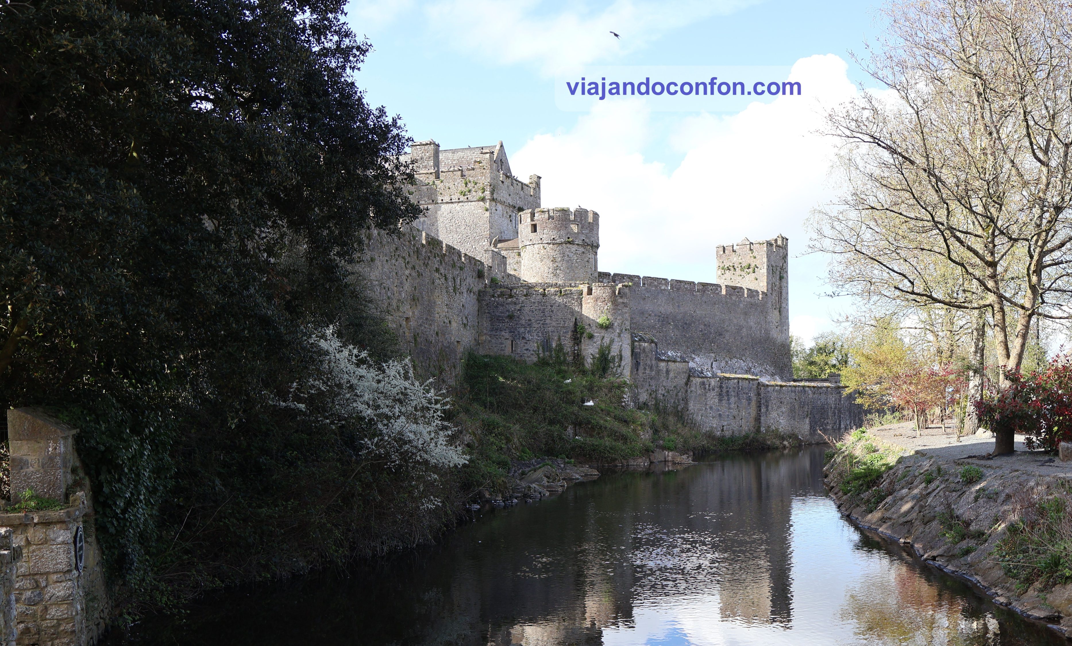
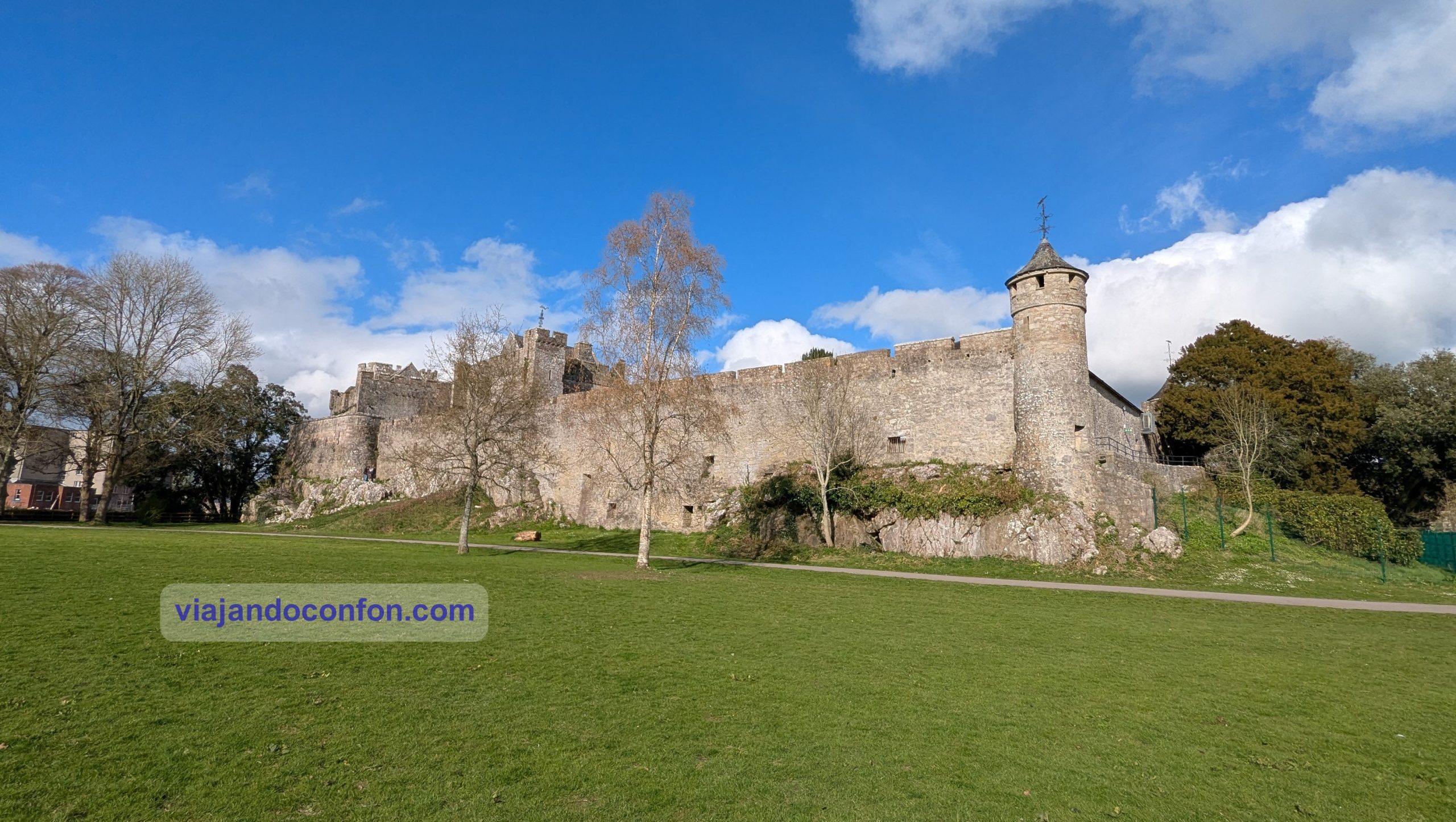
Nos ponemos en camino a nuestro siguiente destino, que era la ciudad de Cahir (Chathair), en el condado de Tipperary, a ver su castillo. El nombre Cathair o an Chathair se traduce como «fortaleza circular de piedra».
Durante gran parte de su historia, la ciudad ha estado influenciada por la familia Butler. De esta familia surgieron los primeros barones de Cahir.
Aparcamos junto al castillo en un aparcamiento de pago, por supuesto.
El castillo de Cahir es uno de los castillos más grandes de Irlanda y se alza sobre una isla en el río Suir. Fue construido a partir de 1142 por Conchobar Ua Briain, rey de Thomond.
Otorgado a la poderosa familia Butler a finales del siglo XIV, el castillo fue ampliado y remodelado entre los siglos XV y XVII. Cayó en ruinas a finales del siglo XVIII y fue restaurado parcialmente en la década de 1840.
En 1961, falleció el último Lord Cahir y el castillo pasó a ser propiedad del estado irlandés.
Descubre en profundidad los tres importantes castillos, Blarney, Rock of Cashel y Cahir con una magnífica VISITA GUIADA con Get Your Guide
Como la comida no había sido muy bollante y faltaba rato para ser la hora de cenar, nos fuimos a un supermercado cercano. Compramos unas porquerías y allí mismo nos las comimos al sol.
Después de la merienda nos pusimos camino de Cork, de la que nos separaban unos 80 km.
Cork, en gaélico Corcaigh, (de corcach que significa pantano), es la segunda ciudad más grande de la República de Irlanda. Con casi 300.000 habitantes es la capital del condado de Cork y la ciudad más grande de la provincia de Munster.
Cork fue fundada en el siglo VI como un asentamiento monástico y fue expandida por los invasores vikingos alrededor del año 915. Su carta fundacional fue otorgada por el príncipe Juan en 1185.
El sobrenombre de la ciudad, “la ciudad rebelde”, tiene su origen en su apoyo a la causa yorkista durante las Guerras de las Rosas (1455-1487).
Los habitantes de Cork a veces se refieren a la ciudad como “la verdadera capital”, en referencia a su oposición al Tratado Anglo-Irlandés durante la Guerra Civil Irlandesa.
Aparcamos en una zona algo alejada del centro. Un zona residencial en la que es gratis aparcar a partir de las 6 de la tarde. En unos 20 minutos llegamos al centro de la ciudad, que es una isla entre dos canales del río Lee.
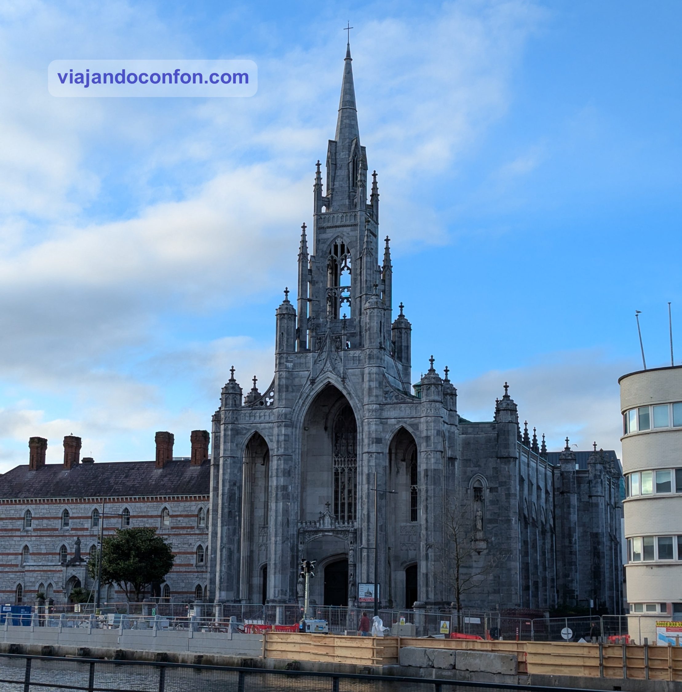
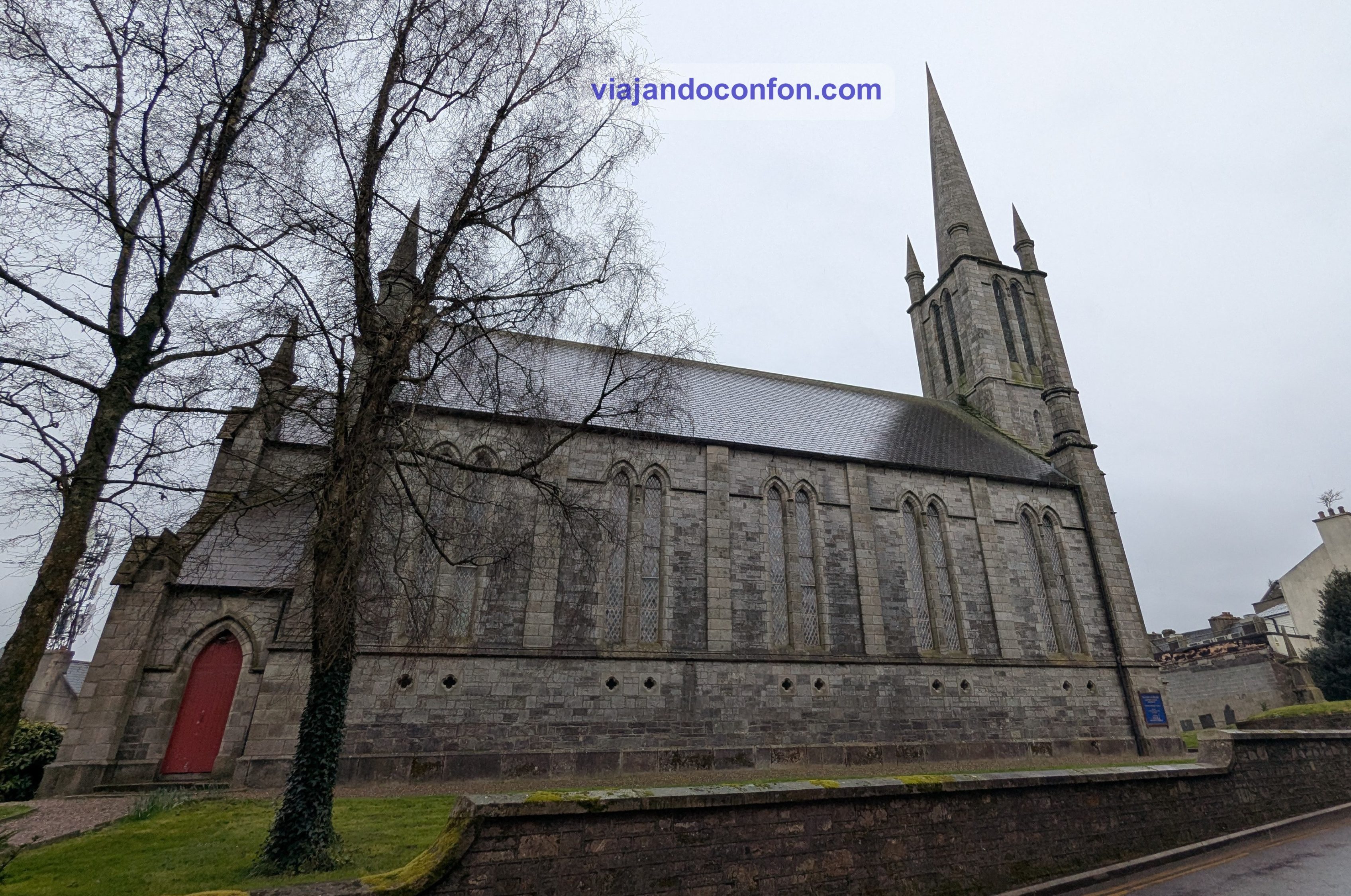
Lo primero que nos encontramos es la Holy Trinity Roman Catholic Church, la Iglesia Católica Romana de la Santísima Trinidad. También conocida como la Iglesia Memorial del Padre Mathew, es una iglesia y convento católico de estilo neogótico situado en el muelle del Padre Mathew.
Pertenece a la Orden de los Frailes Menores Capuchinos y es la única iglesia dedicada al Padre Theobald Mathew.
La construcción de la iglesia comenzó a principios de la década de 1830, pero se detuvo poco antes de la Gran Hambruna. No se completaría hasta 1890, a tiempo para el centenario del nacimiento del padre Mathew.
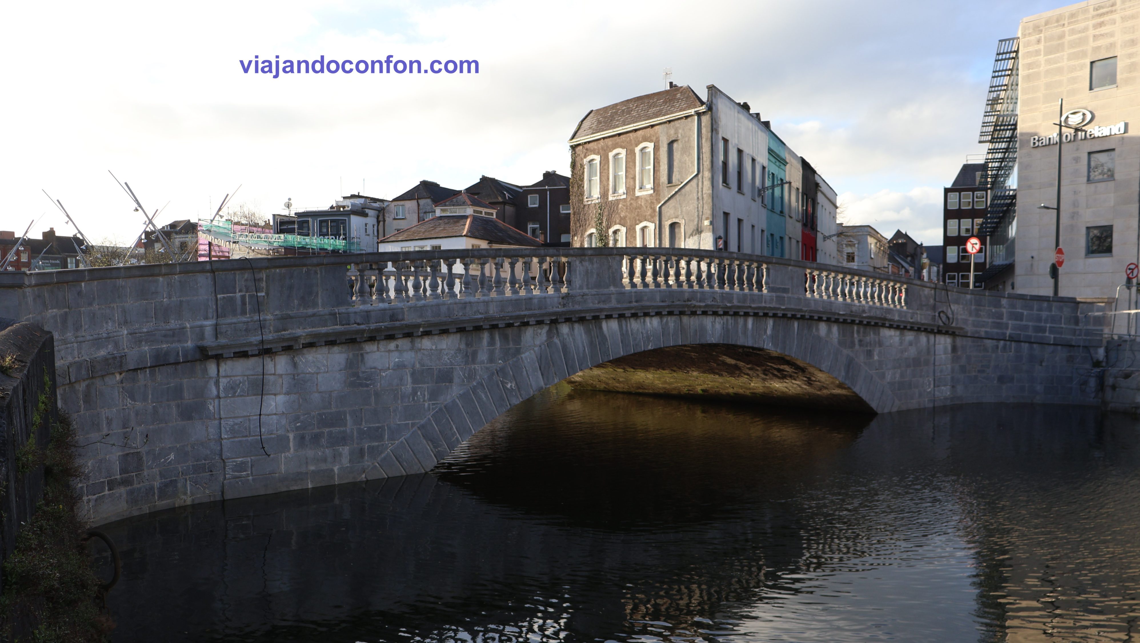
Cruzamos el río Lee por el Parliament Bridge, el Puente del Parlamento. Se construyó en 1807 para sustituir el anitguo puente de madera de mediados del siglo XVIII.
Vamos paseando por el animado centro de la ciudad hasta St. Patrick’s Street (Sráid Naomh Pádraig). Es la principal calle comercial de la ciudad. Data de finales del siglo XVIII, cuando la ciudad se expandió más allá de las murallas de la antigua ciudad.
Durante la década de 1780, muchas de las calles que hoy conforman el centro de Cork se formaron al salvar los cauces del río Lee, entre islas pantanosas.
Partes de Patrick Street sufrieron graves daños durante la Guerra de Independencia irlandesa. Fue en un suceso conocido como el “Incendio de Cork” en 1920. Esto incluyó el centro comercial Munster Arcade y los grandes almacenes Grant’s.
Descubre Cork con esta fabulosa VISITA GUIADA de Get Your Guide
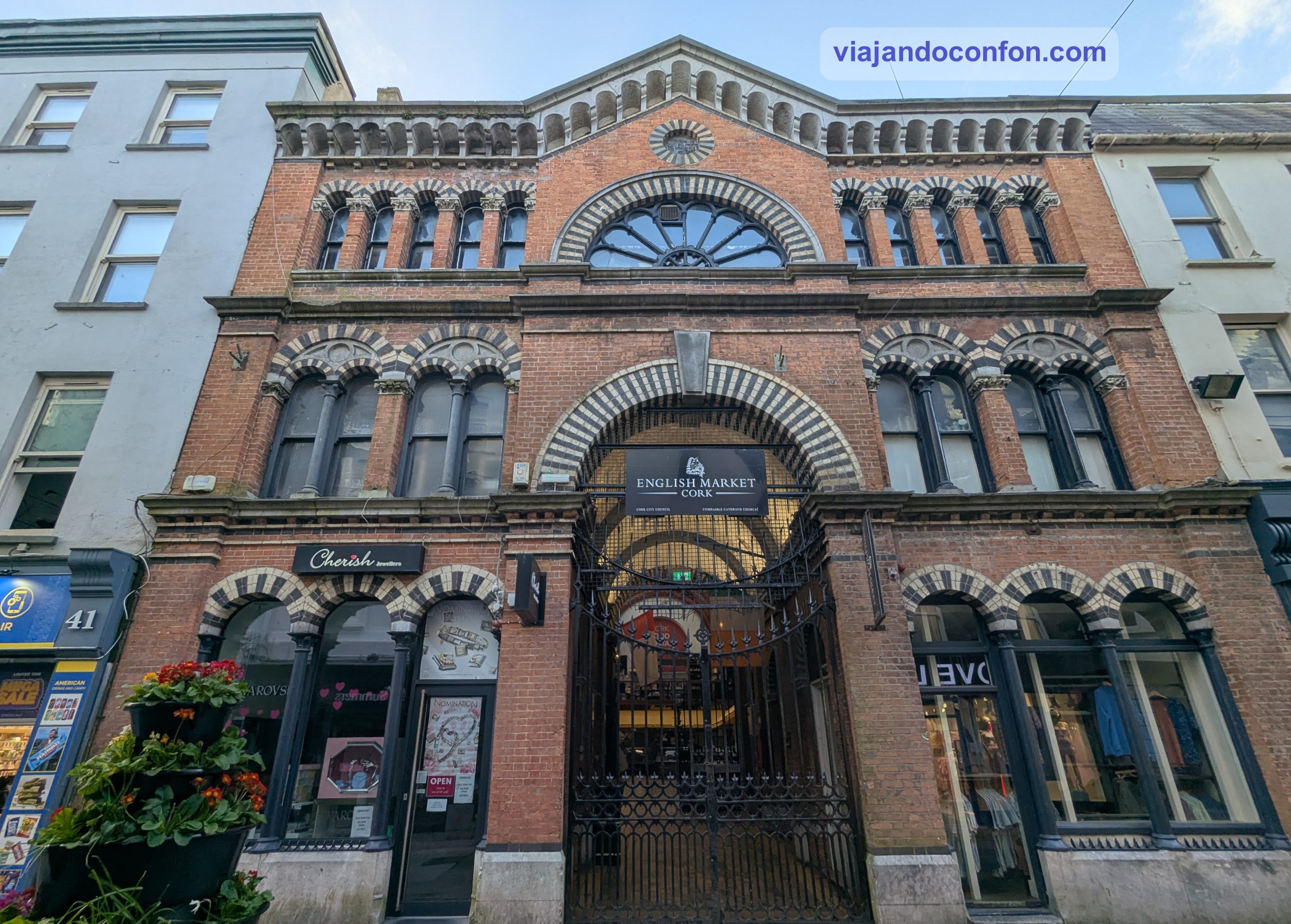
Desde aquí nos acercamos hasta English Market (An Margadh Sasanach). Es un mercado municipal de alimentos ubicado en el centro de la ciudad. El mercado es reconocido tanto por su arquitectura de mediados del siglo XIX como por sus productos artesanales locales.
El mercado se ha convertido en una atracción turística. El chef Rick Stein lo ha descrito como el “mejor mercado cubierto del Reino Unido e Irlanda”.
De vuelta a St. Patrick Street nos topamos con St Peter and St Paul’s Roman Catholic Church. La iglesia de San Pedro y San Pablo se construyó para reemplazar la capilla de Carey’s Lane, una estructura mucho más pequeña construida en 1786.
Bajo la dirección del archidiácono John Murphy, en la década de 1850 se convocó un concurso de diseño que ganó E. W. Pugin. Se empezó a construir en 1859 y se prolongó hasta 1864.
Su consagración tuvo que aplazarse hasta 1866 debido a que las deudas asociadas a su construcción aún no se habían saldado.
Tras una breve parada en el baño de un cercano centro comercial, nos ponemos en camino de la catedral. Aunque iríamos pasando por algunos lugares reseñables. Como uno que llamó nuestra atención, Triskel Arts Centre.
Este antiguo edificio fue la iglesia principal de Cork en el siglo XVII y se encuentra en el emplazamiento de edificios religiosos que datan de al menos 1050. Fue desacralizada en 1979 y posteriormente adquirida por el Ayuntamiento de Cork. El edificio albergó el Archivo Municipal y del Condado de Cork hasta 2005.
El Ayuntamiento de Cork y el Centro de Arte Triskel desarrollaron Christchurch como un espacio cultural en el centro de la ciudad, inaugurado en 2011. La antigua iglesia ahora está integrada en este centro de arte
Un poco más al sur nos topamos con The Counting House. Es un edificio de estilo Tudor neoclásico construido en 1919 en el solar de la antigua cervecería Beamish and Crawford.
Me pareció un edificio muy curioso.
Justo antes de cruzar el río ya podemos contemplar los muros del Elizabeth Fort, un fuerte estrellado del siglo XVII.
Originalmente se construyó como fortificación defensiva en terreno elevado fuera de las murallas de la ciudad. Esta creció alrededor del fuerte, que asumió diversas funciones, entre ellas, el uso como cuartel militar, prisión y comisaría de policía.
Pero en esta ocasión no nos iba a dar tiempo de visitarlo. Por desgracia.
Desde aquí también divisamos una bonita panorámica de la catedral, a la que nos estábamos acercando.
Catedral. A la izquierda, con forma redondeada, Elizabeth Fort
Por fin llegamos a Saint Fin Barre’s Cathedral, una catedral neogótica de tres torres dedicada a Finbarr de Cork, santo patrón de la ciudad.
El uso cristiano de este lugar se remonta al siglo VII d. C., cuando, según la tradición local, Finbarr de Cork fundó un monasterio. El edificio original sobrevivió hasta el siglo XII, cuando cayó en desuso o fue destruido durante la invasión normanda de Irlanda.
Alrededor de 1536, durante la Reforma Protestante, la catedral pasó a formar parte de la iglesia establecida, posteriormente conocida como la Iglesia de Irlanda. En 1730 se construyó otro templo, pero era considerado por muchos como simple y sin rasgos distintivos.
La actual se construyó en 1863 según diseño del arquitecto victoriano William Burges. Este diseñó la mayor parte de la arquitectura, la escultura, las vidrieras, los mosaicos y el mobiliario interior de la catedral.
La catedral fue consagrada en 1870 y las agujas de piedra caliza se terminaron en octubre de 1879. Muchas de las esculturas exteriores, incluidas las gárgolas, fueron modeladas por Thomas Nicholls. Las entradas contienen figuras de más de una docena de personajes bíblicos, coronadas por un tímpano que muestra una escena de la Resurrección.
Una vez terminada la visita a la catedral, tocaba buscar algo para cenar. Después de mucho mirar acabamos cenando en un restaurante de comida palestina llamado Izz Cafe. Fue todo un acierto. La comida espectacular y el servicio también. Una de las camareras era valenciana y era muy simpática.
Encuentra las mejores actividades y tours en Cork e Irlanda con Civitatis:
*Nos ayuda a mantener el blog
Tras la cena volvimos al coche y nos fuimos al hotel. La verdad es que la búsqueda de alojamiento en Cork fue una odisea. Todo extremadamente caro. De lo más barato y decente que encontramos fue el CorkInternational Hotel, que estaba en el aeropuerto. 169€ nos costó la noche.
La habitación estaba muy bien. Muy amplia y más moderna que el hall, que parecía sacado de una peli de los 80. Pero el baño… eso era otra cosa. La bañera, en vez de mampara tenía una poco higiénica cortina. Para no resbalar, la aún más antihigiénica alfombrilla de goma. Para terminar, el grifo sólo era el de la pared, nada de manual… un coñazo vaya. Por 169€ la noche podía ser algo más higiénico.
Encuentra tu hotel ideal al mejor precio en Cork e Irlanda con Agoda:
*Nos ayuda a mantener el blog
4 de abril
Para no perder las costumbres, madrugamos. Desayunamos algo y nos ponemos en camino con un tiempo terrible. Lluvia y un viento tremendo.
Primera parada: Blarney Castle, es una fortaleza medieval a unos 17 km. de Cork.
El castillo de Blarney data de antes de 1200, cuando se cree que se construyó una casa de madera en el lugar. Alrededor de 1210, esta fue reemplazada por una fortificación de piedra. Fue destruido en 1446, pero posteriormente reconstruido por Cormac Láidir MacCarthy, Señor de Muscry.
La torre del homenaje se construyó a partir de 1446 y en ella se encuentra la famosa Piedra de Blarney. Se dice que si besas la piedra, obtienes el don de la elocuencia. Para ello tienes que asomarte al vacío boca abajo y besarla.
En el recinto también se ubica Blarney House, construida en 1874 en estilo baronial escocés por John Lanyon. Esta sustituyó a otra gran casa construida en el siglo XV por la familia Jefferyes.
Llegamos y, aparte del dineral que cuesta la entrada (24€), resulta que el aparcamiento se paga aparte. Son sólo 2€, pero un mojón para ellos. Encontramos fácil aparcamiento junto a unas instalaciones deportivas a 10 minutos andando.
Antes de salir al siguente destino hicimos una pausa para tomar un café calentito en un Centra. Por suerte había dejado de llover pero hacía un frío que te camba la peluca.
Volvemos al coche y nos ponemos en camino de nuevo. Esta vez vamos a las ruinas del Convento y Castillo de Kilcrea, a 22 km.
El Convento de Kilcrea es una abadía medieval en ruinas situada cerca de Ovens, en el condado de Cork. Tanto el convento como el castillo, situado en ruinas al oeste, fueron construidos por franciscanos observantes a mediados del siglo XV. Fue por invitación de Cormac Láidir MacCarthy, señor de Muskerry, como protección contra las tropas inglesas.
MacCarthy murió en batalla en 1494 y está enterrado en el lugar.
El nombre Kilcrea deriva del irlandés Cill Chré, que significa ‘Celda de Cyra’. Cyra fue una abadesa de principios de la Edad Media que, según se dice, fundó un convento al este del monasterio en la parroquia de St Owen’s.
El convento fue saqueado varias veces por el ejército inglés a finales del siglo XVI, sufriendo daños considerables, pero permaneció ocupado por frailes hasta la década de 1620.
Actualmente el convento sigue estando en uso como cementerio.
Unos 300 metros al oeste se encuentra el castillo. Para llegar hay que cruzar por enmedio de un sembrado privado. Pero tiene un senderillo hecho. Eso si, no te salgas de el. Justo antes de entrar al sembrado también hay un cartel adivirtiendo que el castillo está en ruinas y puede ser peligroso.
El Castillo de Kilcrea es una torreón y un recinto fortificado en ruinas del siglo XV. Tanto la torreón como el convento fueron construidos en una zona pantanosa por Cormac Laidir MacCarthy, noveno señor de Muskerry. Se hizo sobre un antiguo fuerte que posiblemente data de la Edad de Bronce.
Textos de la década de 1840 indican que el recinto estaba rodeado por dos torres cuadradas. Sin embargo, cualquier evidencia física de una segunda torre en el recinto se ha perdido entre la maleza.
A diferencia del convento, que es propiedad del Estado, las ruinas se encuentran en terrenos de propiedad privada. El terreno adyacente a las ruinas actualmente sirve como granja de ganado.
Volvemos al coche y cruzamos el estrechísimo puente de acceso, mientras todos los sensores de aproximación del vehículo pitaban a la vez.
Nos ponemos en camino al siguiente destino, Kenmare Stone Circle, a unos 80km. Pero antes había que comer. Lo hicimos en un restaurante de carretera llamado An Crúiscín Lán Cafe. La comida estaba bien aunque nada espectacular.
Tras la comida llegamos a nuestro destino, Kenmare Stone Circle. Es uno de los círculos de piedra más grandes del suroeste de Irlanda, con unas dimensiones de 17,4 x 15,8 m.
Los círculos de piedra se construyeron durante la Edad de Bronce (2200-500 a. C.), y se cree que tenían fines rituales y ceremoniales. A menudo se orientaban según ciertos eventos solares y lunares, como la posición del sol en el horizonte durante un solsticio.
El Círculo de Piedra de Kenmare está compuesto por 15 grandes rocas. En el centro se encuentra un impresionante dolmen de rocas con una gigantesca piedra de coronación. No se conoce con certeza el significado de este monumento, pero sí sabemos que los dólmenes solían marcar el lugar de enterramiento de alguien importante, como un druida (de ahí el nombre local, “El Círculo del Druida”).
Por desgracia entre la lluvia y el terrorífico viento que hacía, se nos hizo imposible su visita.
Sin más demora, volvemos a la carretera y nos dirigimos a Ring of Kerry (Mórchuaird Chiarraí). Se trata de una carretera circular de 179 kilómetros en el condado de Kerry.
A parte de algunos elementos reseñables, podemos destacar el espectacular paisaje de valles y lagos. Un recorrido para ir parando a menudo para disfrutarlo.
Eso si, el viento era tan, tan fuerte, que se llevaba el coche, literalmente. Había que tener mucho cuidado. Sobre todo, al abrir la puerta ya que corría el riesgo de salir volando. Nos recordó mucho a nuestro viaje a Islandia.
Hay que destacar Ladies View Viewpoint, uno de los miradores panorámicos más conocidos de Killarney. Recibe su nombre en honor a las damas de compañía de la reina Victoria, que formaron parte de su séquito durante su visita a Killarney en 1861.
El viento era tan brutal que, en un momento dado, tuvimos que parar por un árbol caído en la carretera. Ahí nos entró una mijilla de miedo.
Continuamos con tan maravilloso paisaje con preciosos lagos. Algo que me impactó fue el tremendo oleaje que había en los lagos. Parecía el mar rompiendo en la costa. Todo debido al viento, claro.
Después del bonito y lleno de curvas y estrecheces, llegamos al Castillo de Ross. Se trata de una casa torre y torreón del siglo XV. Está situado a orillas del lago Leane, en el Parque Nacional de Killarney, condado de Kerry.
Es la residencia ancestral de los jefes del clan O’Donoghue, posteriormente asociado con la familia Browne de Killarney.
Se construyó a finales del siglo XV por el clan gobernante local, los O’Donoghues Mór (Ross), aunque su propiedad pasó a manos de los MacCarthy Mór durante la Segunda Rebelión de Desmond en la década de 1580.
Curiosidad: Cuenta la leyenda que O’Donoghue saltó o fue succionado por la ventana de la gran cámara en lo alto del castillo y desapareció en las aguas del lago junto con su caballo, su mesa y su biblioteca. Se dice que ahora O’Donoghue vive en un gran palacio en el fondo del lago, desde donde vigila atentamente todo lo que ve.
El castillo fue uno de los últimos en rendirse a los parlamentarios de Oliver Cromwell durante las Guerras Confederadas Irlandesas. Sólo fue tomado cuando se transportó artillería por barco a través del río Laune.
En su interior, de manera gratuita podemos visitar una sala en donde encontraremos la historia y como se vivía en el castillo en las diferentes épocas. Para visitar el resto, debe ser mediante visita guiada. La entrada sólo se puede comprar en taquilla y los grupos son solamente de 15 personas.
Si te pasa como a nosotros y están agotadas, tan sólo por ver el precioso entorno merece la pena la visita.
Como aún era algo temprano, tras el leñazo que supuso llenar el depósito del coche de combustible (65€), nos llegamos a las ruinas de la cercana Catedral de Aghadoe, en la ciudad homónima.
Esta fue una iglesia que posiblemente sirvió como sede episcopal en Aghadoe. Es posible que Aghadoe albergara una iglesia ya en el siglo VII. Los restos que se conservan corresponden a una estructura de piedra construida entre los siglos XI y XII.
La visita era corta así que nos propusimos disfrutar del viaje hasta el alojamiento, a unos 52km. Volvemos a flipar con el paisaje. Primero con los valles y luego con la costa de la Península de Dingle.
Decidimos hacer un pequeño alto en el camino en The Inch Beach. Es una espectacular playa de unos 5 km de longitud, rodeada de un precioso paisaje verde y amarillo.
Poco después llegamos a nuestro alojamiento. Es un pequeño estudio en la localidad de Lios Póil, en el Condado de Kerry. Nuevo, con cocina y desayuno. En medio del campo con unas vistas espectaculares.
Encuentra tu hotel ideal al mejor precio en Irlanda con Agoda:
*Nos ayuda a mantener el blog
Aquí dejamos esta entrada, como siempre, para que no se haga demasiado larga.
Aquí dejamos un mapa con los lugares visitados:
Descubre las mejores actividades y tours en Irlanda con Civitatis:
Seguimos nuestro viaje por Irlanda. Hoy toca recoger el coche para empezar nuestro road trip por el país.
Como siempre, recomendamos viajar con un buen seguro de viajes. IATI es especialista en seguros de viaje y, por ser nuestro lector, tienes un 5% de descuento.
Toca madrugar. Desayunamos algo rápido y nos disponemos a tomar en Dublín Express para volver al aeropuerto. Teníamos hora de recogida del coche a las 8.30.
Lo recogemos y nos ponemos al mando. Hay que acostumbrarse rápido a conducir por el lado contrario de la carretera y con el volante también al otro lado. Así que nos decidimos por un coche automático. Conseguimos salir vivos de Dublín y llegar a la autovía.
Después de 50 km y 40 minutos llegamos al primer destino: Enniskerry (Áth na Sceire). Es es una ciudad en el condado de Wicklow con unos 2.000 habitantes. Está situado a orillas del río Glencullen, en las estribaciones de las montañas de Wicklow.
Enniskerry es un pueblo planificado que data de la década de 1840, con edificios originales diseñados en estilo neotudor. Es un pequeño y encantador pueblecito en el que destaca su plaza central, con su monumental reloj en el centro.
Aparcamos en un aparcamiento gratuito, que creo que fue el único en toda Irlanda en el que no pagamos y nos fuimos a pasear. Aunque el pueblo se nos acabó pronto. Así que decidimos tomar un segundo desayuno, como los hobbits.
Aprovechando que hacía solecito, nos sentamos en la terracita de un sitio llamado The Bear Paw Deli. Allí nos tomamos un café muy rico y un brownie que estaba de muerte. Todo nos costó 15,80€.
Tras el desayuno volvemos a ponernos en camino. Siguiente destino: Glendalough (Gleann Dá Loch), literalmente “Valle de dos lagos”. Se trata de un valle glaciar en el condado de Wicklow, famoso por un asentamiento monástico altomedieval fundado en el siglo VI por San Kevin. Que es lo que venimos a visitar.
Kevin, descendiente de una de las familias gobernantes de Leinster, estudió de niño bajo la tutela de tres hombres santos: Eoghan, Lochan y Eanna. Este fundó aquí el monasterio con un pequeño grupo de monjes. Murió alrededor del año 618 y durante los siguientes seis siglos, Glendalough prosperó convirtiéndose en un importante centro de peregrinación.
Antes de su disolución en 1539 sufrió varios ataques vikingos. Aunque el peor fue por parte de los ingleses en 1398. Estos destruyeron la mayor parte de los edificios.
Dejamos el coche en el aparcamiento junto al centro de visitantes y pagamos los 4€ que cuesta por coche. Damos un bonito paseo por el precioso entorno hasta el monasterio.
Entramos al recinto por la entrada principal, uno de los monumentos más importantes del complejo. Originalmente constaba de dos plantas con dos elegantes arcos de granito y techo de madera.
Dentro de la puerta, en el muro oeste, se encuentra una piedra con una cruz grabada. Esta marcaba el santuario, el límite del área de refugio.
A mano derecha está la Round Tower, de 30 metros de altura y construida con pizarra mica intercalada con granito. La entrada a esta se encuentra a 3.5 metros de altura para facilitar su defensa.
Estas torres eran puntos de referencia para los visitantes que se aproximaban. Se construían como campanarios, pero también servían como almacenes y como refugios en tiempos de ataque.
Lo siguiente que nos encontramos es St. Peter and St. Pauls’ Cathedral, Catedral de San Pedro y San Pablo. Es, sin duda, el edificio más grande e imponente de Glendalough.
Su construcción tuvo varias fases, la primera de las cuales consistió en la nave actual con sus antas. El presbiterio y la sacristía datan de finales del siglo XII y principios del XIII. El arco del presbiterio y el ventanal este estaban finamente decorados, aunque muchas de las piedras se han perdido.
A pocos metros al sur de la catedral, una antigua cruz de granito local, con un anillo sin perforar, se conoce comúnmente como la Cruz de San Kevin.
Un poco más al sur nos topamos con Priests’ House, la Casa de los Sacerdotes. Es un pequeño edificio románico con un arco decorativo en el extremo oriental. Debe su nombre a la costumbre de enterrar allí a los sacerdotes durante los siglos XVIII y XIX.
Se desconoce su propósito original, aunque es posible que se utilizara para albergar reliquias de San Kevin. Fue reconstruida casi por completo a partir de las piedras originales, según un boceto de Beranger de 1779.
En el extremo sur del recinto se encuentra St. Kevin’s Church, la iglesia de San Kevin. Se le conoce comúnmente como la Cocina de San Kevin, ya que el campanario se asemeja a una chimenea de cocina. Sin embargo, no se cocinaba comida allí.
A escasos metros al oeste del recinto se encuentran las ruinas de St. Mary’s Church. Es una de las iglesias más antiguas y mejor construidas. La iglesia de Santa María o de Nuestra Señora, consta de una nave con un presbiterio posterior.
Su portal oeste de granito, con arquitrabe, tiene jambas inclinadas y un dintel macizo. En la parte inferior del dintel está inscrita una inusual cruz de San Andrés o cruz en forma de X.
El ventanal este es de arco de medio punto, con una moldura y dos cabezas talladas muy desgastadas en el exterior.
Para más comodidad, puedes hacer una visita guiada desde Dublín con Get Your Guide.
Aquí damos por terminada nuestra visita a Glendalough. Nos vamos en dirección al coche por otro camino, disfrutando una vez más de las preciosas vistas.
Ponemos rumbo a nuestro siguiente destino, Ferns, del que nos separaban 75 km. Como empezaba a hacerse tarde decidimos buscar algo por el camino para comer. Buscando en maps fuimos a parar a la ciudad de Arklow (An tInbhear Mór), el “Gran Estuario”.
Se trata de una pequeña ciudad de algo más de 13.000 habitantes fundada en el siglo X por los vikingos.
Curiosidad: Arklow fue el lugar de una de las batallas más sangrientas de la rebelión de 1798.
Aparcamos en un céntrico aparcamiento que costaba 1,50€ la hora. Comemos en un pub cercano llamado The Old Ship Inn. El sitio era un poco cutre pero comimos de maravilla. El precio, el mismo de todos los sitios, 42,30€ los dos.
Con la barriga bien llena nos disponemos a ir a dar una vuelta por la ciudad. Pasamos por lo poco que queda del Castillo de Ormonde. Sus orígenes se remontan a la época vikinga.
Aunque existen pruebas de que el emplazamiento del castillo de Ormonde fue una base vikinga estacional desde el siglo IX, los registros documentados solo comenzaron con la llegada de los normandos.
Actualmente apenas se conserva una pequeña parte del muro.
Justo enfrente se encuentra St. Mary’s & Peter’s Catholic Church. La iglesia de Santa María y San Pedro se construyó en 1861 en estilo renacentista. Su arquitecto fue el irlandés Patrick Byrne.
A 5 minutos andando encontramos Saint Saviour’s Church, la Iglesia de San Salvador. Fue construida por Sir Arthur Bloomfield en 1899 en estilo gótico inglés temprano.
Por desgracia a esta hora estaba cerrada y no pudimos admirar su interior. La verdad es que tiene muy buena pinta.
Desde aquí nos acercamos a un supermercado cercano. Allí compramos cosas para desayunar al día siguiente y algo para merendar.
Volvemos al coche y nos ponemos en camino a Ferns, del que nos separaban 36km.
Ferns (Fearna Mór Maedhóg) es una ciudad histórica en el norte del condado de Wexford. Se cree que se fundó cuando en 598 se estableció un monasterio dedicado a San Mogue de Clonmore (San Aidan), obispo de Ferns.
La ciudad se convirtió en la capital del Reino de Leinster. También en la capital de Irlanda, cuando los reyes de esa parte meridional de la provincia establecieron allí su sede de poder. Era una ciudad muy grande, pero se redujo tras un incendio que la destruyó casi por completo.
Pero lo que nosotros veníamos a visitar es St. Mary’s Augustinian Abbey. Se trata de una abadía agustina en ruinas construida sobre un antiguo monasterio cristiano fundado por Máedóc de Ferns. Se construyó alrededor de 116 por orden del rey de Leinster Diarmait Mac Murchada. Que, además, se encuentra enterrado aquí.
La abadía fue suprimida el 7 de abril de 1539.
El coche lo aparcamos junto a The Cathedral Church of St. Edan, la Catedral de San Edán. La catedral católica romana medieval original fue construida por el obispo San Juan en la década de 1230.
El edificio fue incendiado en la época isabelina por los O’Byrne de Wicklow (1544 – 1597), y solo queda una pequeña parte de las ruinas.
Aunque la reina Isabel I de Inglaterra (1533 – 1603) ordenó su reconstrucción, solo se restauró una sección del coro. Este fue posteriormente modificado a principios del siglo XIX.
La catedral fue reordenada nuevamente a principios del siglo XX gracias a los esfuerzos de Thomas Brownell Gibson, deán desde 1908 hasta 1926.
Hasta 1949, se la conocía como Catedral de San Ædan, una variante ortográfica de Edan o Aidan.
Desde aquí nos dirigimos a otro lugar histórico: Vinegar Hill, a unos 15 km. Aquí tuvo lugar la Batalla de Vinegar Hill, un enfrentamiento militar durante la Rebelión Irlandesa de 1798.
Tuvo lugar el 21 de junio de 1798 entre una fuerza de unos 13.000 soldados gubernamentales británicos al mando de Gerard Lake y 16.000 rebeldes de los Irlandeses Unidos liderados por Anthony Perry. Esta batalla se desarrolló en un gran campamento rebelde en Vinegar Hill y en las calles de Enniscorthy, en el condado de Wexford.
Los irlandeses sufrieron una importante derrota. Esto marcó el último intento importante de los rebeldes por mantener y controlar el territorio conquistado en Wexford.
Hoy solo quedan los restos del molino de viento, que fue el centro de mando del campamento rebelde y allí izaban su estandarte. Cuando los rebeldes fueron derrotados el estandarte fue reemplazado por el Estandarte Real Inglés.
Desde aquí tenemos unas curiosas vistas de los alrededores y también tenemos un servicio. Eso si, el último tramo de carretera es tela marinera.
Debido al fuerte viento y a la lluvia que caía de lado, no pudimos pasar allí demasiado tiempo. Así que decidimos bajar a Enniscorthy, a apenas 5 minutos de camino.
Enniscorthy (Inis Córthaidh) es la segunda ciudad más grande del condado de Wexford. Está situada a orillas del río Slaney, cerca de las montañas Blackstairs y de Curracloe, la playa más larga de Irlanda. El nombre de la ciudad podría referirse tanto a la «Isla de Corthaidh» como a la «Isla de las Rocas».
En la ciudad se encuentra la catedral de la diócesis católica romana de Ferns. Así como otros lugares históricos como el castillo de Enniscorthy y el lugar clave de la batalla de la Rebelión de 1798.
Aparcamos en un aparcamiento céntrico, pagando, por supuesto, y nos ponemos camino del castillo bajo la imparable lluvia.
El castillo de Enniscorthy empezó a construirse, sobre los restos de otro más antiguo de madera, a finales de la década de 1190. Se hizo por orden del caballero normando Philip De Prendergast como residencia para el y su esposa.
Sus descendientes normandos residieron en el castillo hasta la década de 1370. Entonces fue atacado por Art MacMurrough Kavanagh con éxito. Su dinastía lo retuvo hasta 1536, cuando lo cedió, junto con las tierras circundantes, al señor sajón Leonard Grey.
Pasó por diversas manos hasta mediados del siglo XX, en el que se convirtió en el museo del condado de Wexford.
Actualmente también alberga exposiciones dedicadas a sus últimos inquilinos, la familia Roche, y una pequeña muestra sobre el patrimonio industrial y comercial de Enniscorthy.
Muy cerquita nos topamos con St. Mary’s Church, la Iglesia de Santa Maria, una iglesia anglicana del siglo XIX. Aunque tenga aspecto de ser más antigua, la construyó Joseph Welland en la década de 1850.
Seguimos nuestro lluvioso paseo por la ciudad hasta llegar a St Aidan’s Cathedral, la Catedral de San Aidan, la iglesia catedral de la diócesis católica romana de Ferns.
Con la finalización de la antigua catedral en 1809, Enniscorthy se convirtió en el centro episcopal de la diócesis de Ferns. Con el tiempo, el edificio resultó necesitar reparaciones y ser inadecuado para las necesidades de la diócesis.
En 1843 se construyó una nueva catedral, diseñada por Augustus Welby Pugin, supuestamente inspirada en la abadía de Tintern en Gales. Está dedicada a Máedóc de Ferns, también conocido como Áedan o Aidan, quien murió en 626.
Ya un poco hartos de tanta lluvia, decidimos buscar un sitio para tomar algo caliente. Lo hicimos en un sitio llamado Heavenly Cafe. Un chocolate caliente y un bizcocho de naranja que estaban de vicio. Además, la camarera que nos atendió era muy simpática. Los dos chocolates y un trozo de bizcocho nos costó 11€.
Tras el frugaz refrigerio nos ponemos en camino a Wexford (Loch Garman) a unos 25 minutos.
Wexford es la capital del Condado de Wexford y se encuentra en la orilla sur del puerto de Wexford, el estuario del río Slaney. Fue fundada por los vikingos alrededor del año 800 d. C. La llamaron Veisafjǫrðr, que significa “ensenada de las marismas”.
Desde el siglo IX hasta principios del siglo XII fue una ciudad vikinga. Siendo una ciudad-estado en gran medida independiente que solo debía tributos simbólicos a los reyes irlandeses de Leinster.
En mayo de 1169, Dermot MacMurrough, rey de Leinster, y su aliado normando Robert Fitz-Stephen sitiaron Wexford. Los habitantes nórdicos resistieron con fiereza hasta que el obispo de Ferns los persuadió para que aceptaran un acuerdo con Dermot.
Como seguía lloviendo, hacía mucho frío y viento, y se hacía tarde, decidimos no visitar la ciudad. Así que aparcamos (¡gratis!) cerca de un supermercado para comprar algo de cenar e ir al alojamiento.
El alojamiento era una habitación en un alojamiento turístico llamado Brookvale que contratamos por Agoda. El sitio es una pasada y la anfitriona muy agradable. Nos tenía la chimenea encendida y, además, nos dio sugerencias para el día siguiente. Teníamos la suerte de ser los únicos huéspedes y teníamos toda la casa para nosotros.
Cenamos. Charlamos un rato con nuestra anfitriona, y a la cama. Por cierto, nos costó 110€ la noche.
Descubre las mejores actividades y tours en Wexford con Get Your Guide
3 de abril
Nos levantamos temprano para aprovechar el día. Desayunamos y nos ponemos en camino al Cabo de Hook.
Históricamente llamado Rindowan, es un cabo en el condado de Wexford, en la orilla este del estuario de las Tres Hermanas. Asi es como se conoce la confluencia de los ríos Nore, Suir y Barrow.
En irlandés, su nombre original era Rinn Dubháin, Punta de Dubhán. Era en honor a un santo británico del siglo V con ese nombre (literalmente «pequeño de pelo negro»).
A parte del hermoso paisaje, también pasamos por algún elemento reseñable. Como las rinas de Templetown Church. La torre medieval fue construida por los Caballeros Hospitalarios en terrenos confiscados a los Caballeros Templarios.
La iglesia del siglo XIX conserva sus muros intactos, pero el tejado a dos aguas se ha perdido por completo.
Después de 26 km, de los cuales la mitad por una carretera un tanto… especial, llegamos al Faro de Hook. Este es el segundo faro en funcionamiento más antiguo del mundo, tras la Torre de Hércules (casi 2.000 años de historia), en España.
Fue construido en el siglo XIII por William Marshall, conde de Pembroke, yerno de Strongbow, quien sucedió a este como señor de Leinster. El primer mapa que muestra el faro en funcionamiento data de 1240.
Los primeros guardianes del faro fueron un pequeño grupo de monjes cuyo monasterio se ubicaba en la península. Estos abandonaron la torre y fueron reemplazados por los primeros fareros a mediados del siglo XVII.
En 1972, la electricidad se convirtió en la fuente de energía. Para marzo de 1996, el faro de Hook pasó a funcionar automáticamente,
El acceso al faro solo es posible mediante visitas guiadas, disponibles durante todo el año. Al pie del faro hay una cafetería, una tienda de regalos y una exposición marítima.
Poco rato pudimos estar. El viento era tan salvaje que apenas podíamos abrir las puertas del coche. Así que un paseito y de vuelta al coche. Nos ponemos en camino del siguiente destino, Tintern Abbey, a 17 km.
Pero antes también pasamos por algún lugar inesperado. Como las ruinas de St. Dubhán’s Church, que data del siglo XI. Aunque su emplazamiento tiene una larga historia. En el siglo V, San Dubhán, un monje galés, construyó aquí una pequeña iglesia de madera.
A finales del siglo XI se erigió una iglesia de piedra. Los normandos ampliaron esta iglesia tras su llegada a la península de Hook.
Un poco más adelante nos topamos con Church of All Saints, la iglesia de Todos los Santos, en Templetown. Es una iglesia católica construida entre 1896 y 1898; y restaurada en 1998.
Unos 10 minutos después llegamos a uno de los imprescindibles de todo viaje a Irlanda: la Abadía de Tintern.
Tintern Abbey es una abadía cistercense en ruinas fundada alrededor del año 1200 por William Marshal, conde de Pembroke. Fue como resultado de una promesa que había hecho cuando su barco quedó atrapado en una tormenta cerca.
Una vez establecida, la abadía fue colonizada por monjes de la abadía cisterciense de Tintern, en Monmouthshire, Gales, de la cual Marshal también era patrón.
Tras la disolución de los monasterios, la abadía y sus terrenos fueron cedidos primero a Sir James Croft. Y más tarde, en 1575, a Anthony Colclough de Staffordshire, soldado de Enrique VIII.
La última integrante de la familia Colclough en residir en Tintern fue Lucey Marie Biddulph Colclough y, tras su partida en 1959, el Estado irlandés inició obras de conservación y consolidación en el lugar.
La entrada cuesta 5€. En su interior encontraremos una exposición sobre las obras de restauración. Otra sobre la fauna que habita aquí y una más sobre el sistema de construcción de la abadía.
Una de las empleadas resultó ser de Barcelona pero llevaba muchos años viviendo en Irlanda. Allí nos tiramos un rato de cháchara con ella y nos dio algunos consejos para nuestro viaje.
Tras la visita a la preciosa abadía, nos ponemos camino al siguiente destino, la ciudad de Waterford.
Para llegar hasta allí tomamos el Ballyhack Ferry, un pequeño barco que cruza el río Barrow. Por 10€ por vehículo nos ahoramos una hora de camino. Se toma en la localidad Ballyhack y nos bajamos en Passage East.
Unos 20 minutos después dejamos el coche en un aparcamiento (de pago) bastante céntrico. Aprovechamos para tomar el segundo desayuno en un sitio llamado WICH+BREW. Como todos los cafés que tomamos en Irlanda, tenía el tamaño de una pinta. Estaba bueno pero, el bollo de canela… estaba brutal. Todo nos costó 15,90€.
Waterford (Port Láirge) es la capital del condado homónimo y es la ciudad más antigua de todo Irlanda. Su nombre proviene del nórdico antiguo Veðrafjǫrðr, que significa «fiordo de carnero».
Los vikingos establecieron un asentamiento cerca de Waterford en 853. Pro todos los asentamientos fueron abandonados hacia el año 902, tras la expulsión de los vikingos por los irlandeses nativos.
Los vikingos se restablecieron en Irlanda, en Waterford, en 914. Estaban liderados inicialmente por Ottir Iarla hasta 917. Posteriormente por Ragnall ua Ímair y la dinastía Uí Ímair, y construyeron la que sería la primera ciudad de Irlanda.
En 1167, Diarmait Mac Murchada, el rey depuesto de Leinster, fracasó en su intento de tomar Waterford. Regresó en 1170 con mercenarios cambro-normandos al mando de Richard de Clare, segundo conde de Pembroke. Juntos sitiaron y conquistaron la ciudad tras una defensa desesperada.
Durante la Edad Media, Waterford fue la segunda ciudad más importante de Irlanda después de Dublín. En el siglo XV, Waterford repelió los asedios de dos pretendientes al trono inglés: Lambert Simnel y Perkin Warbeck. Como resultado, el rey Enrique VII le dio a la ciudad su lema: Urbs Intacta Manet Waterfordia («Waterford permanece intacta»).
El siglo XVIII fue un periodo de gran prosperidad para Waterford. Muchos de los edificios más destacados de la ciudad surgieron durante esta época.
Nos dirigimos a The Viking Triangle, el Triángulo Vikingo, como se conoce al barrio más antiguo de la ciudad. Esta zona, rodeada por las fortificaciones originales del siglo X, tiene forma triangular y su vértice se encuentra en la Torre de Reginald.
Reginald’s Tower iba a ser nuestra primera visita, que forma parte de los Waterford Treasures. La torre ha tenido diversos usos durante siglos y es un importante punto de referencia en Waterford. También es el edificio cívico más antiguo de Irlanda.
La torre, también conocida como Dundory (una palabra de origen irlandés que significa fortaleza de roble), es el único monumento en Irlanda que lleva el nombre de un vikingo. Posiblemente Ragnall o Reginald, el fundador de la ciudad en 914.
El príncipe Juan de Inglaterra desembarcó en 1185 en Waterford y organizó la reconstrucción de las defensas de la antigua ciudad vikinga, incluyendo la torre. Su nieto Eduardo I, ordenó que esta torre se utilizara para encarcelar a cualquiera que intentara defraudar la muralla defensiva.
En 1394 Ricardo II de Inglaterra desembarcó en Waterford y utilizó esta torre para almacenar sus municiones.
Curiosidad: Tras el asedio de las tropa inglesas de Oliver Cromwell en 1610, una bala de cañón impactó en la torre. Esta bala aún se conerva en el sitio del impacto.
En 1819 vuelve a convertirse en prisión para delincuente menores y borrachos. Para 1861 se convierte en la residencia del Alto Condestable de Waterford.
Fue vivienda hasta 1959 en el que su último morador la abandona. Desde entonces es un museo.
Si tienes más tiempo que nosotros, descubre el Triángulo Vikingo a fondo con esta VISITA GUIADA
Muy cerca se encuentra Grayfriars Abbey (The French Church). La Iglesia Francesa, también conocida como Abadía de Greyfriars, es un antiguo convento franciscano construido en 1241. Este convento fue uno de los primeros en construirse en Irlanda, fundado por el caballero anglonormando Sir Hugh Purcell.
El convento fue suprimido con la disolución de los monasterios en abril de 1541 por Enrique VIII. Pero a los frailes se les permitió permanecer en la ciudad. Enrique VIII otorgó una carta real en 1544 para convertir parte del edificio en un hospital y asilo.
En el siglo XVII, el obispo Nathaniel Foy adaptó el coro de la iglesia para que lo utilizaran los hugonotes que habían sido invitados a Waterford para trabajar en la industria del lino. Esto dio origen al nombre de “Iglesia Francesa”.
En 1810, se construyó una iglesia metodista en el emplazamiento del claustro medieval del convento, que se amplió en 1885. Actualmente alberga el Museo del Tiempo de Waterford.
A la entrada de la antigua iglesia se alza un monumento a Luke Wadding, un sacerdote nacido en Waterford en el siglo XVII.
Al lado de la abadía encontramos King of the Vikings. Es una experiencia de realidad virtual que te sumerge en la vida de estos sanguinarios saqueadores esclavistas, constructores de ciudades y comerciantes internacionales.
Puedes comprar cómodamente tus entradas para King of Vikings en el SIGUIENTE ENLACE
Unos metros más al sur se ubica Christ Church Cathedral, la Catedral de la Santísima Trinidad.
La primera iglesia en este emplazamiento se construyó en el siglo XI. En 1170 fue el lugar donde se celebró la boda de Richard de Clare, segundo conde de Pembroke (“Strongbow”), y Aoife Ní Diarmait.
Esta primera iglesia fue reemplazada en 1210 por una catedral gótica. Estuvo en uso hasta su demolición en 1773.
El nuevo diseño fue elegido por el arquitecto local John Roberts en 1774. Este también fue responsable de la catedral católica y de gran parte de la arquitectura georgiana de Waterford. El campanario no se erigió hasta 1783 y el edificio no se terminó definitivamente hasta al menos 1792.
Tras la catedral se encuentra el Museo Medieval, que incluye dos salas. El Salón de los Coristas del siglo XIII y la Bodega del Alcalde del siglo XV.
También alberga la única prenda que se conserva de Enrique VIII: un gorro de mantenimiento. Este gorro, junto con una espada, fue otorgado al alcalde de Waterford en 1536.
Puedes comprar cómodamente tus entradas para el Museo Medieval en el SIGUIENTE ENLACE
Una sorpresa que nos llevamos es que, en la plaza de la catedral había un ajedrez gigantesco. Desconocemos el porqué.
Justo enfrente hubo otra cosa que nos llamó la atención. Un taller artesanal de fabricación de cristal mediante el soplo. Me pareció realmente hipnótico.
Otro elemenque nos llamó la atención, con aspecto de antiguo edificio religioso, que resultó ser el Waterford Badminton Club. No he conseguido encontrar nada de información sobre el edificio. Pero está chulo.
Muy cerquita se encuentra otro de los Tesoros de Waterford: The Bishop’s Palace, El Palacio del Obispo. Se construyó en 1741 en estilo georgiano por el arquitecto anglo-alemán Richard Cassels. Originalmente due la residencia del obispo en Waterford.
Actualmente es un museo que narra la historia de Waterford desde 1700 hasta la década de 1970. Contiene la única cruz de luto de Bonaparte que se conserva. Una de las doce que se fabricaron tras la muerte de Napoleón Bonaparte en 1821.
Puedes comprar cómodamente tus entradas para el Palacio Episcopal en el SIGUIENTE ENLACE
Junto al palacio se ubica el Teatro Real, fundado como teatro con patente en 1785. Con sala de espectáculos y salones de actos diseñados por el arquitecto local John Roberts. El teatro sufrió un incendio el 5 de abril de 1837.
El edificio fue remodelado a su forma actual en 1876, bajo la dirección de John Royston, quien presentó comedias y ópera bufa.
Curiosidad: Oscar Wilde dio una conferencia aquí tras su famosa gira por Estados Unidos en 1882.
Aquí damos por finalizada nuestra visita a la ciudad de Waterford. Visita que, sin duda, merece la pena. También damos por finalizada esta entrada, para que no se haga demasiado larga.
No te pierdas la próxima entrada.
Descubre las mejores actividades y tours en Irlanda con Civitatis:
Para ofrecer las mejores experiencias, utilizamos tecnologías como las cookies para almacenar y/o acceder a la información del dispositivo. El consentimiento de estas tecnologías nos permitirá procesar datos como el comportamiento de navegación o las identificaciones únicas en este sitio. No consentir o retirar el consentimiento, puede afectar negativamente a ciertas características y funciones.
Funcional
Siempre activo
El almacenamiento o acceso técnico es estrictamente necesario para el propósito legítimo de permitir el uso de un servicio específico explícitamente solicitado por el abonado o usuario, o con el único propósito de llevar a cabo la transmisión de una comunicación a través de una red de comunicaciones electrónicas.
Preferencias
El almacenamiento o acceso técnico es necesario para la finalidad legítima de almacenar preferencias no solicitadas por el abonado o usuario.
Estadísticas
El almacenamiento o acceso técnico que es utilizado exclusivamente con fines estadísticos.El almacenamiento o acceso técnico que se utiliza exclusivamente con fines estadísticos anónimos. Sin un requerimiento, el cumplimiento voluntario por parte de tu Proveedor de servicios de Internet, o los registros adicionales de un tercero, la información almacenada o recuperada sólo para este propósito no se puede utilizar para identificarte.
Marketing
El almacenamiento o acceso técnico es necesario para crear perfiles de usuario para enviar publicidad, o para rastrear al usuario en una web o en varias web con fines de marketing similares.