Berlín es la capital de Alemania y uno de los 16 estados federados alemanes. Con casi 4 millones de habitantes es la ciudad más poblada del país y de Europa Central.
Como ciudad de gran importancia económica, Berlín está realmente bien comunicada. Nosotros, como buenos turistas, casi seguro que llegaremos en avión.
Avión
Situado a 40 kilómetros de la ciudad, el aeropuerto Berlín-Brandeburgo Willy Brandt será al que llegaremos desde cualquier lugar del mundo. Fue inaugurado en 2020 para sustituir el aeropuerto de Tegel y el de Schönefeld. Aunque realmente el actual es una renovación y ampliación de éste últmo.
Desde el aeropuerto tenemos varias opciones para llegar a la ciudad. Son las siguientes:
Servicio de traslado: No es el más barato pero si el más cómodo. Te recomendamos el de Civitatis.
*Nos ayuda a mantener el blog
Tren / S-Bahn: Esta es la opción más barata. La estación de tren se encuentra en la Terminal 1, en el nivel U2. Estas son las opciones que tenemos:
Airport Express (FEX). El más rápido, 30 minutos hasta la estación central de Berlín (Hauptbahnhof). La frecuencia es de cada 30 minutos y el precio 5€ (3.50€ reducida).
S-Bahn (cercanías): Podemos tomar las líneas S9 y S45 según nuestro destino. Ambas pasan cada 20 minutos y el trayecto dura unos 30 minutos. El precio 5€ (3.50€ reducida).
Taxi. Es el medio de transporte más caro. El trayecto hasta el centro de Berlón oscila los 100€.
Encuentra tu hotel ideal al mejor precio en Berlín con Agoda:
*Nos ayuda a mantener el blog
Tren
Otro medio de transporte eficiente (nosotros lo usamos para ir a Copenhague) es el tren. Conecta no sólo con Alemania sino con alguna capital europea. Aunque, lógicamente es una opción más lenta.
La estación principal de la ciudad es Berlin Hbf, la Estación Central de Berlín, aunque hay otras estaciones grandes como Potsdamer Platz Bhf.
La compañía alemana de ferrocarriles es Deutsche Bahn y poodrás encontrar toda la información en su Web Oficial.
Descubre las mejores actividades en Berlín con Civitatis:
*Nos ayuda a mantener el blog
Transporte en Berlín
Metro (U-Bahn)
Junto con S-Bahn, va a ser el emdio de transporte público que más usaremos. Se empezó a construir en 1902 y durante la I y II Guerra Mundial, su construcción tuvo que ser detenida y las instalaciones sufrieron importantes daños.
Durante la división del país, el metro también fue dividido dejando algunas estaciones totalmente abandonadas.
Hoy en día, el metro cuenta con 10 líneas y es uno de los más eficientes de Europa.
El horario es de 4.30 a 00.30 y tiene una frecuencia de entre 3 y 5 minutos aproximadamente. Los viernes, sábados, domingos y festivos la mayor parte de las líneas funcionan prácticamente durante toda la noche.
Tren (S-Bahn)
Los trenes S-Bahn son los cercanías de Berlín. Recorren prácticamente la totalidad de la ciudad con sus 15 líneas. Es el medio de transporte más eficaces para llegar hasta algunas visitas cercanas interesantes, como Potsdam.
El S-Bahn y el U-Banh dependen de operadores diferentes pero comparten las mismas tarifas.
El horario es de 4.30 a 00.30 y tiene una frecuencia de entre 10 y 20 minutos aproximadamente. Los viernes, sábados, domingos y festivos la mayor parte de las líneas funcionan prácticamente durante toda la noche.
Tranvía
Inaugurado en 1865, el tranvía de Berlín es uno de los más largos del mundo con 22 líneas y casi 400 estaciones. En sus inicios eran de tracción animal.
Tras la Segunda Guerra Mundial fue dividida y en la parte occidental, en 1967 quedaban tan sólo dos líneas en funcionamiento.
U-Bahn sobre Oberbaumbrücke
Bus
La red de bus de Berlín cuenta con 300 líneas con las que podemos llegar a cualquier rincón de la ciudad. Aunque es más lento que el S-Bahn y U-Bahn, nos resultarán especialmente últiles los nocturnos, que son 45 líneas. Éstas circulan entre las 00.30 y las 4.30 con una frecuencia de 30 minutos.
El precio de estas líneas es el mismo que el de las diurnas y el billete se puede comprar directamente en el bus.
Taxi
El taxi es, como en todos sitios, el medio de transporte más caro. Son de color crema y llevan el cartel de “TAXI” en la parte superior. Todos llevan taxímetro y se pueden tomar en las paradas o pararlos mientras están en circulación.
Hay una tarifa fija de 5€ aunque hay que comunicárselo al conductor al subir, siempre que se pare mientras está en circulación. En las paradas no te lo aplican. Se apilca siempre y cuando la distancia sea menor a 2 km y la palabra en concreto es: “Kurzstrecke“.
Cuando la distancia sea mayor el precio es de 2€ por kilómetro hasta los 7 km. Luego será de 1,5€ por kilómetro.
Bicicleta
Para nosotros es el medio más efectivo y económico para recorrer Berlín. Encontraremos carriles bici por toda la ciudad, conductores que respetan a los ciclistas y pocas cuestas (importante).
Puedes alquilarlas en muchos hoteles aunque el precio suele ser más elevado que en las múltiples empresas que se encuentran por toda la ciudad.
Aunque lo ideal es alquilar una de las 5.000 bicis de las cientos de estaciones que hay por toda la ciudad de Nextbike.
Berlín no es una ciudad cara para dormir, aunque encontrarás todo tipo de precios y categorías. A continuación te dejamos algunas sugerencias. Esperamos que te sirvan de ayuda:
Berlín, con una población de casi 4 millones de habitantes, es la capital de Alemania. Se localiza al noreste del país. Por la ciudad fluyen los ríos Spree, Havel, Panke, Dahme y Wuhle.
Con una turbulenta historia, vamos a descubrir los lugares turísticos por excelencia de la ciudad alemana.
Encuentra tu hotel ideal al mejor precio en Berlín con Agoda:
*Nos ayuda a mantener el blog
Dato curioso: Berlín es la ciudad con más puentes del mundo, con más de 1700. Tiene 400 más que Venecia.
CONSEJO: para nosotros, la mejor manera de moverse por Berlín es en bici. Tienes carriles por toda la ciudad y los conductores te resepetan. Podrás encontrar mochos sitios donde alquilarla.
01. Cruzar la Puerta de Brandeburgo (Brandenburger Tor)
La foto más clásica en Berlín, sin duda.
Fue ordenada construir por rey prusiano Friedrich Wilhelm II entre los años 1789 y 1793 por el arquitecto Carl Gotthard Langhans en estilo neoclásico temprano. Es el monumento más famoso de Berlín y símbolo nacional alemán y fue construida donde antiguamente se encontraba la puerta que marcaba el inicio de la carretera de Berlín a la ciudad de Brandenburg an der Havel, capital del Margraviato de Brandeburgo.
La puerta resultó gravemente dañada durante la Segunda Guerra Mundial en la Batalla de Berlín. De la cuadriga sólo se conserva la cabeza, expuesta en el Museo Märkisches de Berlín.
En 1956 se decidió reconstruir la puerta. Se rehizo la cuadriga con el molde original aunque se suprimieron la cruz de hierro y el águila por considerarlos símbolos del militarismo alemán por las autoridades de Berlín Oriental.
Tras la construcción del muro en 1961. La Puerta de Brandeburgo quedó en la zona de nadie que dividía la ciudad, hasta que en 1991, con la reunificación del país, que fue de nuevo restaurada. En esta restauración se le volvió a añadir el águila y la cruz de hierro a la cuadriga.
Cómo llegar: parada Brandenburger Tor líneas 1, 2, 25 y 26 de S-Bahn y línea U5 de U-Bahn.
VISITA IMPRESCINDIBLE
02. Sobrecogerte en el Monumento del Holocausto
Fue diseñado por el arquitecto estadounidense de origen judío Peter Eisenman.
Se construyó entre 2003 y 2005 para honrar a los 6 millones de judíos asesinados bajo el gobierno de Adolf Hitler. El monumento ocupa una superficie de 19.000 m² y consta de 2.711 estelas (aunque originalmente se iban a construir 4.000).
En este emplazamiento se encontraban la villa y el búnker del ministro de propaganda de la Alemania Nazi Joseph Goebbels. Más tarde, entre 1961 y 1989, esta área estaba sin urbanizar y era parte de la tierra de nadie que hacía frontera entre los dos Berlín.
Cómo llegar: parada Brandenburger Tor líneas 1, 2, 25 y 26 de S-Bahn y línea U5 de U-Bahn.
VISITA IMPRESCINDIBLE
03. Visitar el Edificio del Reichstag
El edificio del Reichstag es la sede del parlamento alemán desde 1999. Aunque desde 1994 se reúne aquí la Asamblea Federal para elegir a su presidente.
Se construyó en estilo neorrenacentista entre 1884 y 1894 por el arquitecto Paul Wallot para albergar el Reichstag del Imperio Alemán y, más tarde, el de la República de Weimar.
Quedó parcialmente destruido durante un incendio en 1933 que fue provocado pero no se sabe por quien.
Durante la batalla de Berlín en la Segunda Guerra Mundial volvió a sufrir graves daños. Este fue el último reducto de resistencia del ejército alemán hasta su toma por parte del ejército rojo.
Durante los años 60 fue reformado y entre 1995 y 1999 fue renovado según un diseño de Norman Foster, al edificio que podemos ver en la actualidad.
Hoy se puede visitar la cúpula de cristal y la azotea desde la que hay bonitas vistas de los alrededores. También se puede realizar una visita guiada por el edificio.
Hay varias formas de solicitar la visita. La primera es con antelación rellenando un formulario en el siguiente enlace.
Si no has reservado con antelación, tienes un sistema de última hora. Podrá apersonarse en el Servicio de Visitas que se encuentra en las proximidades del edificio del Reichstag, junto al Berlin-Pavillon en la parte sur de la Scheidemannstraße.
El horario de la oficina es de 8.00 a 18.00 entre el 1 de noviembre y el 31 de marzo; y de 8.00 a 20.00 entre el 1 de abril y el 31 de octubre.
También encontramos un restaurante en la terraza del edificio.
Puerta de Brandeburgo desde el Reichstag
Cómo llegar: estación Bundestag línea U5 de U-Banh. Estación Brandenburger Tor líneas 1, 2, 25 y 26 de S-Bahn y línea U5 de U-Bahn.
Horario: todos los días de 8.00 a 00.00 (última entrada a las 21.45). Cerrado el 24 de diciembre. El 31 de diciembre cierra a las 16.00.
Precio: gratis.
VISITA IMPRESCINDIBLE.
04. East Side Gallery
Es una galería al aire libre pintada a lo largo del trozo del muro de Berlín más largo que se conserva. Mide más de un kilómetro y fue pintado en la primavera de 1990 por 118 artistas de 21 países diferentes.
La galería es la más grande del mundo al aire libre. Consta de 103 murales que rinden homenaje a la libertad y la esperanza que supuso para el mundo entero el fin de la guerra fría.
Cómo llegar: Estación Warschauer Straße líneas 3, 5, 7, 9 y 75 de S-Bahn y líneas 1 y 3 de U-Bahn.
Precio: gratis.
VISITA IMPRESCINDIBLE
05. Cruzar el Puente de Oberbaum (Oberbaumbrücke)
Se trata de un precioso puente que cruza el río Spree uniendo los distritos de Kreuzberg y Friedrichshain.
El puente fue construido por la empresa Siemens & Halske en estilo neogótico entre 1894 y 1896 para sustituir el anterior puente de madera. Desde 1902 circula por su planta superior la línea U1 de metro y en la planta inferior incluye un pasillo peatonal techado.
En el año 1945 el puente fue dinamitado por las tropas alemanas para evitar el avance del ejército rojo, sufriendo severos daños. Pero no fue destruido por completo.
Hasta la construcción del muro de Berlín en 1961, el puente se convirtió en paso fronterizo entre el sector soviético y el estadounidense, transitado sólo peatonalmente. Después del levantamiento del muro, el paso se cerró. El paso solamente se abría por periodos de varios días en momentos puntuales. Hasta 1972 en el que se abrió definitivamente como paso fronterizo.
Tras la caída del muro, el puente se restauró a su aspecto original y en 1995 se abrió de nuevo al tráfico.
El puente es una obra de arte aunque, como todo Berlín, está infestado de graffitis.
Cómo llegar: Estación Warschauer Straße líneas 3, 5, 7, 9 y 75 de S-Bahn y líneas 1 y 3 de U-Bahn / Estación U Schlesisches Tor líneas 1 y 3 de U-Bahn.
VISITA IMPRESCINDIBLE
06. Alexanderplatz
Esta enorme plaza rectangular se construyó para sustituir a la anterior plaza situada frente al Königs Thor. Desde la Edad Media era conocida como Ochsenmarkt o “Mercado del Buey”.
Su nombre actual es de 1805 y se le puso en honor al zar ruso Alejandro I.
La plaza ha sido remodelada varias veces. La actual data de los años 60 del siglo XX tras su destrucción (y la de los edificios colindantes) durante los bombardeos de la Segunda Guerra Mundial.
Hay varios elementos reseñables en la plaza, empezando por la Torre de Televisión (Fernsehturm). Construida en 1969 y con 368 metros, es la estructura más alta de Alemania. Orgullo del Gobierno de la RDA, fue construida para mostrar la superioridad del comunismo sobre el capitalismo.
Desde lo alto de la torre podrás admirar las vistas más impresionantes de todo Berlín.
Información general de la torre:
Horario: Desde marzo hasta octubre: todos los días de 9:00 a 00:00 horas / Desde noviembre hasta febrero: todos los días de 10:00 a 23:00 horas.
Precio: 25,50€ / Niños de 4 a 14 años: 14,50€ / Menores de 4 años: gratis.
Los otros elementos reseñables de la plaza son la Iglesia Marienkirche, construida en 1380, la Fuente de Neptuno y el Ayuntamiento Rojo. El nombre del ayuntamiento procede del color de sus ladrillos, no por ser de origen comunista.
Cómo llegar: Estación Berlin Alexanderplatz Bahnhof. Líneas 3, 5, 7, 9 y 75 de S-Bahn. Líneas 2, 5 y 8 de U-Bahn.
Estación U Rotes Rathaus. Línea 5 de U-Bahn.
VISITA IMPRESCINDIBLE
Compra tu entrada sin colas a la torre al mejor precio con Civitatis:
*Nos ayuda a mantener el blog
07. Cruzar el Checkpoint Charlie
Fue el control fronterizo más importante de la frontera entre los dos Berlín entre 1945 y 1990. Se encontraba en la Friedrichstraße y abría el paso a la zona de control aliada con la soviética, donde actualmente se unen los barrios de Mitte y Kreuzberg.
Por aquí sólo podía pasar una pequeña parte de población de la que solo se incluían militares, empleados de las embajadas aliadas, extranjeros, trabajadores de la delegación permanente de la RFA y funcionarios de la RDA.
El control fue demolido el 22 de junio de 1990. El actual se inauguró el 13 de agosto de 2000, con la caseta de control idéntica a la que había y un cartel que reza “Está abandonando el sector americano”.
Actualmente es uno de los puntos turísticos más importantes de Berlín. También podrás ver fotografías y textos de la época.
Cómo llegar: estación Kochstraße. Línea 6 de U-Bahn.
VISITA IMPRESCINDIBLE
08. Pasear por el precioso Tiergarten
Con 210 hectáreas y ubicado en pleno centro de la ciudad, es el principal parque de Berlín (y 2º más grande tras Grunewald). Su nombre significa jardín de animales, recordando sus inicios como coto de casa y zona de recreo de los aristócratas de Prusia.
Durante las Revoluciones de 1848, los manifestantes se reunían en el Tiergarten frente a la tropa del ejército prusiano.
Tiergarten desde el edificio del Reischtag
La mejor forma de recorrer el parque es dando un agradable paseo en bici por él.
Cómo llegar: estación Bundestag línea U5 de U-Banh. Estación Brandenburger Tor líneas 1, 2, 25 y 26 de S-Bahn y línea U5 de U-Bahn.
VISITA IMPRESCINDIBLE
09. Subir a la Columna de la Victoria (Siegessäule)
Ubicada en el centro de Tiergarten, se construyó para conmemorar la victoria de Prusia en alianza con el Imperio austríaco contra Dinamarca en la Guerra de los Ducados de 1864.
En principio fue ubicada frente al edificio del Reichstag en 1874. Fue trasladada a su ubicación actual durante la Remodelación de Berlín llevada a cabo por la Alemania Nazi.
Sobrevivió a los bombardeos aliados aunque Francia quiso demolerla tras la Segunda Guerra Mundial. No pudo tras el veto angloestadounidense pero si que se llavaron los relieves que aludían a su derrota.
Se puede subir a la torre para admirar una bonitas vistas del parque y Berlín.
Horario: de lunes a viernes de 9.30 a 18.30. Sábados y domingos de 9.30 a 19.00.
Precio: 3.50€.
VISITA RECOMENDADA
10. Visitar el precioso Palacio de Charlottenburg (Schloss Charlottenburg)
Schloss Charlottenburg se construyó, en estilo barroco, entre 1695 y 1699 por el arquitecto Johann Arnold Nering por orden de Sofía Carlota de Hannover, esposa del príncipe Federico III, Margrave elector de Brandeburgo y, en un principio, se llamó Palacio de Lietzenburg.
Tras la muerte de Sofía con tan sólo 36 años, Friedrich nombró al palacio y a las zonas de alrededor Charlottemburg en su honor.
La visita a Charlottenburg es imprescindible y no has visitado Berlín si no paseas por sus preciosos jardines.
Cómo llegar: Estación U Richard-Wagner-Platz. Línea 7 de U-Bahn. Caminar 10 minutos desde la estación.
Horario: todos los días desde las 8.00 hasta el anochecer.
Precio: Gratis.
VISITA IMPRESCINDIBLE
11. Isla de los museos (Museumsinsel)
La Isla de los Museos es un conjunto de cinco museos situados en la parte norte de la Isla Spree, en el centro histórico de Berlín.
Es uno de los monumentos más importantes de la capital alemana y uno de los complejos museísticos más importantes de Europa.
Fue construido entre 1830 y 1930 por encargo de los reyes prusianos e inscrito en 1999 en la Lista del Patrimonio Mundial de la UNESCO como complejo completo.
La Isla de los Museos está formada por el Altes Museum (Museo Antiguo), el Museo Nuevo, la Antigua Galería Nacional, el Museo Bode y el Museo de Pérgamo.
Éstos son los museos más interesantes:
Altes Museum (Museo Antiguo)
Fue construido entre 1825 y 1830 por Karl Friedrich Schinkel, por encargo de rey Federico Guillermo III. Es una de las principales obras del clasicismo alemán.
Altes Museum (Museo Antiguo)
Alberga la colección de antigüedades de los museos estatales de la ciudad. Aunque en un principio se construyó para albergar la colección de arte de la familia real prusiana.
Horario: de martes a domingo de 10.00 a a18.00. Lunes cerrado.
Precio: 12€ / Museum Island + Panorama: 24€. Válido por un día para todos los museos de la Isla y el Panorama de Pérgamo.
Neues Museum (Museo Nuevo)
Es también museo arqueológico construido entre 1843 y 1855 por el arquitecto Friedrich August Stüler, discípulo de Karl Friedrich Schinkel.
Casi destruido durante la Segunda Guerra Mundial fue reconstruido e inaugurado en 2009.
Horario: de martes a domingo de 10.00 a a18.00. Lunes cerrado.
Precio: 14€ / Museum Island + Panorama: 24€. Válido por un día para todos los museos de la Isla y el Panorama de Pérgamo.
Alte Nationalgalerie (Antigua Galería Nacional)
Fue fundada en 1861 una galería que muestra obras de arte del siglo XIX de la colección de la Fundación Cultural de Herencia Prusiana.
Horario: de martes a domingo de 10.00 a a18.00. Lunes cerrado.
Precio: 12€ / Museum Island + Panorama: 24€. Válido por un día para todos los museos de la Isla y el Panorama de Pérgamo.
Cómo llegar a la Isla de los Museos: estación U Museumsinsel, línea 5 de U-Banh.
VISITA RECOMENDADA
Disfruta de una bonita visita guiada por la Isla de los Museos con Civitatis:
*Nos ayuda a mantener el blog
12. Catedral de Berlín (Berliner Dom)
La Catedral de Berlín se encuentra en Lutsgarten, unos jardines que antaño eran una ciénaga, mandada a drenar en 1573 por Príncipe-Elector de el Margraviato de Brandeburgo, Juan Jorge I de Hohenzollern, para usarla de tierras de cultivo.
En tiempos de Federico Guillermo I se convirtió en campo de instrucción y a finales del siglo XVII, Federico Guillermo II mandó a que se reconvirtieran en jardines.
Durante el gobierno de los Nacionalsocialistas se cubrió de cemento y se usó para desfiles y manifestaciones.
Hoy vuelve a ser un jardín con varios edificios y monumentos, como Granitschale im, un gran cuenco de granito considerado una de las maravillas del mundo en el Berlín del siglo XIX e inaugurado en 1834 con un gran desayuno para 40 personas (va en serio). Se le conoce cariñosamente como la “sopera berlinesa”.
La catedral se construyó entre 1895 y 1905 en estilo neobarroco por el arquitecto Julius Raschdorff. El edificio actual está construido donde antes se encontraba una iglesia barroca de 1747 que fue demolida en 1894 por orden del Kaiser Guillermo II.
Como casi todo Berlín, la catedral quedó muy dañada después de los bombardeos de la Segunda Guerra Mundial. Se reconstruyó entre 1975 y 1993.
Cómo llegar: estación U Museumsinsel. Línea 5 de U-Banh.
Horario: de lunes a viernes de 9.00 a 18.00. Sábados de 9.00 a 17.00. Domingos de 12.00 a 17.00.
Precio: 10€.
VISITA IMPRESCINDIBLE
13. Topografía del Terror (Dokumentationszentrum Topographie des Terrors)
Es un museo situado en la zona donde se encontraban las antiguas dependencias de la Oficina de Seguridad Principal del Reich SS, la sede de Sicherheitspolizei, SD, Einsatzgruppen y Gestapo.
En el podemos encontrar exhibiciones permanentes e itinerantes sobre los horrores llevados a cabo por estos organismos durante la Alemania Nazi.
Junto al museo se encuentra el tramo más largo del muro de Berlín que se conserva.
Cómo llegar: estación Kochstraße. Línea 6 de U-Bahn
Horario: todos los días de 10.00 a 20.00.
Precio: gratis.
VISITA RECOMENDADA
14. Berlin Wall Memorial (Gedenkstätte Berliner Mauer)
Se trata de un monumento memorial situado en el centro de Berlín en el que se encuentra conservada la última edificación de seguridad del muro de Berlín. El monumento fue creado en 1998 por la República Federal de Alemania y el Estado Federal de Berlín.
Aquí podemos encontrar también una Capilla de la Reconciliación, el Centro de Documentación del Muro de Berlín, un tramo de 60 metros de la antigua frontera, una ventana del recuerdo y un centro de visitantes.
Cómo llegar: estación U Bernauer Straße. Línea 8 de U-Bahn. / Estación Nordbahnhof. Líneas 1, 2, 25 y 26 de S-Bahn.
Horarios: exposición al aire libre de lunes a domingo de 8.00 a 22.00 / Centro de Documentación y Centro de Visitantes de martes a domingo, de 10.00 a 18.00.
Precio: gratis (Los tours tienen un precio de 3,50€).
15. Ver doble en Gendarmenmarkt
Gendarmenmarkt (mercado de los gendarmes) construida en 1688 por el arquitecto Johann Arnold Nering, es considerada la plaza más bonita de Berlín. Y según los berlineses la más bonita de Europa.
En este lugar se asentaron gran parte de los inmigrantes hugonotes franceses, a los que el “Gran Elector”, Federico Guillermo I de Brandeburgo, les había concedido derechos ciudadanos y la protección de su libertad religiosa por medio del edicto de Potsdam en 1685.
En la Segunda Guerra Mundial el Gendarmenmarkt sufrió fuertes daños.
Durante el régimen de la RDA el nombre oficial de la plaza era Platz der Akademie (Plaza de la Academia). El 2 de octubre de 1990 fue escenario del último acto público de la RDA. Kurt Masur condujo la Novena Sinfonía de Beethoven ante el último Jefe de Gobierno de la RDA, Lothar de Maizière.
Tras la reunificación de Alemania la plaza recobró su nombre histórico, Gendarmenmarkt.
En Gendarmenmarket destacan tres edificios: las catedrales Französischer Dom (Catedral Francesa) y Deutscher Dom (Catedral Alemana) y entre ambas, Konzerthaus Berlin (Ópera de Berlín).
Konzerthaus Berlin fue construida por Friedrich Schinkel entre 1818 y 1821, en el sitio donde se encontraba el Teatro Nacional, destruido por un incendio 1817. El edificio que hoy vemos en una reconstrucción de 1979-1984 ya que el original resultó gravemente dañado durante la Segunda Guerra Mundial.
Konzerthaus Berlin
Französischer Dom (Catedral Francesa) fue construida originalmente entre 1701 y 1705 para la comunidad hugonote. Su diseño se inspiró en el destruido templo hugonote de Charenton-Saint-Maurice, Francia.
En 1785 Carl von Gontard modificó la iglesia y construyó junto a ella la torre con cúpula. Fue dañada gravemente durante la Segunda Guerra Mundial, y reconstruida entre 1977 y 1981.
Actualmente, a parte de su congregación, se usa para convenciones de la Iglesia evangélica de Alemania.
Esta iglesia tampoco es una catedral en sentido estricto porque nunca ha sido sede obispal.
Se puede subir a lo alto de la torre para admirar las vistas y en el sótano hay un restaurante.
Französischer Dom (Catedral Francesa)
Deutscher Dom (Catedral Alemana), oficialmente Iglesia Nueva, fue construida entre 1701 y 1708 por Giovanni Simonetti según el proyecto de Martin Grünberg. Carl von Gontard construyó la cúpula entre 1780 y 1785.
La iglesia quedó prácticamente destruida durante los bombardeos de Berlín en 1943 y no se empezó su reconstrucción hasta 1977. Su reconstrucción terminó en 1988 pero no se inauguró hasta 1996 como el Museo del Bundestag, sobre la historia parlamentaria de Alemania.
La iglesia no es una catedral en sentido estricto porque no es sede obispal.
Cómo llegar: estación U Hausvogteiplatz, línea 2 de U-Bahn. / Estación U Stadtmitte, líneas 2 y 6 de U-Bahn.
VISITA IMPRESCINDIBLE
16. Potsdamer Platz
Es una de las plazas más céntricas y con más actividad de la ciudad. Se desarrolló como punto de importancia comercial a partir del siglo XIX. Aquí podemos encontrar el semáforo más antiguo de Europa.
Una mijilla desenfocada
Fue destruida prácticamente por completo durante la Segunda Guerra Mundial y se mantuvo así durante más de 40 años, siendo parte de la tierra de nadie que separaba el Berlín Occidental del Oriental.
Tras la reunificación de Alemania se llevó a cabo un ambicioso proyecto de reconstrucción llevado a cabo a partir de 1993 que lo convierte de nuevo en uno de los puntos comerciales de Berlín.
En la plaza destaca el Sony Center, un edificio comercial, de oficinas y residencial con aires futuristas diseñado por el arquitecto Helmut Jahn.
En la entrada del Sony Center desde Postdamer Platz se puede ver parte de la fachada del Hotel Esplanade, lujoso hotel destruido durante la Segunda Guerra Mundial. Aunque la iluminación que tiene le da aspecto de lupanar. Todo hay que decirlo.
Hotel Esplanade
Cómo llegar: estación S+U Potsdamer Platz Bhf (Berlin), líneas 1, 2, 25 y 26 de S-Bahn / Línea 2 de U-Banh.
17. Kaiser-Wilhelm-Gedächtnis-Kirche (Iglesia Memorial del káiser Guillermo I)
La iglesia evangélica fue construida en estilo neorrománico entre 1891 y 1895 por el arquitecto Franz Schwechten.
La iglesia fue parcialmente destruida por los bombardeos de la Segunda Guerra Mundial. Lo poco que quedó en pie se conservó como recuerdo del terror de la guerra. Entre 1959 y 1961, según el proyecto de Egon Eiermann, se construyó la nueva parte moderna de la iglesia.
Encuentra las mejores actividades y tours en Berlín con Civitatis:
*Nos ayuda a mantener el blog
18. Bebelplatz
Considerada una de las plazas más bonitas de Berlín, fue creada en 1740 tras el derribo de la antigua fortificación de Berlín.
Es tristemente famosa por la noche del 10 de mayo de 1933, cuando el gobierno de Adolf Hitler llevó a cabo la quema de libros en la que se arrojaron al fuego obras de la literatura universal de autores como Thomas Mann o Karl Marx.
En la plaza se encuentra varios edificios significativos como el edificio de la Humboldt-Universität zu Berlin, la Universidad Humboldt, fundada en 1810 por el prusiano liberal Wilhelm von Humboldt.
También encontramos Staatsoper Unter den Linden, la Ópera Nacional, construida entre 1741 y 1743, en estilo clasicismo prusiano, como Ópera Real, según el proyecto de Georg Wenzeslaus von Knobelsdorff. Fue totalmente destruida durante la Segunda Guerra Mundial y reconstruida exactamente igual entre 1952 y 1955.
En Bebelplatz también se encuentra St. Hedwigs-Kathedrale, la Catedral de Santa Eduvigis. Construida entre 1747 y 1773 siendo la primera iglesia católica de Berlín.
Desde la fundación del obispado de Berlín en 1930, es la iglesia del obispo en la Friedrichstadt y posee el título papal honorífico de Basilica minor.
Como no iba a ser de otra manera, quedó destruida por los bombardeos de la Segunda Guerra Mundial y fue reconstruida entre 1952 y 1963.
Cómo llegar a Bebelplatz: estación U Museumsinsel, línea 5 de U-Banh.
19. Descubrir la historia del Estadio Olímpico de Berlín
El estadio Olímpico está situado en el distrito de Charlottenburg al oeste de Berlín y tiene una rica historia.
Fue diseñado por el arquitecto alemán Werner March y construido entre 1934 y 1936 con capacidad para 100.000 espectadores.
Se inauguró el 1 de agosto de 1936 y fue la sede principal de los Juegos Olímpicos de Berlín.
Está construido reemplazando el Estadio Alemán que debería haber sido sede de los Juegos Olímpicos de Berlín de 1916 que fueron cancelados por la Primera Guerra Mundial.
La zona de alrededor, conocida como Olympiapark (anteriormente Reichssportfeld), incluía el Maifeld para eventos de propaganda, el Glockenturm (Torre de la Campana) y el anfiteatro, conocido hoy como Waldbühne.
Durante la segunda guerra mundial sirvió como instalaciones militares que incluían un búnker y un almacén de munición.
Hoy en día, tras varias remodelaciones, tiene capacidad para 74.000 espectadores y es hogar del equipo de fútbol Hertha BSC y alberga competiciones de alto nivel de multitud de deportes.
Glockenturm (Torre de la Campana)
Por cierto. A la torre de la campana se puede subir y las vistas son realmente espectaculares.
Cómo llegar: estación S Olympiastadion (Berlin), líneas 3, 5 y 9 de S-Bahn.
Horario: todos los días de 10.00 a 16.00. Los días de partido del Herta BSC, no hay visitas.
Precio: 11€.
20. Comprobar como se vivía durante los bombardeos en Berliner Unterwelten
Berliner Unterwelten es un museo abierto en 1997 en un búnker antibombardeos de la Segunda Guerra Mundial. Durante la guerra fría fue mejorado preparándose para cuando estallara el conflicto armado.
Mediante tours guiados podremos comprobar como se usaban y cuanta gente podían albergar en su interior los más de 3.000 búnkeres que se encontraban en la capital germana.
Los tours se realizan en varios idiomas según horarios incluidos en castellano.
Cómo llegar: estación S+U Gesundbrunnen Bhf, líneas 1, 2, 25, 26, 41 y 42 de S-Bahn / Línea 8 de U-Bahn.
Se trata de una pequeña exposición que describe la división de Alemania y Berlín con documentos y objetos originales. La entrada es gratuita.
Cómo llegar: se encuentra junto al Checkpoint Charlie.
Horario: todos los días de 11.00 a 17.00.
22. Cruzar un paso de peatones obedeciendo a Ampelmann
Ampelmännchen (literalmente “hombrecillo del semáforo”) son siluetas que representan a un hombre con sombrero típica de los semáforos de los pasos de peatones de la extinta República Democrática Alemana.
Fue creado en 1961 en el Berlín Oriental por el psicólogo Karl Peglau. Lo hizo pensando en el 10% de la población berlinesa que no era capaza de diferenciar los colores.
Éste propuso poner figuras geométricas en los semáforos. Fue desechada por el elevado coste de cambiar todos los semáforos completos.
Pero le surgió una nueva idea, que fue eliminar el color ámbar solo de las señales para peatones y sustituirlas por el ahora popular personajillo.
El rojo extiende los brazos en cruz y el verde está dando un paso hacia adelante.
23. Comer un buen Currywurst
El Currywurst es el fast food por excelencia de Alemania, famoso por todo el país aunque originario de Berlín. Consiste básicamente en salchicha acompañada de papas fritas y con su típica salsa de tomate y curry.
24. Crucero por el río Spree
Nos encantan los paseos en barco. Es un hecho. Por el río Spree podrás conocer Berlín desde otro punto de vista. Como el edificio del Reichstag o la Isla de los Museos.
Aquí te recomendamos uno fantástico, el de Civitatis. Y si es con cena… aún mejor:
*Nos ayuda a mantener el blog
25. Visitar la espectacular Potsdam
Potsdam es una ciudad situada a 20km al oeste de Berlín. Fue fundada el el siglo VII con el nombre de Poztupimi.
En 1660 el rey Federico Guillermo I lo eligió como residencia de caza. Más tarde se convirtió en lugar de residencia de la familia real prusiana, que cosntruyeron los hermosos palacios y jardines que podemos visitar hoy.
En 1990, Potsdam fue declarada Patrimonio de la Humanidad por la UNESCO.
Es una ciudad preciosa que ya analizaremos en otra entrada mas completa.
Cómo llegar: se puede llegar facilmente con la línea 7 de S-Bahn desde muchas estaciónes desde el centro de Berlín.
Mapa con los lugares visitados:
Descubre las mejores actividades en Berlín con Civitatis:
Second day in Prague. We get up early to make the most of the day and are surprised to find that the snow has set. There is not much. Mostly in gardens and on rooftops, but it was going to be a different sight. But we had to hurry because it was not going to last long.
Staroměstské náměstí
March 26th
We went out into the street. It’s freezing cold: -3ºc with a wind chill of -9ºc. But it’s worth the spectacle.
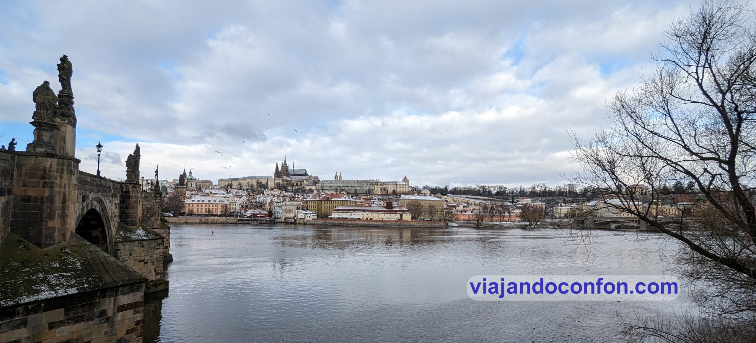
We go for a walk back to Charles Bridge. There the views are amazing. Another view of the previous day.
Mount Petřín
We head towards the castle, stopping at every moment to take photos and videos.
As we had not yet had breakfast, we bought a trdelník at a place that had been recommended to us. It is a sweet of Hungarian origin, although it is called Kürtőskalács there, which we tried in Romania. It’s like a kind of rolled pastry that in Romania (read the travel diary here) they used to grill it.
In Prague you can find it everywhere, although it’s made on a gas cooker.
We climb the 200 steps of Zámecké schody and at the top, more spectacle.
Now we are going to Prague’s castle, Pražský hrad.
Pražský hrad was built in the 9th century. It was the residence of the Bohemian kings and Holy Roman Emperors. Later presidents of Czechoslovakia and the Czech Republic. It houses the Bohemian Crown Jewels.
The last renovation was carried out by architect Jože Plečnik between 1920 and 1934. It was commissioned by the first president of Czechoslovakia, Tomáš Masaryk.
There are several noteworthy features within the complex, but let’s not get ahead of ourselves.
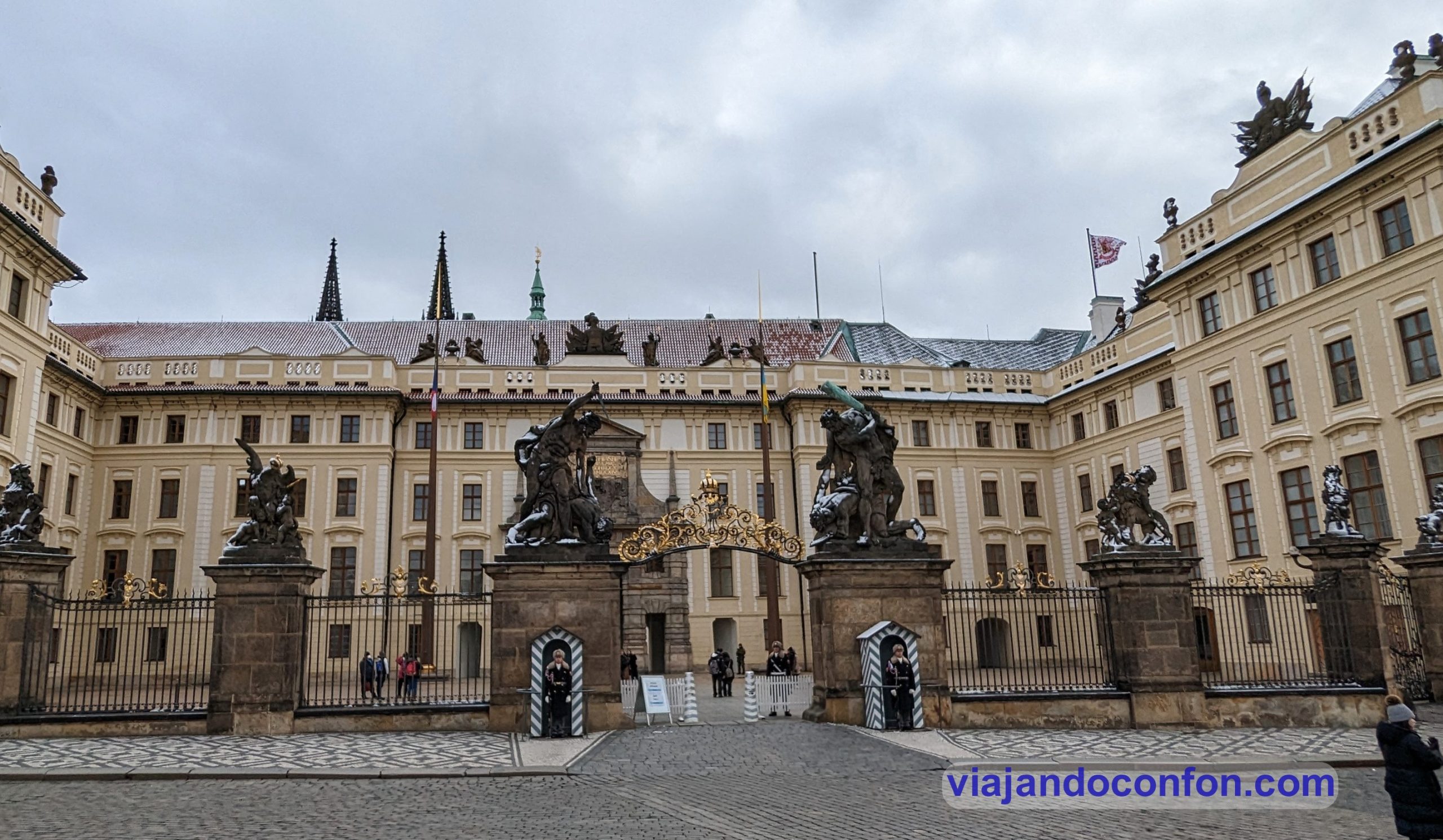
The main gate, guarded by Sousoší Souboj Titánů, is striking. This is translated as a statue of Titans Fighting. They are the work of sculptor Ignác František Platzer, who made them between 1761 and 1762.
Pražský hrad
We went straight to the entrance to the site, which is free of charge. But to access some of the monuments you have to pay. We pass a strict security check and we are inside.
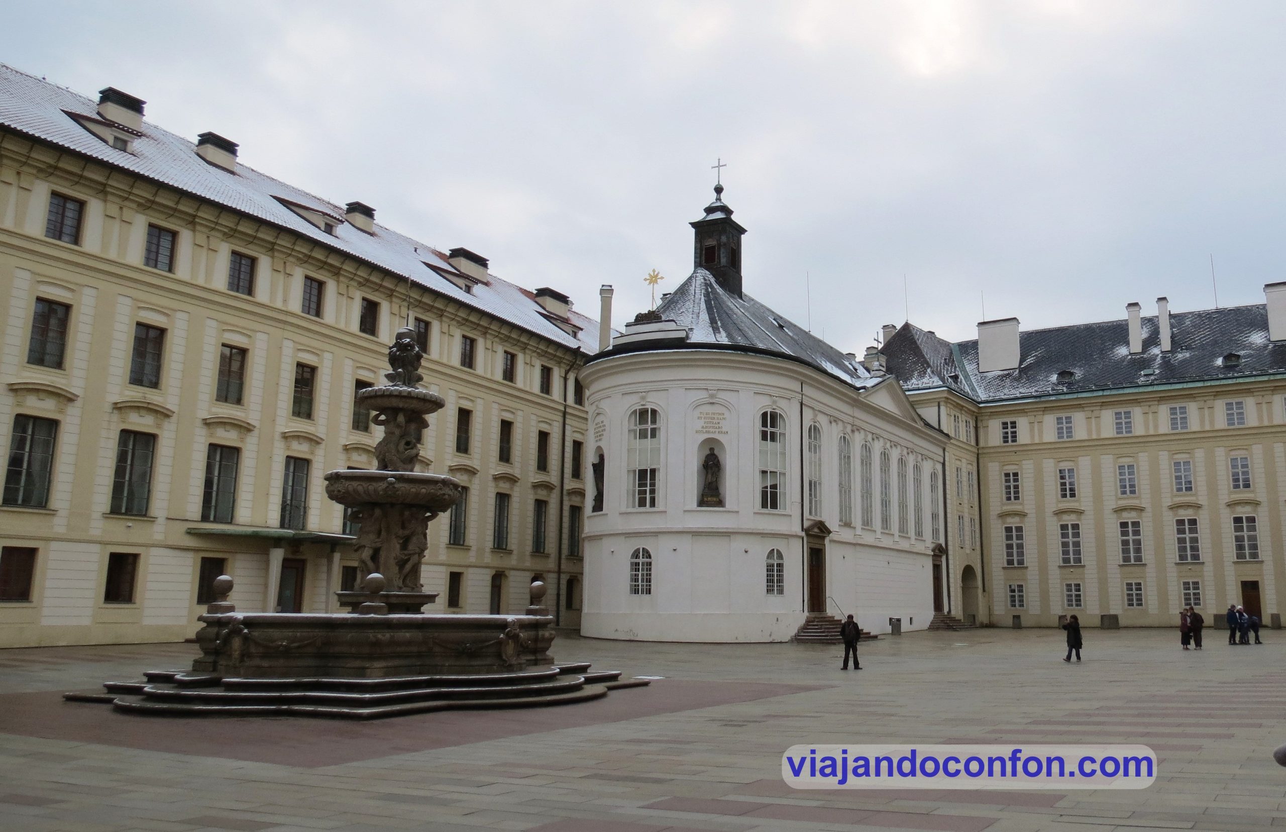
We cross the first gate into a large courtyard, Druhé nádvoří Pražského hradu.
Druhé nádvoří Pražského hradu means Second Courtyard of Prague Castle. In the centre of the courtyard is the Kohlova kašna, the Fountain of Khol. It was made by sculptor Hieronymus Kohl and stonemason Francesco Bartolomeo della Torre in 1686.
Kohlova kašna, the Fountain of Khol
The square is also home to Kaple svatého Kříže, the Chapel of the Holy Cross. The original chapel was built between 1756 and 1767 by Anselm Martin Lurag. It is built in the Baroque and Clacistic styles.
Between 1852 and 1856 the interior was modified by order of the new Emperor Ferdinand V.
Between 1960 and 1963, the chapel was converted into an exhibition hall for the Treasury of St. Vitus. From 1990 it was used for tourist information. In 2012 it was restored as the exhibition hall of the Treasury of St. Vitus.
Kaple svatého Kříže, the Chapel of the Holy Cross
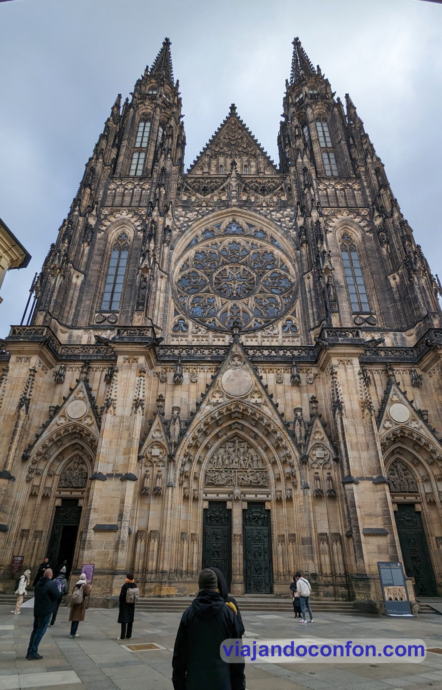
We cross the next gate and come face to face with the spectacular west façade of Katedrála Sv. Víta, the Cathedral of St. Vitus.
The cathedral was built between 1344 and 1420 and is the greatest example of Gothic art in the city. The project was designed by the French architect Matthias of Arras.
A Romanesque rotunda (a temple, not the one for vehicles) and a basilica once stood on this site. Both were dedicated to St. Vitus.
Katedrála Sv. Víta, the Cathedral of St. Vitus
It was the site of the coronation of all the kings of Bohemia. All the holy bishops, archbishops and many kings are also buried here.
The cathedral has been owned by the Czech state since the beginning of its construction.
The west façade is the oldest of the building. It is decorated with statues of fourteen saints, one of King Charles IV and one of his architects.
Opposite the front façade of the cathedral are the ticket offices. This is where we bought our tickets for the cathedral and the castle.
You can choose between different types of tickets. We bought the basic ticket. For 250 CZK (10,50€). It includes the former Royal Palace, St. George’s Basilica, the Golden Alley and the cathedral.
Pražský hrad ticket
For an additional 200 CZK (8.40€) it includes two exhibitions: the history of the castle and a photo gallery. Another 150 CZK (6.30€) and you also get a climb up the cathedral tower. If you want the full package you have to fork out 600 CZK (25€), which I think is a real bargain.
We have to say that ticket prices in Prague are really expensive. Much more expensive than in the other countries we have been to. If you want to get into all the sites… save, save a lot.
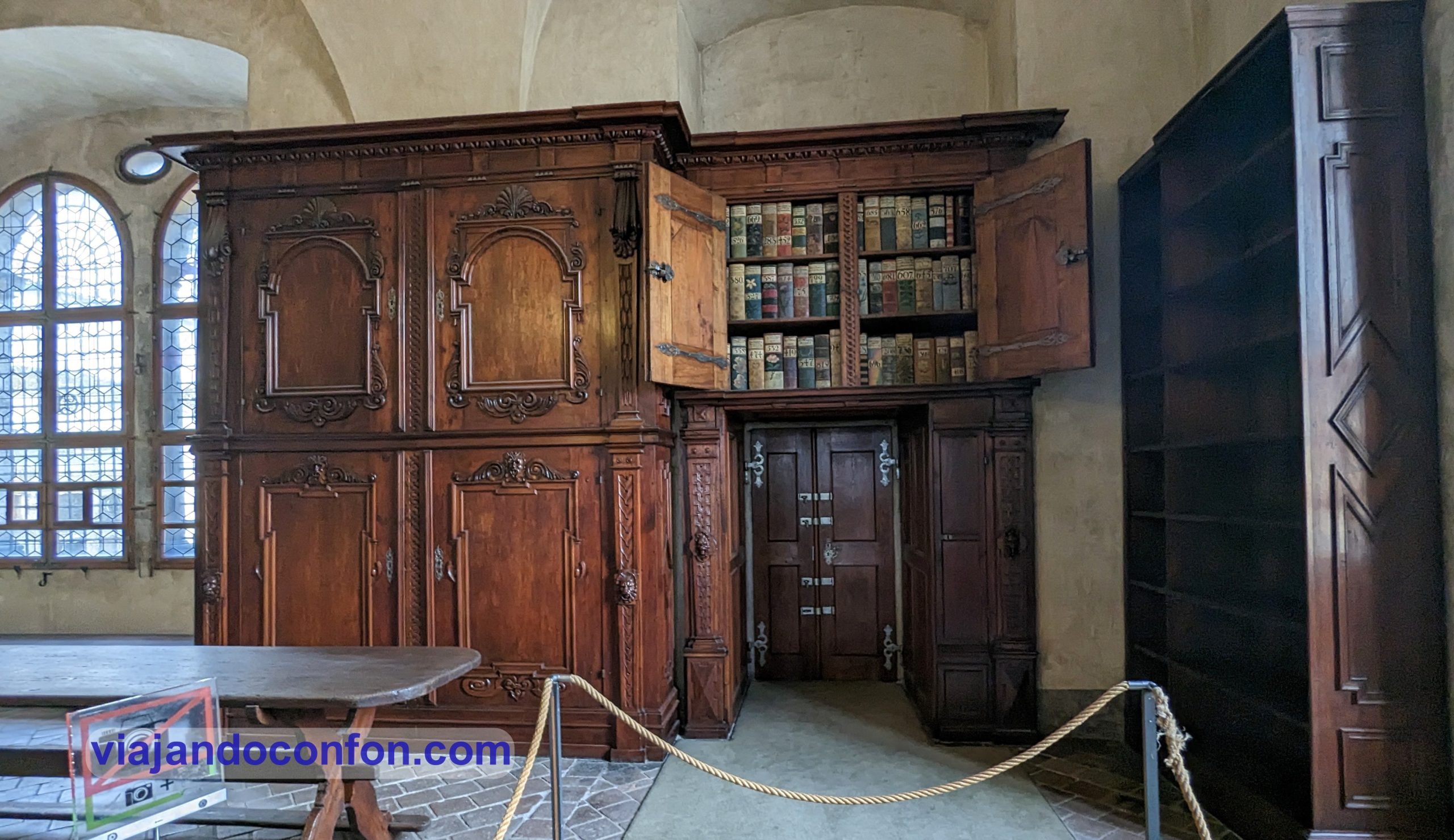
After buying the entrance ticket, we went to the third courtyard. There you will find Archiv Pražského hradu, the archive of Prague Castle, created in 1920.
Archiv Pražského hradu, the archive of Prague Castle
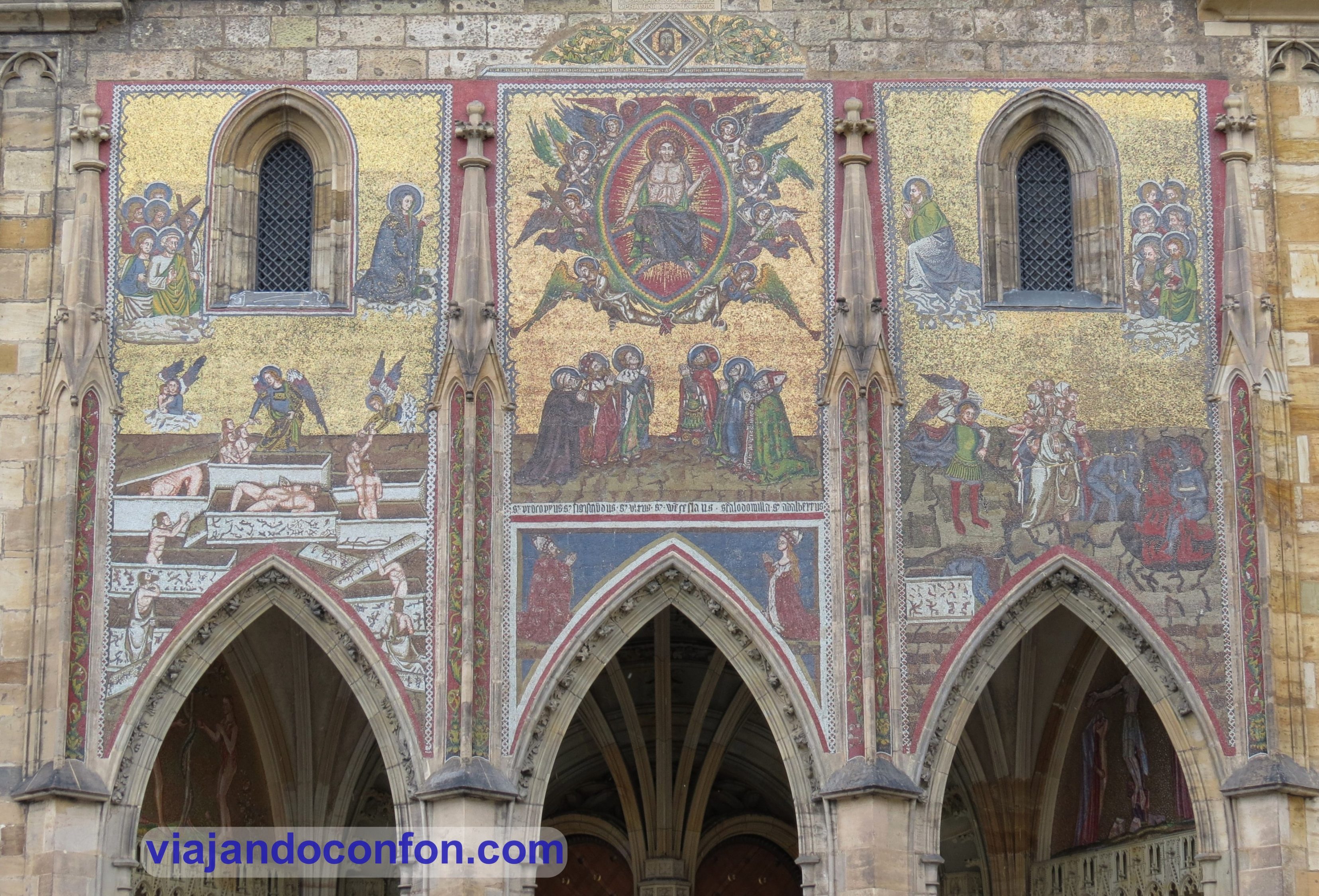
But the most impressive feature of the square is the south façade of the cathedral. Here we find the Golden Door, which owes its name to the red and gold background of the mosaics. It is the work of Niccoletto Semitecolo and depicts the Last Judgement.
This façade was the main entrance for 5 centuries. The entrance to the main tower is also located here. This was built in 1770 by Peter Parler. It is 99 m high and is crowned by a Renaissance dome by Pacassi.
This courtyard is also the site of the socha sv. Jiří s kašnou, the statue of St. George. It was made in bronze in 1373 by the Saxon sculptors Martin and Georg from “Clussenberch” (Cluj-Napoca, in present-day Romania).
The statue was originally placed in Bratislava, Slovakia. Later it travelled to Königgrätz in Bohemia. It finally landed in Prague in 1471.
socha sv. Jiří s kašnou, the statue of St. George
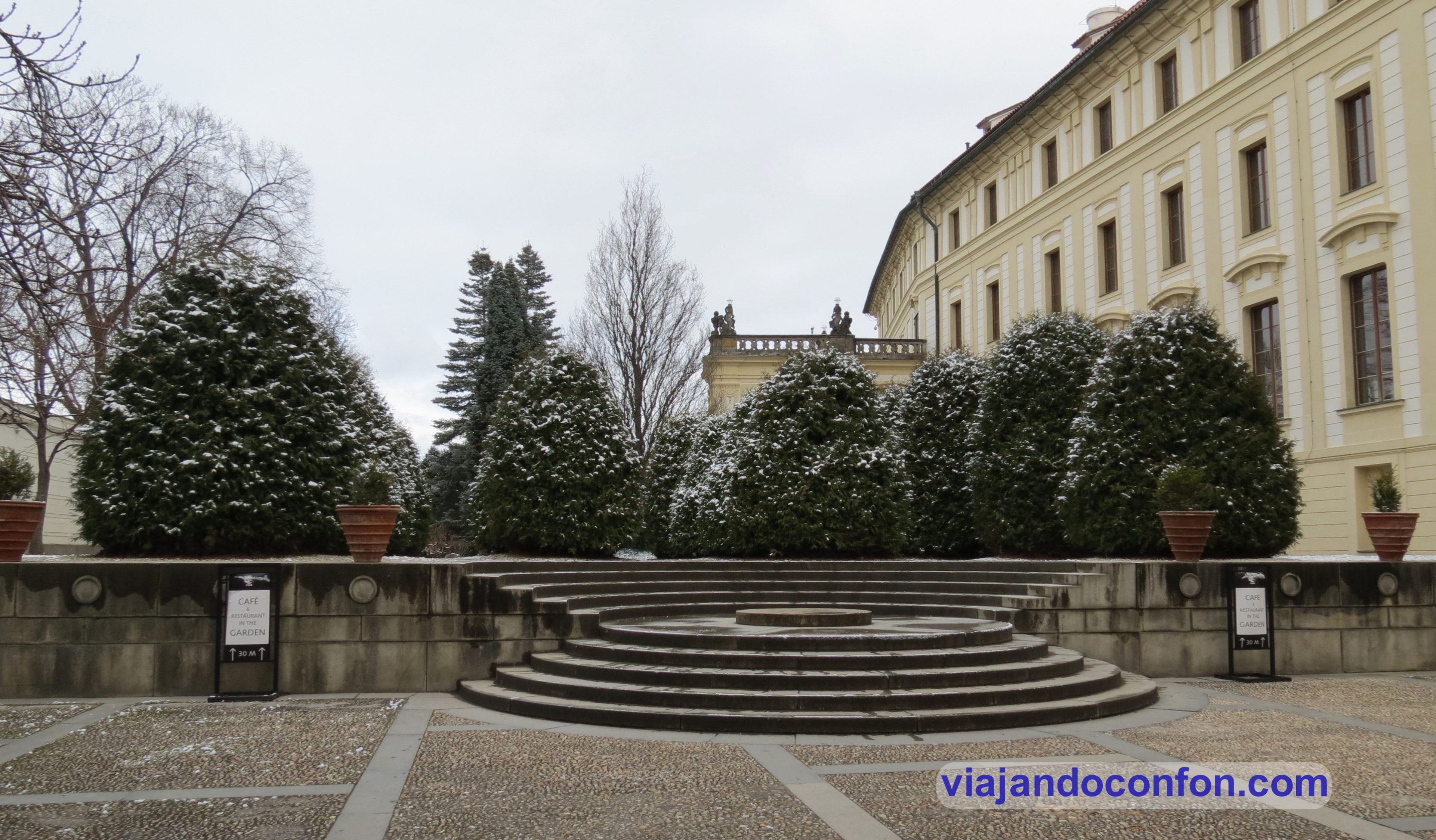
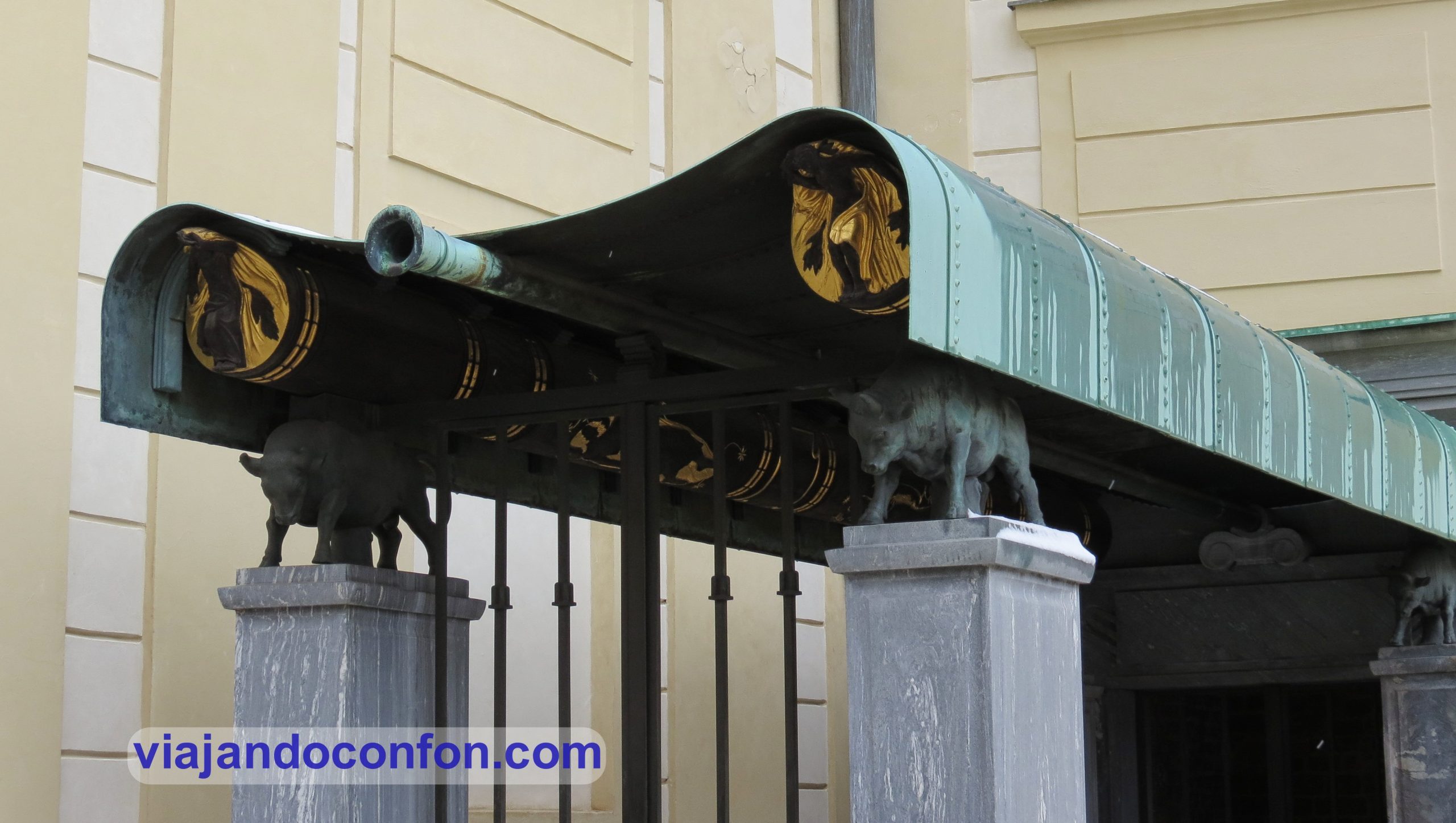
This is also the location of Býčí schodiště, the Bull’s Staircase. It connects the Third Courtyard of Prague Castle with the Na Valech Garden. It was designed by the castle architect Josip Plečnik in 1927.
Býčí schodiště, the Bull’s Staircase
Next to the gate to the Old Royal Palace is Orlí kašna, the Eagle Fountain. It was originally part of the fountain created in 1662 by the sculptor Francesco Caratti. He placed a sculpture of St. George with a dragon on top.
A group of dolphins were placed on the column but were stolen. After the theft, an eagle was placed on the column. It was later replaced by a gilded copper ball with lead nozzles, designed by Josip Plečnik.
Orlí kašna, the Eagle Fountain
Now we enter Starý královský palác, the Old Royal Palace. The original residential building was built at Prague Castle as early as the 9th-10th centuries. It was made almost entirely of wood, but its exact location is unknown.
In the 12th century, the new residence was built in the Romanesque style on the orders of Prince Soběslav.
At the beginning of the 14th century, Charles IV extended the Romanesque building to create a Gothic palace. His son, Wenceslas IV, added two perpendicular wings and the Chapel of All Saints was rebuilt.
Starý královský palác, the Old Royal Palace
During the 15th century it was abandoned for 80 years. In 1483 King Vladislav Jagiello returns to the castle and begins the last large-scale reconstruction of the palace.
We enter the palace and next to the gift shop is Vladislav’s Bedroom. Built in 1490, it served as an audience hall.
Leaving the souvenir shop, we enter the enormous Vladislavský sál, the Vladislav Hall. It was built between 1490 and 1502 by Benedikt Rejt and measures 62 x 16 metres and is thirteen metres high.
Since the 16th century it has been the scene of coronation feasts and banquets. It has also been the scene of knights’ tournaments and markets with artistic and luxury goods.
Vladislavský sál, the Vladislav Hall.
On the right side is a door leading to the Ludvík wing with several rooms. This wing was remodelled by Rudolf II of Habsburg (1552 – 1612) for the Imperial Court Council.
On 23 May 1618, Vilém Slavat of Chlum and Košumberk and Jaroslav Bořita of Martinice, two regional rulers, were thrown out of the window, together with the scribe Fabritius. This was called the Defenestration of Prague.
Adjoining the Vladislav Hall at the other end is the Diet. The furnishings inside give an idea of how the Diet developed after 1627.
A little further on we find a portal with stairs leading upwards. Here you will find Zemské desky, the rooms of the land records. Here you will find all the documents of land property records that survived the Great Fire.
Another room is decorated with painted coats of arms of the highest officials of the Kingdom of Bohemia.
This concludes our visit to the Old Royal Palace in Prague.
We leave and make our way to the west square of the castle, Náměstí U Svatého Jiří. Here the cathedral delights us with its rear façade.
The square is also the site of Carratiho kašna, the Carrati Fountain. It used to house the statue of St. George. The original base was moved to the third courtyard, where it is now the Orlí kašna fountain.
The present fountain dates from 1840. Until 1928 it was located next to the Old Royal Palace.
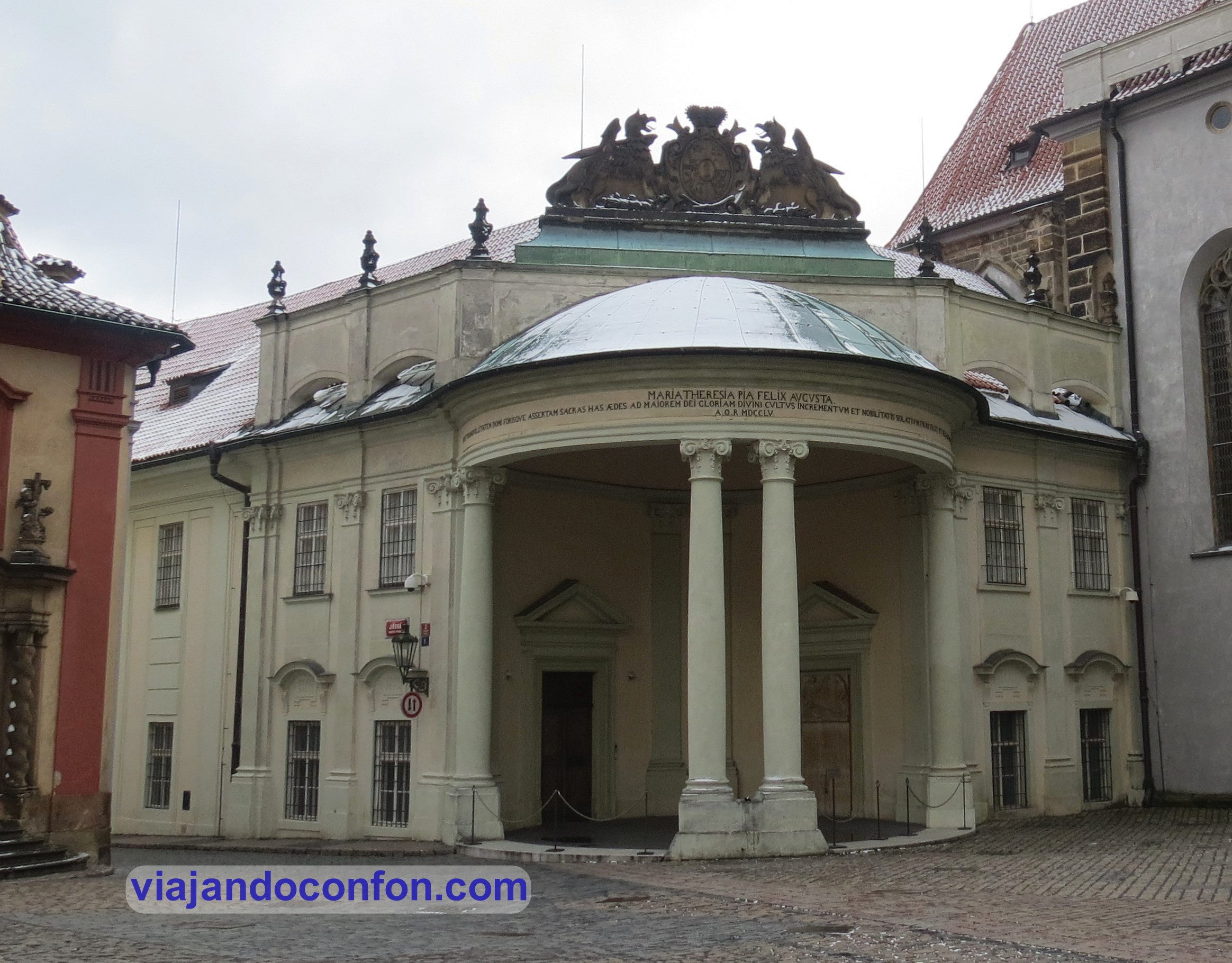
To the southwest of the square is the Tereziánský ústav šlechtičen, the Institution of Noble Ladies of Prague Castle. Also known as the Royal Teresian Institution of Noble Ladies of Prague Castle.
It was founded by Empress Maria Theresa in 1755. The institution occupied the so-called Rosenberg Palace as well as the Gothic All Saints’ Chapel. On 1 May 1919, the government of the newly created Czechoslovak Republic decreed the dissolution of the institution.
Today the building is used for various purposes, such as the Archives of the Office of the President of the Republic.
Tereziánský ústav šlechtičen
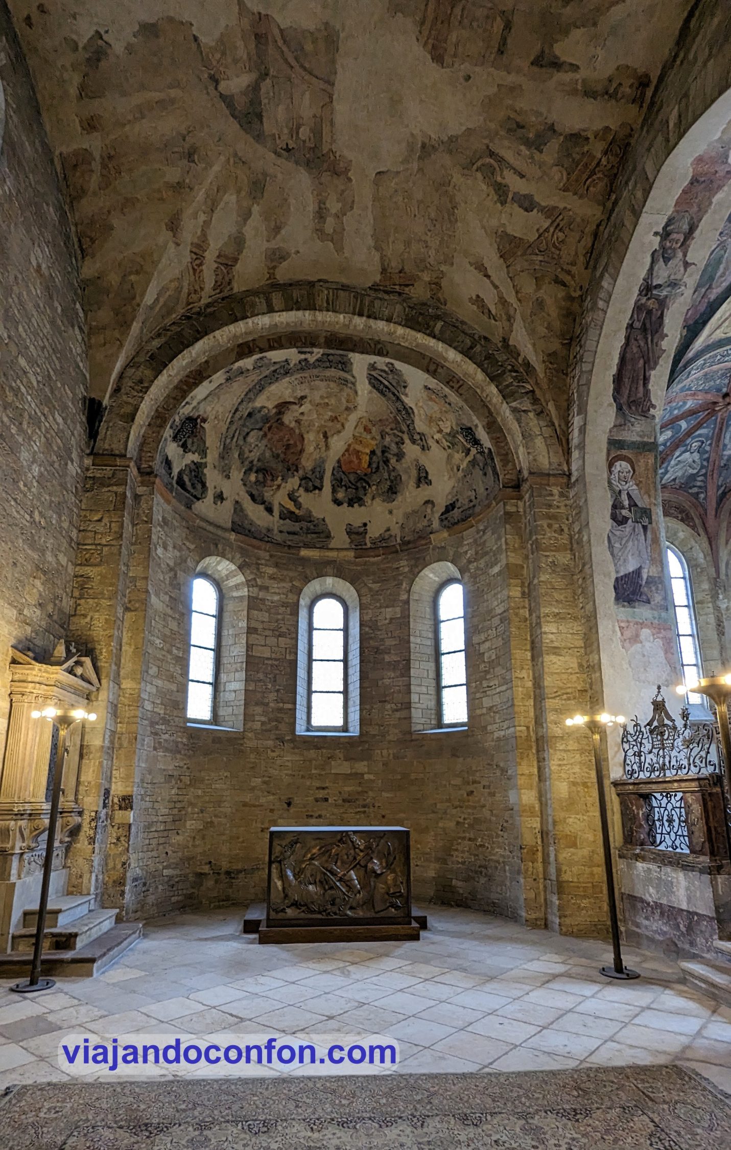
And in the far west, Bazilika svatého Jiří, St. George’s Basilica. Another attraction for which we have a ticket.
It was created as the second church of Prague Castle. Only the foundations of the original building founded around 920 by Prince Vratislav I have been preserved.
With the foundation of the monastery in 973 the church was rebuilt and enlarged.
After a devastating fire in 1142, the church was rebuilt in the Romanesque style. In the first half of the 13th century, the Chapel of St. Ludmila and the entrance portico on the west side were added.
The present appearance is the result of a reconstruction between 1887 and 1908, in an attempt to restore its 12th century Romanesque appearance.
The remains of St Ludmila of Bohemia have been buried here since the 11th century. After the great fire of 1142, the remains were relocated behind the high altar.
At the back of the church is the chapel of St. Ludmila.
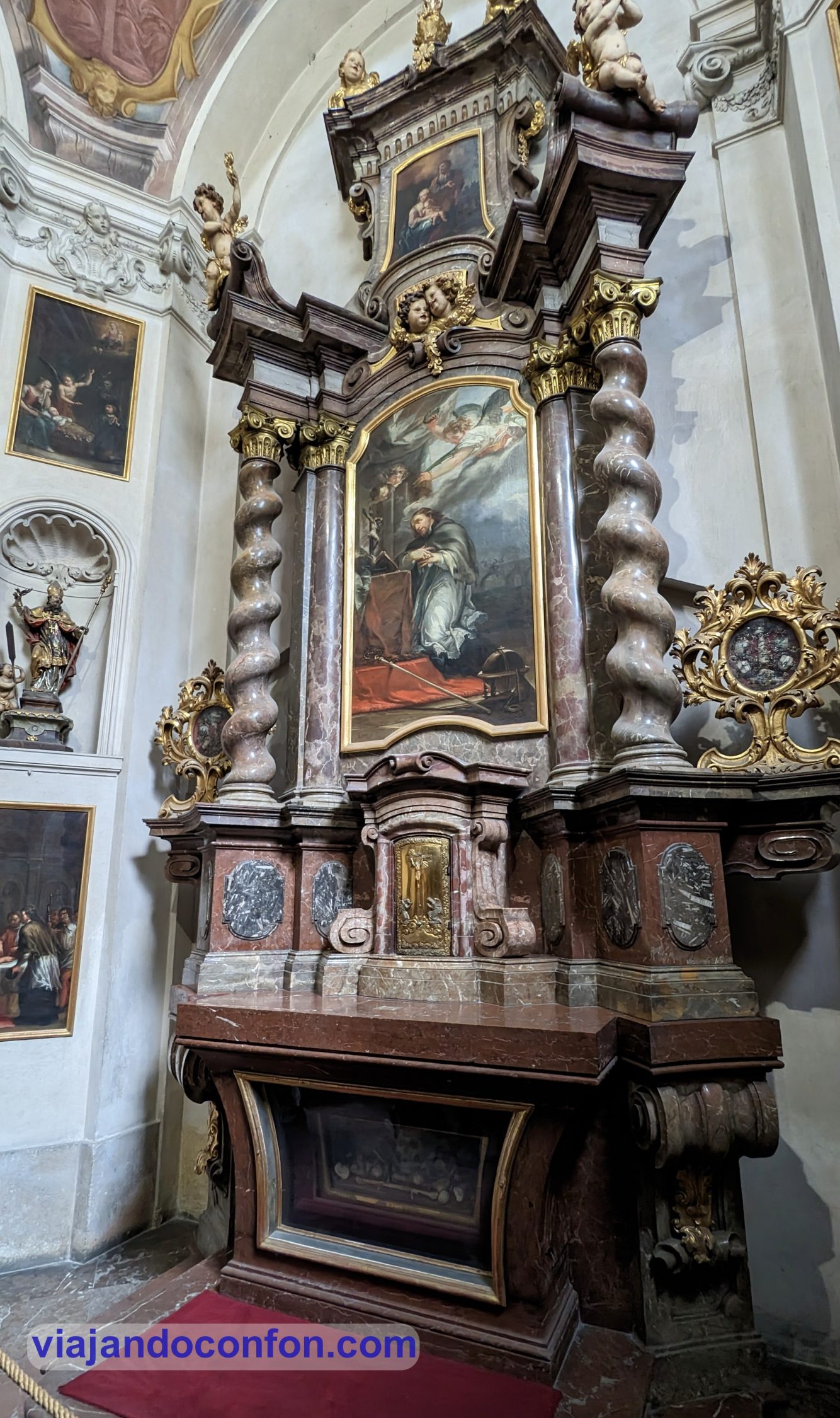
The basilica also houses the Chapel of St. John of Nepomuk, built between 1717 and 1722. The chapel was consecrated on 10 May 1722 by St. Vitus canon Jan Rudolf Špork.
The remains of (supposedly) St. Theodora are preserved under the altar.
Chapel of St. John of Nepomuk
Remains of Saint Theodora
We finish our visit to the basilica and set off again. We head towards Zlatá ulička u Daliborky, the Golden Lane.
Zlatá ulička u Daliborky was built at the end of the 16th century, originally to house the twenty-four guards of Emperor Rudolf II of Habsburg (1555 – 1612) and their families.
The alley owes its name to the goldsmiths who later lived here. Famous writers such as Franz Kafka and the Nobel laureate Jaroslav Seifert lived here for a short period of time.
Zlatá ulička u Daliborky, the Golden Lane
Since 2011, an exhibition dedicated to its history from 1600 to 1956 has been on display in the alley.
The walk became very special as the snow fell on us.
As it was early and we didn’t have a reservation until 2 o’clock for lunch, we decided to have a coffee. We did so at a place called Vikárka Restaurant. Big mistake. Extremely slow service. Almost an hour for coffee. We had to run.
The entrance to the cathedral was included in the basic pass.
One of the elements I liked the most was the Chapel of St. Wenceslas. It is Gothic in style and was built between 1362 and 1367. It was consecrated before Charles IV.
It is located in the same place where the Rotunda of St. Vitus stood, where St. Wenceslas was executed. The impressive paintings date from 1509.
The spectacular tomb of St. John of Nepomuk, made of silver in 1736, is also a highlight. The goldsmiths were Joseph Emanuel Fischer von Erlach, Antonio Corradini and Jan Josef Würt.
Tomb of St. John of Nepomuk
After the visit to the cathedral, we set off at a brisk pace for the restaurant we had booked. The place in question is called Pork’s. It is a place specialising in pork with a very small menu where the roast knuckle is the star.
We arrived at the place by the skin of our teeth. There was a long queue, although it was for those without a reservation. We went in, looked for our reservation and… surprise! we had made it for the next day. Even so, the guy sits us down. The place is huge and has about a million tables.
The food was over the top good and it’s not expensive. But we ordered too much…
In case you can’t tell from my expression, it looked like butter. And for dessert: beer ice cream.
In total we spent 1,020 CZK (44.35€), but we had ordered food for 3 people.
With our stomachs full (and beyond) we headed to our next destination. We visited the Muzeum Karlova mostu, the Charles Bridge Museum. The entrance is included in the castle pass.
In the museum you can learn about the history of Prague’s most famous bridge. From its construction to the present day, including its restorations. In the basement you can see part of the foundations of the old Judith Bridge on display.
Interesting… but only if you have time.
Muzeum Karlova mostu
After the visit to the museum we set off for the Dancing House. Although there were actually several things of note during this one.
Like the otters… yes, the otters. The water rats. An invasive species that arrived from South America and has colonised most of the country. The Czech state is trying to wipe them out, but tourists and many locals feed them. It is an invasive species that threatens the endemic ecosystem. So the best thing to do is NOT TO FEED them.
But let’s get down to business, we come to Most Legií, the Legion Bridge. It was built between 1898 and 1901 by architect Antonín Balšánek and engineer Jiří Soukup.
This bridge replaced the old chain bridge that operated from 1841 and 1898.
Most Legií, the Legion Bridge
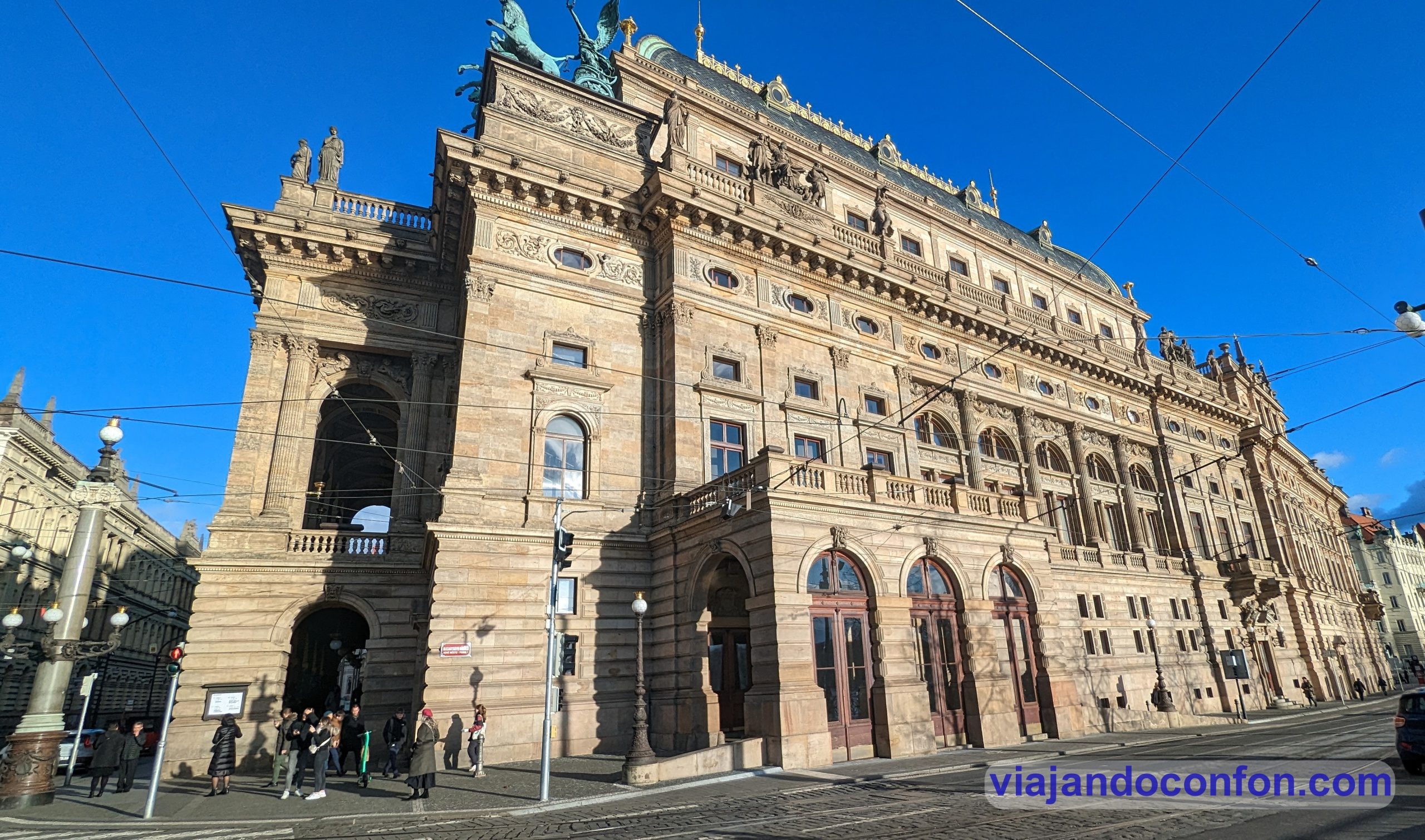
Národní divadlo, the National Theatre, is located next to the bridge. In 1844, the Czech politician František Palacký proposed the construction of a large theatre in parliament. It was to house the nascent Czech National Opera.
Construction did not begin until 1868 and was completed in 1877. The architect was Josef Zítek.
It was opened on 11 June 1881 with a performance of Bedřich Smetana’s opera Libuše. It was used for the visit of Crown Prince Rudolf of Austria.
In 1977 it was closed for extensive restoration. It reopened on 18 November 1983, again with a performance of Libuše.
Národní divadlo, the National Theatre
A little further south we find Palác Žofín, the Žofín Palace. It is a neo-Renaissance chateau located on Slovanský Island in the Moldova River.
In 1830, the island, then called Barvířský ostrov, was bought by a prosperous miller. He built this chateau there between 1836 and 1837. It was named after Princess Sophia, mother of Austrian Emperor Franz Joseph I (King of Hungary and Bohemia).
In 1925 it was renamed Slovanský ostrov to commemorate the Prague Slavic Congress of 1848.
In 1884, the city of Prague bought the island, including the palace, which was reconstructed as a two-storey building. The exterior and interior were renovated between 1991 and 1994.
Palác Žofín, the Žofín Palace
At the southern tip of the island, but actually in the middle of the river, is Šítkovská vodárenská věž. It is a water tower built at the end of the 15th century. It was built to replace the old wooden one from 1495, which burnt down in 1501. After the fire, it was rebuilt in wood, which burnt down again in 1588.
Between 1588 and 1591 the current one was built. In 1641 it was severely damaged during the Swedish siege of Prague. It was repaired in 1651.
The tower served as a central water supply. It distributed water by gravity to the fountains and houses in the New Town and the Old Town. It served this purpose until 1847.
Close by is Tančící dům, the Dancing House. Built between 1992 and 1996, it is a deconstructivist building. The design is the work of the Czech-Croatian architect Vlado Milunić.
It was a controversial design as it clashes with the beautiful Baroque, Gothic and Art Nouveau buildings in the area. It is curious, but it is really ugly as hell.
The building houses a hotel, a gallery, a restaurant and a bar. It’s just another tourist attraction for Instagram…
Tančící dům, the Dancing House
This building is just across the street and is actually much nicer:
We rest for a while and then set off for our next destination. This is a free tour of the mysteries and legends of Prague.
On the way, we take a short detour to the Deymovský palác, the Deymovský Palace. On its façade we find another of David Černý’s sculptures: Three women on a house.
These are three statues of women engaged in different activities.
From here straight to the free tour. It was a marvellous experience. Dani, the guide, you can tell he lives it with passion. Highly recommended.
After the free tour we left totally exhausted for the hotel. But first we had to have dinner. We did so at the Palladium, in a sandwich franchise called Bageterie Boulevard. They weren’t bad but they were nothing special. Dinner cost us 418 CZK (18€).
After dinner we retired to the hotel to rest. Tomorrow we have to get up early for an excursion.
Around 2 am we arrive at the hotel. We check in and go to sleep. This time we chose the Ibis Praha Old Town. Very central and cheap. 40€ per night plus another 5€ per night for taxes.
Find your ideal hotel at the best price in Prague with Agoda:
February 25th
Given the time we arrived at the hotel, we decided not to get up too early so that the day would catch us rested. At 9 o’clock we get up and at 10 o’clock we are on our way.
First impression of Prague: it is freezing cold. So the first thing to do is to have breakfast with a hot coffee to have energy.
The first place we can contemplate is Náměstí Republiky (Republic Square). Here we can observe several remarkable buildings. The most striking is Obecní dům, the municipal house.
It is an auditorium inaugurated in 1912 and built in Art Nouveau style by architects Antonín Balšánek and Osvald Polívka.
Obecní dům, the municipal house
Right next to it we find Prašná brána, the Gunpowder Tower. One of the must-see sights of the city.
The Powder Tower was built in late Gothic style in 1475. Its architect was Matěj Rejsek. It was one of the gates of the city wall defending the city. In the 19th century it was rebuilt in neo-Gothic style.
The current name of the Gunpowder Gate (Prašná brána) comes from the 18th century, when it served as a gunpowder storehouse.
Prašná brána, the Gunpowder Tower
We crossed the gate and entered Staré Město, the Old Town. We reached Staroměstské náměst, the Old Town Square.
The square arose in the 12th century and many remarkable buildings can be seen here. On the pavement of the square you can see the inscription commemorating the execution of 27 Czech personalities in 1621 and the Prague meridian.
Staroměstské náměst, the Old Town Square
Prague meridian
On the square next to a crowd of tourists at all hours we find Staroměstská radnice, Prague’s town hall with its famous astronomical clock.
The town hall building was built in 1338. It was by order of the Bohemian king and Count of Luxembourg John of Luxembourg, the Blind.
The building underwent numerous renovations and extensions over the years. Today it is made up of several buildings in Gothic and Renaissance styles.
Staroměstská radnice
The main attraction of the town hall is Pražský orloj, the astronomical clock. It was built by the clockmaker Nicholas of Kadan and Jan Šindel, professor of mathematics and astronomy at Charles University in Prague.
The oldest part of the clock is the mechanism of the astronomical dial dating from 1410.
The calendar and the Gothic sculptures that decorate the façade were added at the end of the 15th century.
Pražský orloj, the astronomical clock
Four figures stand out on the clock:
Lust represented by a Turkish prince with a mandolin.
Death represented by a skeleton with an hourglass.
Greed represented by a merchant with a bag.
Vanity represented by a man holding a mirror.
Every hour on the hour, between 9 o’clock in the morning and 9 o’clock at night, the figures are set in motion. The vain one looks at himself in the mirror, the greedy one moves his bag, the skeleton brandishes his scythe and pulls a rope, the lustful one shakes his head.
Through the small windows then begins the walk of the apostles. The twelve apostles parade slowly leaning out of the window preceded by St. Peter.
Pražský orloj, the astronomical clock
Since it was only 10 minutes to the Apostles’ Walk, we decided to wait in the crowd. At that moment it was starting to snow, which made it even more spectacular.
After this, we continue contemplating the square. Another of the most remarkable buildings is Chrám Matky Boží před Týnem, the Church of Our Lady of Týn.
A Romanesque church already existed here in the 11th century. It was a hospital church for foreign merchants coming to the Týn courtyard. In 1256 it was replaced by a Gothic church.
The present building was begun in 1360. The church was designed in late Gothic style under the influence of Matthias of Arras and later Peter Parler. The building was completed in 1450 although the north tower was in 1471.
For the south tower had to wait until 1511, being the work of the architect Matěj Rejsek.
Chrám Matky Boží před Týnem, the Church of Our Lady of Týn
Just ahead, next to the meridian, is Mariánský sloup, the Marian Column. It is a monumental baroque column made of sandstone. It consists of a sculpture of Mary Immaculate at the top and other statues on the pedestal.
Next to it is Památník Jana Husa, the monument to Jan Hus. Installed in 1915, Ladislav Šaloun’s work is one of the most important Czech Art Nouveau symbolist works.
Jan Hus (1370-1415) was a Czech theologian and philosopher, rector of the Charles University in Prague. As a reformer and preacher he is considered one of the forerunners of the Protestant Reformation.
He was burned at the stake after being condemned for heresy at the Council of Constance.
Památník Jana Husa, the monument to Jan Hus
Behind the monument is the Golz-Kinských Palác, the Golz-Kinských palace. The palace was originally built for the Golz family between 1755 and 1765. The building was designed by Kilian Ignaz Dientzenhofer in the rococo style.
Today it is one of the seats of the Prague National Gallery.
Golz-Kinských Palác, the Golz-Kinských palace
The other notable building is Kostel sv. Mikuláše, the church of St. Nicholas. This is one of the oldest churches in Prague, being mentioned as early as 1273.
In 1635 the church passed into the hands of the Benedictines, who built a monastery between 1727 and 1730. Between 1730 and 1735 they built the new church in the Baroque style.
Kostel sv. Mikuláše, the church of St. Nicholas
After seeing the square, we walked in the direction of Charles Bridge.
I was very struck by a building that is part of the town hall. It is Dům U Minuty, a clear example of Czech bourgeois renaissance architecture. The façade is decorated with sgraffiti depicting scenes inspired by biblical and mythological scenes. Contemporary Renaissance legends are also depicted.
Between 1889 and 1896, Franz Kafka lived here with his parents.
Dům U Minuty
To the east of the Old Town Square is Malém náměstí (Small Square). In the centre is Kašna na Malém náměstí, the Wishing Fountain.
It is a wrought-iron fountain surrounded by a Renaissance grille dating from 1878. Before that, however, there was a well from the late 16th century.
Another notable building is Rottův dům, the house of Vincenc Josef Rott. He was a wealthy Prague merchant.
The building was rebuilt between 1896 and 1897 by his son Ladislav Rott. It has a Neo-Renaissance façade by František Kindl. It is painted according to the design of illustrator Mikoláš Alš.
The façade is decorated with plant motifs and paintings of allegories of craftsmanship and agriculture.
Rottův dům and Fountain of Wishes
After walking along Karlova Street, we reach Křižovnické náměstí, the Crusader Square. Around the square, apart from the Charles Bridge, there are several notable landmarks:
On the north side we find Kostel svatého Františka z Assisi, the monastic church of St. Francis of Assisi. It was built between 1679 and 1689 in the Baroque style. It was built by the Italian builders Gaudenzio Casanova and, after his death, by Domenico Canevalle. However, the project was designed by the French architect Jan Baptista Mathey.
The church was built on the foundations of the Gothic church of the Holy Spirit. It was inaugurated by the Archbishop of Prague Jan Bedřich of Waldstein in 1688.
Kostel svatého Františka z Assisi
On the east side, we find Kostel Nejsvětějšího Salvátora, the Church of St. Saviour. It is part of the Klementinum (to be discussed later).
The church was built on the foundations of the Gothic church of St. Clement of the Dominican Order. Construction began in 1578.
In 1581, the primate of the neighbouring Jewish ghetto, Mordechai Maisel, donated 100 thalers to build the church. This testifies to a tolerant atmosphere and the peaceful coexistence of different religions in Prague.
Between 1654 and 1659, according to Lurago’s design, a new façade was built with three arcades reminiscent of Roman triumphal arches. In 1714, the towers were built by the architect František Maximilian Kaňka.
Nejsvětějšího Salvátora, the Church of St. Saviour
In the centre is the Pomník Karla IV, the monument to Charles IV. It is a neo-Gothic monument built by Jacob Daniel Burgschmiet according to a design by Ernst Julius Hähnel in 1844.
At the top of the monument is Charles IV with the charter of the university in his hand. Underneath is the inscription “Karolo Quarto Auctori Suo Literarum Universitas / Festo saeculari quinto 1848“. In Latin it reads: “Karolo Quarto Auctori Suo Literarum Universitas / Festo saeculari quinto 1848“.
Right at the base of the monument there are allegorical statues of the four faculties of Charles’ University. At that time they were: theology, medicine, law and philosophy.
Pomník Karla IV, the monument to Charles IV
And at the western end is Staroměstská mostecká věž, the tower of the Old Town Bridge. It was built in the Gothic style in the mid-14th century by order of Charles IV. It was designed by the German architect Schwäbisch Gmünd and is another of the city gates.
During the siege of Prague by the Swedes in 1648 in the Thirty Years’ War, the tower was bombed. The decoration on its western façade was destroyed.
The present appearance is due to a renovation carried out between 1874 and 1878. It was under the direction of architect Josef Mocker.
In 1621 the heads of 27 executed participants in the uprising against the Habsburgs were hung in iron baskets outside. They remained there for 10 years as a deterrent for future uprisings.
The tower is considered one of the most impressive works of Gothic architecture.
Staroměstská mostecká věž
This is the beginning of Karlův most, the Charles Bridge. It is the oldest bridge in Prague and the second oldest in the country. After the Písek Stone Bridge.
It was built between 1357 and 1402 with the approval of King Charles IV. It replaced the old Judith Bridge, which was destroyed during a flood in 1342. Its name, Judith, had been named after the wife of King Ladislaus I.
It was originally known as the Stone Bridge. It was not until 1870 that it was called Charles Bridge.
Karlův most, the Charles Bridge
The foundation stone was laid by Charles IV on 9 July 1357 (9.7.1357) at 5:31 in the morning. This date and time were not chosen by chance.
This date was determined by astrologers and numerologists close to the king. This precise moment can be stated as 135797531. It forms a capicua sequence of ascending and descending odd digits, which is engraved on the tower of the Old City.
From 1683 to 1928, 30 statues of saints were installed on the pillars of the bridge.
One of the most famous is that of St. John of Nepomuk, the patron saint of Bohemia. He was the confessor of Sophia of Bavaria, the queen consort of Bohemia. He refused to break the vow of sacramental secrecy, which caused the wrath of King Wenceslas IV of Bohemia.
It is said that after being tortured by the king, he agreed to tell his wife’s secrets to the first soul he met in the hall. What she did would be up to her and the king. The first soul was a dog. Wenceslas was so angry that he condemned it to be thrown into the river after cutting out its tongue.
The statue has a bronze image depicting this act. It is said that if you touch it, your deepest secrets will never come to light.
John of Nepomuk was the first saint to be martyred for keeping the secret of confession. He is the protector against slander, and due to the manner of his death, protector against floods.
Next to the statue is an image of Saint John, right on the spot where he was thrown into the river.
It is said that touching it fulfils a deity. A tour guide told us that if you do the ritual right, you will return to Prague.
Just in case, we did it. Here I am performing the ritual:
On the other side of the bridge, in Malá Strana, the old quarter, we find Malostranská mostecká věž, another of the city’s towers. It is actually two towers. Both form the gateway to the quarter.
The higher tower, dating from 1464, is a continuation of the bridge tower in the Old Town of Parléř with its late Gothic architecture.
The lower one, in Renaissance style, dates from 1591 and replaces a Romanesque tower from the 12th century.
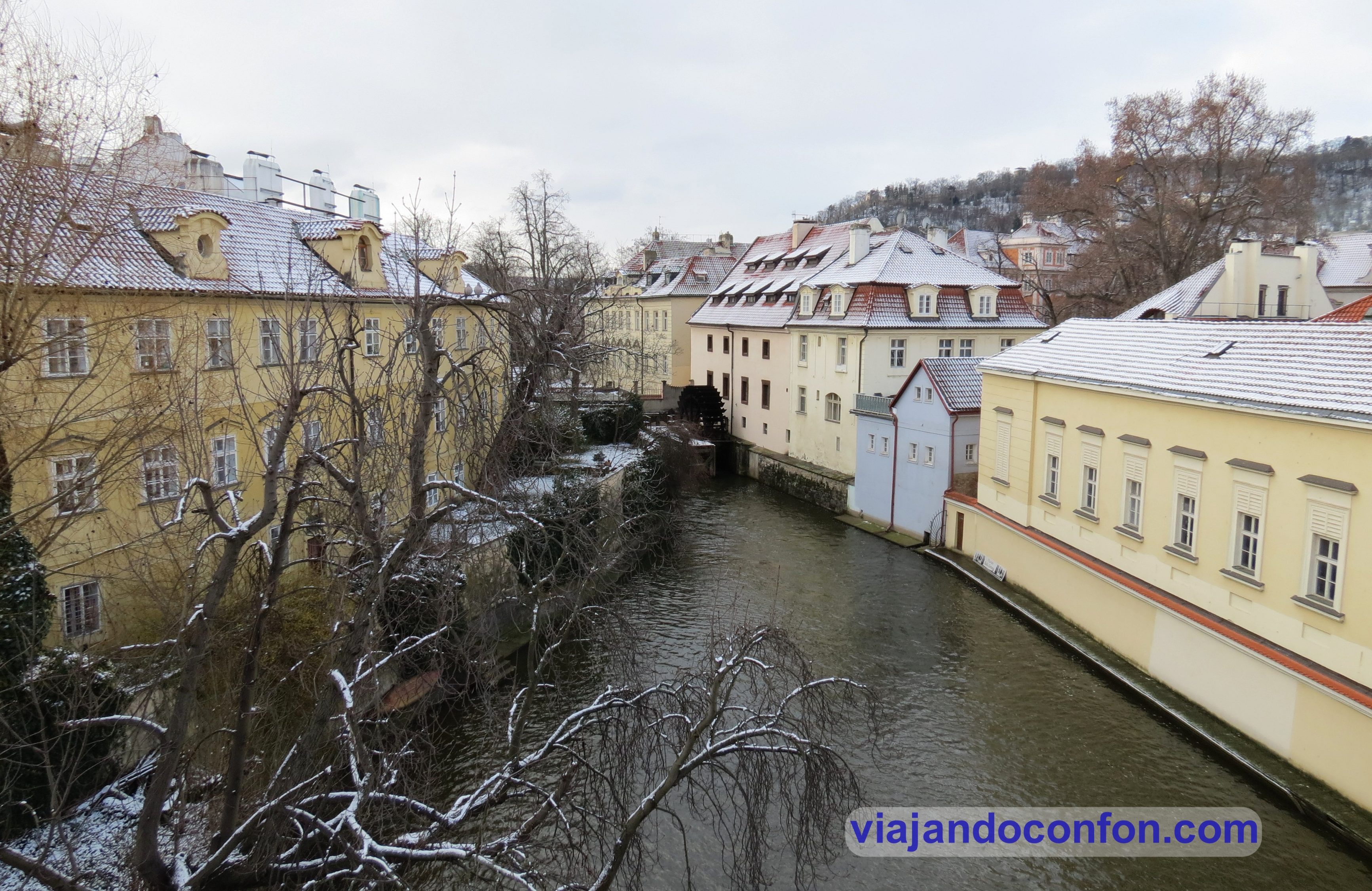
But before we visit Malá Strana, we go down to the island of Kampa. The oldest mention of Kampa dates back to 1169. It was in the foundation charter of the Church of the Order of Malta during the reign of King Vladislav II.
The island acquired its present form by modifying the terrain and the bed of the river Čertovka in the mill channel. It was also shaped by the debris from various disasters, especially the Great Fire of 1541.
The first buildings were mills with attached plots (mill gardens), which later became aristocratic gardens.
In the northern part is Na Kampě Square surrounded by ornamental buildings. The southern part of the island consists of Kampa Park.
During the weekend there was a flea market with stalls selling drinks and local food on the square.
After the walk through the square, we arrived at Kampa Park.
It is home to Museum Kampa, the museum of contemporary art in Central Europe. It is located in the area known as the Sova Mills in Malá Strana.
It houses the collection of Jan and Meda Mládek, František Kupka and the Cubist sculptor Otto Gutfreund. There are also several works by key 20th-century artists from the so-called Eastern Bloc.
Outside is the work Miminka by sculptor David Černý. Known as the Giant Babies of Kampa. It depicts three strange crawling giant babies.
After the walk through the park, we turned around and went to Mlýn Huť. It is a 13th century water mill that belonged to the monastery of Chotěšov, located 100 km from Prague.
In 1293, it was bought by the provost of Vyšehrad Jan and became the property of the Dominican nuns of Malostran. At the beginning of the 16th century, it became the property of Viktorín Kornel, a cadastral official.
In 1624 it passed into the hands of Pavel Michna z Vacínova, who attached it to his house on the present site.
Next to it is a peculiar sculpture. It is Vodník, a spirit of the waters.
According to mythology, when he gets angry he breaks dams, watermills and even drowns all living things. Fishermen and millers make offerings to calm him down. Otherwise he would drag people to his underwater abode to serve him as slaves for eternity.
The Vodník store the souls of the drowned in porcelain cups which they revere as their most precious possession. Through the number they possess they show their wealth and status to other vodník.
Just a few metres away is Lennonova zeď, Lennon’s wall outside Kampa. Shortly after John Lennon’s death, this wall was transformed into a makeshift memorial with a painting of the singer’s face. Lit candles accompanied quotes from John’s songs about peace and freedom in the world.
Soon slogans criticising the communist regime that ruled the country began to appear. The regime banned the playing of the ex-Beatle’s songs because of their subversive message.
The communist police proceeded to erase them, but every time they tried, the graffiti was repeated. Even the installation of surveillance cameras did not prevent the graffiti from being repeated.
The wall is owned by the Knights of the Order of the Maltese Cross, who allow new graffiti to be painted on it without interruption.
We head into Malá Strana and go in search of a place to eat that was recommended in some blogs. The place is called Krčma U krále Brabantského. Czech food at a good price.
The restaurant looks like an ornate medieval tavern. It is really very nice. The food is quite good. The service… quite average. They took a long time to take our order. They took a long time to serve us our drinks. A second course arrived first, followed by the drink. After a while another second course and finally the first course….
Still, a positive experience. The meal cost 950 CZK (40€) including service. Because the service is paid separately. It is not obligatory like tipping in the USA but it is not nice not to leave a tip. It is recommended to tip 10% of the total.
In the evening they organise a medieval show, but we did not attend (it costs a fortune).
After lunch, we went to the castle area, up a million stairs. This devil’s spawn is known as Nové zámecké schody (New Castle Stairs).
They were built in the 17th century to replace the steep cart track that had been here since 1278. The last reconstruction dates back to 1972.
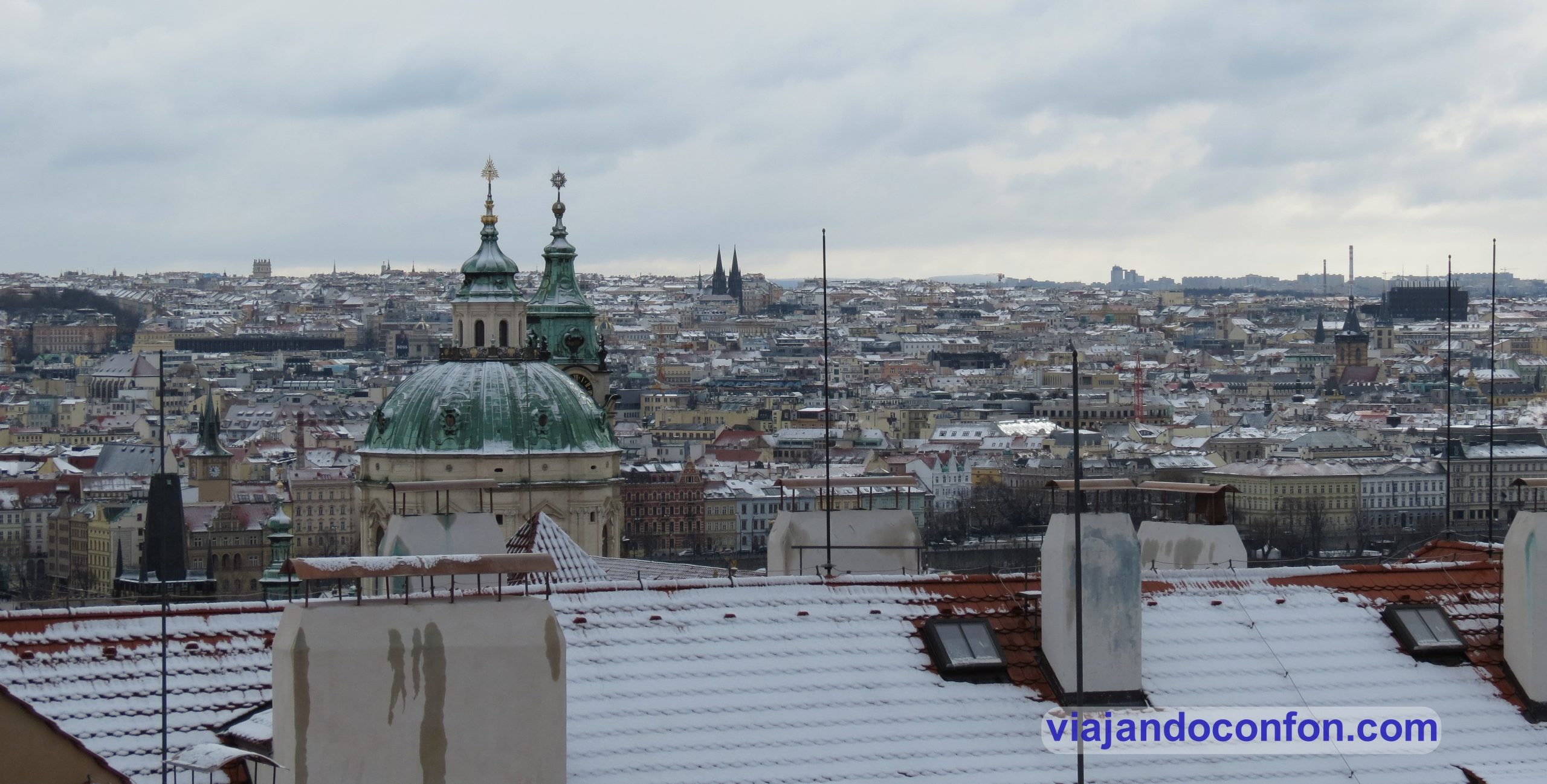
We climbed the 220 steps and got to the top. It was not as hard as it looked. At the top of the stairs we had a spectacular view of the city.
Nearby is the terrace of a Starbucks with even more spectacular views. It’s not the first one we’ve seen with a great location, like the one at the Shibuya crossroads in Tokyo.
After getting some air, we head to Hradčanské náměstí, the Hradcany square.
We will talk about the castle later during the visit…
In Hradčanské náměstí there are many remarkable sights. Starting with Arcibiskupský palác, the Archbishop’s Palace.
The rococo palace was built in several different phases. The original building was a residence for Archbishop Antonín Brus of Mohelnice, who first renovated it in the Czech Renaissance style between 1562 and 1564.
After several more alterations, it acquired its present rococo appearance in 1765 by the architect Johann Joseph Wirch.
Arcibiskupský palác
Next to it is Kandelábr pouličního osvětlení. One of the three remaining monumental lampposts in Prague. It is the work of architect Aleš Linsbauer and sculptor Eduard Veselý.
Kandelábr pouličního osvětlení
The square also contains two buildings that are part of the Národní galerie Praha, the National Gallery of Prague. One is Salmovský palác and the other is Schwarzenberský palác.
Salmovský palác, the Salmovský Palace, was built between 1800 and 1811 in the Classicist style. The work was carried out by architect František Pavíček on the orders of Prague Archbishop Vilém Florentin.
The chateau was bought by the Schwarzenbergs in 1811 and confiscated by the Germans in 1940.
After the war it passed into the hands of the Czechoslovak state in 1947. It was first used as flats and, from 1983, as the Swiss embassy.
In 2002 it became part of the National Gallery in Prague.
Salmovský palác
Schwarzenberský palác, a Renaissance palace, was built between 1545 and 1567.
The palace passed through various noble families of Prague until 1719 when it was acquired by the Schwarzenberg family.
From 1909 the Schwarzenbergs rented the premises to the National Technical Museum. Until 1940 he was arrested by the Gestapo and the palace was confiscated by the Nazis. He managed to flee to the United States, and on his return after the war, in 1947, the Czechoslovak state expropriated the chateau from him.
It then became the Museum of Military History. In 2002 it became the property of the National Gallery in Prague.
Schwarzenberský palác
At the western end of the square is the Toskánský palác, a Baroque-Classicist palace from the end of the 17th century.
Construction of the palace was begun by Count Michael Osvald Thun-Hohenstein in 1690. He died in 1694 before the construction was completed.
The unfinished building was bought by Anna Marie Františka, Duchess of Tuscany in 1718. Hence its present name: Palazzo Toscano.
The palace was completed by the French architect Jean Baptiste Mathey in collaboration with the Italian Giacomo Antonio Canevalle.
Today, the building is used by the Ministry of Foreign Affairs of the Czech Republic.
Toskánský palác
The Martinický palác, built in 1541, is one of the most beautiful Renaissance buildings in Prague in the second half of the 16th century.
It was owned by Ondřej Teyfl of Kinsdorf and Zeilberk, and in 1589 it was sold to Jiří Bořit of Martinice na Smečná. The latter immediately began to rebuild it. From this period there are sgraffito paintings on the main and courtyard façades. They depict scenes from the life of Joseph of Egypt, the exploits of Samson and Hercules.
Discover the best activities and tours in Prague with Civitatis:
The chateau was owned by the Martinic family until 1788. In 1799, the chateau became the property of Josefa Weitenweberová. At that time, 26 dwellings were built, which gradually increased to 70.
There were rented flats in the chateau until 1967. Between that year and 1973 it was rebuilt by architect Zdeněk Hölzel for the Office of the Chief Architect of the City of Prague. This function lasted until 1994.
In 2016, the palace was bought by a Czech investment group. The palace facilities can be rented for conferences, wedding ceremonies and other social events.
I was really struck by its exterior decoration.
Martinický palác
It was getting close to time for our free tour of Prague. We went down to the meeting point but before that, we went into a grocery shop to get water and change a 1.000 CZK note to pay for the tour. It seems a trivial thing but this will be very important for something that happened to us on the last day.
We did the free tour of civitatis and it was great, as always. Pedro, the guide was very nice and told us a lot of the history of the city.
If you want to do the same tour, click on the following link:
After the tour, the cold and tiredness was starting to take its toll, in fact, it was starting to snow quite heavily. We decided to have some dinner and go to rest.
As we are masochists and we like to be cold, we had dinner in some little stalls in the street in the Old Town Square.
It’s funny to eat while it’s snowing on you. We had a Czech-style roast ham, which was delicious, and Czech sausage with potato salad.
Dinner was very tasty, but it was time for a rest. So a walk in the snow to the hotel.
As the entry became excessively long, I’m going to divide the diary into several entries so that it doesn’t become tiresome.
El espectacular paisaje del Parque Nacional de Timanfaya es el resultado de las erupciones volcánicas sucedidas entre 1720 y 1736. Y, más tarde, en 1824.
02. Contemplar el asombroso espectáculo en el Islote de Hilario
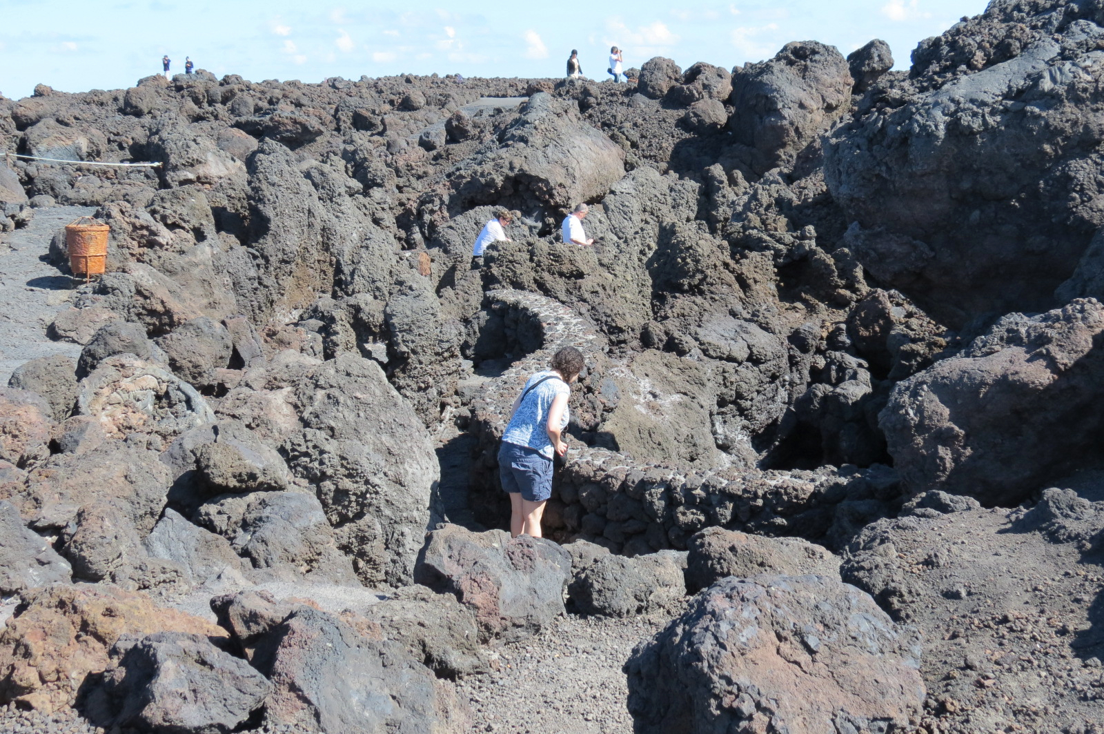
Disfruta del espectacular paisaje lunar de Timanfaya con el paseo que te dan en bus, que es la única forma de recorrer la zona más protegida.
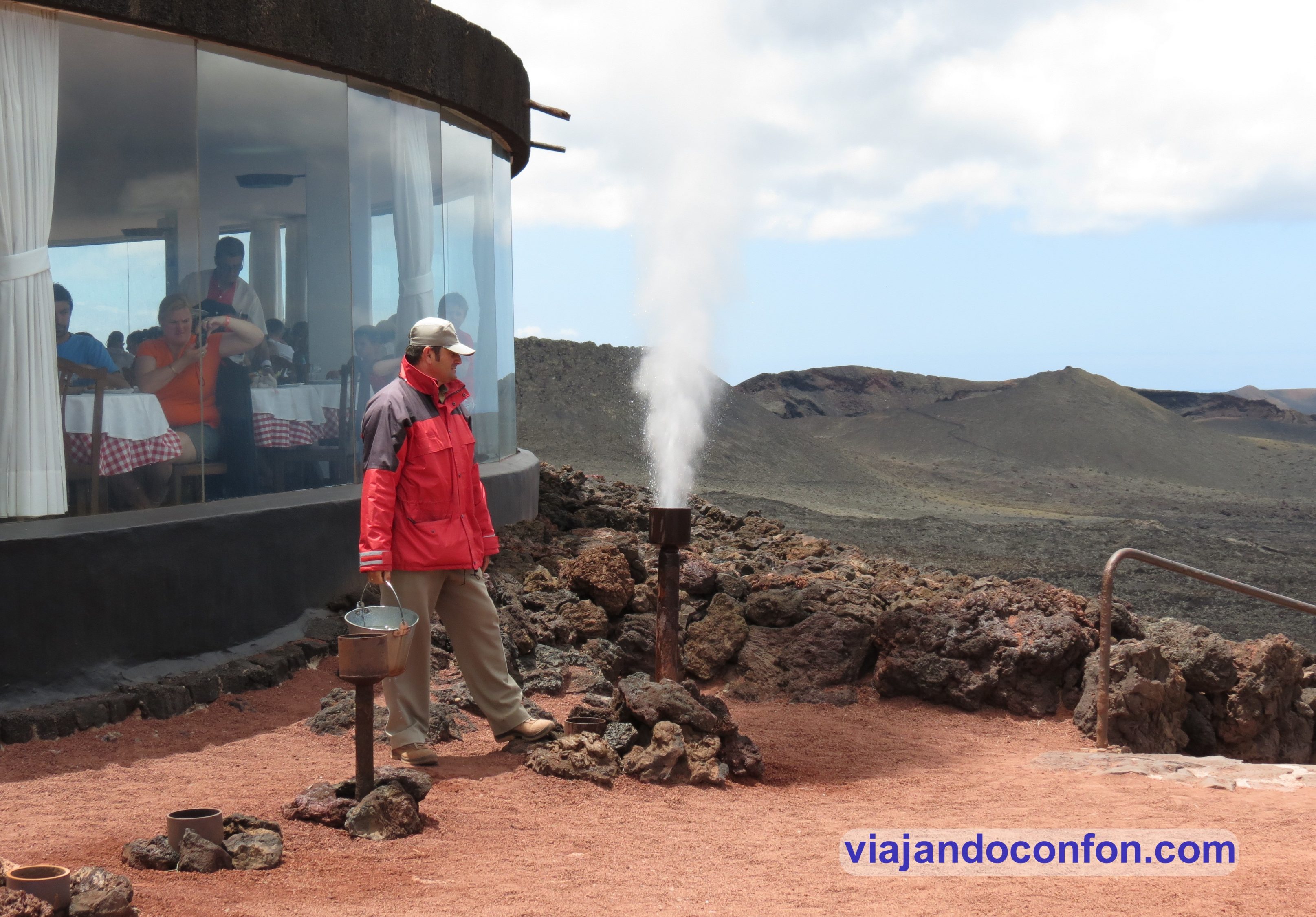
También podras disfrutar del espectáculo geotérmico, en el que echan un cubo de agua en un agujero en la tierra y sale disparado en forma de géiser.
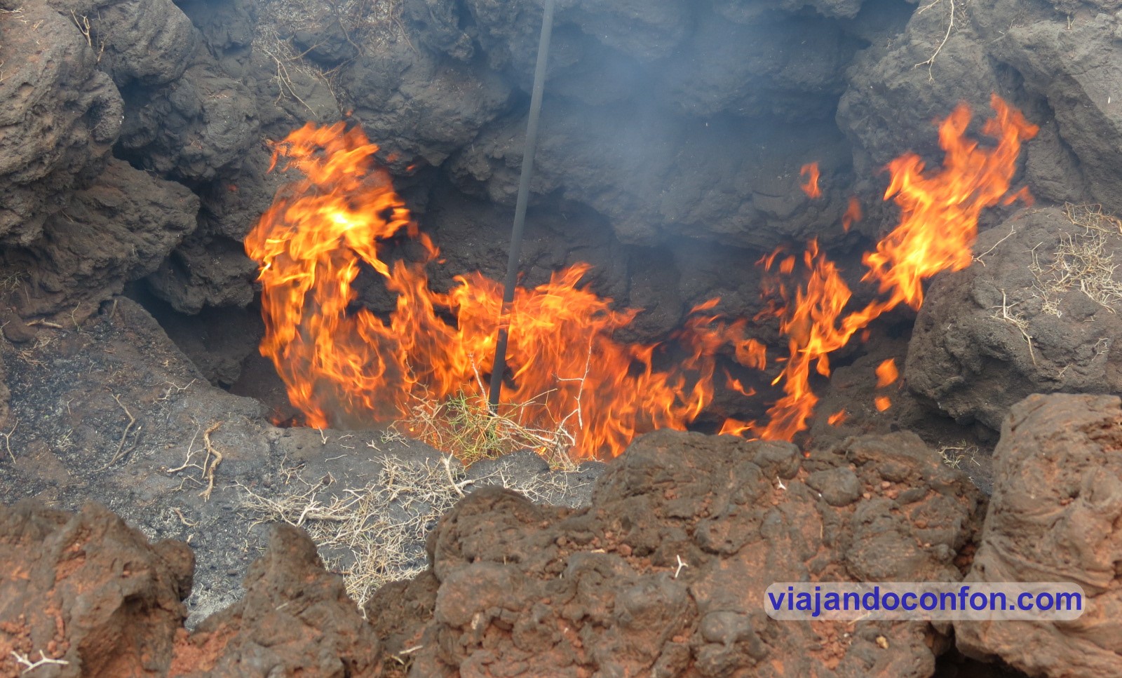
O también ver como se incendia una bola de paja por el calor de la tierra.
En el centro de interpretación también se encuentra un restaurante cuya particularidad es la de cocinar con el calor que sale del fuego.
03. Observar las caprichosas formas geológicas de Los Hervideros
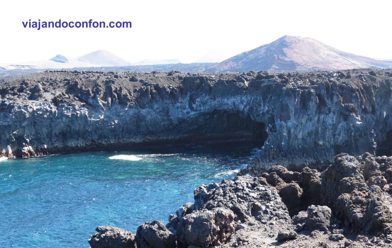
Otro de los lugares dentro de Timanfaya, donde la lava se encuentra con el océano. Ese choque entre la lava caliente y el frío océano dan lugar las caprichosas formas que podemos contemplar en Los Hervideros.
Precio: gratis.
Como siempre, recomendamos viajar con un buen seguro de viajes. IATI es especialista en seguros de viaje y, por ser nuestro lector, tienes un 5% de descuento.
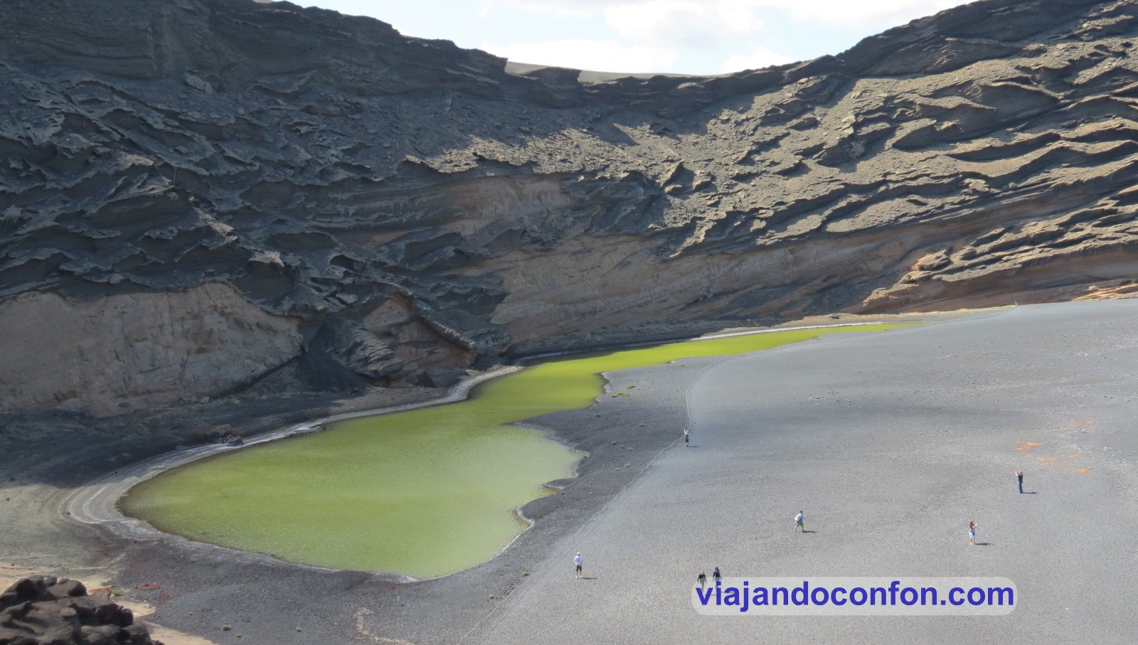
Seguimos en Timanfaya y visitamos otro de los lugares emblemáticos de Lanzarote: el Charco de los Clicos.
Se trata de una pequeña laguna con agua de color verde intenso. Este color proviene de una especie de alga que habita en él, Ruppia maritima. Así como del azufre que contiene la laguna.
El nombre proviene de un Bivalvo llamado Clico que se recoge en la zona para consumo humano.
05. Contemplar La Graciosa desde el Mirador del Río
Es una de las obras más representativas del lanzaroteño César Manrique. Fue inaugurado en 1973 y contiene una cafetería, una tienda de recuerdos y una plataforma mirador a 475 metros de altura.
Desde aquí tenemos unas magnificas vistas de los riscos de Famara, el Río, que es el canal que separa Lanzarote de La Graciosa, y de ésta pequeña isla.
Riscos de Famara
Tras La Graciosa podemos contemplar el resto del Archipiélago Chinijo. Este archipiélago está conformado por 3 islas y 2 islotes. La Graciosa, la más grande y única poblada por el ser humano. La segunda isla es Alegranza y la tercera, Montaña Clara. Los islotes son el Roque del Este y Roque del Oeste, este ultimo conocido por “Roque del Infierno”.
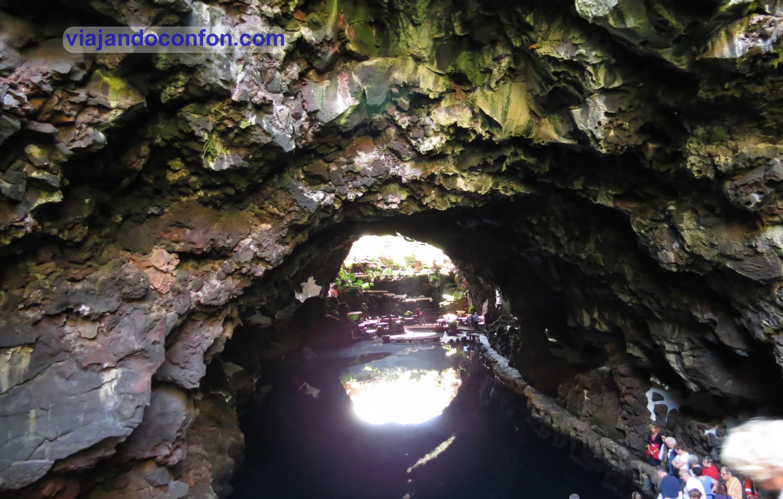
Los Jameos del Agua es un centro de Arte, Cultura y Turismo creado por César Manrique. Un jameo es una abertura al exterior de un tubo volcánico porducido por el hundimiento del techo. La palabra es de orígen aborígen canario.
Fue inaugurado en 1968 y está situado en el tubo de La Corona. Producto de la erupción del volcán de La Corona, hace 4.000 años.
El espacio está formado por tres jameos. El Chico donde se encuentra el restaurante y es la entrada al recinto. Tras éste se encuentra una preciosa laguna de aguas cristalinas. Es fruto de las filtraciones de agua de mar (se encuentra por debajo del nivel de mar).
En esta laguna conviven 77 especies endémicas, resaltando el famoso Cangrejo Ciego (Munidopsis Polymorpha). Un diminuto cangrejo de color blanco y símbolo de la isla de Lanzarote.
IMPORTANTE: El Cangrejo Ciego está en peligro de extinción, siendo los metales altamente peligrosos para estos pequeños y hermosos animales. Por ello, está totalmente prohibido lanzar monedas u otros objetos a la laguna o bañarse.
Tras esta encontramos el Jameo Grande. Que es donde está situada la piscina y el Jameo de la Cazuela. En este se encuentra el espectacular auditorio natural. Tiene capacidad de 550 espectadores y tiene una acústica impresionante.
La Cueva de los Verdes es una serie de grutas volcánicas de unos 8 km de longitud. Aunque sólo se puede visitar alrededor de 1 km.
Está integrado en la zona de Malpaís de la Corona, fruto de la eurpción del volcán de La Corona hace 4.000 años. Se dice que la parte submarina de este tubo volcánico es el Túnel de la Atlántida.
Se cree que su nombre viene del apellido de una familia que usaba la cueva como almacén y para guardar el ganado. Durante los siglos XVI y XVII servía de refugio para la población contra los ataques provenientes de piratas del norte de África.
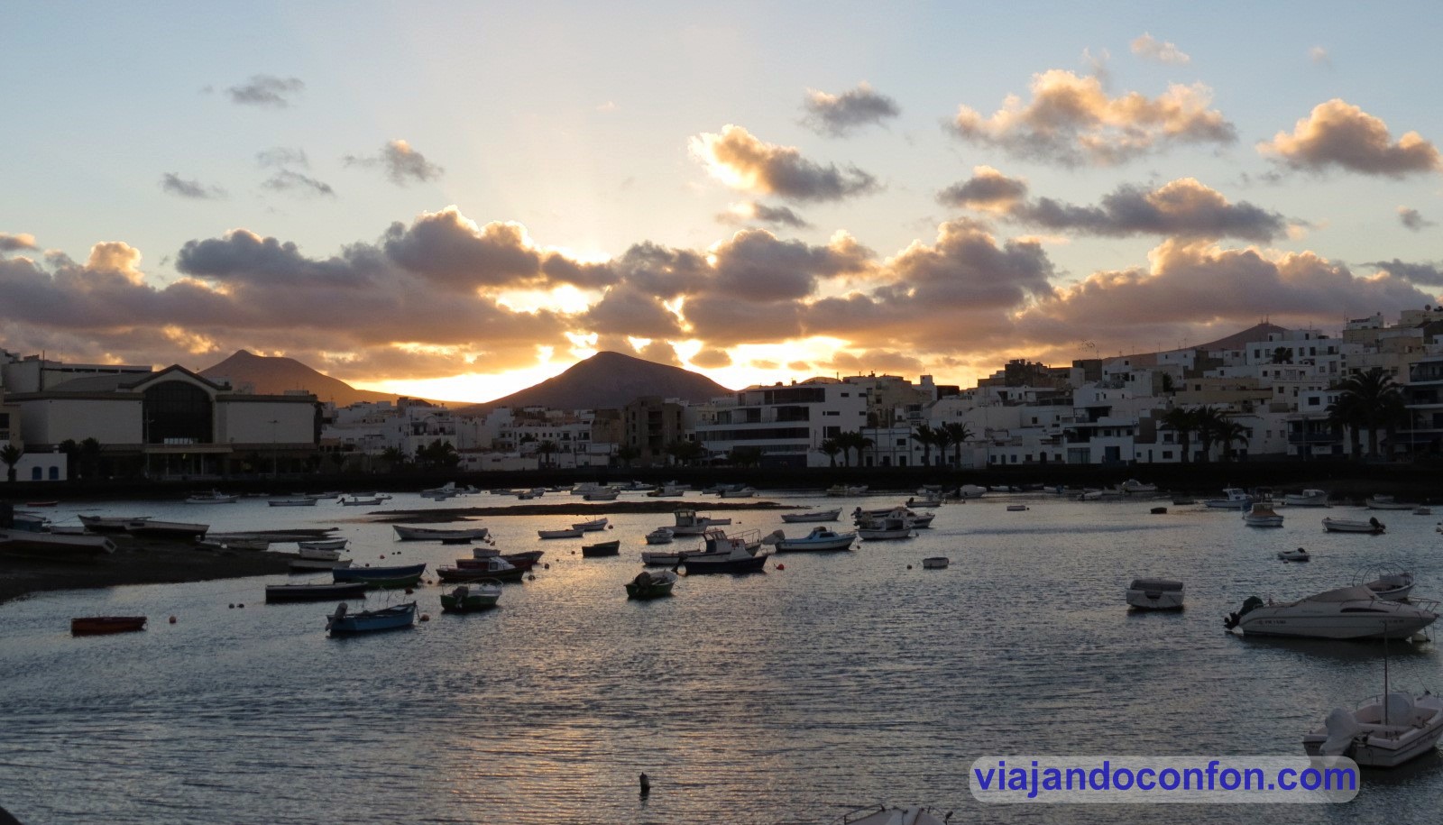
08. Contemplar el precioso atardecer en el Charco de San Ginés
El Charco de San Ginés es una laguna natural con salida al mar. Situado en el casco antiguo de Arrecife, nació como un pequeño puerto pesquero.
Hoy es un precioso paseo desde el que admirar una hermosa puesta de sol.
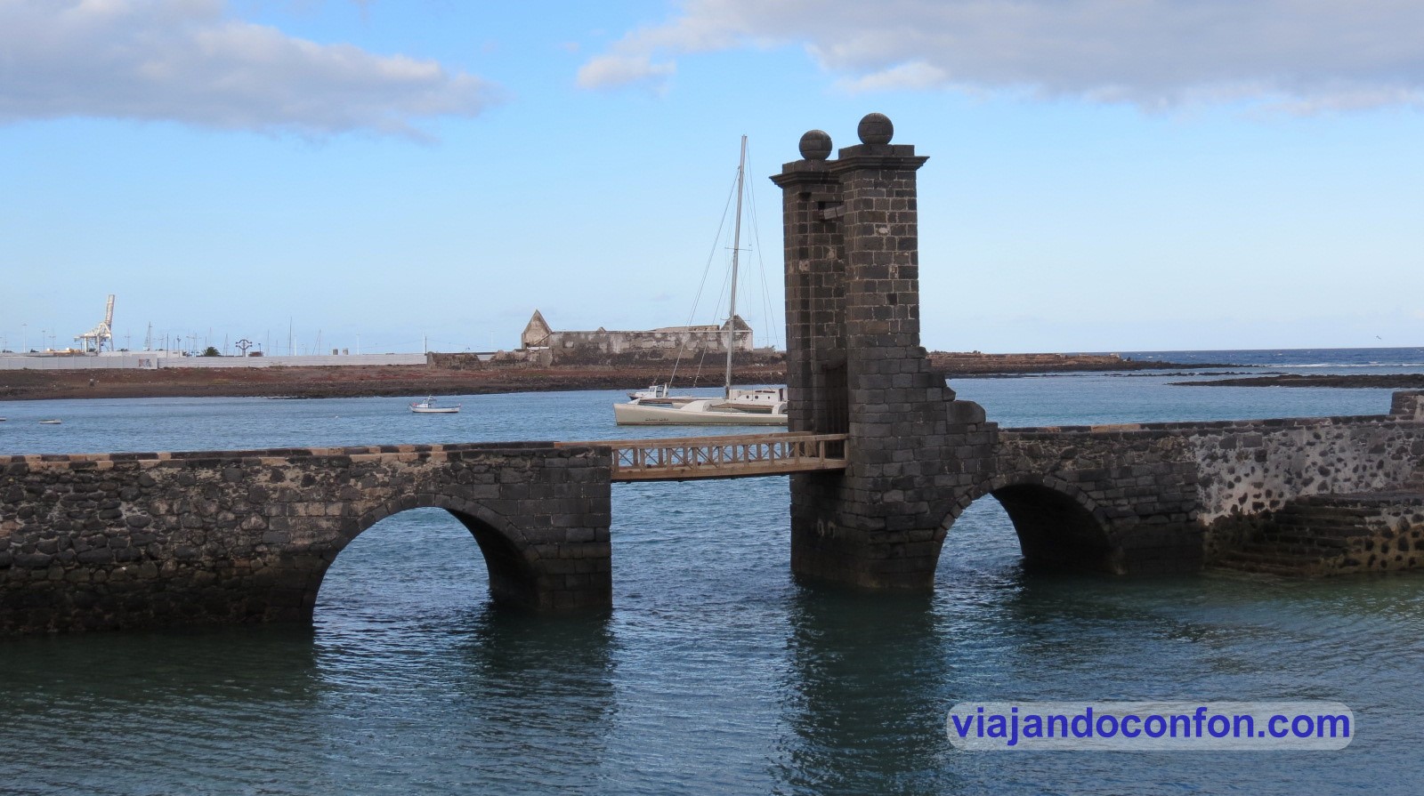
09. Recorrer la historia de Arrecife en el Castillo de San Gabriel
El castillo de San Gabriel se construye en 1587 en el islote Del Quemado. Lo hace el arquitecto italiano Leonardo Torriani para sustituir la anterior fortaleza de madera que se encontraba aquí desde 1576.
El islote toma su nombre del incendio que acabó con dicha estructura de madera durante un ataque pirata turco-argelino en 1586.
En el siglo XVIII se construye el Puente de las Bolas, con la que el islote queda unido a la ciudad de Arrecife.
Desde 1972 se encuentra aquí un museo arqueológico y etongráfico, rebautizado en 2014 como Museo de Historia de Arrecife.
Castillo de San Gabriel
10. Darte un baño en Famara disfrutando de sus espectaculares riscos
Famara es magia pura, un paraíso. Al cobijo de los pespectaculares riscos de Famara, en el que se encuentra el pico más alto de la isla, Peñas del Chache (672m), encontramos este espectacular paisaje.
También podemos observar desde aquí la mayor parte del archipiélago Chinijo.
En sus 6 km de extensión puede uno disfrutar del baño, teniendo en cuenta los vientos que se pueden levantar. Vientos que hacen que sea un lugar perfecto para la prácticas de deportes como el surf y el kitesurf.
Descubre las mejores actividades y tours en Lanzarote con Civitatis:
Córdoba es la tercera ciudad más poblada de Andalucía con una población de 320.000 habitantes. Se encuentra situada en una depresión a orillas del Guadalquivir y al pie de Sierra Morena.
Fundada por los romanos durante el siglo II a. C., se convirtió en la capital de la Hispania Ulterior en tiempos de la República romana. Aunque su momento de mayor esplendor trascurrió durante la dominación musulmana de la península ibérica, cuando se alzó como capital del Emirato de Córdoba.
Durante el Califato de Córdoba se convirtió en la ciudad más habitada, culta y opulenta de Europa, así como en un centro líder mundial de la educación.
Encuentra tu hotel ideal al mejor precio en Córdoba con Agoda:
Córdoba, en la comunidad autónoma de Andalucía, es la capital de la provincia homónima. Está situada en una depresión a orillas del Guadalquivir y al pie de Sierra Morena.
Hoy vamos a descubrir 10 cosas imprescindibles que hacer en la ciudad.
Fue construida como mezquita en el año 784. Se construyó en el lugar donde se encontraba la basílica hispanorromana de San Vicente Mártir. Aunque algunos historiadores ponen en duda esta teoría.
Durante el Emirato y el Califato de Córdoba sufrió numerosas reestructuraciones y ampliaciones. Llegó a ser la segunda mezquita más grande del mundo tras la de La Meca.
Tras la conquista cristiana de la ciudad en 1238 se consagra como catedral.
En 1523, bajo la dirección de los arquitectos Hernán Ruiz, el Viejo y su hijo, se construyó su basílica cruciforme renacentista de estilo plateresco.
A partir del siglo XII fue llamada Catedral de Santa María Madre de Dios hasta el XVI que se rebautizó con el nombre de Catedral de la Asunción de Nuestra Señora.
Hoy es la sede el cabildo catedralicio de la Diócesis de Córdoba y está reservado al culto católico.
Disfruta de una maravillosa visita guiada por la Mezquita con Civitatis:
*Nos ayuda a mantener el blog
02. Cruzar el Puente Romano
El puente romano de Córdoba está situado sobre el río Guadalquivir. Une el barrio del Campo de la Verdad con el Barrio de la Catedral.
Mide 331 metros y fuen construido en el siglo I. Fue el único puente con que contó la ciudad durante veinte siglos, hasta la construcción del puente de San Rafael a mediados del siglo XX.
En el extremo sur-este se encuentra la Torre de la Calahorra. Es una fortaleza de origen islámico construida como protección para la entrada del puente.
No se sabe la fecha exacta de su construcción, pero se nombra por primera vez en 1236. Tras la conquista castellana de Córdoba.
A través de los siglos se le dan diferentes usos como prisión para nobles o cuartel de la Guardia Civil.
A lo largo del puente podemos ver en el río restos de distintos molinos. Como el molino de San Antonio, de origen incierto (se cree que medieval), se sabe que ya existía en el siglo XVIII.
Fue molino harinero y debe su nombre a una imagen de San Antonio que se ubicaba en una hornacina en la fachada. Funcionó hasta mediados del siglo XX, en que se usó el edificio para construir barcas para cruzar el Guadalquivir.
Molino de San Antonio
Molino de la Albolafia
03. Atravesar la Puerta del Puente
Se trata de una de las puertas originales de la muralla de la ciudad. Tras la reconquista por los cristianos pasó a conocerse como puerta de Algeciras.
Su aspecto actual data del siglo XVI cuando Hernán Ruiz III manda a remodelarla con motivo de la visita del rey Felipe II.
04. Alcázar de los Reyes Cristianos
Su construcción se inició durante el reinado de Alfonso X en el siglo XII y finalizado por su bisnieto Alfonso XI en 1328. En su lugar se encontraba el Alcázar de los Omeyas, una fortaleza andalusí musulmana.
Los últimos monarcas que habitaron el alcázar fueron los Reyes Católicos y aquí estuvo preso el emir Boabdil.
Tras la conquista de Granada el edificio pasa a ser la sede del Tribunal de la Inquisición española. Fue hasta su abolición por las Cortes de Cádiz en 1812. Entonces pasó a ser una prisión hasta la 2ª República Española, cuando fue declarado Monumento Nacional (1931).
Durante los años 50 del siglo XX fue restaurado y abierto al público en 1960.
Los jardines del Alcázar ocupan actualmente parte del histórico de las antiguas Huertas del Alcázar. Su aspecto actual data de mediados del siglo XX.
En ellos encontramos varias estatuas como la que rememora la reunión entre los Reyes Católicos con Cristóbal Colón.
Horario del 16 de Septiembre al 14 de Junio: martes a viernes de 8:15 a 20:00 / Sábados de 9:30 a 18:00 / Domingos y festivos de 8:15 a 14:45.
Lunes cerrado.
Horario del 15 de Junio al 15 de Septiembre: Martes a Domingo de 8:15 a 14:45. Festivos de 8:15 a 14:45.
Lunes cerrado.
El último acceso al museo será media hora antes del cierre.
Precio: General 4.91€ / Reducida 2.66€ / Menores de 14 años gratis / Residentes gratis.
CONSEJO: Los jueves no festivos, acceso gratuito a partir de las 18:00 horas durante el horario de invierno y a partir de las 12:00 durante el horario de verano, hasta completar aforo.
Encuentra una maravillosa visita guiada por el Alcázar de Córdoba con Civitatis:
*Incluye la entrada*
05. Baños del Alcázar Califal
Fueron construidos por el califa cordobés Al-Hakam II y formaban parte del desaparecido Alcázar Omeya siendo, posiblemente, los más importantes de la ciudad.
Durante los siglos XI, XII y XIII, los baños del alcázar fueron reutilizados por almorávides y almohades.
Fueron descubiertos en 1903 accidentalmente pero fueron soterrados casi sobre la marcha (el progreso…). Fue en 1961 cuando fueron sacados a la luz.
Los baños el Alcázar Califal fueron inscritos como Bien de Interés Cultural en 1985.
Horario del 16 de Septiembre al 14 de Junio: martes a viernes de 8:15 a 20:00 / Sábados de 9:30 a 18:00 / Domingos y festivos de 8:15 a 14:45.
Lunes cerrado.
Horario del 15 de Junio al 15 de Septiembre: Martes a Domingo de 8:15 a 14:45. Festivos de 8:15 a 14:45.
Lunes cerrado.
El último acceso al museo será media hora antes del cierre.
Precios: General: 3.11€ / Reducida: 1.76€ / Menores de 14 años gratis / Residentes gratis.
Es el barrio en el que habitaba la comundiad judía entre los siglos XIII y XV. En él se pueden ver, además de la Mezquita-Catedral, museos como la Casa de Sefarad y monumentos como la Sinagoga, el Zoco Municipal y la capilla mudéjar de San Bartolomé.
07. Conocer la cultura judía en la Sinagoga de Córdoba
Fue construida entre 1314 y 1315 en estilo mudéjar.
La sala de oración está recubierta de ricas yeserías con decoraciones labradas, lacerías de estrellas de cuatro, seis y ocho puntas, temas vegetales y epigráfia hebrea, recogida fundamentalmente del Libro de los Salmos.
La sinagoga estuvo en uso hasta 1492, año en el que fue decretada la expulsión de los judíos por los Reyes Católicos. Entonces pasa por diferentes usos hasta 1876 dando lugar a la intervención de la Comisión de Monumentos de Córdoba, y a su declaracion como Monumento Nacional en 1885.
Horario del 16 de septiembre al 15 de junio: martes a sábados de 9:00 a 21:00. Domingos, festivos y lunes víspera de festivos de 9.00 a 15.00 h. Lunes cerrado (excepto festivos).
Horario del 16 de junio al 15 de septiembre: martes a domingo, festivos y lunes vísperas de festivos de 9:00 a 15:00. Lunes cerrado (excepto festivos).
08. Conocer la historia en el Museo Arqueológico de Córdoba
El Museo Arqueológico de Córdoba (MAECO) está situado en el antiguo palacio de los Páez de Castillejo y en un edificio anexo de nueva planta.
En él encontramos una gran variedad de piezas que abarcan desde la Prehistoria hasta la Baja Edad Media.
En el sótano encontramos los restos arqueológicos del teatro romano de Colonia Patricia Corduba, del siglo I a.C.
El teatro podría albergar hasta 15.000 espectadores y estuvo en uso hasta el siglo III.
La verdad es que es una visita que merece mucho la pena. Sobre todo siendo gratis para los ciudadanos de la Unión Europea. 1.50€ para los no comunitarios… así que no hay excusa.
Horario del 16 de junio al 16 de septiembre: martes a domingo de 9:00 a 15:00.
Lunes cerradoexcepto festivos y vísperas de festivos.
Horario del 16 de septiembre al 16 de junio: de martes a sábado de 09:00 a 21:00 / domingos y festivos de 09:00 a 15:00.
Lunes cerrado excepto festivos y vísperas de festivos.
Precio: gratis para los ciudadanos de la U.E. / 1.50€ para el resto de nacionalidades.
09. Descansar tomándote algo en la Plaza de la Corredera
Fue construida en 1683 por el arquitecto Antonio Ramós Valdés. Su nombre proviene de las corridas de toros que se celebraban aquí.
Además de los toros, aquí se celebraban los juicios (Autos de Fe) y se ajusticiaba a los condenados por la Inquisición Española.
Es la única plaza mayor cuadrangular de Andalucía y uno de los lugares más emblemáticos de Córdoba.
Realmente hay evidencias de una plaza anterior del siglo XIV. De finales de esta época destaca el Mercado de Sánchez Peña (1583 – 1586).
Fue construido como cárcel y casa del corregidor hasta que en 1835, en el que fue trasladada al Alcázar de los Reyes Cristianos. Tras esto se convirtió en una fábrica de sombreros y se instaló la primera máquina de vapor de la ciudad.
El otro edificio reseñable, también de antes de la remodelación es la Casa de Doña Jacinta. Famosa porque su dueña, doña Ana de Jacinto se negó a que su vivienda fuera demolida para ampliar la plaza.
El asunto llegó hasta la corte y Doña Jacinta consiguió que el rey Carlos II le diera la razón mediante una cédula real.
Hoy la plaza está llena de terracitas en las que sentarse a tomar algo. Realmente hay demasiadas y desluce un poco la fenomenal arquitectura de la plaza. Pero se está de un bien…
Y dejamos lo mejor para el final:
10. Visitar las ruinas de la Madīnat al-Zahrā (Medina Azahara)
Situada a 8 km de la ciudad de Córdoba, Madīnat al-Zahrā (Ciudad Brillante) fue una ciudad palatina edificada en el siglo X. Se construyó por órden de Abderraman III, primer califa de Córdoba.
Su construcción comenzó en el año 936 y se prolongó durante varias fases hasta el reinado del primogénito de Abderramán, Al-Hakam II.
Medina Azahara fue destruida entre los años 1010 y 1013, siendo sus materiales reutilizados en otros lugares.
Las excavaciones arqueológicas dieron comienzo en 1911 y en 1923 fueron declaradas bien de interés cultural. El 1 de julio de 2018 fue declarado como Patrimonio de la Humanidad de la Unesco.
Para visitarla debes aparcar en el centro de visitantes. Allí se ecnuentran las taquillas y el museo de la medina.
Antes de subir a la medina visualizamos un video explicativo con su historia y podemos ver numeros piezas extraidas de la excavación.
Tras la visita al centro de interpretación, tomamos un bus lanzadera que nos lleva hasta la espectacular Medina.
CONSEJO: Lo ideal es contratar un guía para empaparte bien de la interesantísima historia de la medina.
Encuentra una fantástica visita guiada por Medina Azahara con Civitatis:
Visitamos Alcalá de Henares continuando la vuelta a casa desde Navarra.
Después de varias horas de camino llegamos al hotel, el Ibis Alcalá de Henares La Garena. En la línea de todos los Ibis por 58.90€ por noche. Muy tranquilo porque daba la impresión de que éramos los únicos huéspedes del hotel. El aparcamiento estaba vacío.
Encuentra tu hotel ideal al mejor precio en Alcalá de Henares con Agoda:
*Nos ayuda a mantener el blog
Dejamos las cosas, descansamos un poco y nos fuimos a visitar la ciudad.
Aparcamos junto a la Puerta de Madrid. Fue construida en el año 1788 para sustituir la antigua puerta de la muralla medieval.
Puerta de Madrid
Un poco más adelante se encuentra la Catedral de los Santos Justo y Pastor. Levantada como una capilla en el año 411. En el lugar donde se cree que fueron ejecutados San Justo y San Pastor en el año 304 en la Hispania romana.
Durante el periodo visigodo se convierte en catedral. En el año 1054, los musulmanes reconquistan la ciudad y destruyen la catedral.
En el año 1118 los cristianos reconquistan la ciudad. Fue en el año 1122 se reconstruye de nuevo la catedral.
Justo enfrente se encuentra la ermita de Santa Lucía. Es una de las construcciones religiosas más emblemáticas de la ciudad. Fue construida en el siglo XII en estilo románico-mudéjar.
El edificio actual data del siglo XVII y está construida en estilo barroco.
Durante la Edad Media, y hasta el año 1515, se reunía allí el concejo de la villa. Por esto es considerada la primera sede del ayuntamiento de la ciudad.
Ermita de Santa Lucía
Muy cerca encontramos el Palacio Arzobispal, la residencia de los arzobispos de Toledo en Alcalá de Henares. Construido a partir del siglo XIII y hasta las últimas renovaciones en el siglo XX, se suceden estilos como el mudéjar, renacentista y barroco.
En él llegaron a residir diferentes monarcas castellanos. Aquí nacieron Catalina de Aragón y emperador alemán Fernando. También aquí se celebró la primera reunión entre los Reyes Católicos y Cristóbal Colón.
A su lado se encuentra el convento de San Bernardo, fundado por el cardenal Bernardo Sandoval y Rojas. La iglesia se construyó entre 1617 y 1626 cuando se realizó la bendición del templo.
Desde aquí nos disponemos a recorrer la cercana calle mayor, que está rebosante de bares, restaurantes y terrazas. Aquí se encuentra la casa natal de Miguel de Cervantes.
Durante mucho tiempo hubo un intenso debate sobre el lugar de nacimiento del escritor, hasta que en 1948 Luis Astrana Marín, dio a conocer la ubicación exacta en este edificio. Después de esto, el ayuntamiento compró en 1954 y en 1956 se inauguró el museo cervantino.
Ya casi al final de la calle mayor se encuentra la Iglesia de la Compañía de Jesús, actual parroquia de Santa María la Mayor, construida entre 1602 y 1625 por el arquitecto Bartolomé de Bustamante y sufragada por Doña Catalina de Mendoza y Mendoza.
Volvemos un poco sobre nuestros pasos hasta la plaza de San Diego, donde se encuentra el precioso edificio del colegio mayor de San Ildefonso, que pertenece a la universidad de Alcalá de Henares. Fundado en 1499 por el Cardenal Cisneros como origen de la Universidad de Alcalá histórica, fue colegio mayor hasta su clausura en el año 1798. Hoy en día es sede del rectorado de la universidad.
Casi al lado se encuentra la plaza Cervantes. La plaza se creó en el año 1184 como plaza del mercado. Luego se le llamó plaza de la Constitución, y desde el año 1879 es la plaza de Cervantes, cuando se erigió en el centro de la plaza un monumento al escritor.
En la plaza se encuentra el ayuntamiento, en el edificio que que en un principio fue el Colegio-convento de la Orden de Clérigos Regulares Ministros de los Enfermos de San Carlos Borromeo y de San Camilo de Lelis o de Agonizantes, hasta el año 1855.
En un extremo sur de la plaza encontramos las ruinas de la iglesia de Santa María, construida en el siglo XV y destruida en el año 1936 durante la Guerra Civil. Hoy en día solo se conservan la torre del Oidor y la capilla, ambas restauradas.
Por detrás, encontramos el edificio de la facultad de filosofía y letras, en el edificio donde antiguamente se encontraba el Colegio Menor de San Ciriaco y Santa Paula, conocido como Colegio de Málaga, fundado en 1611 Juan Alonso de Moscoso, obispo consecutivamente de Guadix-Baza, León y Málaga.
Descubre las mejores actividades y tours en Alcalá de Henares con Civitatis:
Aquí encontrarás datos básicos que debes conocer antes de tu viaje a Lituania.
Documentación
Al ser parte de la Unión Europea, para los ciudadanos de la UE no hace falta obetenr visado. Vale con Pasaporte o D.N.I.
Sanidad
En Lituania se encuentra una familia de garrapatas conocida como Ixodes Ricinos, que son peligrosas por dos tipos de enfermedades graves que pueden transmitir a los animales y a los seres humanos: la ENCEFALITIS CENTRO-EUROPEA y la ENFERMEDAD DE LYME.
Para esto se recomienda:
Informarse sobre las vacunas requeridas antes de visitar Lituania.
Tener especial cuidado durante el verano en excursiones en las zonas de campo, por el bosque o en los alrededores de los lagos.
Usar pantalones largos y prendas de color claro para facilitar la identificación de los insectos.
Usar repelentes para insectos y si las garrapatas se encuentran en la piel extraerlas inmediatamente con una pinza.
La República de Lituania mantiene un sistema de hospitales públicos de calidad. Si viaja provisto de Tarjeta Sanitaria Europea (TSE) le serán prestados los servicios de atención de urgencias no necesariamente de forma gratuita.
Como siempre, recomendamos viajar con un buen seguro de viajes. IATI es especialista en seguros de viaje y, por ser nuestro lector, tienes un 5% de descuento.
Desde su independencia de la Unión Soviética en 1993, la moneda en circulación era la Litas lituana. Con esa moneda es con la que viajamos nosotros en 2012.
Fue a partir de 2014 cuando Lituania adoptó el Euro y dejó de usarse gradualmente su moneda.
SE RECOMIENDA extremar la precaución a quienes viajen en coche u otro tipo de transporte terrestre por Lituania. El mal estado de las calzadas y los adelantamientos en vías de un solo carril son comunes, ya que en ocasiones los conductores utilizan el arcén como un tercer carril.
Los límites de velocidad oscilan entre el máximo de 50 km/h en ciudad, 70 km/h en carreteras convencionales y los 110-130km/h en autovías. La red de autovías/ autopistas en Lituania está en expansión y en la actualidad no es muy amplia. Existen tramos entre Kaunas y Klaipėda y entre Vilnius y Panavezys.
La mayor parte de las carreteras, en gran medida debido también a las duras condiciones climatológicas del invierno, suelen tener el firme en deficiente estado, apenas están iluminadas y las vías principales suelen tener un tráfico denso, especialmente de camiones. El índice de accidentes de tráfico es uno de los más altos de la Unión Europea.
La legislación vial de Lituania es MUY ESTRICTA. Muy especialmente en casos de omisión del deber de socorro, fuga o consumo de alcohol o drogas.
Encuentra tu hotel ideal al mejor precio en Lituania con Agoda.
*Nos ayuda a mantener el blog
A tener en cuenta
La legislación lituana es MUY ESTRICTA en cuestiones de orden público. Existe una muy escasa permisividad por parte de jueces y policías con comportamientos antisociales, escándalos, peleas o demás tipos de alteraciones como gamberradas y delitos menores en ambientes universitarios o festivos.
La legislación lituana es MUY ESTRICTA en lo que se refiere al respeto debido a los símbolos nacionales.
El Código Penal de Lituania castiga con hasta dos años de prisión a aquellos que retiren, rompan, ensucien, quemen o ultrajen la bandera y otros símbolos del Estado de Lituania. La misma pena se impone a quien ridiculice o haga burla pública del Himno Nacional.
Todo cosas de sentido común, que no todos tenemos.
Queda también PROHIBIDO mostrar símbolos o hacer apología de la Unión Soviética, la República Socialista de Lituania y portar emblemas que muestren la hoz y el martillo, el lazo de San Jorge o la Estrella Roja Soviética so pena administrativa.
Encuentra las mejores actividades y tours en Lituania con Civitatis.
Para ofrecer las mejores experiencias, utilizamos tecnologías como las cookies para almacenar y/o acceder a la información del dispositivo. El consentimiento de estas tecnologías nos permitirá procesar datos como el comportamiento de navegación o las identificaciones únicas en este sitio. No consentir o retirar el consentimiento, puede afectar negativamente a ciertas características y funciones.
Funcional
Siempre activo
El almacenamiento o acceso técnico es estrictamente necesario para el propósito legítimo de permitir el uso de un servicio específico explícitamente solicitado por el abonado o usuario, o con el único propósito de llevar a cabo la transmisión de una comunicación a través de una red de comunicaciones electrónicas.
Preferencias
El almacenamiento o acceso técnico es necesario para la finalidad legítima de almacenar preferencias no solicitadas por el abonado o usuario.
Estadísticas
El almacenamiento o acceso técnico que es utilizado exclusivamente con fines estadísticos.El almacenamiento o acceso técnico que se utiliza exclusivamente con fines estadísticos anónimos. Sin un requerimiento, el cumplimiento voluntario por parte de tu Proveedor de servicios de Internet, o los registros adicionales de un tercero, la información almacenada o recuperada sólo para este propósito no se puede utilizar para identificarte.
Marketing
El almacenamiento o acceso técnico es necesario para crear perfiles de usuario para enviar publicidad, o para rastrear al usuario en una web o en varias web con fines de marketing similares.